Personal Forecasts -- Ex-Tropical Storm Colin and 92L

This is the general tropical discussion area. Anyone can take their shot at predicting a storms path.

Moderator: S2k Moderators

Forum rules

The posts in this forum are NOT official forecasts and should not be used as such. They are just the opinion of the poster and may or may not be backed by sound meteorological data. They are NOT endorsed by any professional institution or STORM2K. For official information, please refer to products from the National Hurricane Center and National Weather Service.

Help Support Storm2K
Message
Author
JonathanBelles
Professional-Met
Professional-Met
Posts: 11430
Age: 35
Joined: Sat Dec 24, 2005 9:00 pm
Location: School: Florida State University (Tallahassee, FL) Home: St. Petersburg, Florida
Contact:

Personal Forecasts -- Ex-Tropical Storm Colin and 92L

#1 Postby JonathanBelles » Sun Aug 01, 2010 8:54 pm

Storm2k.org Disclaimer: The posts in this forum are NOT official forecast and should not be used as such. They are just the opinion of the poster and may or may not be backed by sound meteorological data. They are NOT endorsed by any professional institution or storm2k.org. For official information, please refer to the NHC and NWS products


AL080110 Invest 91L

Image

Invest 91L is being watched for an upgrade to Tropical Depression status in the next 24 hours;

This discussion will be in a shortened format in order to provide my views on this invest and its possible development.

...Brief Discussion...An area of strong convection is present over the eastern Atlantic Ocean in the vicinity of 11.5N36.2W. This system seems like it is well stacked and on its way in development. Shear seems low right now (less than 10kts), Sea Surface temps are plentiful, and upper air patterns (convergence/divergence) are good. My only concern at this time is the dry air to the north. Moisture is clearly better to the south of the system. The Saharan Air Layer is obstusive to the north, and water vapor imagery shows dry air ahead of the system. My initial track forecast brings what should be a named storm at the time through a northeastern islands of the Caribbean Sea. I think that the models are underestimating the strength of the ridge. Late in the model hours there is a trough that comes into the picture from the east coast, and for that reason I left the end of the 'cone' more open than I usually would. This trough could pick up the tropical storm and take it back out to sea without hitting land. The intensity is a bit easier to place. It should be a steady intensification until just east of the islands where there should be a dry air interaction with the storm.

Forecast Likelihoods:
Early Forecast Confidence: 80%
Late Forecast Confidence: 50%
91L Cyclogenesis: 95%

Meteorology Student Jonathan -- Fact789

_____________________________________________________________

As always, please ask questions of my forecast or comment upon it. Any and all questions and comments will be taken as a constructive educational experience, and are very much welcomed. Thank You!
Last edited by JonathanBelles on Wed Aug 04, 2010 9:55 pm, edited 2 times in total.
0 likes   

User avatar
Extremeweatherguy
Category 5
Category 5
Posts: 11095
Joined: Mon Oct 10, 2005 8:13 pm
Location: Florida

#2 Postby Extremeweatherguy » Mon Aug 02, 2010 5:04 pm

Here is my initial track idea and discussion for Tropical Depression #4:

Image
Graphic created August 2nd, 2010 at 5:25pm

DISCUSSION:

I believe TD #4 will slowly get its act together as it pushes WNW toward the northeastern Caribbean Islands. At this time I do think it will brush these islands as a tropical storm, likely causing some minor/moderate issues. In the longer term, I then expect the storm to get into the Bahamas region later this week/this weekend and begin to slow as the ridge to the north gradually breaks down. I do not believe the breakdown caused by the trough will be as dramatic or quick as the current modeling shows though, and this will lead to a potential significant threat to the southeast USA. Once the weakness finally does take hold I think Colin (possibly a strong TS or hurricane by that point) will scoot toward the NW and then N into the vicinity of South Carolina.

If this forecast played out exactly, the greatest impacts from the storm would be felt in the NE Caribbean Islands, the Bahamas, the east coast of Florida, and the coastal regions of Georgia, South Carolina and North Carolina.


Current confidence level in this forecast: LOW (subject to large changes in the coming days)

Things to watch for that would change the forecast:

1) Where does Colin actually slow down/turn? The point at which Colin slows down and prepares for its NW or N turn will be key. At the moment I think that will happen in the northwest Bahamas, but any deviation east/west could mean large differences in the final landfall location. Slightly further west would put the bullseye on Florida, while slightly further east would mean real trouble for North Carolina up to New England. This turning location will be highly dependent on just how strong the trough ends up being and whether or not it can dig as much as predicted by the modeling. A stronger/deeper trough will raise the threat further east and a weaker/shallower trough will raise the threat further west.

2) Wind shear. At this point I do not believe shear will reach high enough levels to kill future Colin, but I do think it should remain strong enough to keep rapid intensification at bay. This scenario would lead to the possibility of a Cat. 1/2 hurricane, but a major would be unlikely. If, however, the shear is stronger/weaker than I expect, then obviously things would change both track-wise and especially strength-wise.

3) Does the storm get stuck long enough for the ridge to build back in and push it west? If the storm slows in the Bahamas region long enough and the trough is not strong enough to lift the storm out, then there is the possibility that it might wait for the ridge to re-build and push the storm W or WNW. This was the scenario seen in yesterday's morning runs of the GFS, and it is not impossible that such a solution could re-appear in future model runs.

Personal Forecast Disclaimer:
The posts in this forum are NOT official forecast and should not be used as such. They are just the opinion of the poster and may or may not be backed by sound meteorological data. They are NOT endorsed by any professional institution or storm2k.org. For official information, please refer to the NHC and NWS products.
0 likes   

lebron23
Category 1
Category 1
Posts: 389
Age: 32
Joined: Sat May 24, 2008 11:58 am
Contact:

Re: Personal Forecasts -- Tropical Depression 4

#3 Postby lebron23 » Mon Aug 02, 2010 8:28 pm

This is my forecast track, Kitty Hawk/ Norfolk landfall
Image

Uploaded with ImageShack.us

Personal Forecast Disclaimer:
The posts in this forum are NOT official forecast and should not be used as such. They are just the opinion of the poster and may or may not be backed by sound meteorological data. They are NOT endorsed by any professional institution or storm2k.org. For official information, please refer to the NHC and NWS products
Last edited by lebron23 on Mon Aug 02, 2010 8:48 pm, edited 1 time in total.
0 likes   

Iceperple
Tropical Wave
Tropical Wave
Posts: 7
Joined: Sun May 30, 2010 4:16 am

#4 Postby Iceperple » Mon Aug 02, 2010 8:39 pm

What it will be?I don't expect an apperance of CAT3 or more,the system was not enable to be like that.

The trough(whether use this word in English?) wasn't close enough to the Tropical Cyclone,while oceanichigh was in a sheightening phase,so I think the system have plenty time to increase, and the track will be west than NHC forcast——even EC.

But after the Polar Low rotate to the North America.Supplied by the Cold Advection,Wind Shear should be higher—near 30kts or more.
0 likes   

JonathanBelles
Professional-Met
Professional-Met
Posts: 11430
Age: 35
Joined: Sat Dec 24, 2005 9:00 pm
Location: School: Florida State University (Tallahassee, FL) Home: St. Petersburg, Florida
Contact:

Re: Personal Forecasts -- Tropical Depression 4

#5 Postby JonathanBelles » Mon Aug 02, 2010 9:14 pm

Storm2k.org Disclaimer: The posts in this forum are NOT official forecast and should not be used as such. They are just the opinion of the poster and may or may not be backed by sound meteorological data. They are NOT endorsed by any professional institution or storm2k.org. For official information, please refer to the NHC and NWS products


AL080210 Tropical Depression 4 -- Submitted 10:15pm

Definitions (These are my definitions, and are not from the NHC or anywhere else)

o Invest: Area of interest that the National Hurricane Center and others are watching for possible development into a tropical cyclone. Short for investigation; generally of low pressure areas.
o Wind Shear: Directional wind moving in a direction that hinders cyclonic development in the tropics. Shear takes the tops of clouds off the top of a cyclone.

Image

Tropical Depression #4 has been upgraded from invest 91L;

...Synopsis...TD4 is getting more organized as it moves towards the west. TD4 is currently located in the vicinity of 13.2N45.9W and is moving quite fast with a pressure as analyzed by the NHC with a pressure of 1006mb and winds of 30kts. Convection is pulsing up and down, but at the time of writing this discussion moderate to strong convection is present. Shear is relatively low for the time being, and an anticyclone is showing signs of development over TD4. The system remains well stacked for now, but my concerns with dry air have amplified since yesterday. Dry air is present around more than half of TD4, and the future track doesn't show any better conditions.

...Prognosis... Overall, my track still lies further left than the National Hurricane Center due to the fact that I think the models are overestimating the ridge that is supposed to keep TD4 to the south. Trends are slowly to left as well. My track still is outside of the Caribbean Islands, but not as far as the NHC track. With the likely interaction with dry air and increasing shear around 2-3 days, I would bring the intensity to what will likely become Tropical Storm Colin to a maximum intensity of 45kts within the 2-3 day time frame. Beyond that we will have to see what interactions Colin has with the ridge, dry air, and shear. I think there will be a slight weakening in the 4+ day time frame.

...Tropical Interests... Interests in the northeastern Caribbean Islands, the Bahamas, and the Southeastern US should keep their eyes on the movements and intensities of TD4 and the future TS Colin. The northeastern Islands could begin feeling the effects of To-Be-Colin early on Wednesday.

Forecast Likelihoods:
Forecast Confidence: 50%
Tropical Storm Status: 70%

Meteorology Student Jonathan -- Fact789
_____________________________________________________________

As always, please ask questions of my forecast or comment upon it. Any and all questions and comments will be taken as a constructive educational experience, and are very much welcomed. Thank You!
0 likes   

User avatar
Hurricane Andrew
S2K Supporter
S2K Supporter
Posts: 1891
Age: 26
Joined: Sun May 23, 2010 2:53 pm
Location: KS

#6 Postby Hurricane Andrew » Tue Aug 03, 2010 6:01 am

@fact-Are you thinking TS coling might ride up the east coast?

By the way, you were right. We havew TS colin. Great forecast!
0 likes   

The Enthusiast
NREMT-AEMT, WX nerd

Irene '11, Sandy '12, Irma '17 (SAR)

"Hard to think we were born to live this way..." -Wage War

JonathanBelles
Professional-Met
Professional-Met
Posts: 11430
Age: 35
Joined: Sat Dec 24, 2005 9:00 pm
Location: School: Florida State University (Tallahassee, FL) Home: St. Petersburg, Florida
Contact:

Re:

#7 Postby JonathanBelles » Tue Aug 03, 2010 9:12 am

Hurricane Andrew wrote:@fact-Are you thinking TS coling might ride up the east coast?

By the way, you were right. We havew TS colin. Great forecast!


Its too early to know for sure, but the current models are showing it could get close to the North Carolina coastline.

Honestly, I expected it still to be a TD at this time, which is why I said 30 hours. I didn't expect it to become a TS until between 11a and 11pm today.
0 likes   

User avatar
Hurricane Andrew
S2K Supporter
S2K Supporter
Posts: 1891
Age: 26
Joined: Sun May 23, 2010 2:53 pm
Location: KS

ATL : Tropical Storm Colin - DISCUSSION

#8 Postby Hurricane Andrew » Tue Aug 03, 2010 10:16 am

Personal Forecast Disclaimer:
The posts in this forum are NOT official forecast and should not be used as such. They are just the opinion of the poster and may or may not be backed by sound meteorological data. They are NOT endorsed by any professional institution or storm2k.org. For official information, please refer to the NHC and NWS products.

My forecast

0 Hours-40MPH-TS
6 Hours-40MPH-TS
12 Hours-40MPH-TS
24 Hours-35MPH-TD
48 Hours-35MPH-TD
72 Hours-40MPH-TS
96 Hours-55MPH-TS
120 Hours-60MPH-TS

Next update at 5PM
0 likes   

The Enthusiast
NREMT-AEMT, WX nerd

Irene '11, Sandy '12, Irma '17 (SAR)

"Hard to think we were born to live this way..." -Wage War

lebron23
Category 1
Category 1
Posts: 389
Age: 32
Joined: Sat May 24, 2008 11:58 am
Contact:

Re: Personal Forecasts -- Tropical Storm Colin

#9 Postby lebron23 » Tue Aug 03, 2010 12:34 pm

Track as of 12:35 CT 8/3/10

Image

Uploaded with ImageShack.us

TS Colin looks to be falling apart and as of my noon update I have Colin falling into a open wave. I also have Colin a bit more south than of the official NHC track.

Next update around 4-6PM CT time.

Storm2k.org Disclaimer: The posts in this forum are NOT official forecast and should not be used as such. They are just the opinion of the poster and may or may not be backed by sound meteorological data. They are NOT endorsed by any professional institution or storm2k.org. For official information, please refer to the NHC and NWS products
Last edited by lebron23 on Tue Aug 03, 2010 12:40 pm, edited 1 time in total.
0 likes   

User avatar
Extremeweatherguy
Category 5
Category 5
Posts: 11095
Joined: Mon Oct 10, 2005 8:13 pm
Location: Florida

#10 Postby Extremeweatherguy » Tue Aug 03, 2010 12:39 pm

Second Forecast Update for TS Colin:

Image
Image created August 3rd, 2010 at 1:30pm

CURRENT - 40mph
WED AFTN - 35mph
THUR AFTN - 40mph
FRI AFTN - 45mph
SAT AFTN - 50mph
SUN AFTN - 50mph


Discussion:

Colin does not have a good Satellite appearance this afternoon, and all indications are that the storm's circulation center, if it indeed has a closed one, is probably very weak. I expect this ragged look to remain for at least the next 24 hours as the storm continues to race WNW. There is a chance that the storm could degenerate into an open wave during this time, but if it does not, then I do believe Colin will be able to gets its act together by later in the week. While shear should still be a problem in the longer term, slower overall storm motion will probably allow Colin to reach minimal/moderate tropical storm strength by this weekend as it approaches the southeastern USA. If shear manages to let up more than expected, a hurricane is not entirely out of the question.

In terms of track, I expect a general WNW motion to continue, eventually bending more NW by Friday in response to an approaching trough. I do not expect the trough to be strong enough to turn the storm completely away from land though, and Colin should be getting very close to the southeastern USA coastline by Sunday afternoon. At this point things get a little tricky. Assuming Colin is still intact, I see one of two scenarios playing out. Either the weakness in the ridge remains strong enough and Colin will scoot N or NE into the Carolinas, or the ridge will build back in and push the slowing/stalling Colin westward into South Carolina/Georgia/Florida. As of now I believe both scenarios have an equal chance of playing out.

Forecast Confidence: LOW/MEDIUM (some changes possible over the next few days)

Personal Forecast Disclaimer:
The posts in this forum are NOT official forecast and should not be used as such. They are just the opinion of the poster and may or may not be backed by sound meteorological data. They are NOT endorsed by any professional institution or storm2k.org. For official information, please refer to the NHC and NWS products.


QUICK UPDATE (August 4th, 2010 5pm):

The possibility of Colin opening into a wave as I discussed yesterday did indeed play out. However, the storm now appears to be bouncing back and I believe that we will ultimately see a strong tropical storm or hurricane out of this before all is said and done. The good news though is that the weakness in the ridge actually looks to be as strong as the models were predicting. This means that a recurve is looking more and more likely. The southeast USA will probably be "ok" this go around, but Bermuda will need to watch closely over the coming days.

Here is my updated track idea..

Image
Last edited by Extremeweatherguy on Wed Aug 04, 2010 4:07 pm, edited 3 times in total.
0 likes   

User avatar
Hurricane Andrew
S2K Supporter
S2K Supporter
Posts: 1891
Age: 26
Joined: Sun May 23, 2010 2:53 pm
Location: KS

Re: ATL : Tropical Storm Colin - DISCUSSION

#11 Postby Hurricane Andrew » Tue Aug 03, 2010 2:06 pm

cycloneye wrote:Wow,look at the speed it's going.

285DEG SPDCUR = 30KT

Personal Forecast Disclaimer:
The posts in this forum are NOT official forecast and should not be used as such. They are just the opinion of the poster and may or may not be backed by sound meteorological data. They are NOT endorsed by any professional institution or storm2k.org. For official information, please refer to the NHC and NWS products.

I think the LLC will race ahead and get shredded. It might last, but advosories will probably be canclled.

The MLC, will last, and i think it might work its way to the surface when it gets to better conditions.

Please people, post your thoughts on this.
0 likes   

The Enthusiast
NREMT-AEMT, WX nerd

Irene '11, Sandy '12, Irma '17 (SAR)

"Hard to think we were born to live this way..." -Wage War

lebron23
Category 1
Category 1
Posts: 389
Age: 32
Joined: Sat May 24, 2008 11:58 am
Contact:

Re: Personal Forecasts -- Tropical Storm Colin

#12 Postby lebron23 » Tue Aug 03, 2010 7:27 pm

Image

Uploaded with ImageShack.us

NOW - REM L
WED EVE- REM L
THUR EVE - REM L
FRI EVE - REM L
SAT EVE - 40mph
SUN EVE - 50mph


Personal Forecast Disclaimer:
The posts in this forum are NOT official forecast and should not be used as such. They are just the opinion of the poster and may or may not be backed by sound meteorological data. They are NOT endorsed by any professional institution or storm2k.org. For official information, please refer to the NHC and NWS products.
0 likes   

JonathanBelles
Professional-Met
Professional-Met
Posts: 11430
Age: 35
Joined: Sat Dec 24, 2005 9:00 pm
Location: School: Florida State University (Tallahassee, FL) Home: St. Petersburg, Florida
Contact:

Re: Personal Forecasts -- Tropical Storm Colin

#13 Postby JonathanBelles » Wed Aug 04, 2010 9:30 pm

Storm2k.org Disclaimer: The posts in this forum are NOT official forecast and should not be used as such. They are just the opinion of the poster and may or may not be backed by sound meteorological data. They are NOT endorsed by any professional institution or storm2k.org. For official information, please refer to the NHC and NWS products


AL080410 -- Invest 92L – Ex-TS Colin

Definitions (These are my definitions, and are not from the NHC or anywhere else)
o Invest: Area of interest that the National Hurricane Center and others are watching for possible development into a tropical cyclone. Short for investigation; generally of low pressure areas.
o Wind Shear: Directional wind moving in a direction that hinders cyclonic development in the tropics. Shear takes the tops of clouds off the top of a cyclone.
o Ocean Heat Content: Temperature of greater depth than just a few feet below sea level feeds storms much more successfully than a shallow sea surface temperature.
o Cyclogenesis: birth of a cyclone

Image

Invest 92L seems to be drying up while Ex-TS Colin seems to be getting its act together;

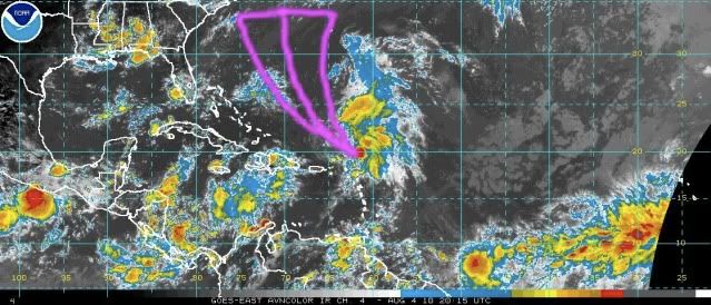
...Synopsis... Starting tonight with Invest 92L, which is looking the worst that it has since its genesis. This disturbance is located near 14.6N76.5W and is moving towards the west. The main culprit with this one is that its lower level environment. By this I mean that in the lower parts of the atmosphere, 92L is not bringing in air (convergence) to send it up to the upper atmosphere where 92L is actively diverting air away from the system, therefore it is removing all of the air and moisture from itself. This is mainly due to a anticyclone that would normally set itself up over a tropical system, but 92L is not feeding the anticyclone. Until 92L can get some sort of convergence going to feed the upper atmosphere, 92L will not look any better.

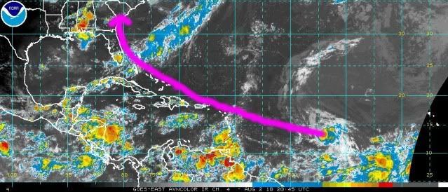
In a completely different case, ex-TS Colin is looking very well organized tonight. This disturbance is located in the vicinity of 20.2N62.1W under a very strong ball of convection. It seems that the shear that was ripping Colin apart yesterday has abated by quite a bit, and dry air does seems to have moved out of the way. The shredder that was seen yesterday on satellite is now gone. The upper air patterns seems to be good for now, but I have some concern with some higher shear to the west where divergence is actually negative. There still is a rather dry area associated with an upper level low to the north. The entire system has begun to slow down, but is now moving at speeds about 15-20kts. Ocean Heat Content will be losing its punch as Ex-Colin gains latitude, but the SST's ahead are well warm enough to provide fuel to the system.

...Prognosis for Track and Intensity... For 92L, I am using the lower level currents to describe track, but there is some uncertainty with quite a few NWS offices along the gulf coast. The low level currents should take 92L W or WNW along the northern coast of Honduras. There is an outside chance that 92L will get further north and could move into the central Yucatan, then we would be forecasting for the Bay of Campeche. I am almost ready to say this should be undeclared as an invest, and in the last hour or so the NHC has shown some signs of the same thoughts. At this time I cannot forecast any growth, and until I see some sign of convergence, I have to say there is nearly dead.

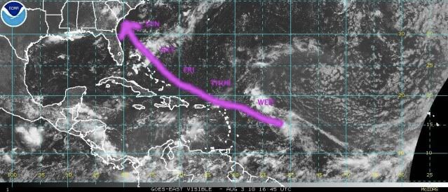
As for Ex-TS Colin, I will start with track. Movement over the next few days will be quite slow. The 00Z BAMS seem to show a slow recurve, while others recurve it rather quickly. The further west Ex-Colin gets, the less steering currents there are. I think that Ex-Colin will recurve well to the west of the island of Bermuda, somewhere between half and one-third of the way from Bermuda to the US coast. This will be a little easier to forecast when we see a curve taking place.

The NHC has noted that Ex-Colin has winds of Tropical Storm force. Many of the models quickly ramp Ex-Colin up to hurricane strength within 3-4 days when shear completely relaxes. Some of this growth may come from an acceleration with latitude commonly found with exiting tropical cyclones. I think that the chances of becoming a strong tropical storm are pretty good over the weekend or on Monday. This would bring a brush of a moderate Tropical Storm to Bermuda, possibly around 50kts. Colin should regain tropical status in the next 24-36 hours.

...Interests...Honduras, Nicaragua, Belize, and the Yucatan peninsula of Mexico should be watching 92L for the threats of heavy rain and moderate to heavy wind.

Bermuda should be watching Colin for the threat of tropical storm force winds, heavy rain, and light surge/high waves on the southern and western facing beaches. Interests in the Bahamas and in the southeastern US should be watching for higher than normal waves with the passing of Colin.

Forecast Likelihoods:
Forecast Confidence: 60%
92L Cyclogenesis: <5%
Colin Cyclogenesis (Re-attainment of Tropical Status): 70%

Meteorology Student Jonathan -- Fact789
________________________________________________
Please bear with me in doing forecasts for each system. I will be moving to Florida State over the next two weeks and my time will become crunched, and I may not be able to make as many forecasts as I would like.
0 likes   

lebron23
Category 1
Category 1
Posts: 389
Age: 32
Joined: Sat May 24, 2008 11:58 am
Contact:

Re: Personal Forecasts -- Ex-Tropical Storm Colin and 92L

#14 Postby lebron23 » Thu Aug 05, 2010 3:45 pm

4pm CDT

Image

Uploaded with ImageShack.us

Storm2k.org Disclaimer: The posts in this forum are NOT official forecast and should not be used as such. They are just the opinion of the poster and may or may not be backed by sound meteorological data. They are NOT endorsed by any professional institution or storm2k.org. For official information, please refer to the NHC and NWS products
0 likes   


Return to “Talkin' Tropics”

Who is online

Users browsing this forum: dl20415, tolakram and 37 guests