http://www.cpc.ncep.noaa.gov/products/p ... /mjo.shtml
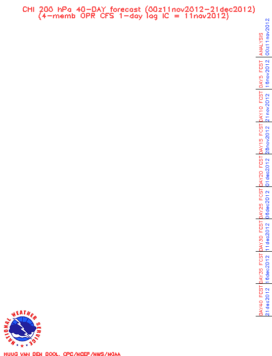
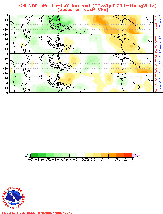
One interesting chart is the 200-hPa Velocity Potential Forecasts in the "Forecasts" section of the web page. There's the link labeled "Global Forecast System" that goes out 15 days and another called "Climate Forecast System" that goes out 40 days. The charts show projected areas of likely rising air (thunderstorms) in green and areas of sinking air in brown in 5 day increments. The current forecast is for a large area of sinking air to develop across the Caribbean, southern Gulf, and MDR for the next 2 weeks (see below). The 40-day Chi predicts that the sinking air will last until the last week of September. If these projections are correct (BIG IF), then we may be in for quite a quiet September.
Also on the web page are various MJO predictions, and some links to explanations of what these graphics mean.
These links and many more may be found on my revised Hurricane Links web page:
http://myweb.cableone.net/nolasue/hurricane.html
15-Day Forecast:
40-Day Forecast