91E Invest at EPAC

This is the general tropical discussion area. Anyone can take their shot at predicting a storms path.

Moderator: S2k Moderators

Forum rules

The posts in this forum are NOT official forecasts and should not be used as such. They are just the opinion of the poster and may or may not be backed by sound meteorological data. They are NOT endorsed by any professional institution or STORM2K. For official information, please refer to products from the National Hurricane Center and National Weather Service.

Help Support Storm2K
Message
Author
User avatar
cycloneye
Admin
Admin
Posts: 148497
Age: 69
Joined: Thu Oct 10, 2002 10:54 am
Location: San Juan, Puerto Rico

91E Invest at EPAC

#1 Postby cycloneye » Thu Oct 13, 2005 10:08 am

Image

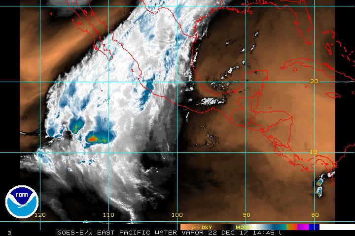
The EPAC still is fairly active after invest 90E tried to develop but didn't do so.


GLOBAL MODEL DATA TIME 00UTC 13.10.2005


NEW TROPICAL STORM FORECAST TO DEVELOP AFTER 36 HOURS

FORECAST POSITION AT T+24 : 11.3N 101.7W


VERIFYING TIME POSITION STRENGTH TENDENCY

-------------- -------- -------- --------

12UTC 14.10.2005 11.3N 101.7W WEAK

00UTC 15.10.2005 11.6N 101.7W WEAK LITTLE CHANGE

12UTC 15.10.2005 12.0N 101.4W WEAK LITTLE CHANGE

00UTC 16.10.2005 12.2N 101.9W WEAK LITTLE CHANGE

12UTC 16.10.2005 12.2N 102.6W WEAK INTENSIFYING SLIGHTLY

00UTC 17.10.2005 12.2N 102.4W WEAK LITTLE CHANGE

12UTC 17.10.2005 12.7N 102.3W WEAK WEAKENING SLIGHTLY

00UTC 18.10.2005 12.8N 102.6W WEAK WEAKENING SLIGHTLY

12UTC 18.10.2005 12.8N 103.8W WEAK LITTLE CHANGE

00UTC 19.10.2005 12.9N 104.4W WEAK LITTLE CHANGE


UKMET has it developing in a weak stage.
0 likes   
Visit the Caribbean-Central America Weather Thread where you can find at first post web cams,radars
and observations from Caribbean basin members Click Here

User avatar
cycloneye
Admin
Admin
Posts: 148497
Age: 69
Joined: Thu Oct 10, 2002 10:54 am
Location: San Juan, Puerto Rico

#2 Postby cycloneye » Thu Oct 13, 2005 7:38 pm


TROPICAL DEPRESSION INVEST (EP912005) ON 20051014 0000 UTC

...00 HRS... ...12 HRS... ...24 HRS... ...36 HRS...
051014 0000 051014 1200 051015 0000 051015 1200

LAT LON LAT LON LAT LON LAT LON
BAMD 10.5N 100.5W 10.7N 101.1W 10.5N 101.9W 9.9N 103.2W
BAMM 10.5N 100.5W 10.7N 100.4W 10.3N 100.8W 9.3N 101.8W
LBAR 10.5N 100.5W 10.9N 100.7W 11.3N 101.3W 11.6N 102.3W
SHIP 25KTS 26KTS 27KTS 30KTS
DSHP 25KTS 26KTS 27KTS 30KTS

...48 HRS... ...72 HRS... ...96 HRS... ..120 HRS...
051016 0000 051017 0000 051018 0000 051019 0000

LAT LON LAT LON LAT LON LAT LON
BAMD 9.6N 104.5W 11.0N 106.4W 13.0N 109.0W 13.3N 112.5W
BAMM 8.7N 103.1W 8.7N 105.3W 7.7N 108.6W 4.4N 114.9W
LBAR 12.0N 103.2W 14.2N 104.9W 15.2N 106.7W 13.2N 108.6W
SHIP 32KTS 33KTS 36KTS 32KTS
DSHP 32KTS 33KTS 36KTS 32KTS

...INITIAL CONDITIONS...
LATCUR = 10.5N LONCUR = 100.5W DIRCUR = 90DEG SPDCUR = 2KT
LATM12 = 10.7N LONM12 = 100.9W DIRM12 = 154DEG SPDM12 = 2KT
LATM24 = 11.1N LONM24 = 100.8W
WNDCUR = 25KT RMAXWD = 25NM WNDM12 = 20KT
CENPRS = 1008MB OUTPRS = 1011MB OUTRAD = 150NM SDEPTH = D
RD34NE = 0NM RD34SE = 0NM RD34SW = 0NM RD34NW = 0NM


If it develops into a Tropical Storm it will be named Pilar but the models are not too bullish about this system being a strong one.
0 likes   

whereverwx
Category 5
Category 5
Posts: 1109
Joined: Mon May 31, 2004 10:15 pm

#3 Postby whereverwx » Thu Oct 13, 2005 7:50 pm

I really doubt it will make it. Look at all of that dry air.

Image
0 likes   

Matt-hurricanewatcher

#4 Postby Matt-hurricanewatcher » Thu Oct 13, 2005 9:35 pm

13/2345 UTC 10.7N 101.1W T1.5/1.5 91E -- East Pacific Ocean
0 likes   

hurricanefreak1988
Category 3
Category 3
Posts: 869
Joined: Thu Jul 22, 2004 10:13 pm
Location: Fayetteville, NC
Contact:

#5 Postby hurricanefreak1988 » Thu Oct 13, 2005 11:05 pm

Yeah baby, bring that orange stuff down. Shut down the entire E-Pac!!! :grrr:

Not that we need help, though. Matt will be wearing that avatar, don't you worry. We've got the title locked up. :P
0 likes   

Matt-hurricanewatcher

#6 Postby Matt-hurricanewatcher » Fri Oct 14, 2005 4:37 am

Come on in Develop. Cut the Atlantic down to 4 if this develops...Come on Eastern pacific 5 more storms to tie.
0 likes   

Matt-hurricanewatcher

#7 Postby Matt-hurricanewatcher » Fri Oct 14, 2005 4:43 am

Hey Atlantic take this. Beat this if you can!

http://weather.unisys.com/hurricane/e_p ... /track.gif

Good luck! :roll:

# Name Date Wind Pres Cat
1 Hurricane EKEKA 26 JAN- 9 FEB 100 - 3
2 Tropical Storm HALI 28-30 MAR 45 - -
3 Tropical Storm AGATHA 1- 5 JUN 60 990 -
4 Tropical Storm BLAS 22-23 JUN 35 1004 -
5 Hurricane CELIA 22 JUN- 4 JUL 125 935 4
6 Hurricane DARBY 2-10 JUL 105 968 3
7 Hurricane ESTELLE 9-17 JUL 120 943 4
8 Hurricane FRANK 13-23 JUL 125 935 4
9 Hurricane GEORGETTE 14-26 JUL 95 964 2
10 Tropical Storm HOWARD 26-30 JUL 55 992 -
11 Tropical Storm ISIS 28 JUL- 2 AUG 55 992 -
12 Hurricane JAVIER 30 JUL-12 AUG 70 985 1
13 Tropical Storm KAY 18-22 AUG 45 1000 -
14 Hurricane LESTER 20-24 AUG 70 985 1
15 Tropical Storm MADELINE 27-31 AUG 45 999 -
16 Tropical Storm NEWTON 27-31 AUG 45 999 -
17 Hurricane ORLENE 2-14 SEP 125 934 4
18 Hurricane INIKI 5-13 SEP 125 938 4
19 Hurricane PAINE 11-16 SEP 65 987 1
20 Hurricane ROSLYN 13-25 SEP 85 975 2
21 Hurricane SEYMOUR 17-27 SEP 75 980 1
22 Hurricane TINA 17 SEP-11 OCT 130 932 4
23 Hurricane VIRGIL 1- 5 OCT 115 948 4
24 Hurricane WINIFRED 6-10 OCT 100 960 3
25 Tropical Storm XAVIER 13-15 OCT 40 1003 -
26 Tropical Storm YOLANDA 15-22 OCT 55 993 -
27 Tropical Storm ZEKE 25-30 OCT 45 1000

27 cyclones!!! 8-)
0 likes   

User avatar
HURAKAN
Professional-Met
Professional-Met
Posts: 46086
Age: 38
Joined: Thu May 20, 2004 4:34 pm
Location: Key West, FL
Contact:

#8 Postby HURAKAN » Fri Oct 14, 2005 7:13 am

Matt-hurricanewatcher wrote:Hey Atlantic take this. Beat this if you can!

http://weather.unisys.com/hurricane/e_p ... /track.gif

Good luck! :roll:

# Name Date Wind Pres Cat
1 Hurricane EKEKA 26 JAN- 9 FEB 100 - 3
2 Tropical Storm HALI 28-30 MAR 45 - -

3 Tropical Storm AGATHA 1- 5 JUN 60 990 -
4 Tropical Storm BLAS 22-23 JUN 35 1004 -
5 Hurricane CELIA 22 JUN- 4 JUL 125 935 4
6 Hurricane DARBY 2-10 JUL 105 968 3
7 Hurricane ESTELLE 9-17 JUL 120 943 4
8 Hurricane FRANK 13-23 JUL 125 935 4
9 Hurricane GEORGETTE 14-26 JUL 95 964 2
10 Tropical Storm HOWARD 26-30 JUL 55 992 -
11 Tropical Storm ISIS 28 JUL- 2 AUG 55 992 -
12 Hurricane JAVIER 30 JUL-12 AUG 70 985 1
13 Tropical Storm KAY 18-22 AUG 45 1000 -
14 Hurricane LESTER 20-24 AUG 70 985 1
15 Tropical Storm MADELINE 27-31 AUG 45 999 -
16 Tropical Storm NEWTON 27-31 AUG 45 999 -
17 Hurricane ORLENE 2-14 SEP 125 934 4
18 Hurricane INIKI 5-13 SEP 125 938 4
19 Hurricane PAINE 11-16 SEP 65 987 1
20 Hurricane ROSLYN 13-25 SEP 85 975 2
21 Hurricane SEYMOUR 17-27 SEP 75 980 1
22 Hurricane TINA 17 SEP-11 OCT 130 932 4
23 Hurricane VIRGIL 1- 5 OCT 115 948 4
24 Hurricane WINIFRED 6-10 OCT 100 960 3
25 Tropical Storm XAVIER 13-15 OCT 40 1003 -
26 Tropical Storm YOLANDA 15-22 OCT 55 993 -
27 Tropical Storm ZEKE 25-30 OCT 45 1000

27 cyclones!!! 8-)


In reality there where only 24 EPAC tropical systems, all the ones that I colored in brown are from the CPAC.
0 likes   

bombarderoazul
Tropical Storm
Tropical Storm
Posts: 186
Joined: Tue Sep 20, 2005 4:12 pm

#9 Postby bombarderoazul » Fri Oct 14, 2005 8:30 am

That was still a very impressive year and it was more stormy than any year of the Atlantic, they actually got to the letter Z, Zeke.
0 likes   

User avatar
HURAKAN
Professional-Met
Professional-Met
Posts: 46086
Age: 38
Joined: Thu May 20, 2004 4:34 pm
Location: Key West, FL
Contact:

#10 Postby HURAKAN » Fri Oct 14, 2005 8:38 am

bombarderoazul wrote:That was still a very impressive year and it was more stormy than any year of the Atlantic, they actually got to the letter Z, Zeke.


It shouldn't be a surprise since the EPAC is USUALLY more active than the Atlantic, and specially, during an EL NIÑO year.

A nadie le debe sorprender que el pacífico occidental sea más activo que el atlántico, y especialmente durante un año en el cual el fenómeno del Niño esté presente.
0 likes   

bombarderoazul
Tropical Storm
Tropical Storm
Posts: 186
Joined: Tue Sep 20, 2005 4:12 pm

#11 Postby bombarderoazul » Fri Oct 14, 2005 8:48 am

1997 tambien fue una temporada fuerte de huracanes en el pacifico, el huracan Linda se convirtio el huracan mas fuerte de todos los tiempos en el pacifico occidental.
0 likes   

User avatar
cycloneye
Admin
Admin
Posts: 148497
Age: 69
Joined: Thu Oct 10, 2002 10:54 am
Location: San Juan, Puerto Rico

#12 Postby cycloneye » Fri Oct 14, 2005 8:55 am

bombarderoazul wrote:1997 tambien fue una temporada fuerte de huracanes en el pacifico, el huracan Linda se convirtio el huracan mas fuerte de todos los tiempos en el pacifico occidental.


Ese fue el ano donde el nino has sido uno de los mas fuertes que se sepa y por eso el atlantico fue bajo lo normal en ese ano.

That was the year when el nino was very strong and that is why the atlantic was below normal in cyclone formations.
0 likes   
Visit the Caribbean-Central America Weather Thread where you can find at first post web cams,radars
and observations from Caribbean basin members Click Here

User avatar
HURAKAN
Professional-Met
Professional-Met
Posts: 46086
Age: 38
Joined: Thu May 20, 2004 4:34 pm
Location: Key West, FL
Contact:

#13 Postby HURAKAN » Fri Oct 14, 2005 8:56 am

bombarderoazul wrote:1997 tambien fue una temporada fuerte de huracanes en el pacifico, el huracan Linda se convirtio el huracan mas fuerte de todos los tiempos en el pacifico occidental.


Cuando escribas en español haslo también en inglés, recuerda que en este foro muchos no hablan español. Estoy de acuerdo con lo que dices.

When you post in Spanish, do it also in English, remember that in this forum a lot of people don't speak Spanish. I agree on what you are saying.
0 likes   

Matt-hurricanewatcher

#14 Postby Matt-hurricanewatcher » Fri Oct 14, 2005 5:21 pm

000
ABPZ20 KNHC 142211
TWOEP
TROPICAL WEATHER OUTLOOK
NWS TPC/NATIONAL HURRICANE CENTER MIAMI FL
4 PM PDT FRI OCT 14 2005

FOR THE EASTERN NORTH PACIFIC... EAST OF 140 DEGREES WEST LONGITUDE.

THE SMALL BUT WELL-DEFINED LOW PRESSURE AREA CENTERED ABOUT 430
MILES SOUTH OF ACAPULCO MEXICO IS SHOWING SIGNS OF INCREASED
ORGANIZATION. UPPER-LEVEL WINDS HAVE BECOME SOMEWHAT MORE FAVORABLE
... AND THIS SYSTEM COULD BECOME A TROPICAL DEPRESSION LATER TONIGHT
OR ON SATURDAY.

ELSEWHERE...TROPICAL STORM FORMATION IS NOT EXPECTED THROUGH
SATURDAY.

FORECASTER STEWART
0 likes   

User avatar
cycloneye
Admin
Admin
Posts: 148497
Age: 69
Joined: Thu Oct 10, 2002 10:54 am
Location: San Juan, Puerto Rico

#15 Postby cycloneye » Fri Oct 14, 2005 7:41 pm


TROPICAL DEPRESSION (EP912005) ON 20051015 0000 UTC

...00 HRS... ...12 HRS... ...24 HRS... ...36 HRS...
051015 0000 051015 1200 051016 0000 051016 1200

LAT LON LAT LON LAT LON LAT LON
BAMD 11.0N 101.2W 11.2N 102.4W 11.5N 103.6W 12.4N 104.7W
BAMM 11.0N 101.2W 11.1N 102.2W 11.1N 103.2W 11.4N 104.4W
LBAR 11.0N 101.2W 11.4N 102.1W 11.7N 103.0W 12.7N 104.0W
SHIP 30KTS 32KTS 32KTS 33KTS
DSHP 30KTS 32KTS 32KTS 33KTS

...48 HRS... ...72 HRS... ...96 HRS... ..120 HRS...
051017 0000 051018 0000 051019 0000 051020 0000

LAT LON LAT LON LAT LON LAT LON
BAMD 13.9N 105.6W 17.3N 107.2W 19.7N 108.1W 21.6N 106.8W
BAMM 12.0N 105.5W 13.1N 108.3W 13.0N 111.9W 11.8N 116.3W
LBAR 13.6N 105.1W 14.2N 107.3W 13.3N 110.3W 10.5N 113.6W
SHIP 35KTS 39KTS 44KTS 43KTS
DSHP 35KTS 39KTS 44KTS 43KTS

...INITIAL CONDITIONS...
LATCUR = 11.0N LONCUR = 101.2W DIRCUR = 270DEG SPDCUR = 2KT
LATM12 = 11.0N LONM12 = 100.5W DIRM12 = 292DEG SPDM12 = 3KT
LATM24 = 10.5N LONM24 = 100.5W
WNDCUR = 30KT RMAXWD = 25NM WNDM12 = 25KT
CENPRS = 1008MB OUTPRS = 1011MB OUTRAD = 150NM SDEPTH = D
RD34NE = 0NM RD34SE = 0NM RD34SW = 0NM RD34NW = 0NM
0 likes   
Visit the Caribbean-Central America Weather Thread where you can find at first post web cams,radars
and observations from Caribbean basin members Click Here


Return to “Talkin' Tropics”

Who is online

Users browsing this forum: No registered users and 163 guests