

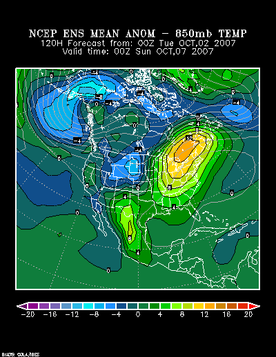
Forecast 850 mb anomalies at 120 hours:
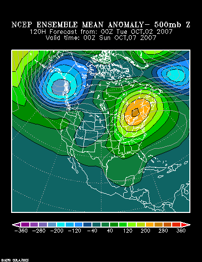
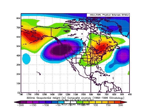
The forecast 500 mb pattern for that time closely resembles a composite of three very warm periods in the October 1-10 timeframe (1950-2006). Those warm spells occurred in 1950, 1967, and 1997.
Forecast 500 mb Height Anomalies at 120 hours:
Composite 500 mb Height Anomalies:
The following were the highest temperatures during the three similar outbreaks of warmth for select cities:
October 1-3, 1950:
Boston: 84°
Burlington: 82°
New York City: 86°
Philadelphia: 85°
Toronto: 78° (25.6°C)
Washington, DC (DCA): 87°
October 2-5, 1967:
Boston: 81°
Burlington: 77°
New York City: 86°
Philadelphia: 88°
Toronto: 79° (26.1°C)
Washington, DC (DCA): 91°
October 8-10, 1997:
Boston: 82°
Burlington: 76°
New York City: 82°
Philadelphia: 84°
Toronto: 75° (24.0°C)
Washington, DC (DCA): 87°
Conclusion:
Given the above data, I believe it is likely that New York City, Philadelphia, and Washington, DC will see temperatures peak at or above 85° during the upcoming warm period. Boston and Burlington should both see the highest temperature reach or exceed 80°. Toronto will likely see its temperature peak at or above 25°C (77°F). There is some possibility that Toronto could see a high temperature of 80° (26.7°C) and that Washington, DC might see the temperature approach or reach 90°.
Interestingly enough, for the three periods analyzed above, Toronto saw its first 0°C (32°F) or lower reading 10-14 days after the start of the warm period. As a result, it would not be surprising if Toronto saw its first freeze around October near mid-month, probably October 13-18 to allow for some margin of error.


