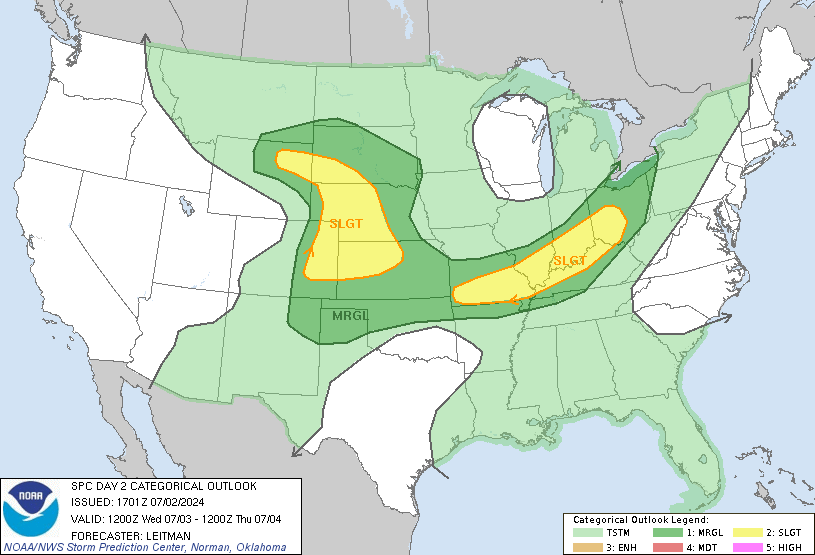
STORM PREDICTION CENTER...NWS/NCEP...NORMAN OK
DAY 2 CONVECTIVE OUTLOOK...REF AWIPS GRAPHIC PGWI47 KWNS.
VALID 221200Z - 231200Z
A MODERATE RISK OF SEVERE STORMS IS FORECAST FOR ERN SC...ERN NC...
AND FAR SERN VA FOR SATURDAY AFTERNOON AND EVENING TO THE RIGHT OF
A LINE FROM 15 SE SAV 30 NE AGS 40 ENE CLT ORF.
THERE IS A SLGT RISK OF SVR TSTMS TO THE RIGHT OF A LINE FROM PNS
HSV LOZ 10 ENE ACY ...CONT... MLB 35 NW FMY.
GEN TSTMS ARE FCST TO THE RIGHT OF A LINE FROM 10 NNW WRL 10 W RAP
BBW 30 SE IML 25 SE AKO FCL CAG 15 SSW LND 10 NNW WRL.
GEN TSTMS ARE FCST TO THE RIGHT OF A LINE FROM 35 SSW HUM GWO SDF
DUJ 10 WNW UCA 30 S AUG.
...SIGNIFICANT WIND EVENT IS POSSIBLE OVER THE MID-ATLANTIC STATES
SATURDAY AFTERNOON AND EVENING...
...SYNOPSIS...
POWERFUL UPPER TROUGH/SURFACE LOW WILL TRACK QUICKLY FROM THE LOWER
MS VALLEY INTO THE UPPER OH VALLEY/NERN STATES...WITH A FAST-MOVING
COLD FRONT BEING THE FOCUS FOR A LONG SQUALL LINE WITH SEVERE/
SIGNIFICANT SEVERE STORMS FOR MUCH OF THE SERN STATES ON DAY 2.
A LINE OF STRONG TO SEVERE STORMS WILL LIKELY BE ONGOING AT THE
BEGINNING OF THE PERIOD FROM TN/ERN AL INTO THE WRN FL PANHANDLE...
AND MAY BE AS FAR EAST AS WRN GA. SLY LOW-LEVEL WINDS AHEAD OF THE
UPPER TROUGH SHOULD ALLOW MOISTURE/INSTABILITY TO MOVE INLAND OVER
THE SERN STATES BY LATE MORNING/EARLY AFTERNOON WITH MID 60 SURFACE
DEWPOINTS EXPECTED INTO SRN GA...ERN CAROLINAS AND FAR SERN VA.
THE 12Z ETAKF INDICATES THE GREATEST INSTABILITY /MUCAPE AOA 1500
J/KG WITHIN THE MODERATE RISK AREA...WHILE THE ETA CONTINUES TO
SHOW LESS INSTABILITY OVER THIS REGION FOR SATURDAY AFTERNOON.
DESPITE THIS DISAGREEMENT IN INSTABILITY...ALL MODELS CONTINUE TO
SHOW INCREASING AND VERY STRONG WIND FIELDS TO SUPPORT DAMAGING
WINDS AND ISOLATED TORNADOES AS THE SQUALL LINE MOVES INTO THE
CAROLINAS/SERN VA AND ERN GA/NRN FL SATURDAY AFTERNOON. ATTM...THE
GREATEST POTENTIAL FOR SIGNIFICANT SEVERE STORMS WILL BE DURING THE
AFTERNOON AND EARLY EVENING OVER THE ERN CAROLINAS INTO FAR SERN
VA. GIVEN THE STRENGTH OF THIS SYSTEM...THE POTENTIAL EXISTS FOR
ISOLATED GUSTY/DAMAGING WINDS TO REACH AS FAR NORTH AS ERN PA INTO
SRN NEW ENGLAND...DESPITE REMAINING SNOW COVER.
http://www.spc.noaa.gov/products/outlook/day2otlk.html
Eastern Carolinas and SE VA under moderate risk of severe TS
Moderator: S2k Moderators
Forum rules
The posts in this forum are NOT official forecast and should not be used as such. They are just the opinion of the poster and may or may not be backed by sound meteorological data. They are NOT endorsed by any professional institution or STORM2K.
- Stormsfury
- Category 5

- Posts: 10549
- Age: 53
- Joined: Wed Feb 05, 2003 6:27 pm
- Location: Summerville, SC
- Stormsfury
- Category 5

- Posts: 10549
- Age: 53
- Joined: Wed Feb 05, 2003 6:27 pm
- Location: Summerville, SC
-
Rob-TheStormChaser
-
Rob-TheStormChaser
A SLGT risk implies well-organized severe thunderstorms are expected but in small numbers and/or low coverage. Within a slight risk area, 5-29 reports of 1 inch of larger hail, and/or 3-5 tornadoes, and/or 5-29 wind events are forecast.
MDT risks imply a greater concentration of severe thunderstorms, and in most situations, greater magnitude of severe weather. Within a moderate risk area, at least 30 reports of hail 1 inch or larger, or 6-19 tornadoes, or numerous wind events (30 that might be associated with a squall line, bow echo or derecho) are forecast.
The HIGH risk area almost always means a major severe weather outbreak is expected, with great coverage of severe weather and enhanced likelihood of extreme severe (i.e., violent tornadoes or extreme convective wind events over a large area). Within a high risk area, expect at least 20 tornadoes with at least 2 of them rated F3+, or an extreme derecho causing 50+ widespread wind events (50+) with numerous higher end wind (80+ mph) and structural damage reports.
0 likes
- Stormsfury
- Category 5

- Posts: 10549
- Age: 53
- Joined: Wed Feb 05, 2003 6:27 pm
- Location: Summerville, SC
Return to “USA & Caribbean Weather”
Who is online
Users browsing this forum: wxman22 and 117 guests


