Texas Spring 2026
Moderator: S2k Moderators
Forum rules

The posts in this forum are NOT official forecast and should not be used as such. They are just the opinion of the poster and may or may not be backed by sound meteorological data. They are NOT endorsed by any professional institution or STORM2K.


Re: Texas Spring 2026
Wisconsin and Michigan are experiencing flooding. One of their wettest Aprils ever. Usually their rainy month is June and early July during summer when it's warm enough, it warmed early.
0 likes
The above post and any post by Ntxw is NOT an official forecast and should not be used as such. It is just the opinion of the poster and may or may not be backed by sound meteorological data. It is NOT endorsed by any professional institution including Storm2k. For official information, please refer to NWS products.
Help support Storm2K!
-
wxman22

- Category 5

- Posts: 2042
- Joined: Mon Jan 30, 2006 12:39 am
- Location: Wichita Falls, TX
- Contact:
Re: Texas Spring 2026
The front will bring a needed break from the severe weather. The next severe weather sequence may start by late next week.
Day 4-8 Convective Outlook
NWS Storm Prediction Center Norman OK
0241 AM CDT Fri Apr 17 2026
Valid 201200Z - 251200Z
...DISCUSSION...
A dry, continental airmass will persist across most of the CONUS for
the first part of next week. Severe weather chances will start to
increase by the middle of the week and into the later part of the
week. Forecast guidance consistently shows mid 60s F dewpoints
across the Plains and into the Midwest. However, aloft the pattern
remains quite uncertain. The ECMWF and the GEFS and EPS all show a
developing large-scale trough centered across the western CONUS with
multiple shortwave troughs which could result in severe weather
Day6/Wed to Day 8/Fri. However, the 00Z GFS and the EC-AIFS show a
consolidated mid-level trough which could result in a much more
substantial severe weather event across the central/southern Plains.
At this time, uncertainty is too high for specific risk areas, but
Day6/Wed to Day 8/Fri will likely feature multiple days of severe
weather across portions of the central/southern Plains.
..Bentley.. 04/17/2026
0 likes

Re: Texas Spring 2026
wxman22 wrote:The front will bring a needed break from the severe weather. The next severe weather sequence may start by late next week.Day 4-8 Convective Outlook
NWS Storm Prediction Center Norman OK
0241 AM CDT Fri Apr 17 2026
Valid 201200Z - 251200Z
...DISCUSSION...
A dry, continental airmass will persist across most of the CONUS for
the first part of next week. Severe weather chances will start to
increase by the middle of the week and into the later part of the
week. Forecast guidance consistently shows mid 60s F dewpoints
across the Plains and into the Midwest. However, aloft the pattern
remains quite uncertain. The ECMWF and the GEFS and EPS all show a
developing large-scale trough centered across the western CONUS with
multiple shortwave troughs which could result in severe weather
Day6/Wed to Day 8/Fri. However, the 00Z GFS and the EC-AIFS show a
consolidated mid-level trough which could result in a much more
substantial severe weather event across the central/southern Plains.
At this time, uncertainty is too high for specific risk areas, but
Day6/Wed to Day 8/Fri will likely feature multiple days of severe
weather across portions of the central/southern Plains.
..Bentley.. 04/17/2026
You think SETX will see any severe weather next week?
0 likes
-
Stratton23
- Category 5
- Posts: 3587
- Joined: Fri Jul 21, 2023 10:59 pm
- Location: Katy, Tx
Re: Texas Spring 2026
I think the pattern late next week with the blocking in canada slowing everything down, looks to be more of a heavy rain/ flooding setup compared to a severe threat, at least in my opinion, GFS/ Euro have been hinting at some pretty excessive rainfall totals for areas like central and se texas in the 10-14 day period, systems wont be able to eject as fast with that - NAO slowing things down
0 likes
-
wxman22
- Category 5
- Posts: 2042
- Joined: Mon Jan 30, 2006 12:39 am
- Location: Wichita Falls, TX
- Contact:
Re: Texas Spring 2026
The SPC is referring to the strong cyclogenesis some models are showing on the Lee side of the Rockies by the middle of next week. Still far out so things will change but something to watch for those in the northern half of the state into the central Plains just in case.

Last edited by wxman22 on Fri Apr 17, 2026 11:47 am, edited 2 times in total.
0 likes
Re: Texas Spring 2026
Stratton23 wrote:I think the pattern late next week with the blocking in canada slowing everything down, looks to be more of a heavy rain/ flooding setup compared to a severe threat, at least in my opinion, GFS/ Euro have been hinting at some pretty excessive rainfall totals for areas like central and se texas in the 10-14 day period, systems wont be able to eject as fast with that - NAO slowing things down
I posted about the super typhoon recurve and pattern interference. Good to see the models into that idea. The longer range ecmwf and cfsv2 have been showing a more El Nino pattern later into April where systems meander. So far it's not really been El-Nino-ish pattern it's the change of seasons temperature gradient migration and the rains go with it. Upcoming pattern as you alluded to, slows everything down.
Ntxw wrote:I would watch the cyclone forming in the WPAC, big sprawling typhoons is signature El Nino in the early season. It has potential to become a very strong recurving typhoon and buckling the north Pacific pattern down the road later in the month and into early May. Perhaps cooler than normal and very heavy rains.
1 likes
The above post and any post by Ntxw is NOT an official forecast and should not be used as such. It is just the opinion of the poster and may or may not be backed by sound meteorological data. It is NOT endorsed by any professional institution including Storm2k. For official information, please refer to NWS products.
Help support Storm2K!
Help support Storm2K!
-
wxman22
- Category 5
- Posts: 2042
- Joined: Mon Jan 30, 2006 12:39 am
- Location: Wichita Falls, TX
- Contact:
Re: Texas Spring 2026
Cpv17 wrote:wxman22 wrote:The front will bring a needed break from the severe weather. The next severe weather sequence may start by late next week.Day 4-8 Convective Outlook
NWS Storm Prediction Center Norman OK
0241 AM CDT Fri Apr 17 2026
Valid 201200Z - 251200Z
...DISCUSSION...
A dry, continental airmass will persist across most of the CONUS for
the first part of next week. Severe weather chances will start to
increase by the middle of the week and into the later part of the
week. Forecast guidance consistently shows mid 60s F dewpoints
across the Plains and into the Midwest. However, aloft the pattern
remains quite uncertain. The ECMWF and the GEFS and EPS all show a
developing large-scale trough centered across the western CONUS with
multiple shortwave troughs which could result in severe weather
Day6/Wed to Day 8/Fri. However, the 00Z GFS and the EC-AIFS show a
consolidated mid-level trough which could result in a much more
substantial severe weather event across the central/southern Plains.
At this time, uncertainty is too high for specific risk areas, but
Day6/Wed to Day 8/Fri will likely feature multiple days of severe
weather across portions of the central/southern Plains.
..Bentley.. 04/17/2026
You think SETX will see any severe weather next week?
The SE ridge looks to finally flatten next week. This should allow the subtropical jet to become more active in the southern portions of the state. This time of year even in a slow or nebulous pattern, at least low end severe weather is always a possibility. Things become more dependent on mesoscale driven features though and less synoptic based.
0 likes
Re: Texas Spring 2026
The tornado event is again happening up north in Minnesota, Iowa, Illinois, and Wisconsin this afternoon.
Cooler air on the way.
Cooler air on the way.
1 likes
The above post and any post by Ntxw is NOT an official forecast and should not be used as such. It is just the opinion of the poster and may or may not be backed by sound meteorological data. It is NOT endorsed by any professional institution including Storm2k. For official information, please refer to NWS products.
Help support Storm2K!
Help support Storm2K!
-
rwfromkansas
- Category 5
- Posts: 3064
- Joined: Sat Aug 27, 2005 12:47 am
- Location: North Fort Worth
-
wxman22
- Category 5
- Posts: 2042
- Joined: Mon Jan 30, 2006 12:39 am
- Location: Wichita Falls, TX
- Contact:
Re: Texas Spring 2026
Ntxw wrote:The tornado event is again happening up north in Minnesota, Iowa, Illinois, and Wisconsin this afternoon.
Cooler air on the way.
This has to be a record breaking year for tornadoes up there in the Great Lakes Region.Crazy how active its been especially this early in the season there.That warm front that's been stalled up there for weeks is putting in the work.
0 likes
-
wxman22
- Category 5
- Posts: 2042
- Joined: Mon Jan 30, 2006 12:39 am
- Location: Wichita Falls, TX
- Contact:
Re: Texas Spring 2026
Stratton23 wrote:I think the pattern late next week with the blocking in canada slowing everything down, looks to be more of a heavy rain/ flooding setup compared to a severe threat, at least in my opinion, GFS/ Euro have been hinting at some pretty excessive rainfall totals for areas like central and se texas in the 10-14 day period, systems wont be able to eject as fast with that - NAO slowing things down
Some models are showing some hefty dew points and precipitable waters by next weekend along with a stalled front... that's a recipe for excessive rainfall somewhere.
0 likes
-
Brent
- S2K Supporter

- Posts: 38785
- Age: 37
- Joined: Sun May 16, 2004 10:30 pm
- Location: Tulsa Oklahoma
- Contact:
Re: Texas Spring 2026
Tulsa mentioning a frost advisory possible for Sunday morning 
There was another random spinup in Ponca City
There was another random spinup in Ponca City
0 likes
#neversummer
-
CaptinCrunch

- S2K Supporter
- Posts: 8786
- Age: 58
- Joined: Mon Nov 03, 2003 4:33 pm
- Location: Kennedale, TX (Tarrant Co.)
Re: Texas Spring 2026
I doubt we see anything more than a passing shower, sad times my friends. The Spring models are acting like the winter models, 7-10 days out. It geographically oddity 
0 likes
-
CaptinCrunch
- S2K Supporter
- Posts: 8786
- Age: 58
- Joined: Mon Nov 03, 2003 4:33 pm
- Location: Kennedale, TX (Tarrant Co.)
Re: Texas Spring 2026
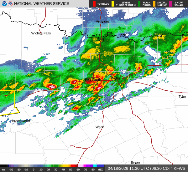
Nice cool steady rain, nothing hard witha few rumbles of thunder. Very Fall like morning 
0 likes
Re: Texas Spring 2026
Definitely does feel like Fall weather. Below normal..is this real? Windows open.
1 likes
The above post and any post by Ntxw is NOT an official forecast and should not be used as such. It is just the opinion of the poster and may or may not be backed by sound meteorological data. It is NOT endorsed by any professional institution including Storm2k. For official information, please refer to NWS products.
Help support Storm2K!
Help support Storm2K!
-
rwfromkansas
- Category 5
- Posts: 3064
- Joined: Sat Aug 27, 2005 12:47 am
- Location: North Fort Worth
-
mmmmsnouts
- Tropical Storm

- Posts: 218
- Joined: Tue Sep 05, 2023 10:04 pm
- Location: Arlington, TX
Re: Texas Spring 2026
Nice soaking rain in Arlington, with a perfectly timed dry-ish window while I was waiting in line outside for Record Store Day.
0 likes
Return to “USA & Caribbean Weather”
Who is online
Users browsing this forum: Google Adsense [Bot], wxman22 and 202 guests