SE TX/SW LA weather: Much cooler and WET after Tuesday
Moderator: S2k Moderators
Forum rules

The posts in this forum are NOT official forecast and should not be used as such. They are just the opinion of the poster and may or may not be backed by sound meteorological data. They are NOT endorsed by any professional institution or STORM2K.
-
Ed Mahmoud
Re: SE TX/SW LA weather: Possible Severe Weather
Lots of dark clouds, wind, and thunder. And about 12 drops of rain here near 1960 and Veterans Memorial.
0 likes
-
wlfpack81

- Professional-Met

- Posts: 417
- Joined: Thu Sep 18, 2003 11:19 am
- Location: Arlington, VA
- Contact:
Re: SE TX/SW LA weather: Possible Severe Weather
Okay so Comcast sucks when it comes to setting up your personal webspace so I made an account on flickr. Here's the image I took. Sorry for the blurriness of the photo.

0 likes
-
srainhoutx

- S2K Supporter

- Posts: 6919
- Age: 68
- Joined: Sun Jan 14, 2007 11:34 am
- Location: Haywood County, NC
- Contact:
Re: SE TX/SW LA weather: Possible Severe Weather
wlfpack81 wrote:Okay so Comcast sucks when it comes to setting up your personal webspace so I made an account on flickr. Here's the image I took. Sorry for the blurriness of the photo.
Great shot wlfpack.
0 likes
-
southerngale

- Retired Staff

- Posts: 27418
- Joined: Thu Oct 10, 2002 1:27 am
- Location: Southeast Texas (Beaumont area)

-
CajunMama
- Retired Staff
- Posts: 10791
- Joined: Thu Feb 06, 2003 9:57 pm
- Location: 30.22N, 92.05W Lafayette, LA
Re: SE TX/SW LA weather: Possible Severe Weather
06/21/2008 0625 PM
Lafayette, Lafayette Parish.
Hail e0.75 inch, reported by public.
Seen near a softball field.
06/21/2008 0636 PM
Lafayette, Lafayette Parish.
Hail e0.50 inch, reported by trained spotter.
Spotter reported dime size hail at the intersection of camellia Blvd and Johnston street. Very heavy rainfall also occurring.
06/21/2008 0640 PM
Lafayette, Lafayette Parish.
Hail m1.00 inch, reported by broadcast media.
Quarter size hail reported on the corner of Pinhook and kaliste saloom Road.
My son lives about a block away from Pinhook & Kaliste Saloom. He said it hailed for about 10 minutes or so. His camera was in his car and he wasn't about to run out and get it!
Lafayette, Lafayette Parish.
Hail e0.75 inch, reported by public.
Seen near a softball field.
06/21/2008 0636 PM
Lafayette, Lafayette Parish.
Hail e0.50 inch, reported by trained spotter.
Spotter reported dime size hail at the intersection of camellia Blvd and Johnston street. Very heavy rainfall also occurring.
06/21/2008 0640 PM
Lafayette, Lafayette Parish.
Hail m1.00 inch, reported by broadcast media.
Quarter size hail reported on the corner of Pinhook and kaliste saloom Road.
My son lives about a block away from Pinhook & Kaliste Saloom. He said it hailed for about 10 minutes or so. His camera was in his car and he wasn't about to run out and get it!
0 likes
-
lrak

- S2K Supporter
- Posts: 1770
- Age: 59
- Joined: Thu Jun 21, 2007 2:48 pm
- Location: Corpus Christi, TX
Re: SE TX/SW LA weather: Possible Severe Weather
http://radar.weather.gov/radar.php?rid= ... 11&loop=no

Will these thunderstorms hold together and make it all the way down to Corpus Christi?
And that is an awesome picture.
Karl
Will these thunderstorms hold together and make it all the way down to Corpus Christi?
And that is an awesome picture.
Karl
0 likes
-
srainhoutx
- S2K Supporter
- Posts: 6919
- Age: 68
- Joined: Sun Jan 14, 2007 11:34 am
- Location: Haywood County, NC
- Contact:
Re: SE TX/SW LA weather: Possible Severe Weather
Great view tonight of our little system that generated a funnel near Pearland...
http://adds.aviationweather.noaa.gov/sa ... e&itype=ir
AREA FORECAST DISCUSSION
NATIONAL WEATHER SERVICE HOUSTON/GALVESTON TX
900 PM CDT SAT JUN 21 2008
.DISCUSSION...
WELL-DEFINED SFC OUTFLOW BOUNDARY (PERHAPS THE ACTUAL SFC FRONT) NOW
EXTENDS FROM EDNA TO SARGENT TO WELL OFF THE COAST OF GALVESTON.
THE BOUNDARY WILL CONTINUE WORKING ITS WAY SOUTH. WILL MAINTAIN
CHANCE POPS WITH SEVERE MENTION FOR THE FAR SW ZONES UNTIL
MIDNIGHT. ELSEWHERE...HAVE DROPPED MENTION OF PRECIP FOR TONIGHT
AS ATMOSPHERE HAS BECOME TOO STABLE TO SUPPORT REDEVELOPMENT.
DRIER AIRMASS WILL GRADUALLY FILTER IN FROM THE NORTH OVERNIGHT
WHICH WILL RESULT IN SLIGHTLY COOLER MIN TEMPS FOR INLAND ZONES.
BEST MOISTURE/INSTABILITY ON SUNDAY WILL BE CONFINED TO THE
COASTAL ZONES WHERE SFC BOUNDARY MAY REMAIN IN PLACE AND WEAK
SEABREEZE WILL WORK ITS WAY INLAND. CONVECTIVE DEVELOPMENT SUN
AFTN SHOULD BE CONFINED MAINLY TO AREAS SOUTH OF HOUSTON. ABUNDANT
SUNSHINE...DRIER AIRMASS...AND LIGHT NORTHERLY WINDS WILL FAVOR
ANOTHER HOT AFTERNOON SUNDAY...WITH MANY LOCATIONS LIKELY TO REACH
THE UPPER 90S AGAIN.
WE RECEIVED SEVERAL REPORTS OF WIND DAMAGE AND AT LEAST ONE REPORT
OF GOLFBALL SIZED HAIL FROM THE STORMS TONIGHT. WILL SEND OUT AN
LSR LATER THIS EVENING.
http://www.srh.noaa.gov/productview.php?pil=HGXAFDHGX
0 likes
-
wlfpack81
- Professional-Met
- Posts: 417
- Joined: Thu Sep 18, 2003 11:19 am
- Location: Arlington, VA
- Contact:
Re: SE TX/SW LA weather: Possible Severe Weather
Watching KPRC right now & they showed 3 other photos taken from Pearland of the funnel today. Really great shots and one was a nice wide view of the funnel and cloud base. However, looking at the report of damage from SW Houston and one resident stating she saw a tornado (even made the circular motion w/her hands) there's a chance this thing may have briefly been on the ground as it moved through SW portions of Houston though there's no official confirmation from the NWS yet.
0 likes
-
srainhoutx
- S2K Supporter
- Posts: 6919
- Age: 68
- Joined: Sun Jan 14, 2007 11:34 am
- Location: Haywood County, NC
- Contact:
Re: SE TX/SW LA weather: Possible Severe Weather
wlfpack81 wrote:Watching KPRC right now & they showed 3 other photos taken from Pearland of the funnel today. Really great shots and one was a nice wide view of the funnel and cloud base. However, looking at the report of damage from SW Houston and one resident stating she saw a tornado (even made the circular motion w/her hands) there's a chance this thing may have briefly been on the ground as it moved through SW portions of Houston though there's no official confirmation from the NWS yet.
I have to agree. Your photo alone shows the potential that touch down had occrrred. Saw reports at 6:35 pm of funnel near 288 and Beltway 8.
0 likes
-
CajunMama
- Retired Staff
- Posts: 10791
- Joined: Thu Feb 06, 2003 9:57 pm
- Location: 30.22N, 92.05W Lafayette, LA
Re: SE TX/SW LA weather: Possible Severe Weather
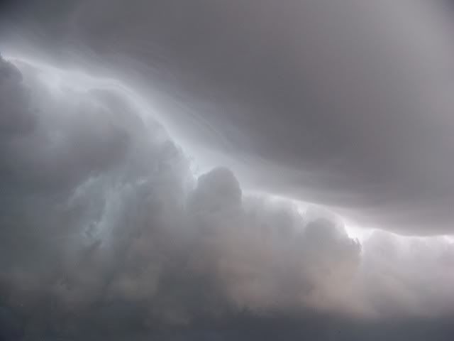
Y'all might not find these interesting but i thought they were kind of neat. I got a couple of photos of the storms merging. The two different clouds were neat. The top right clouds were real smooth looking and the bottom left clouds were rough and mean looking.


0 likes
-
southerngale
- Retired Staff
- Posts: 27418
- Joined: Thu Oct 10, 2002 1:27 am
- Location: Southeast Texas (Beaumont area)

-
jasons2k

- Storm2k Executive

- Posts: 8290
- Age: 52
- Joined: Wed Jul 06, 2005 12:32 pm
- Location: The Woodlands, TX
Re: SE TX/SW LA weather: Possible Severe Weather
Wow, great photos from Lafayette and Pearland - thanks for posting!! Quite an active few days.
0 likes

Re: SE TX/SW LA weather: Possible Severe Weather
Here are some mammatus clouds in League during the past few days. Finally picked up some well needed rain.


0 likes
-
Yankeegirl

- Category 5

- Posts: 3417
- Age: 50
- Joined: Sun May 23, 2004 11:59 pm
- Location: Cy-Fair, Northwest Houston
- Contact:
-
Ed Mahmoud
Re:
Yankeegirl wrote:We didnt get much rain yesterday, but just a tad to the east of here must have got nailed, our power was out last night/evening for 5 hours!!
Just turned off the sprinkler to watch NASCAR race unidsturbed, as despite thunder, lightning, ominous clouds and wind, both Friday and Saturday, almost no rain.
But, just saw on models thread, 12Z Euro brings a strong tropical wave, almost a tropical depression, into Mexico just South of Brownsville next weekend, with deep layer onshore flow and lots of moisture for all of the Texas coast. Houston would be a tad far North for the best rain action, maybe, but a week out, for a global model, it looks like it has potential.

0 likes
-
srainhoutx
- S2K Supporter
- Posts: 6919
- Age: 68
- Joined: Sun Jan 14, 2007 11:34 am
- Location: Haywood County, NC
- Contact:
Re: SE TX/SW LA weather: Possible Severe Weather
And in model voodoo land the GFS "hints" that we might get something a bit later. But that's for another time and place.
0 likes

Re: SE TX/SW LA weather: Possible Severe Weather
What a storm!
I spotted a funnel (though it never touched the ground) Sat at around 6:12PM, just east of 288S & Beltway 8. First time. Wow, just a surreal experience.
I spotted a funnel (though it never touched the ground) Sat at around 6:12PM, just east of 288S & Beltway 8. First time. Wow, just a surreal experience.
0 likes
-
srainhoutx
- S2K Supporter
- Posts: 6919
- Age: 68
- Joined: Sun Jan 14, 2007 11:34 am
- Location: Haywood County, NC
- Contact:
Re: SE TX/SW LA weather: Possible Severe Weather
HGX needed some assistance from CRP this afternoon with Short Term Forecast...
SHORT TERM FORECAST
NATIONAL WEATHER SERVICE HOUSTON/GALVESTON TX
ISSUED BY NATIONAL WEATHER SERVICE CORPUS CHRISTI TX
202 PM CDT MON JUN 23 2008
GMZ335-355-375-TXZ163-164-176>179-196-198>200-212>214-227-237-238-
232115-
GALVESTON BAY-WATERS FROM HIGH ISLAND TO FREEPORT OUT 20 NM-
WATERS FROM HIGH ISLAND TO FREEPORT 20 TO 60 NM-HOUSTON-TRINITY-
MADISON-WALKER-SAN JACINTO-POLK-BRAZOS-GRIMES-MONTGOMERY-LIBERTY-
WALLER-HARRIS-CHAMBERS-FORT BEND-BRAZORIA-GALVESTON-
INCLUDING THE CITIES OF...CROCKETT...TRINITY...GROVETON...
MADISONVILLE...HUNTSVILLE...SHEPHERD...COLDSPRING...LIVINGSTON...
CORRIGAN...ONALASKA...COLLEGE STATION...BRYAN...NAVASOTA...
THE WOODLANDS...CONROE...WILLIS...LIBERTY...CLEVELAND...DAYTON...
HEMPSTEAD...PRAIRIE VIEW...BROOKSHIRE...HOUSTON...PASADENA...
KATY...TOMBALL...HUMBLE...WINNIE...MONT BELVIEU...ANAHUAC...
SUGAR LAND...MISSOURI CITY...RICHMOND...ROSENBERG...PEARLAND...
LAKE JACKSON...ALVIN...ANGLETON...FREEPORT...LEAGUE CITY...
TEXAS CITY...FRIENDSWOOD...GALVESTON
202 PM CDT MON JUN 23 2008
.NOW...
ISOLATED SHOWERS AND THUNDERSTORMS...MOVING NORTHWEST AROUND 15
MPH...WILL CONTINUE TO DEVELOP THIS AFTERNOON OVER PORTIONS OF
SOUTHEAST TEXAS. RAINFALL AMOUNTS WILL AVERAGE BETWEEN 1/4 AND 1/2
INCH...WITH LOCALLY HIGHER AMOUNTS IN ANY THUNDERSTORMS OR SLOW-
MOVING SHOWERS. BRIEF WIND GUSTS UP TO 35 MPH AND OCCASIONAL
LIGHTNING WILL ACCOMPANY ANY OF THE THUNDERSTORMS. THROUGH 4
PM...MOST OF THE RAINFALL WILL BE CONCENTRATED EAST OF A ANGLETON
TO KATY LINE.
Actually getting a good sprinkle as storms develope ahead of seabreeze.
0 likes
Return to “USA & Caribbean Weather”
Who is online
Users browsing this forum: Cpv17, South Texas Storms, txtwister78 and 33 guests