We have a tornado watch...
Moderator: S2k Moderators
Forum rules

The posts in this forum are NOT official forecast and should not be used as such. They are just the opinion of the poster and may or may not be backed by sound meteorological data. They are NOT endorsed by any professional institution or STORM2K.
-
wx247

- S2K Supporter

- Posts: 14279
- Age: 42
- Joined: Wed Feb 05, 2003 10:35 pm
- Location: Monett, Missouri
- Contact:
We have a tornado watch...
Stay tuned for details!
0 likes
Personal Forecast Disclaimer:
The posts in this forum are NOT official forecast and should not be used as such. They are just the opinion of the poster and may or may not be backed by sound meteorological data. They are NOT endorsed by any professional institution or storm2k.org. For official information, please refer to the NHC and NWS products.
The posts in this forum are NOT official forecast and should not be used as such. They are just the opinion of the poster and may or may not be backed by sound meteorological data. They are NOT endorsed by any professional institution or storm2k.org. For official information, please refer to the NHC and NWS products.
-
wx247
- S2K Supporter
- Posts: 14279
- Age: 42
- Joined: Wed Feb 05, 2003 10:35 pm
- Location: Monett, Missouri
- Contact:
BULLETIN - IMMEDIATE BROADCAST REQUESTED
AREAL OUTLINE FOR TORNADO WATCH NUMBER 93
NATIONAL WEATHER SERVICE NORMAN OK
205 PM CDT TUE APR 20 2004
TORNADO WATCH NUMBER 93 IN EFFECT UNTIL 800 PM CDT.
IN OKLAHOMA THIS WATCH INCLUDES 20 COUNTIES...
OKC081-119-210100-
IN CENTRAL OKLAHOMA THIS WATCH INCLUDES 2 COUNTIES...
LINCOLN PAYNE
$$
OKC021-101-107-210100-
IN EAST CENTRAL OKLAHOMA THIS WATCH INCLUDES 3 COUNTIES...
CHEROKEE MUSKOGEE OKFUSKEE
$$
OKC001-035-037-041-097-105-111-113-117-131-143-145-147-210100-
IN NORTHEAST OKLAHOMA THIS WATCH INCLUDES 13 COUNTIES...
ADAIR CRAIG CREEK DELAWARE
MAYES NOWATA OKMULGEE OSAGE
PAWNEE ROGERS TULSA WAGONER
WASHINGTON
$$
0 likes
Personal Forecast Disclaimer:
The posts in this forum are NOT official forecast and should not be used as such. They are just the opinion of the poster and may or may not be backed by sound meteorological data. They are NOT endorsed by any professional institution or storm2k.org. For official information, please refer to the NHC and NWS products.
The posts in this forum are NOT official forecast and should not be used as such. They are just the opinion of the poster and may or may not be backed by sound meteorological data. They are NOT endorsed by any professional institution or storm2k.org. For official information, please refer to the NHC and NWS products.
-
wx247
- S2K Supporter
- Posts: 14279
- Age: 42
- Joined: Wed Feb 05, 2003 10:35 pm
- Location: Monett, Missouri
- Contact:
SLSAR
BULLETIN - IMMEDIATE BROADCAST REQUESTED
ARKANSAS AREAL OUTLINE FOR TORNADO WATCH NUMBER 93
NATIONAL WEATHER SERVICE LITTLE ROCK AR
206 PM CDT TUE APR 20 2004
TORNADO WATCH NUMBER 93 IN EFFECT UNTIL 800 PM CDT.
IN ARKANSAS THIS WATCH INCLUDES 2 COUNTIES...
ARC007-143-210100-
IN NORTHWEST ARKANSAS THIS WATCH INCLUDES 2 COUNTIES...
BENTON AND WASHINGTON
$$
WWWW
*********************************
As soon as I get the SPC statement I will pass it along to you.
0 likes
Personal Forecast Disclaimer:
The posts in this forum are NOT official forecast and should not be used as such. They are just the opinion of the poster and may or may not be backed by sound meteorological data. They are NOT endorsed by any professional institution or storm2k.org. For official information, please refer to the NHC and NWS products.
The posts in this forum are NOT official forecast and should not be used as such. They are just the opinion of the poster and may or may not be backed by sound meteorological data. They are NOT endorsed by any professional institution or storm2k.org. For official information, please refer to the NHC and NWS products.
-
Guest
WWUS20 KWNS 201908
SEL3
SPC WW 201905
ARZ000-KSZ000-MOZ000-OKZ000-210100-
URGENT - IMMEDIATE BROADCAST REQUESTED
TORNADO WATCH NUMBER 93
NWS STORM PREDICTION CENTER NORMAN OK
205 PM CDT TUE APR 20 2004
THE NWS STORM PREDICTION CENTER HAS ISSUED A
TORNADO WATCH FOR PORTIONS OF
EXTREME NORTHWEST ARKANSAS
SOUTHEAST KANSAS
SOUTHWEST MISSOURI
NORTHEAST OKLAHOMA
EFFECTIVE THIS TUESDAY AFTERNOON AND EVENING FROM 205 PM UNTIL 800
PM CDT.
TORNADOES...HAIL TO 2 INCHES IN DIAMETER...THUNDERSTORM WIND GUSTS
TO 70 MPH...AND DANGEROUS LIGHTNING ARE POSSIBLE IN THESE AREAS.
THE TORNADO WATCH AREA IS ALONG AND 85 STATUTE MILES NORTH AND
SOUTH OF A LINE FROM 5 MILES NORTHWEST OF PONCA CITY OKLAHOMA TO
15 MILES NORTHEAST OF MONETT MISSOURI.
REMEMBER...A TORNADO WATCH MEANS CONDITIONS ARE FAVORABLE FOR
TORNADOES AND SEVERE THUNDERSTORMS IN AND CLOSE TO THE WATCH AREA.
PERSONS IN THESE AREAS SHOULD BE ON THE LOOKOUT FOR THREATENING
WEATHER CONDITIONS AND LISTEN FOR LATER STATEMENTS AND POSSIBLE
WARNINGS.
DISCUSSION...SCATTERED SEVERE STORMS ARE FORECAST TO DEVELOP OVER
SOUTHEAST KS AND NORTHEAST OK DURING THE NEXT FEW HOURS. LOW CLOUDS
ARE SLOWLY ERODING...WITH RAPID DESTABILIZATION UNDERWAY. STORM
INITIATION WILL LIKELY BE AIDED BY APPROACHING SHORTWAVE TROUGH OVER
THE TX PANHANDLE. SUPERCELLS ARE LIKELY...WITH THE POTENTIAL FOR
LARGE HAIL AND DAMAGING WINDS. MODEL GUIDANCE ALSO SUGGESTS THAT
LOW LEVEL WIND FIELDS BECOME FAVORABLE FOR ISOLATED TORNADOES BY
EARLY EVENING.
AVIATION...TORNADOES AND A FEW SEVERE THUNDERSTORMS WITH HAIL
SURFACE AND ALOFT TO 2 INCHES. EXTREME TURBULENCE AND SURFACE WIND
GUSTS TO 60 KNOTS. A FEW CUMULONIMBI WITH MAXIMUM TOPS TO 500.
MEAN STORM MOTION VECTOR 24035.
...HART
;380,0970 381,0934 354,0934 353,0970;
0 likes
-
wx247
- S2K Supporter
- Posts: 14279
- Age: 42
- Joined: Wed Feb 05, 2003 10:35 pm
- Location: Monett, Missouri
- Contact:
THE NATIONAL WEATHER SERVICE HAS ISSUED TORNADO WATCH 93 UNTIL 800 PM
CDT TUESDAY EVENING FOR THE FOLLOWING AREAS:
IN KANSAS THIS WATCH INCLUDES 13 COUNTIES...
IN SOUTH CENTRAL KANSAS:
BUTLER COWLEY SEDGWICK
SUMNER
IN SOUTHEAST KANSAS:
ALLEN CHAUTAUQUA ELK
GREENWOOD LABETTE MONTGOMERY
NEOSHO WILSON WOODSON
THIS INCLUDES THE CITIES OF CHANUTE...COFFEYVILLE...DOWNTOWN
WICHITA...EL DORADO...EUREKA...IOLA...PARSONS...SEDAN...WELLINGTON...
WINFIELD AND YATES CENTER.
$$
0 likes
Personal Forecast Disclaimer:
The posts in this forum are NOT official forecast and should not be used as such. They are just the opinion of the poster and may or may not be backed by sound meteorological data. They are NOT endorsed by any professional institution or storm2k.org. For official information, please refer to the NHC and NWS products.
The posts in this forum are NOT official forecast and should not be used as such. They are just the opinion of the poster and may or may not be backed by sound meteorological data. They are NOT endorsed by any professional institution or storm2k.org. For official information, please refer to the NHC and NWS products.
-
wx247
- S2K Supporter
- Posts: 14279
- Age: 42
- Joined: Wed Feb 05, 2003 10:35 pm
- Location: Monett, Missouri
- Contact:
Thanks Bri!
0 likes
Personal Forecast Disclaimer:
The posts in this forum are NOT official forecast and should not be used as such. They are just the opinion of the poster and may or may not be backed by sound meteorological data. They are NOT endorsed by any professional institution or storm2k.org. For official information, please refer to the NHC and NWS products.
The posts in this forum are NOT official forecast and should not be used as such. They are just the opinion of the poster and may or may not be backed by sound meteorological data. They are NOT endorsed by any professional institution or storm2k.org. For official information, please refer to the NHC and NWS products.
-
wx247
- S2K Supporter
- Posts: 14279
- Age: 42
- Joined: Wed Feb 05, 2003 10:35 pm
- Location: Monett, Missouri
- Contact:
I am awaiting the MO counties included... I am sure I am inlcuded, however.
0 likes
Personal Forecast Disclaimer:
The posts in this forum are NOT official forecast and should not be used as such. They are just the opinion of the poster and may or may not be backed by sound meteorological data. They are NOT endorsed by any professional institution or storm2k.org. For official information, please refer to the NHC and NWS products.
The posts in this forum are NOT official forecast and should not be used as such. They are just the opinion of the poster and may or may not be backed by sound meteorological data. They are NOT endorsed by any professional institution or storm2k.org. For official information, please refer to the NHC and NWS products.
-
Guest
-
wx247
- S2K Supporter
- Posts: 14279
- Age: 42
- Joined: Wed Feb 05, 2003 10:35 pm
- Location: Monett, Missouri
- Contact:
NEWeatherguy wrote:Doesn't look like anything too serious (like a PDS situation) but still a tornado watch.
Also, north-central Nebr. and south-central SD have an MD for storms developing by mid to late afternoon.
Yes... I was looking at that just now. I think you guys will get hammered as well. Some impressive numbers forthcoming on instability.
0 likes
Personal Forecast Disclaimer:
The posts in this forum are NOT official forecast and should not be used as such. They are just the opinion of the poster and may or may not be backed by sound meteorological data. They are NOT endorsed by any professional institution or storm2k.org. For official information, please refer to the NHC and NWS products.
The posts in this forum are NOT official forecast and should not be used as such. They are just the opinion of the poster and may or may not be backed by sound meteorological data. They are NOT endorsed by any professional institution or storm2k.org. For official information, please refer to the NHC and NWS products.
-
Guest
wx247 wrote:
Yes... I was looking at that just now. I think you guys will get hammered as well. Some impressive numbers forthcoming on instability.
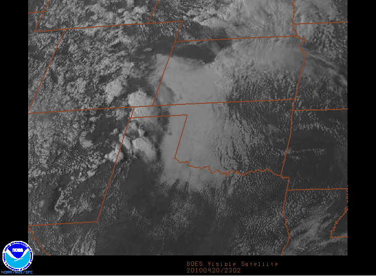
I would say so. Just look at the clearing just west of the Missouri River in Nebraska. RIght now, outside my window in the west burbs of Omaha it is most ly sunny. My radar also shows a few weak echos.
[/img]
0 likes


-
cycloneye

- Admin

- Posts: 149524
- Age: 69
- Joined: Thu Oct 10, 2002 10:54 am
- Location: San Juan, Puerto Rico
Stay safe Garrett and Brian and report back.
0 likes
Visit the Caribbean-Central America Weather Thread where you can find at first post web cams,radars
and observations from Caribbean basin members Click Here
and observations from Caribbean basin members Click Here
-
wx247
- S2K Supporter
- Posts: 14279
- Age: 42
- Joined: Wed Feb 05, 2003 10:35 pm
- Location: Monett, Missouri
- Contact:
Thanks everyone. We have broken out into the sun. The temp has jumped into the 70's and the dewpoint is in the lower 60's.
0 likes
Personal Forecast Disclaimer:
The posts in this forum are NOT official forecast and should not be used as such. They are just the opinion of the poster and may or may not be backed by sound meteorological data. They are NOT endorsed by any professional institution or storm2k.org. For official information, please refer to the NHC and NWS products.
The posts in this forum are NOT official forecast and should not be used as such. They are just the opinion of the poster and may or may not be backed by sound meteorological data. They are NOT endorsed by any professional institution or storm2k.org. For official information, please refer to the NHC and NWS products.
-
wx247
- S2K Supporter
- Posts: 14279
- Age: 42
- Joined: Wed Feb 05, 2003 10:35 pm
- Location: Monett, Missouri
- Contact:
Storms still just west of our local radio station's CWA. We shall see what transpires soon. The first warnings are out for Kay and Noble counties in Oklahoma and Butler County in SE Kansas.
0 likes
Personal Forecast Disclaimer:
The posts in this forum are NOT official forecast and should not be used as such. They are just the opinion of the poster and may or may not be backed by sound meteorological data. They are NOT endorsed by any professional institution or storm2k.org. For official information, please refer to the NHC and NWS products.
The posts in this forum are NOT official forecast and should not be used as such. They are just the opinion of the poster and may or may not be backed by sound meteorological data. They are NOT endorsed by any professional institution or storm2k.org. For official information, please refer to the NHC and NWS products.

-
wx247
- S2K Supporter
- Posts: 14279
- Age: 42
- Joined: Wed Feb 05, 2003 10:35 pm
- Location: Monett, Missouri
- Contact:
Threat continues across the entire watch area according to SPC...
0 likes
Personal Forecast Disclaimer:
The posts in this forum are NOT official forecast and should not be used as such. They are just the opinion of the poster and may or may not be backed by sound meteorological data. They are NOT endorsed by any professional institution or storm2k.org. For official information, please refer to the NHC and NWS products.
The posts in this forum are NOT official forecast and should not be used as such. They are just the opinion of the poster and may or may not be backed by sound meteorological data. They are NOT endorsed by any professional institution or storm2k.org. For official information, please refer to the NHC and NWS products.
Return to “USA & Caribbean Weather”
Who is online
Users browsing this forum: cycloneye and 77 guests