Getting VERY NASTY here... Pictures inside

U.S. & Caribbean Weather Discussions and Severe Weather Events

Moderator: S2k Moderators

Forum rules

The posts in this forum are NOT official forecast and should not be used as such. They are just the opinion of the poster and may or may not be backed by sound meteorological data. They are NOT endorsed by any professional institution or STORM2K.

Help Support Storm2K
Message
Author
chadtm80

Getting VERY NASTY here... Pictures inside

#1 Postby chadtm80 » Tue Jul 15, 2003 3:17 pm

Pictures taken 10 min ago from my front and back yard.. Rolling in QUICK.. BIG BOOMERS!!!

Image


Image


Image
0 likes   

User avatar
isobar
Category 5
Category 5
Posts: 2002
Joined: Thu Feb 06, 2003 9:05 am
Location: Louisville, KY

#2 Postby isobar » Tue Jul 15, 2003 3:22 pm

Wow, turn on the lights Chad. Looks like night time outside.
Impressive pics!
0 likes   

User avatar
therock1811
Category 5
Category 5
Posts: 5163
Age: 39
Joined: Thu May 15, 2003 2:15 pm
Location: Kentucky
Contact:

#3 Postby therock1811 » Tue Jul 15, 2003 3:22 pm

Looks nasty... stay safe!!!!!!!
0 likes   

User avatar
vbhoutex
Storm2k Executive
Storm2k Executive
Posts: 29112
Age: 73
Joined: Wed Oct 09, 2002 11:31 pm
Location: Cypress, TX
Contact:

#4 Postby vbhoutex » Tue Jul 15, 2003 3:26 pm

ARe you having fun yet? Doesn't look that bad here in Hurricane land!!
0 likes   
Skywarn, C.E.R.T.
Please click below to donate to STORM2K to help with the expenses of keeping the site going:
Image

chadtm80

#5 Postby chadtm80 » Tue Jul 15, 2003 3:27 pm

Raining Cats and dogs now

Image


Image

I am right under the dark red... SE of Daytona
0 likes   

User avatar
Lindaloo
Category 5
Category 5
Posts: 22658
Joined: Sat Mar 29, 2003 10:06 am
Location: Pascagoula, MS

#6 Postby Lindaloo » Tue Jul 15, 2003 3:32 pm

Goodness... looks like tornado alley.
0 likes   

chadtm80

#7 Postby chadtm80 » Tue Jul 15, 2003 3:50 pm

I Love it :-)
0 likes   

User avatar
Arizwx
Category 2
Category 2
Posts: 503
Joined: Sat Feb 22, 2003 7:03 am
Location: West Coast,U.S.A.
Contact:

#8 Postby Arizwx » Tue Jul 15, 2003 4:18 pm

Nice wall cloud/rotater setting up...later pic has a beauty of a 'Scud'..well done!
0 likes   

User avatar
Colin
Category 5
Category 5
Posts: 5086
Joined: Fri Apr 18, 2003 4:17 pm
Location: Catasauqua, PA
Contact:

#9 Postby Colin » Tue Jul 15, 2003 4:18 pm

WOW! :o Those are very impressive pics...stay safe!
0 likes   

User avatar
weatherwunder
Category 5
Category 5
Posts: 1098
Age: 62
Joined: Tue Mar 11, 2003 2:21 pm
Location: Lincoln, Nebraska
Contact:

#10 Postby weatherwunder » Tue Jul 15, 2003 6:51 pm

Stay safe buddy!
0 likes   

weatherlover427

#11 Postby weatherlover427 » Tue Jul 15, 2003 9:25 pm

What did you end up getting Chad? :D
0 likes   

User avatar
southerngale
Retired Staff
Retired Staff
Posts: 27418
Joined: Thu Oct 10, 2002 1:27 am
Location: Southeast Texas (Beaumont area)

#12 Postby southerngale » Tue Jul 15, 2003 9:42 pm

Awesome pics Chad! How much rain did you get?
0 likes   
Please support Storm2k by making a donation today. It is greatly appreciated! Click here: Image

Image my Cowboys Image my RocketsImage my Astros

ColdFront77

#13 Postby ColdFront77 » Wed Jul 16, 2003 12:07 am

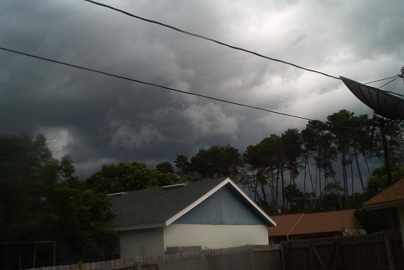
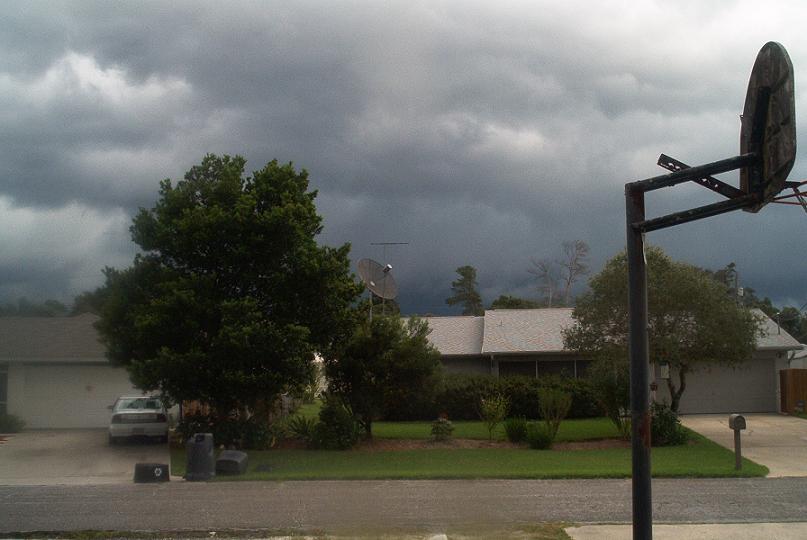
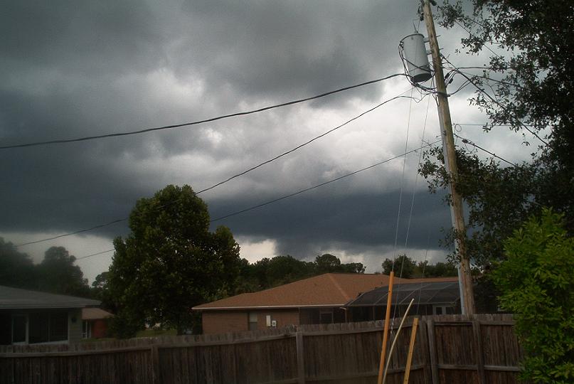
There was some thunderstorm activity in my area as well. The sky didn't look as impressive as it did at your location, Chad... but the southern and western sky still had some ominous clouds, the lightning in the clouds to the north was more interesting than the southern sky.


This Severe Thunderstorm Warning was in effect:

BULLETIN - EAS ACTIVATION REQUESTED...CORRECTED LOCATION NEAR STORM
SEVERE THUNDERSTORM WARNING
NATIONAL WEATHER SERVICE MELBOURNE FL
527 PM EDT TUE JUL 15 2003

THE NATIONAL WEATHER SERVICE IN MELBOURNE HAS ISSUED A

* SEVERE THUNDERSTORM WARNING FOR...
CENTRAL LAKE COUNTY
NORTHWESTERN ORANGE COUNTY
IN EAST CENTRAL FLORIDA

* UNTIL 615 PM EDT

* AT 524 PM EDT...NATIONAL WEATHER SERVICE DOPPLER RADAR INDICATED A
SEVERE THUNDERSTORM OVER FERNDALE. THE STORM WAS NEARLY
STATIONARY.

OTHER LOCATIONS NEAR THIS STORM INCLUDE MONTEVERDE AND LAKE APOPKA.

SEVERE THUNDERSTORMS PRODUCE DAMAGING WINDS IN EXCESS OF 58 MILES AN
HOUR...DESTRUCTIVE HAIL...DEADLY LIGHTNING AND VERY HEAVY RAIN. IF
THE STORM APPROACHES YOU...MOVE TO AN INTERIOR ROOM ON THE LOWEST
FLOOR.

LAT...LON 2856 8180 2851 8160 2872 8149 2879 8176
0 likes   

chadtm80

#14 Postby chadtm80 » Wed Jul 16, 2003 7:24 pm

3.5 Inches!!
0 likes   

User avatar
therock1811
Category 5
Category 5
Posts: 5163
Age: 39
Joined: Thu May 15, 2003 2:15 pm
Location: Kentucky
Contact:

#15 Postby therock1811 » Wed Jul 16, 2003 7:47 pm

And you needed every bit too!!!!!!!!
0 likes   

chadtm80

#16 Postby chadtm80 » Wed Jul 16, 2003 8:31 pm

Yep!! I Love the Florida summer storms
0 likes   


Return to “USA & Caribbean Weather”

Who is online

Users browsing this forum: snownado, TomballEd and 29 guests