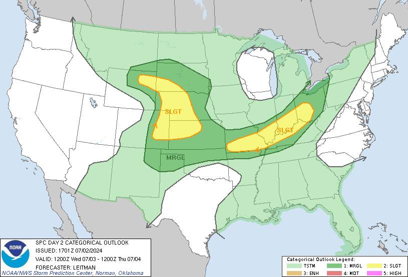
SPC Severe Probability Map For The 4th Of July (Tommorow).

Moderator: S2k Moderators


IndianaWeatherOnline wrote:Evening Update: The spc has now included Northern Indiana and Northern Illinois in a Moderate risk for severe weather on Friday. A slight risk has been added southward like i said it should have been, to around BLoomington, Indiana. By 1 PM on Friday Cape Values are forecast to be around 2500-3000 from Central Indiana into Central Illinois and into Southern Iowa. Cape values will be around 3000-4000 from Northern Indiana and Northern Illinois into WIsconsin and Iowa. Li's will be around
-9 from Indiana and Illinois and -12 in Iowa and Northern Illinois. Some convective activity will likely start to develop by the 2 pm hour. The storms will likely be in the form of supercells and some shear will be present and could be enough for some short lived tornadoes. By 5 PM capes and li's are forecast to be the highest from Central and Northern Indiana and Illinois into Southern Wisconsin. Capes will be 3500-4000 in those areas with li's around -10 to -12. Storms will continue to strenthen and form into a multicellular cluster. There might still be a short lived tornado, but the main threat will definitely be heavy rain and strong damaging winds. The storms will organize into a squall line and possible derecho. One other area i am concerned about would be from Eastern Nebraska into Central Minnesota. Some strong and severe storms could form in these areas as well. So here is my outlook for severe weather: I would include a Moderate risk from Central and Northern Indiana into the NOrthern Half of Illinois, into Southern WIsconsin, all of Iowa, North into all of Lower Michigan, and the Eastern half of Nebraska. A Slight risk would surround these areas.


Return to “USA & Caribbean Weather”
Users browsing this forum: Cpv17, SnowyOwl31, wxman22 and 85 guests