Either way you look at it someone is gonna be getting some snow from it more then likely...........Question is who or where?
My early thoughts is somewhere from the Eastern/Central Great Lakes (Central Michigan) over into the interior of the NE (Especially higher areas) from NW PA to the NNE into Western, NY,N. NH, VT, and Western ME.....................Which of course means i expect the system to develop in the Central Apps and head ene with a possible bomb exploding off the ME coast! I will mention as well that if this system develops quicker farther south and west so will the snow!!!!!! Which is possible! I still say its a bit too early to say what exactly will happen but with the possibilities that exist it should all be mentioned!
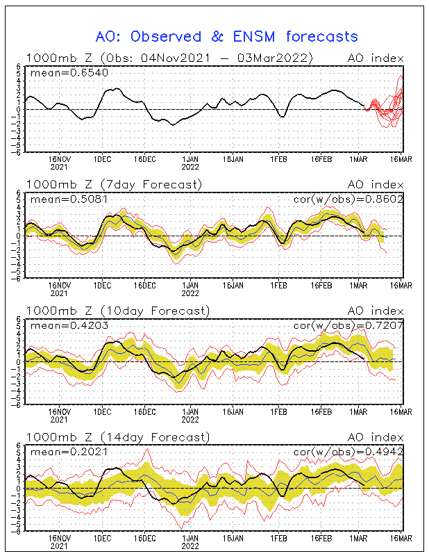
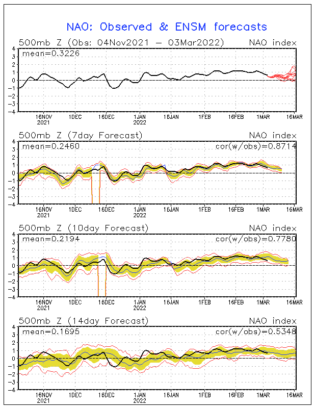
And just to add both the NAO and the AO are headed for the tank!
Below is a look at the AO!

Below here is the NAO!

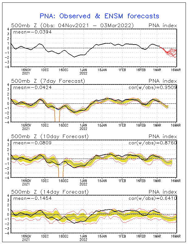
Below here i have added the PNA as well! Which btw is headed for a upswing!!!!

 The posts in this forum are NOT official forecast and should not be used as such. They are just the opinion of the poster and may or may not be backed by sound meteorological data. They are NOT endorsed by any professional institution or


