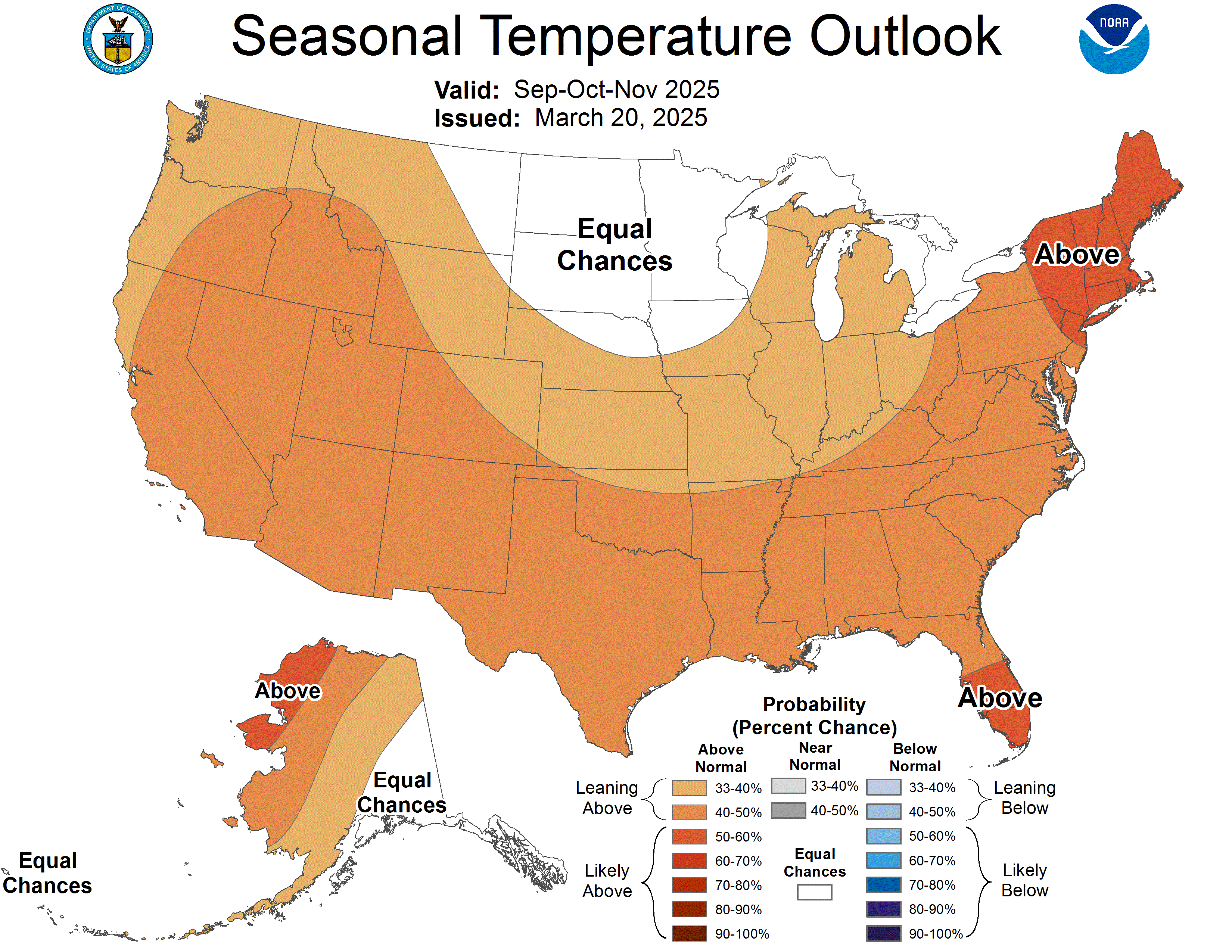
Here are some visuals to help show my previous post. It is remarkable the persistence climo for the major El Nino's. Weak and even moderate events can deviate but the strong (ONI > +1.5C) are very consistent.
All of them featured a normal to mild December, likely because El Nino's peak around NDJ and Canada is flooded with warmth.

By January the El Nino's slowly weaken and their influence becomes less that allows Canada to get cold, however we still keep the roaring lingering subtropical jet.

By February the Nino continues to weaken with the seasonal jet still strong, evidenced by the anomalies

Luckily the southern tier of the US is favored to be below normal. Canonical Nino events generally behave very similar. There are often low skill in forecasting winters that bears weak ENSO events or neutral. But in strong events (strong La Nina, strong El Nino) skill becomes higher as the ENSO event imposes the classic climo that they favor below. Good confidence the upper tier of the US will experience a very mild winter while the lower tier cooler than normal.

 The posts in this forum are NOT official forecast and should not be used as such. They are just the opinion of the poster and may or may not be backed by sound meteorological data. They are NOT endorsed by any professional institution or