When will we see more Arctic Cold?
Moderator: S2k Moderators
Forum rules
 The posts in this forum are NOT official forecast and should not be used as such. They are just the opinion of the poster and may or may not be backed by sound meteorological data. They are NOT endorsed by any professional institution or STORM2K.

The posts in this forum are NOT official forecast and should not be used as such. They are just the opinion of the poster and may or may not be backed by sound meteorological data. They are NOT endorsed by any professional institution or STORM2K.
-
srainhoutx

- S2K Supporter

- Posts: 6919
- Age: 68
- Joined: Sun Jan 14, 2007 11:34 am
- Location: Haywood County, NC
- Contact:
Re: When will we see more Arctic Cold?
Thanks for the Update Don. I know many are wondering what your thought are regarding the Deep South. There were some impressive signals yesterday that indicated the Mid February time frame could offer a significant change to a colder regime for us S of I-40 as well. Thanks for keeping us informed.
0 likes
Carla/Alicia/Jerry(In The Eye)/Michelle/Charley/Ivan/Dennis/Katrina/Rita/Wilma/Ike/Harvey
Member: National Weather Association
Wx Infinity Forums
http://wxinfinity.com/index.php
Facebook.com/WeatherInfinity
Twitter @WeatherInfinity
Member: National Weather Association
Wx Infinity Forums
http://wxinfinity.com/index.php
Facebook.com/WeatherInfinity
Twitter @WeatherInfinity
-
lrak

- S2K Supporter
- Posts: 1770
- Age: 59
- Joined: Thu Jun 21, 2007 2:48 pm
- Location: Corpus Christi, TX
Re: When will we see more Arctic Cold?
One of our local mets mentioned arctic air for next week. And he usually never mentions it until 2 or 3 days out, so this may be a big one for the middle of February.
0 likes
AKA karl
Also
Personal Forecast Disclaimer:
My posts on this forum are NOT official forecast and should not be used as such. My posts are my basic observations and are definitely not backed by any "well some" meteorological knowledge. For official information, please refer to the NHC and NWS products.
Also
Personal Forecast Disclaimer:
My posts on this forum are NOT official forecast and should not be used as such. My posts are my basic observations and are definitely not backed by any "well some" meteorological knowledge. For official information, please refer to the NHC and NWS products.
-
donsutherland1
- S2K Analyst

- Posts: 2718
- Joined: Mon Sep 15, 2003 8:49 pm
- Location: New York
Re: When will we see more Arctic Cold?
srainhoutx wrote:Thanks for the Update Don. I know many are wondering what your thought are regarding the Deep South. There were some impressive signals yesterday that indicated the Mid February time frame could offer a significant change to a colder regime for us S of I-40 as well. Thanks for keeping us informed.
My guess at this time is that the best chance for a freeze down to let's say Houston and also in parts of Florida will likely occur during the second half of February. The block will need to retrograde somewhat before that happens, much as the severe outbreak of January cold in those areas occurred during the latter stages of a severe blocking regime. That does not mean that there can't be a short and fairly sharp shot of cold beforehand, but the best chance for the worst of the cold is a little later.
0 likes
-
donsutherland1
- S2K Analyst
- Posts: 2718
- Joined: Mon Sep 15, 2003 8:49 pm
- Location: New York
Re: When will we see more Arctic Cold?
During the severe blocking episode in December into early January, the Northern Hemisphere saw enormous winter weather impacts, including two Midwest blizzards and a massive Mid-Atlantic snowstorm that shattered that region’s snow drought. With the combination of strong blocking and an active El Niño-driven subtropical jet reappearing for February, the month looked to be cold and story, particularly in the Eastern U.S. True to form, another snowstorm, potentially even larger than the December 18-20, 2009 event, now appears likely in the Mid-Atlantic region.
With a foot or more of snow extremely likely in Washington, D.C., Winter 2009-10 would become the first winter since 1898-99 to see two snowstorms of a foot or more in Washington, D.C.
On February 8, 1899, a rapidly strengthening storm developed along an Arctic front. That storm buried Washington, D.C. under 13.7” of snow. Its streets were lined with “great heaps of snow.” Afterward, the plunge in temperatures “afforded the best sleighing the people of Washington have enjoyed for years” and “the merry jingle of the sleigh-bells was heard everywhere.”
During the February 11-14, 1899 timeframe, a blizzard brought crippling snows to the Mid-Atlantic region and heavy snows into southern New England. Washington, D.C. picked up 20.5” of snow. In the wake of the storm, The Washington Post reported, “As complete a tie-up as the city ever knew, Washington is truly snow-bound.” Farther east, Annapolis was cut off. The Post wrote:
There has been no communication by rail or boat or vehicle…from Annapolis to the outside world. The snow was ten feet high in some places along the county roads. From the State House windows the ice extends as far as the eye can see down the bay.
Although there will not be any historic Arctic outbreaks along the lines of the 1899 one, the forthcoming storm has the chance to become one of the handful of benchmark storms against which Mid-Atlantic storms are compared.
Right now, even as the models shift about in trying to place the northern edge of the snowfall, they have been rock solid on the idea that an area of very heavy snow is likely to cover Washington, D.C., Baltimore and then east-northeastward out to southern New Jersey. Philadelphia is fairly close to that area of excessive snows.
I will post estimates after the 2/5 0z run, but my early thinking concerning this event is that Baltimore and Washington will probably pick up 12”-24” snow and some locally higher amounts near or above 30” won’t be far from the two cities. Atlantic City, Hagerstown and Philadelphia could see 12”-18”. New York City will probably get into an area of 4”-8” snows. Farther north, the confluence will rapidly cut off accumulations. Hence not too far inland, just north of Mount Kisco, NY and also about 10-20 miles inland from the Connecticut coast, there could be little or no snow. Of course, a small shift in the storm’s track of just 25-50 miles could bring heavy snows farther north.
In sum, it is now early February and the dual combination of strong blocking and an active subtropical jet appear poised to deliver in a memorable way. Beyond this storm, there will remain additional opportunities for snow and a third KU snowstorm remains a distinct possibility.
0 likes
-
donsutherland1
- S2K Analyst
- Posts: 2718
- Joined: Mon Sep 15, 2003 8:49 pm
- Location: New York
Re: When will we see more Arctic Cold?
Quick update...
This morning, the AO stood at -4.398. It is progged to head even lower, even as a monster snowstorm moves into the Mid-Atlantic region and a curtain of white slowly descends on that region as the day progresses.
Beyond that, the ensembles are now in strong agreement that the AO will remain at or below -3 for the foreseeable future (and that is before the impact of the forthcoming MMW plays out), with another dive possible toward mid-month. With an active subtropical jet, that could lead to more significant winter weather.
In the near-term, I suspect that the GFS is too warm with the system next week. While I think it will probably bomb a little too late to bring a major snowfall to the East, I still believe DCA to BOS are in the running for moderate accumulations.
Farther out, for the 4-day period centered on 2/13 the latest objective analogs show a number of dates near or during KU snowstorms: 1/30/1966, 2/27/1969, 2/7/1978. Two dates that were near KU or KU-type storms were 2/12/1969 and 3/2/2001. IMO, seeing 2/27/1969 and 3/2/2001 (near the dreaded, for coastal areas, March 2001 near miss) hints that any big storm near mid-month might have a better chance at bringing snows into snow-parched New England. That does not mean that Washington, D.C. or even Richmond would miss out. I suspect that pattern is such that those areas would also benefit from any storms near mid-month.
In addition, even as opportunities for snow appear present through at least mid-month, I suspect that the risk of a severe Arctic outbreak will be growing, particularly if the AO tanks as is shown on some of the guidance. Under such a scenario, southeast Texas could experience a freeze and temperatures could fall to below 40° even as far south as Brownsville. Florida could suffer another freeze, as well. There would be a realistic chance that Key West could add to its winter record of sub-50° minimum temperatures.
All said, looking at the guidance, seeing how the pattern has been evolving, and considering the historic impacts of such developments, my confidence that New York City and Boston will join Richmond, Washington, Baltimore, and Philadelphia with above normal snowfall this month remains good. By month's end, there is a distinct possibility that Baltimore and Washington might be near or above their all-time seasonal snowfall marks.
0 likes
-
srainhoutx
- S2K Supporter
- Posts: 6919
- Age: 68
- Joined: Sun Jan 14, 2007 11:34 am
- Location: Haywood County, NC
- Contact:
Re: When will we see more Arctic Cold?
0 likes
Carla/Alicia/Jerry(In The Eye)/Michelle/Charley/Ivan/Dennis/Katrina/Rita/Wilma/Ike/Harvey
Member: National Weather Association
Wx Infinity Forums
http://wxinfinity.com/index.php
Facebook.com/WeatherInfinity
Twitter @WeatherInfinity
Member: National Weather Association
Wx Infinity Forums
http://wxinfinity.com/index.php
Facebook.com/WeatherInfinity
Twitter @WeatherInfinity
-
Dean4Storms
- S2K Supporter
- Posts: 6358
- Age: 63
- Joined: Sun Aug 31, 2003 1:01 pm
- Location: Miramar Bch. FL
-
srainhoutx
- S2K Supporter
- Posts: 6919
- Age: 68
- Joined: Sun Jan 14, 2007 11:34 am
- Location: Haywood County, NC
- Contact:
Re: When will we see more Arctic Cold?
The pattern is unfolding for what looks to be a memorable February for areas E of the Rockies. The CPC Super Ensembles suggest that a very active period is ahead. MMW event looks to occur Tuesday. I suspect Don will have an update before long, but it is noteworthy to see some of the analogs for the upcoming period...
0 likes
Carla/Alicia/Jerry(In The Eye)/Michelle/Charley/Ivan/Dennis/Katrina/Rita/Wilma/Ike/Harvey
Member: National Weather Association
Wx Infinity Forums
http://wxinfinity.com/index.php
Facebook.com/WeatherInfinity
Twitter @WeatherInfinity
Member: National Weather Association
Wx Infinity Forums
http://wxinfinity.com/index.php
Facebook.com/WeatherInfinity
Twitter @WeatherInfinity
-
donsutherland1
- S2K Analyst
- Posts: 2718
- Joined: Mon Sep 15, 2003 8:49 pm
- Location: New York
Re: When will we see more Arctic Cold?
The latest data show only a slowly fading central Pacific-based El Niño. The just released ENSO Region 3.4 data shows that region's anomaly holding at +1.2°C. The slowly fading El Niño and continued strong blocking will likely lead to opportunities for additional snowstorms beyond the upcoming midweek event. In that event, I continue to expect that DCA to BOS will experience moderate to significant snowfall.
Later, at least on the ensemble guidance, the pattern has a classic look for severe blocking. An active subtropical jet coupled with that pattern could lead to more winter weather highlights. Such highlights could include additional winter storms and, particularly from mid-month and afterward, a growing risk of a strong Arctic outbreak.
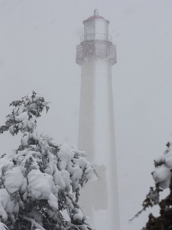
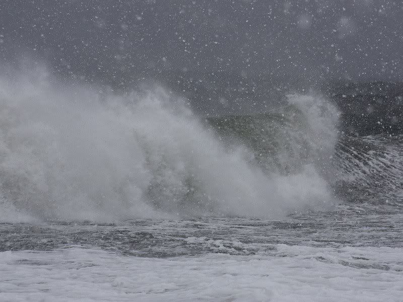
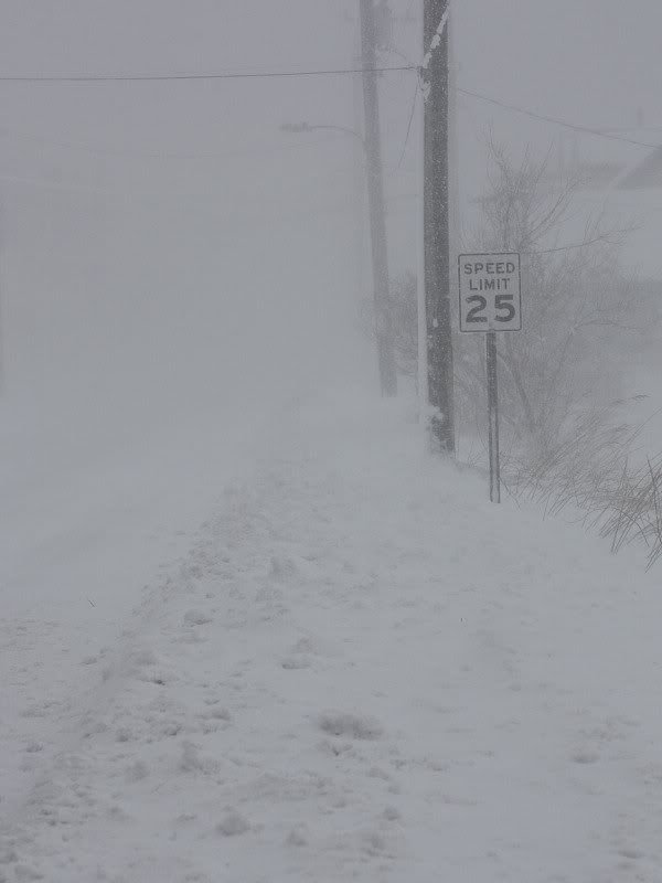
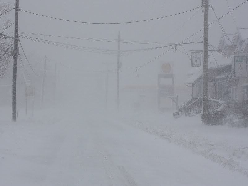
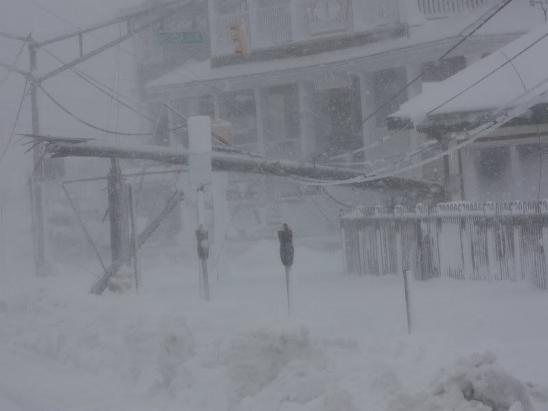
Some photos from the recent Mid-Atlantic blizzard from Cape May, NJ:
Later, at least on the ensemble guidance, the pattern has a classic look for severe blocking. An active subtropical jet coupled with that pattern could lead to more winter weather highlights. Such highlights could include additional winter storms and, particularly from mid-month and afterward, a growing risk of a strong Arctic outbreak.
Some photos from the recent Mid-Atlantic blizzard from Cape May, NJ:
0 likes
-
Portastorm

- Storm2k Moderator

- Posts: 9955
- Age: 63
- Joined: Fri Jul 11, 2003 9:16 am
- Location: Round Rock, TX
- Contact:
Re: When will we see more Arctic Cold?
Thanks Don for the photos! Wow ... reminds me of the some of the winter storms I experienced growing up in northeastern Ohio.
0 likes

-
donsutherland1
- S2K Analyst
- Posts: 2718
- Joined: Mon Sep 15, 2003 8:49 pm
- Location: New York
-
donsutherland1
- S2K Analyst
- Posts: 2718
- Joined: Mon Sep 15, 2003 8:49 pm
- Location: New York
A quick update...
If one examines the forecast 500 mb pattern on the GFS ensemble mean for 240 hours, one finds an area of below normal height anomalies wrapped completely around the block. A complete wrap-around did not occur during either the February 1969 or February 1978 super blocks.
Already, the severe blocking pattern, which saw the AO reach as low as -5.106, has witnessed one KU snowstorm in the Mid-Atlantic. Another such snowstorm is on the way for tonight and tomorrow. As had been noted earlier in this thread, its snow shield is likely to be more expansive, with Washington, DC to Boston experiencing moderate or significant snowfalls. Dulles International Airport has already set a new seasonal snowfall mark. Philadelphia and Washington, DC (DCA) could approach or exceed their seasonal marks after this event.
Beyond it, there have been hints that the pattern could grow more suppressed for a time. Such a development would increase the risk of a strong cold shot to southeast Texas and Florida, with freezes possible. Snow might also occur in an area running from Texas across a portion of the Gulf States into the Southeast. It would not be entirely out of the question if some snow fell in northern Florida (1.5" fell at Jacksonville on 2/13), as happened in 1958 during a time of strong blocking and an energetic subtropical jet.
The suppressed pattern will not mean the end of the risk of big storms for the Mid-Atlantic or Northeast regions. I suspect that as the block continues to slowly retrograde, the closing 7-10 days of the month will feature a renewed risk of East Coast snowstorms.
Finally, given the ongoing MMW, at least the first part of March and possibly beyond could be blocky. At this time, my thinking is that much like the winters of 1957-58 and 1968-69, March will feature a lot of blocking. If that happens, the month as a whole could see widespread cold anomalies. The severest cold relative to normal would likely be focused on the Central Plains upping the risk of a late-season blizzard. Northern New England and Atlantic Canada would be exceptions with likely mild anomalies. So, all in all, the upcoming KU event may not be the last one. Hence, even as 2009-10 joins 1960-61 and 1986-87 with three such events, there is a realistic chance that it could have a fourth one before winter concludes.
0 likes
-
Portastorm
- Storm2k Moderator
- Posts: 9955
- Age: 63
- Joined: Fri Jul 11, 2003 9:16 am
- Location: Round Rock, TX
- Contact:
Re: When will we see more Arctic Cold?
Thanks Don!
Wow, that blocking pattern is stunning! Safe to say folks will be talking about this winter for many years I think, at least in certain parts of the country. The word "historic" should not be used freely but in this case it is merited.
Wow, that blocking pattern is stunning! Safe to say folks will be talking about this winter for many years I think, at least in certain parts of the country. The word "historic" should not be used freely but in this case it is merited.
0 likes
-
srainhoutx
- S2K Supporter
- Posts: 6919
- Age: 68
- Joined: Sun Jan 14, 2007 11:34 am
- Location: Haywood County, NC
- Contact:
Re: When will we see more Arctic Cold?
Thanks for the update Don. For those of us that follow long range trends, we have wondered if the winter of 2009/2010 would rank near or set a new benchmark compared those of past years. It is rather amazing to see that we are closing in on the infamous 1958 analog. Ears should be perked and rightly so as the signals are too difficult to outright dismiss as folly. For the folks that have learned so much this season from the input you have provided, we thank you for sharing your vast historical knowledge and look forward to future updates. What a truly amazing and record setting winter we are experiencing and one that will be remembered for years to come. I have heard others state that this is a once in 50- 60 year event, and that speculation appears to be very close to coming to fruition.
0 likes
Carla/Alicia/Jerry(In The Eye)/Michelle/Charley/Ivan/Dennis/Katrina/Rita/Wilma/Ike/Harvey
Member: National Weather Association
Wx Infinity Forums
http://wxinfinity.com/index.php
Facebook.com/WeatherInfinity
Twitter @WeatherInfinity
Member: National Weather Association
Wx Infinity Forums
http://wxinfinity.com/index.php
Facebook.com/WeatherInfinity
Twitter @WeatherInfinity
-
cycloneye

- Admin

- Posts: 149721
- Age: 69
- Joined: Thu Oct 10, 2002 10:54 am
- Location: San Juan, Puerto Rico
Re: When will we see more Arctic Cold?
[quote="srainhoutx"]Thanks for the update Don. For those of us that follow long range trends, we have wondered if the winter of 2009/2010 would rank near or set a new benchmark compared those of past years. It is rather amazing to see that we are closing in on the infamous 1958 analog. Ears should be perked and rightly so as the signals are too difficult to outright dismiss as folly. For the folks that have learned so much this season from the input you have provided, we thank you for sharing your vast historical knowledge and look forward to future updates. What a truly amazing and record setting winter we are experiencing and one that will be remembered for years to come. I have heard others state that this is a once in 50- 60 year event, and that speculation appears to be very close to coming to fruition.[/quote]
And all of this is happening with not the strongest El Nino of all time,only a moderate to strong one at its peak in mid December.
And all of this is happening with not the strongest El Nino of all time,only a moderate to strong one at its peak in mid December.
0 likes
Visit the Caribbean-Central America Weather Thread where you can find at first post web cams,radars
and observations from Caribbean basin members Click Here
and observations from Caribbean basin members Click Here
-
donsutherland1
- S2K Analyst
- Posts: 2718
- Joined: Mon Sep 15, 2003 8:49 pm
- Location: New York
Today, the AO was -4.117. That marks its sixth consecutive day at or below -4. Through the extended range, the ensemble guidance continues to point to a strongly negative AO. In short, the remarkable blocking that has coincided with an active subtropical jet to produce an epic winter in the Middle Atlantic region is likely to persist.
This winter's rare combination of often severe blocking and a moderate El Niño has resulted in new seasonal snowfall records being established across the Middle Atlantic Region. As of 8 pm today, records include:
Baltimore: 79.9"; Old record: 62.5", 1995-96
Dulles International Airport: 72.8"; Old record: 61.9", 1995-96
Philadelphia: 70.3"; Old record: 65.5", 1995-96
Washington, DC: 55.6"; Old record: 54.4", 1898-99
Baltimore's record is now 28% above the previous mark. Even more impressive, Baltimore's record is greater than the highest seasonal snowfall recorded at either Philadelphia or New York City.
Almost as noteworthy as the seasonal snowfall marks were the enormous snowstorms that blanketed the Middle Atlantic States. To date, Philadelphia has had 2 20" snowstorms. Prior to 2009-10, Philadelphia had just 3 such snowstorms going back to 1884-85. Baltimore had two such snowstorms this winter--and the current one has seen 19.5". Prior to 2009-10, Baltimore had 7 such snowstorms going back to 1883-84.
In the near-term, tomorrow into Saturday morning, a storm will track across the Gulf of Mexico and exit off the Florida coast. It will bring a stripe of snow from Texas, across the Gulf States, and possibly even in northernmost Florida.
Afterward, an energetic upper-level low could try to spin up into a moderate to significant storm along the Middle Atlantic coast. Such a storm has been indicated on the models, so it will be something to watch for next Monday or Tuesday.
Beyond that, as the blocking is likely to remain strong even as the block retrogrades slowly, the risk of an Arctic outbreak will likely increase. The ensemble data shows some significant cold anomalies around February 20 +/- a few days.
0 likes
-
Stephanie

- S2K Supporter
- Posts: 23843
- Age: 63
- Joined: Thu Feb 06, 2003 9:53 am
- Location: Glassboro, NJ
Re: When will we see more Arctic Cold?
This winter's rare combination of often severe blocking and a moderate El Niño has resulted in new seasonal snowfall records being established across the Middle Atlantic Region. As of 8 pm today, records include:
Baltimore: 79.9"; Old record: 62.5", 1995-96
Dulles International Airport: 72.8"; Old record: 61.9", 1995-96
Philadelphia: 70.3"; Old record: 65.5", 1995-96
Washington, DC: 55.6"; Old record: 54.4", 1898-99
Baltimore's record is now 28% above the previous mark. Even more impressive, Baltimore's record is greater than the highest seasonal snowfall recorded at either Philadelphia or New York City.
Almost as noteworthy as the seasonal snowfall marks were the enormous snowstorms that blanketed the Middle Atlantic States. To date, Philadelphia has had 2 20" snowstorms. Prior to 2009-10, Philadelphia had just 3 such snowstorms going back to 1884-85. Baltimore had two such snowstorms this winter--and the current one has seen 19.5". Prior to 2009-10, Baltimore had 7 such snowstorms going back to 1883-84.
Those are incredible statistics - particularly Baltimore's with the higher snowfall total and the number of 20" snowfalls over Philadelphia. It's an hour and a half south of here. Their geography must be just so where more snow gets squeezed out than in Philadelphia. Go figure.
Thanks also for the photos of Cape May.
0 likes
-
StormingB81

- S2K Supporter
- Posts: 5676
- Age: 44
- Joined: Thu Aug 27, 2009 1:45 am
- Location: Rockledge, Florida
Re: When will we see more Arctic Cold?
Stephanie wrote:This winter's rare combination of often severe blocking and a moderate El Niño has resulted in new seasonal snowfall records being established across the Middle Atlantic Region. As of 8 pm today, records include:
Baltimore: 79.9"; Old record: 62.5", 1995-96
Dulles International Airport: 72.8"; Old record: 61.9", 1995-96
Philadelphia: 70.3"; Old record: 65.5", 1995-96
Washington, DC: 55.6"; Old record: 54.4", 1898-99
Baltimore's record is now 28% above the previous mark. Even more impressive, Baltimore's record is greater than the highest seasonal snowfall recorded at either Philadelphia or New York City.
Almost as noteworthy as the seasonal snowfall marks were the enormous snowstorms that blanketed the Middle Atlantic States. To date, Philadelphia has had 2 20" snowstorms. Prior to 2009-10, Philadelphia had just 3 such snowstorms going back to 1884-85. Baltimore had two such snowstorms this winter--and the current one has seen 19.5". Prior to 2009-10, Baltimore had 7 such snowstorms going back to 1883-84.
Those are incredible statistics - particularly Baltimore's with the higher snowfall total and the number of 20" snowfalls over Philadelphia. It's an hour and a half south of here. Their geography must be just so where more snow gets squeezed out than in Philadelphia. Go figure.
Thanks also for the photos of Cape May.
Someone on NBC said that Global Warming is causing this. Whic hmakes me really confused on the wole thing.
0 likes
-
x-y-no

- Category 5

- Posts: 8359
- Age: 65
- Joined: Wed Aug 11, 2004 12:14 pm
- Location: Fort Lauderdale, FL
Re: When will we see more Arctic Cold?
StormingB81 wrote:Someone on NBC said that Global Warming is causing this. Whic hmakes me really confused on the wole thing.
Ugh ... I hate that. No individual regional weather event says anything one way or the other about global warming.
The most one can say about this is that, since global warming theory predicts more extreme precipitation events, this particular event isn't inconsistent with global warming. But by absolutely no means is it either confirmation or refutation of global warming.
0 likes
Who is online
Users browsing this forum: No registered users and 134 guests