So...I believe I've found a (to me at least) mysterious Factor X about the Ozark/Ouachitas "shadow." The lack of height of the hills/mountains wasn't impressive, and the Ozarks are etched by erosion - they aren't classic mountains.
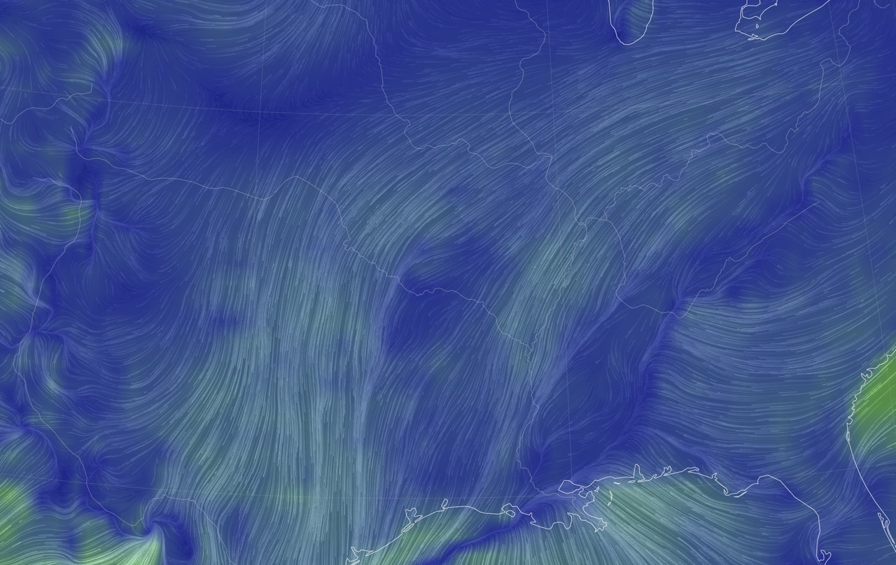
I looked at some wind maps and the polar/arctic air is coming from the Midwest and moving down the plains or the Mississippi River delta. The Ozarks in MO, AR and to some extend the Ouachitas. The shadow has been bugging me a bit, because the Ozark plateau and Ouachitas are 1500 - 2500 feet high at best.
The land west of OKC has this level of altitude. Not the rugged obstruction of the Rockies and the Appalachians.
Then, I found a wind energy and terrain map that provide the (now) obvious clue!
So, moving air from a physics standpoint is a fluid and this obeys those rules and even equations. Increased fluid drag would slow advection and could reduce temp drops in the "shadow," at least temporarily.
So the fluid drag of an object or terrain would look like this:
Fd = 1/2 Cd x Ap x rho[density] x v[sqr]
Sorry about the math!
Here, Cd is the coefficient of drag - how rough a surface is. The higher Cd the greater the turbulence and air drag, slowing down the movement.
Ap = the area blocking air movement of the "ruggedness."
The Ozarks are smooth, not rugged, and are a consequence of erosion of part of a plateau
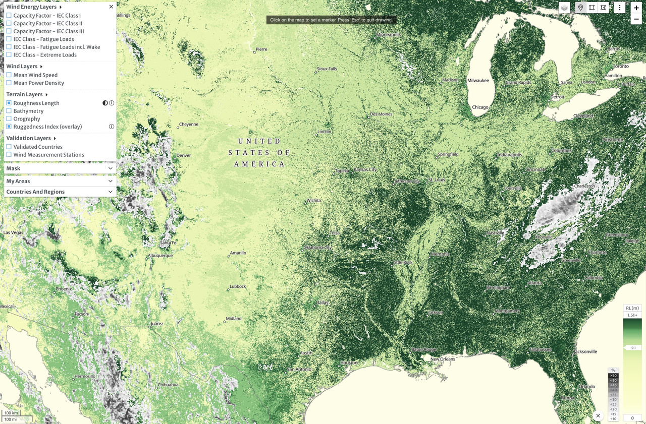
I've attached the map which leads IMO to a surprising answer to this riddle -
As you can see, the Appalachians are riddled with a high Ruggeness Index or obstructions by chains of mountains rising 6500 ft tall. The Rockies have huge obstructions and cause massive turbulence (High Cd and Ap).
Note where high levels of Roughness are (high Cd) which would slow the air. Notice where the roughness of the terrain is low. As an avid map reader and traveloer I know the terrain of everything east of the Rockies pretty well. Note more limited areas of Ruggedness in the Boston Mountains and some of the Ouachitas in AR vs. the Appalacians and Rockies
Where you see high levels of Roughness (which would drag surface air and also contribute to turbulence) are areas of high forestation. The Ozarks and Ouachitas are densely populated with trees as are the Piney Woods. So, the trees are putting a draf on cold advection from the north, especially if the original source of the wind is NNE. The trees make it rough, increasing turbulence and reduction wind speed and advection on the surface.
I should point out that the trees naturally are in areas with greater rainfall and access to gulf moisture. The plains, Mississippi Delta and parts of the Midwest have far fewer trees and forestation.
The windspeed is not surprisingly high in the Great Plains without obstruction or trees!
 tl;dr version: The rough and hilly forests of the Ozarks, Ouachitas, and Piney Woods (underappreciated!) form a buffer or windbreak that slows down cold advection in the "shadow."
 The posts in this forum are NOT official forecast and should not be used as such. They are just the opinion of the poster and may or may not be backed by sound meteorological data. They are NOT endorsed by any professional institution or