#4662 Postby Portastorm » Sat Mar 16, 2013 10:27 am
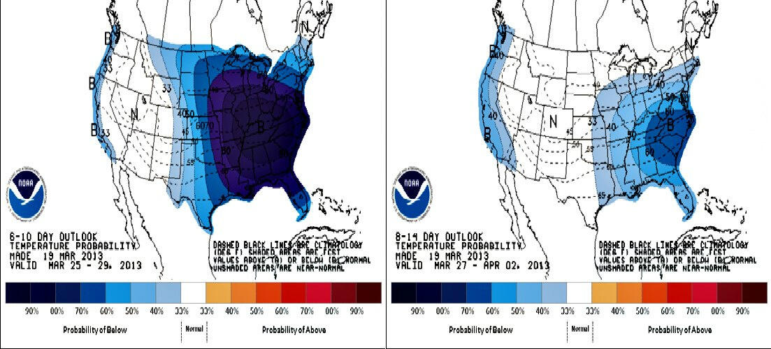
All three major medium range models -- the GFS, Euro, and Canadian -- are all showing a major cold front for next weekend for the Central and Eastern CONUS. The ensembles also support this, so I would say the model support is fairly substantial at this point. Now, I will say we have seen this before only to have the proverbial football pulled from us as we attempt to kick it. I'll have a lot more confidence in next weekend's shivery surprise if we see the models all showing the same thing in a few days.
Based on what I'm seeing, it wouldn't be unreasonable to see a freeze in the northern half of Texas with high temps in the 40s for a day or two with 50s for me and my San Antone buds and friends in southeast Texas. And with temps so warm right now, this front will feel "wintry" to us due to temps dropping some 30 degrees. We shall see.
0 likes
Any forecasts under my name are to be taken with a grain of salt. Get your best forecasts from the National Weather Service and National Hurricane Center.
 The posts in this forum are NOT official forecast and should not be used as such. They are just the opinion of the poster and may or may not be backed by sound meteorological data. They are NOT endorsed by any professional institution or