 The posts in this forum are NOT official forecast and should not be used as such. They are just the opinion of the poster and may or may not be backed by sound meteorological data. They are NOT endorsed by any professional institution or


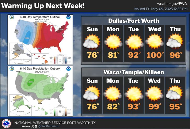
Tuesday will be very warm , dry and breezy with afternoon highs in the 80s. Southwest to west winds in the 15 to 25 mph range along with some gusts to 30 mph will increase the fire weather threat across all of North and Central Texas. Locations along and west of a line from Bowie to Granbury to Lampasas will see the highest threat. Therefore a fire weather watch is in effect Tuesday afternoon.


