The posts in this forum are NOT official forecast and should not be used as such. They are just the opinion of the poster and may or may not be backed by sound meteorological data. They are NOT endorsed by any professional institution or

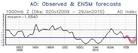
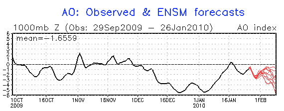
First, it should be noted that the latest ensemble guidance shows increasing support for the AO’s falling to and below -3.000 beginning around February 8:
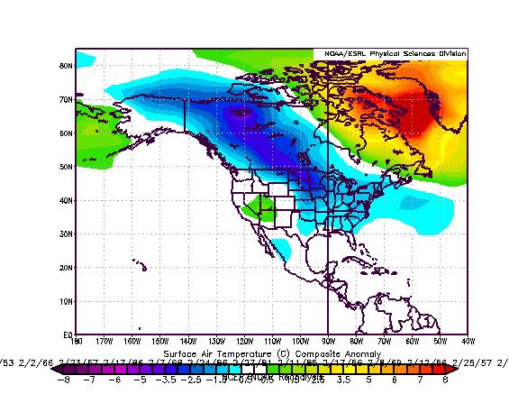
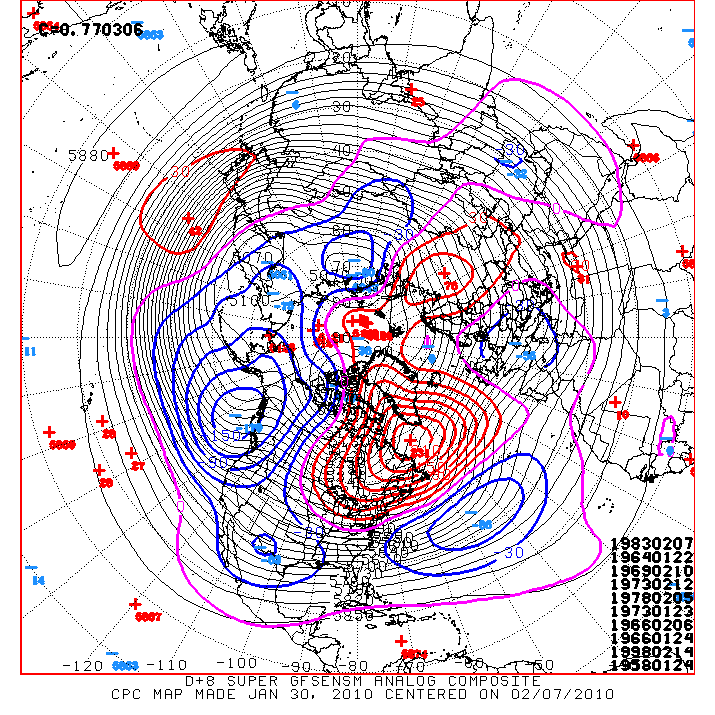
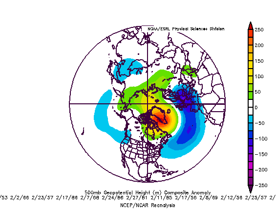
The composite 500 mb height anomalies associated with all days in February (1950-2009) on which the AO was -3.000 or below was:
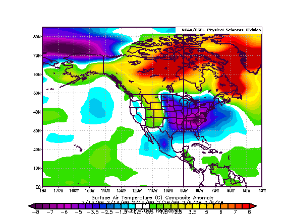
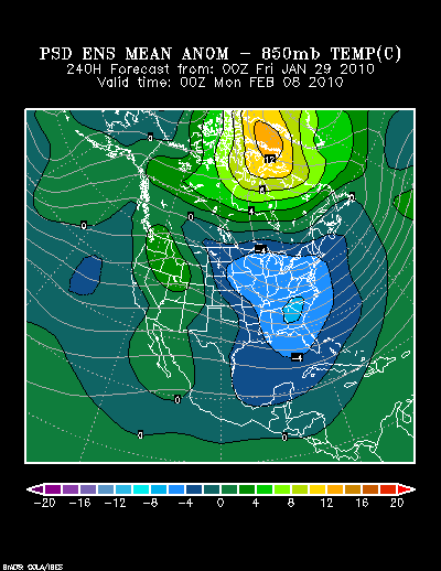
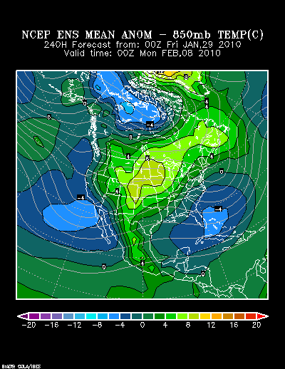
The following shows hours evolution of the 500 mb height anomalies forecast for hours 312 through 360 on the 1/26 0z run of the Reforecast Ensembles:
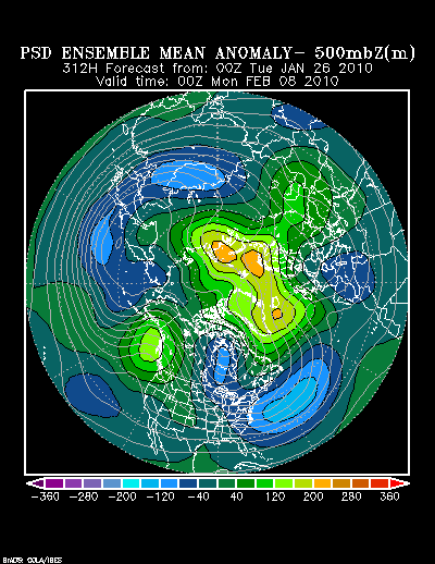
In short, the forecast height anomalies are trending toward the classic pattern one would expect to see with an AO of -3.000 or below. More importantly, one sees the NAO transitioning toward a strong Greenland block even as a negative EPO is developing. Such a dual blocking regime, if it becomes established, could allow for at least one outbreak of severe cold. Such a cold outbreak would have the potential to bring a new freeze to parts of Florida and readings into the 20s in southeast Texas and perhaps even upper 30s in south Texas.
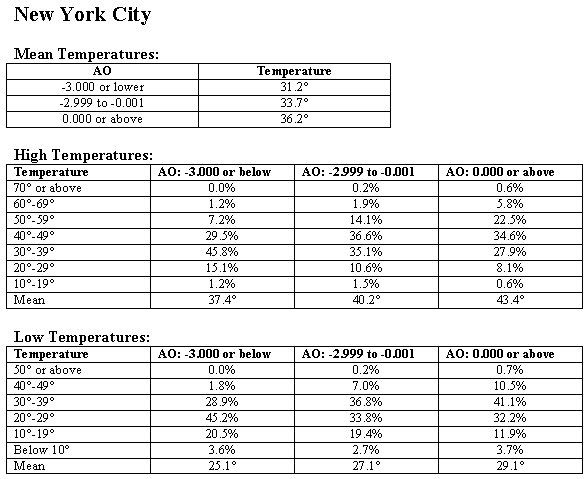
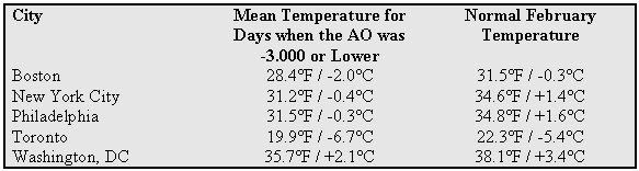
In general, such a pattern is colder than normal. Data for select cities follows:
With a colder pattern getting into place coupled with an active subtropical jet, there will be opportunities for snow. Since 1950, 10/14 (71%) of February Kocin-Uccellini snowstorms (snowstorms of the kind featured in their seminal work Northeast Snowstorms) occurred with a negative AO. Six of those ten storms occurred with the AO at -1.000 or below.
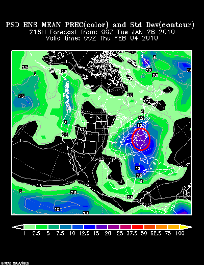
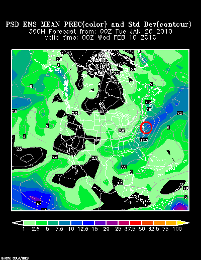
At present, two storm possibilities are shown on the Reforecast Ensembles around hour 216 and hour 360:
Hour 216:
Hour 360:
In sum, the pattern is evolving consistent with the idea that February will likely wind up colder and snowier than normal in the East, wetter than normal on the West Coast, Southwest, and in the Gulf States. The Reforecast Ensembles currently provide the closest match to what one would expect with a severely negative AO in February. It will be interesting to see how the pattern evolves in the coming days.