Pacific Northwest Weather
Moderator: S2k Moderators
Forum rules
 The posts in this forum are NOT official forecast and should not be used as such. They are just the opinion of the poster and may or may not be backed by sound meteorological data. They are NOT endorsed by any professional institution or STORM2K.

The posts in this forum are NOT official forecast and should not be used as such. They are just the opinion of the poster and may or may not be backed by sound meteorological data. They are NOT endorsed by any professional institution or STORM2K.
-
snow_wizzard
- Category 4

- Posts: 994
- Joined: Mon Jan 17, 2005 12:15 am
- Location: Covington, WA
-
TT-SEA
For the last two months (since the Pineapple Express in January) I knew the ridge would hold and any pattern shift would be short-lived and meaningless. Although I thought originally that the ridge would really break down during the first week of March.
I knew there would be a change in March to a much more active pattern. I never believed that we were just going to transition into summer. I will admit that I had my doubts over the weekend as things kept getting pushed back. But sanity has prevailed.
And my "wild March" theory may prove correct. At least the second half of March!!
Next month we may be retracting the drought declaration.
0 likes
-
Guest
Anthony, what you are saying about not having snow in mid-late march sounds sort of like what any average kid has said to me at school. I was blabbing about the upcoming change and saying there is the possibility for snow... They would just tell me to look outside, tell me it's mid march, and blow off even considering the possibility that it could snow... I think you are way underestimating this pattern change.
TT, you did do a good job long term in predicting that march would be a good transition month.. I remember you saying it back in January... But you had serious doubts in late February and early March even about your own prediction. Remember when SnowWizz was saying 2-3 weeks ago that this was going to be it when everyone else was telling him that winter was over, wait til next year...? Just something to remember.
TT, you did do a good job long term in predicting that march would be a good transition month.. I remember you saying it back in January... But you had serious doubts in late February and early March even about your own prediction. Remember when SnowWizz was saying 2-3 weeks ago that this was going to be it when everyone else was telling him that winter was over, wait til next year...? Just something to remember.
0 likes
-
andycottle
- Category 5

- Posts: 1139
- Joined: Thu Jan 06, 2005 11:34 pm
- Location: Woodinville, Wa
Our weather here was mostly cloudy till about oohh...2pm(late afternoon). Skies became partly cloudy for a little while, but by time early evening came, the clouds began to cover the sky again.
Currently at 6:16pm we have cloudy skies with a temp of 50 and humidity 68% with DP of 41 and baro 29.74 and steady. My high today was 57 with a low of 39. -- Andy
Currently at 6:16pm we have cloudy skies with a temp of 50 and humidity 68% with DP of 41 and baro 29.74 and steady. My high today was 57 with a low of 39. -- Andy
0 likes

I'm just trying to be realistic here. It's very RARE to get snow in Seattle the middle of March. I didn't say it can't happen, but it's very rare. I would say the chances are around 5 percent.
I still wouldn't completely jump the gun on this pattern change. It's still almost a week away...although it's already beginning. I think our weather will definitely change, but I don't think it will be as drastic as some think...I'm surprised TT-SEA is this excited.
Anthony
I still wouldn't completely jump the gun on this pattern change. It's still almost a week away...although it's already beginning. I think our weather will definitely change, but I don't think it will be as drastic as some think...I'm surprised TT-SEA is this excited.
Anthony
0 likes

-
TT-SEA
There is going to be snow in some strange places in the next week. I am not too experienced at predicting the details of lowland snow but it is going to happen somewhere.
After that... its just plain wet in the lowlands with heavy snow in the mountains.
I could not have scripted this any better. This is exactly what I envisioned. And exactly what we need.
Anthony... my excitement stems from the reality of the situation. The global pattern is going through a huge re-shuffling. Its undeniable and its going to ultimately balance out the never-ending ridge of the last two months!!
0 likes
-
andycottle
- Category 5
- Posts: 1139
- Joined: Thu Jan 06, 2005 11:34 pm
- Location: Woodinville, Wa
looking at 18z GFS, the 1000MB trough still looks to drop through the upper part of NE Eastern Wa., that will be spreading lots of numorus showers from about the South central sound and points Northward. When this trough comes in for tomorrow, 850MB temp appear around -6C and heights of 1320M. 500MB vorticity heights are 528 to near 534DM. So surface temps should be much cooler tomorrow....as in the upper 40`s to very low 50`s.
A very showery and very unsetteled pattern stays with us for at least the next couple weeks, as well as into the longer range outlook with possable breezy and pretty wet systems that will vary in strengh and intenesty.
Weather looks very interesting come the 19th, 20th time frame as a 992MB low spins very closely just off shore of Central Vancouver Is. This could also be a cold and fairly breezy system as pressure gradents are pretty tight up at 850MB, and really low heights at 1230M and temp of
-9C. 500MB heights drop to near 516DM. If this outlook turns out right, and on the 21st, the far Northern parts of Western Wa., could see a little snow..when that system moves inland over upper portion of Vancouver and Northern B.C. as a 1004MB low. Will see what happens in tonights 00Z run.
-- Andy
PS: Hey Randy, Tim, and the rest...what do you think of this forecast I have done?
0 likes

Currently at 6:40PM its 47.3 degrees and partly cloudy
Memorable march snowstorms for me include the mid March snow of 1997 we had 3" of the white stuff ( can't remember the exact day it started), stuck around for about 2 days.
Then the double whammy of March 2002 we had about 10" around the 10th or so, then we had another 5" or so on the first day of Spring I think it was the 20th. Our high on the first day of spring didn't get out of the low/mid 30's
The biggest one though in my existance came on the 2nd of March 1989, we had according to my weather records that I kept back in that time 14" of snow on the ground, school was cancelled that day. The next day it was 2hrs late, that was a friday, we still had snow on the ground until the 7th........... I am so happy I found my weather logs from back in the late 80's early 90's, been looking for that book for a long time!!!
Looks like the following yr we had more snow starting on the 7th of March of 1990 that stayed on the ground until the 11th. No school delays there, so the roads must have been to warm for the snow to stick to.
Here is more info from my weather logs back then (didn't have temps, just days we had snowfall and snow on the ground and if there were school delays at my school, that must have been very important to me at the time ................
Jan 1989 Same area I live in now (been here all my life in the LK Goodwin area)
Snowed on Jan 5th-6th 2"
Again on the 24th 1"
Again on the 31st 3" My school was not delayed
Febuary 1989
Snowed on the 1st 6" No school
Snowed on the 2nd another 4" No school once again
Snowed on the 3rd another 3" No school for the 3rd day in a row!
Additional snow of 2" on the 4th-5th weekend
Snow flurries for the 6th School 1hr late
Clear and cold on the 7th school 1hr late
The same for the 8th-10th school 1hr late
snow on the ground 11th-20th School on time
WOW the memories of that winter came flooding back when I looked at my logs!!! What an awesome winter, looks like we had a total of 33" of snow, could have been more, I only had records of Jan-march of 1989
Here is the rundown of 1990
Jan 1990...........
Snow fall on the 1st-2nd 3", still on winter break
Snow on the 26th 1" School on time
Snow on the 30-31st School on time
Feb 1990..............
Snow fall on the 6th-8th 2" school on time
Snow fall on the 11th weekend 1"
Snow fall on the 12th-14th 2" Limited bus trans
Snow fall on the 15th 5" School 1hr late
Snow fall on the 16th 3" No School
Snow on the ground 17th-26th Limited bus trans
Dec 1990............
Snow fall on the 16th 1" Weekend
Snow fall on the 18th 4" School on time
Snow fall on the 19th 3" School 2hrs Late
Snow fall on the 20th 5" No School
Snow on ground 21st Start of winter break
Snow on ground 22-24th
Snow fall on the 25th 12" X-Mas
Snow on the ground 26th-31st
Jan 1991...............
Snow fall on the 6th 5" Weekend
Snow on the ground 7th School 1hr Late
Snow on the ground 8th No bus Transportation, Weight restrictions on all county roads
Snow fall on the 27th-28th 3" Weekend
No snowfall in Feb
March 1991...........
Snow fall on the 10th 2" Weekend
Snow on the ground 11th School on time
Hope I didn't bore anyone, was facinating to look back, those were a couple of awesome winters!!!!!!
Memorable march snowstorms for me include the mid March snow of 1997 we had 3" of the white stuff ( can't remember the exact day it started), stuck around for about 2 days.
Then the double whammy of March 2002 we had about 10" around the 10th or so, then we had another 5" or so on the first day of Spring I think it was the 20th. Our high on the first day of spring didn't get out of the low/mid 30's
The biggest one though in my existance came on the 2nd of March 1989, we had according to my weather records that I kept back in that time 14" of snow on the ground, school was cancelled that day. The next day it was 2hrs late, that was a friday, we still had snow on the ground until the 7th........... I am so happy I found my weather logs from back in the late 80's early 90's, been looking for that book for a long time!!!
Looks like the following yr we had more snow starting on the 7th of March of 1990 that stayed on the ground until the 11th. No school delays there, so the roads must have been to warm for the snow to stick to.
Here is more info from my weather logs back then (didn't have temps, just days we had snowfall and snow on the ground and if there were school delays at my school, that must have been very important to me at the time
Jan 1989 Same area I live in now (been here all my life in the LK Goodwin area)
Snowed on Jan 5th-6th 2"
Again on the 24th 1"
Again on the 31st 3" My school was not delayed
Febuary 1989
Snowed on the 1st 6" No school
Snowed on the 2nd another 4" No school once again
Snowed on the 3rd another 3" No school for the 3rd day in a row!
Additional snow of 2" on the 4th-5th weekend
Snow flurries for the 6th School 1hr late
Clear and cold on the 7th school 1hr late
The same for the 8th-10th school 1hr late
snow on the ground 11th-20th School on time
WOW the memories of that winter came flooding back when I looked at my logs!!! What an awesome winter, looks like we had a total of 33" of snow, could have been more, I only had records of Jan-march of 1989
Here is the rundown of 1990
Jan 1990...........
Snow fall on the 1st-2nd 3", still on winter break
Snow on the 26th 1" School on time
Snow on the 30-31st School on time
Feb 1990..............
Snow fall on the 6th-8th 2" school on time
Snow fall on the 11th weekend 1"
Snow fall on the 12th-14th 2" Limited bus trans
Snow fall on the 15th 5" School 1hr late
Snow fall on the 16th 3" No School
Snow on the ground 17th-26th Limited bus trans
Dec 1990............
Snow fall on the 16th 1" Weekend
Snow fall on the 18th 4" School on time
Snow fall on the 19th 3" School 2hrs Late
Snow fall on the 20th 5" No School
Snow on ground 21st Start of winter break
Snow on ground 22-24th
Snow fall on the 25th 12" X-Mas
Snow on the ground 26th-31st
Jan 1991...............
Snow fall on the 6th 5" Weekend
Snow on the ground 7th School 1hr Late
Snow on the ground 8th No bus Transportation, Weight restrictions on all county roads
Snow fall on the 27th-28th 3" Weekend
No snowfall in Feb
March 1991...........
Snow fall on the 10th 2" Weekend
Snow on the ground 11th School on time
Hope I didn't bore anyone, was facinating to look back, those were a couple of awesome winters!!!!!!
0 likes
-
snow_wizzard
- Category 4
- Posts: 994
- Joined: Mon Jan 17, 2005 12:15 am
- Location: Covington, WA
-
snow_wizzard
- Category 4
- Posts: 994
- Joined: Mon Jan 17, 2005 12:15 am
- Location: Covington, WA
Here is the PNA (and AO and such) for the winter of 1988/89
http://www.cpc.ncep.noaa.gov/products/p ... x.1988.gif
Here it is for 1989/90
http://www.cpc.ncep.noaa.gov/products/p ... x.1989.gif
Here it is for 1990/91
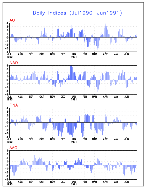
http://www.cpc.ncep.noaa.gov/products/p ... x.1990.gif
You can sure corallate(sp?) my weather logs for snow to the negitive PNA for those yrs, facinating stuff!!
http://www.cpc.ncep.noaa.gov/products/p ... x.1988.gif
Here it is for 1989/90
http://www.cpc.ncep.noaa.gov/products/p ... x.1989.gif
Here it is for 1990/91
http://www.cpc.ncep.noaa.gov/products/p ... x.1990.gif
You can sure corallate(sp?) my weather logs for snow to the negitive PNA for those yrs, facinating stuff!!
0 likes
Found an article I kept from the Seattle times dated Jan 28th 1991 explaining what happened on the Dec 18th 1990 snowstorm that left thousands stranded because it was not forecasted. Very interesting stuff. When I have more time, maybe tomarrow I will type out exactly what the arcticle says.
Well off to bed, currently at 8:10PM its 47.1 degrees
Well off to bed, currently at 8:10PM its 47.1 degrees
0 likes
-
TT-SEA
Wasn't the Dec. 1990 snowstorm a strong PSCZ?! But I do remember it affected a LARGE part of the greater Seattle metro area...places from Everett to Tacoma had between 6-12 inches of snow. And it all depended where you lived...if you went just north of Everett, there was maybe 2-3 inches...but if you were in North Seattle...there was almost 14 inches.
0 likes

AnthonyC wrote:Wasn't the Dec. 1990 snowstorm a strong PSCZ?! But I do remember it affected a LARGE part of the greater Seattle metro area...places from Everett to Tacoma had between 6-12 inches of snow. And it all depended where you lived...if you went just north of Everett, there was maybe 2-3 inches...but if you were in North Seattle...there was almost 14 inches.
Let's hope that happens again in the next few weeks!
0 likes
-
andycottle
- Category 5
- Posts: 1139
- Joined: Thu Jan 06, 2005 11:34 pm
- Location: Woodinville, Wa
Good evening again folks..
Viewing the 00z GFS tonight, the model still showing what could really be a cold and breezy system for 19th & 20th as a 992MB low sits almost stationary of the Central coast of Vancouver Is. 850MB heights fairly low and or near 1230M with temp of -6C and SW winds of 20 to 25kts. 500MB vorticity heights are near 516DM with winds out of the WSW at 40 to 60kts. So my thinking is that the far Northern Western Wa area could see a little snow, while the Seattle area could see a rain/snow mix with maybe a light acumulation on the highest hills. Of course if you look on the flip side of the coin, this just may be an all out rain system or just plain ol` snow for most of Western Wa.
-- Andy
0 likes
-
andycottle
- Category 5
- Posts: 1139
- Joined: Thu Jan 06, 2005 11:34 pm
- Location: Woodinville, Wa
Who is online
Users browsing this forum: Stratton23, wxman22 and 84 guests