As we close out 2008 here on this last day of December, it looks like another post Halloween month with a above average temp.
DECEMBER 2008
[TEMPERATURE DATA]............ [PRECIPITATION DATA]
AVERAGE DAILY:.....H/61.3..... L/36.7
AVERAGE MONTHLY:... 49.0........ TOTAL FOR MONTH:... 0.27
DPTR FM NORMAL:... +2.2........... DPTR FM NORMAL:... -2.23
North Texas Winter 08/09. Analogs, Forecast, and Discussions
Moderator: S2k Moderators
Forum rules
 The posts in this forum are NOT official forecast and should not be used as such. They are just the opinion of the poster and may or may not be backed by sound meteorological data. They are NOT endorsed by any professional institution or STORM2K.

The posts in this forum are NOT official forecast and should not be used as such. They are just the opinion of the poster and may or may not be backed by sound meteorological data. They are NOT endorsed by any professional institution or STORM2K.
-
CaptinCrunch

- S2K Supporter

- Posts: 8784
- Age: 58
- Joined: Mon Nov 03, 2003 4:33 pm
- Location: Kennedale, TX (Tarrant Co.)
-
CaptinCrunch
- S2K Supporter
- Posts: 8784
- Age: 58
- Joined: Mon Nov 03, 2003 4:33 pm
- Location: Kennedale, TX (Tarrant Co.)
Re: North Texas Winter 08/09. Analogs, Forecast, and Discussions
Here's the recap of 2008 weather wise.
December 08
[TEMPERATURE DATA]................................ [PRECIPITATION DATA]
DAILY AVERAGE:.....H/61.1.........L/36.8
AVERAGE MONTHLY:... 49.0.................... TOTAL FOR MONTH:.... 0.27
DPTR FM NORMAL:...... +2.3..................... DPTR FM NORMAL:.... -2.30
2008 was the 2nd warmest year recorded for NTX
Average daily temp was 67.1
High for the year was 107
Low for the year was 23
0 likes
-
CaptinCrunch
- S2K Supporter
- Posts: 8784
- Age: 58
- Joined: Mon Nov 03, 2003 4:33 pm
- Location: Kennedale, TX (Tarrant Co.)
Another record day with a high temp of 84, and a low of 63. 
IT HAS BEEN ANOTHER UNSEASONABLY WARM DAY ACROSS NORTH TEXAS WITH
TEMPERATURES CLIMBING INTO THE UPPER 70S TO MID 80S. AS OF 320
PM... DFW HAD TIED THEIR RECORD HIGH FOR JANUARY WITH 84 DEGREES
AND WACO WAS ONLY 1 DEGREE AWAY.
THE WARM WEATHER WILL COME TO AN END LATE TONIGHT AND SUNDAY
MORNING. A COLD FRONT THAT EXTENDED FROM SOUTH OF KANSAS CITY AND
GAGE INTO EXTREME NORTHEASTERN NEW MEXICO...WILL MOVE SWEEP
SOUTHEAST ACROSS THE RED RIVER BEFORE MIDNIGHT AND THROUGH THE
SOUTHEASTERN ZONES BY MID MORNING SUNDAY. THIS FRONT WILL MOVE
THROUGH DRY. HOWEVER...WE WILL SEE A CHANCE OF RAIN SUNDAY NIGHT
AS ISENTROPIC UPGLIDE INCREASES. TEMPERATURES WILL FALL TO NEAR
OR BELOW FREEZING ACROSS THE NORTH...SO HAVE KEPT THE RAIN OR
FREEZING RAIN WORDING ALONG AND NORTH OF A COMANCHE TO
DENTON...TO PARIS LINE. THE MODELS DISAGREE ON FREEZING LINE AND
THE TIMING OF THE BEGINNING OF THE PRECIPITATION...SO CONFIDENCE
ON THE RAIN/FREEZING RAIN LINE FOR MONDAY MORNING IS NOT VERY
HIGH. TEMPERATURES WILL RISE ABOVE FREEZING AREAWIDE BY MONDAY
AFTERNOON. THE RAIN WILL BE COMING TO AN END FROM WEST TO EAST
TUESDAY. THEIR MAY BE SOME VERY LOW CHANCES OF RAIN ACROSS THE
EAST BY FRIDAY....BUT HAVE OPTED TO LEAVE THIS OUT FOR NOW.
Last edited by CaptinCrunch on Sun Jan 04, 2009 1:24 am, edited 1 time in total.
0 likes
Re: North Texas Winter 08/09. Analogs, Forecast, and Discussions
I am not too familiar with the vegetation in the Dallas or Houston areas....but does this level of warmth begin to trigger any flowers or leaves to start blooming on trees that are deciduous?
0 likes
-
vbhoutex

- Storm2k Executive

- Posts: 29150
- Age: 74
- Joined: Wed Oct 09, 2002 11:31 pm
- Location: Cypress, TX
- Contact:
Re: North Texas Winter 08/09. Analogs, Forecast, and Discussions
jinftl wrote:I am not too familiar with the vegetation in the Dallas or Houston areas....but does this level of warmth begin to trigger any flowers or leaves to start blooming on trees that are deciduous?
Yes we have that happen quite often in Houston. Some years we have a "late season" cold snap(frost or freeze)that nips it all back and sometimes we don't. Of course the warmth has to go on for several days at these levels, at least at this time of year, for that to happen.
0 likes
-
CaptinCrunch
- S2K Supporter
- Posts: 8784
- Age: 58
- Joined: Mon Nov 03, 2003 4:33 pm
- Location: Kennedale, TX (Tarrant Co.)
Re: North Texas Winter 08/09. Analogs, Forecast, and Discussions
AREA FORECAST DISCUSSION
NATIONAL WEATHER SERVICE FORT WORTH TX
1023 AM CST MON JAN 5 2009
.UPDATE...
FREEZING TEMPERATURES HAVE SPREAD AS FAR SOUTH AS TEMPLE AND WACO
AND AS FAR EAST AS CORSICANA. NEWEST MODEL DATA INDICATES WE WILL
HAVE WET-BULBED AS MUCH AS WE CAN OVER THE NEXT COUPLE OF HOURS
AND TEMPS WILL ACTUALLY RISE A COUPLE DEGREES THIS AFTERNOON AS
LOW LEVEL THERMAL PROFILES INCREASE AHEAD OF THE NEXT SHORTWAVE.
ALSO...CONTINUED RAIN WILL BEGIN DRAGGING DOWN WARMER AIR
INDICATED AS A WARM NOSE ON THIS MORNINGS SOUNDING.
THE NEXT COUPLE OF HOURS IS WHEN TEMPS WILL BE LOWEST AND WHEN WE
MAY SEE THE MOST PROBLEMS ASSOCIATED WITH THIS EVENT. SO FAR
IMPACTS HAVE BEEN LIGHT WITH ICING AND ACCIDENTS LIMITED TO
BRIDGES AND OVERPASSES. THE ADVISORY END TIME OF NOON FOR THE
METROPLEX SHOULD WORK OUT WELL...WHILE AREAS TO THE NORTH WILL BE
UNDER AN ADVISORY UNTIL 4 PM.
HAVE ADJUSTED TEMPS AND WEATHER GRIDS ACCORDING TO CURRENT TRENDS
AND THE LATEST THINKING. TEMPERATURES OVERNIGHT TONIGHT WILL
GENERALLY BE ABOVE FREEZING WITH A COLD RAIN CONTINUING INTO
TOMORROW MORNING AS UPPER TROUGH SWINGS EAST.
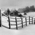
Very lite coating of ice on fences, doghouse, and maibox, but street and the bridges I saw where ice free. Things could have been worse if it hadn't been for the last few day's of 80 degree temps, we didn't go back to cold till yesterday.
But here's kicker, we will be back into the lower 70's by Thursday and lasting into the weekend. Next cool down looks like late Sunday or Monday of next week.
0 likes
-
CaptinCrunch
- S2K Supporter
- Posts: 8784
- Age: 58
- Joined: Mon Nov 03, 2003 4:33 pm
- Location: Kennedale, TX (Tarrant Co.)

-
somethingfunny

- ChatStaff

- Posts: 3926
- Age: 37
- Joined: Thu May 31, 2007 10:30 pm
- Location: McKinney, Texas
Re: North Texas Winter 08/09. Analogs, Forecast, and Discussions
vbhoutex wrote:jinftl wrote:I am not too familiar with the vegetation in the Dallas or Houston areas....but does this level of warmth begin to trigger any flowers or leaves to start blooming on trees that are deciduous?
Yes we have that happen quite often in Houston. Some years we have a "late season" cold snap(frost or freeze)that nips it all back and sometimes we don't. Of course the warmth has to go on for several days at these levels, at least at this time of year, for that to happen.
Like he said above, the warm weather would have to go on for at least a week. Typically a warm pattern like that would feature daily highs in the 60s. Any time it gets into the 70s (and 80s like last week), everybody in NTX knows....you've got less than 24 hours until the next freeze....and plants are much better at predicting the weather than humans.
0 likes
-
CaptinCrunch
- S2K Supporter
- Posts: 8784
- Age: 58
- Joined: Mon Nov 03, 2003 4:33 pm
- Location: Kennedale, TX (Tarrant Co.)
Re: North Texas Winter 08/09. Analogs, Forecast, and Discussions
Well Well Well, let's see how this play's out in the coming days
STILL SOME MODEL DISAGREEMENT ABOUT ARRIVAL OF ARCTIC AIR THE
MIDDLE OF NEXT WEEK. GFS IS TRENDING COLD...ECMWF IS TRENDING
WARM. REGARDLESS...ALL EXTENDED MODELS SHOW STRONG AMPLIFICATION
WITH RIDGING INTO THE GULF OF ALASKA AND TREMENDOUS NORTH-SOUTH
POLAR JET EAST OF THE ROCKIES. THE AMPLITUDE WILL EXCEED 40
DEGREES OF LATITUDE...USHERING BITTER ARCTIC AIR INTO THE CONUS.
MCGRATH AK HAS AN AVERAGE HIGH TEMP OF -33.6F SO FAR THIS MONTH.
NORTHWAY AK WAS ANCHORED AT -60F MUCH OF THE DAY TODAY. SOME
SITES IN EASTERN INTERIOR ALASKA AND ADJACENT YUKON TERRITORY HAVE
REMAINED BELOW -50F THE PAST FEW DAYS. HAVE MAINTAINED EXTENDED
TEMPS WELL BELOW NORMAL. POTENTIAL FOR SEVERE ARCTIC OUTBREAK...
BUT WILL WAIT TO SEE HOW PARAMETERS UNFOLD THE NEXT FEW DAYS
BEFORE PROGGING EXTREME EVENT. WINTRY PRECIP IS POSSIBLE THE END
OF NEXT WEEK...BUT WITH LOW-END CHANCES...WILL REFRAIN FROM
INTRODUCING ANYTHING ALARMING IN NEW DAY 7 (THURS JAN 15).
0 likes
-
CaptinCrunch
- S2K Supporter
- Posts: 8784
- Age: 58
- Joined: Mon Nov 03, 2003 4:33 pm
- Location: Kennedale, TX (Tarrant Co.)
Re:
gboudx wrote:What would be "alarming"? 10" of snow?
WE ARE IN STORE FOR A BIG CHANGE LATTER HALF OF NEXT WEEK AS A BROAD
TROUGH OVER MUCH OF NOAM SENDS COLD ARCTIC AIR DOWN INTO THE REGION.
RELIABLE COMPUTER MODELS ARE STILL HAVING A DIFFICULT TIME
DETERMINING JUST HOW COLD IT WILL BE. THE AIR MASS ORIGINATES IN
NORTHERN AND EASTERN ALASKA WHERE DAYTIME TEMPS HAVE BEEN MINUS 20
TO MINUS 45+ DEGREES. GIVEN THAT WE ARE NOW IN THE DEAD OF
WINTER...STRENGTH OF A RIDGE BUILDING OFF THE WEST COAST...A
MCFARLAND PATTERN SETUP NORMALLY RESULTS IN SOME OF THE COLDEST
TEMPERATURES OF WINTER...THUS WE WILL FOLLOW THE GFS AND UNDER MOS
GUIDANCE NUMBERS SIGNIFICANTLY FOR THURSDAY AND FRIDAY. FORECAST
SOUNDING DO NOT INDICATE ANY POTENTIAL FOR SNOW OR ICE WITH THE
ARCTIC AIR.
As of now no precip, but we'll see? Noticed that forecast highs for Thuesday are only in the lower 30's at best.
0 likes
-
gboudx

- S2K Supporter
- Posts: 4090
- Joined: Thu Sep 04, 2003 1:39 pm
- Location: Rockwall, Tx but from Harvey, La
Re: Re:
CaptinCrunch wrote:
As of now no precip, but we'll see? Noticed that forecast highs for Thuesday are only in the lower 30's at best.
Yeah, you know what cold air is without precip right? Just cold air.
Maybe I'll water down the backyard and make some ice for the kids to slide on.
0 likes
-
CaptinCrunch
- S2K Supporter
- Posts: 8784
- Age: 58
- Joined: Mon Nov 03, 2003 4:33 pm
- Location: Kennedale, TX (Tarrant Co.)
Re: North Texas Winter 08/09. Analogs, Forecast, and Discussions
Well, pack away your parka and snow shoes, and break out the light jackets, looks like a normal week of NTX January weather.
REGARDING THE LATE WEEK FORECAST...TO SAY IT SUCCINCTLY...THERE
WILL BE NO MAJOR ARCTIC OUTBREAK OR ABNORMAL COLD SNAP HERE. 2 OR
3 DAYS AGO BOTH THE ECMWF/GFS WERE FORECASTING THE HUDSON BAY
POLAR LOW TO DROP SOUTH INTO THE GREAT LAKES REGION AND PERSIST
FOR A COUPLE DAYS WHILE THE CORRESPONDING LONG WAVE UPPER TROUGH
RETROGRADED WESTWARD. THIS PATTERN WOULD HAVE BROUGHT ARCTIC AIR
INTO NORTH TEXAS. THE ECMWF CHANGED ITS FORECAST LAST THURSDAY TO
A MORE PROGRESSIVE/EASTWARD MOVING LONG WAVE TROUGH AND NOW
FINALLY THE GFS HAS FOLLOWED IN ITS FOOTSTEPS. THIS MEANS THE CORE
OF THE ARCTIC AIR WILL STAY NORTHEAST OF THE REGION...WITH MUCH
OF THE EASTERN US EXPERIENCING THEIR COLDEST TEMPS OF THE SEASON.
FOR NORTH TEXAS...A COLD FRONT ARRIVE THURSDAY...BUT IT WILL BE
NOTHING OUT OF THE ORDINARY. WE WILL BE JUST ON THE FRINGES OF A
THE LARGE SPRAWLING ARCTIC HIGH PRESSURE CELL HEADED INTO THE
TENNESSEE VALLEY. IN JUST 24 HOURS...THE 12Z GFS IS NOW 20-30
DEGREES WARMER WITH THE LATE WEEK FORECAST...AND IT ACTUALLY LOOKS
TOO WARM NOW. OUT OF RESPECT FOR HOW COLD IT IS ACROSS THE YUKON
AND NW TERRITORIES WILL UNDERCUT GFS GUIDANCE FOR TEMPS AND KEEP
THEM NEAR OR JUST A LITTLE WARMER THAN THE INHERITED FORECAST.
0 likes
-
CaptinCrunch
- S2K Supporter
- Posts: 8784
- Age: 58
- Joined: Mon Nov 03, 2003 4:33 pm
- Location: Kennedale, TX (Tarrant Co.)
Re: North Texas Winter 08/09. Analogs, Forecast, and Discussions
Well so much for all the hype of the ARCTIC express. I'm really getting tired of the up and down weather we been having, 52 one day, 72 the next. This is our average daily high/low thru the 12th (AV. 67.4/ 39.5) with a monthly average of +9.9 above normal.
EXPECT A COOL DRY DAY TODAY. EVEN
THOUGH SKIES WILL BE MOSTLY SUNNY....DECENT COLD AIR ADVECTION
WILL HELP KEEP TEMPERATURES SLIGHTLY BELOW SEASONAL
NORMALS...WITH HIGHS IN THE MID 40S TO LOWER 50S. THE ROLLER
COASTER WEATHER WILL CONTINUE AS WINDS COME BACK AROUND TO THE
SOUTH TONIGHT AS A SURFACE HIGH MOVES OFF TO THE EAST. THE NEXT
FRONT WILL MOVE DOWN THE PLAINS INTO NORTH TEXAS LATE WEDNESDAY
AFTERNOON AND EVENING. WE WILL SEE A BRIEF WARM UP WEDNESDAY THEN
TEMPERATURES WILL DROP AGAIN WEDNESDAY NIGHT. IT WILL BE QUITE
COOL THURSDAY WITH HIGHS STRUGGLING TO CLIMB INTO UPPER 30S TO
MID 40S. WINDS WILL COME BACK AROUND TO THE SOUTH FRIDAY WITH YET
ANOTHER FRONT IN THE PIPELINE FOR SATURDAY. WE MAY SEE SOME LOW
CHANCES OF RAIN ACROSS THE SOUTHEAST THIRD SATURDAY. DRY WEATHER
IS THEN EXPECTED THROUGH MARTIN LUTHER KING JUNIOR DAY WITH
TEMPERATURES NEAR OR ABOVE SEASONAL NORMALS.
0 likes
-
mysterymachinebl
- Tropical Depression

- Posts: 56
- Age: 53
- Joined: Tue Dec 18, 2007 12:19 pm
- Location: Littleton, Co
Re: North Texas Winter 08/09. Analogs, Forecast, and Discussions
So much for a big cool down here....it's going to be back to 60 for the weekend and early next week.
A little snippet about extended forecast from FW NWS....
STILL NO PRECIPITATION IN THE FORECAST. GFS/ECMWF CONTINUE TO
AGREE WELL ON THE EXTENDED EAST OF THE ROCKIES...BUT WEST COAST DIFFERENCES MIGRATE OUR WAY BY LATE NEXT WEEK AND WE MAY BE IN FOR A PATTERN CHANGE.
A little snippet about extended forecast from FW NWS....
STILL NO PRECIPITATION IN THE FORECAST. GFS/ECMWF CONTINUE TO
AGREE WELL ON THE EXTENDED EAST OF THE ROCKIES...BUT WEST COAST DIFFERENCES MIGRATE OUR WAY BY LATE NEXT WEEK AND WE MAY BE IN FOR A PATTERN CHANGE.
0 likes
-
CaptinCrunch
- S2K Supporter
- Posts: 8784
- Age: 58
- Joined: Mon Nov 03, 2003 4:33 pm
- Location: Kennedale, TX (Tarrant Co.)
Re: North Texas Winter 08/09. Analogs, Forecast, and Discussions
EXPECT A COLD NIGHT ACROSS
NORTH TEXAS WITH TEMPS IN THE UPPER TEENS ALONG THE RED RIVER TO
THE UPPER 20S ACROSS THE SOUTH. FRIDAY WILL BE COOL WITH
TEMPERATURES GENERALLY IN THE MID TO UPPER 40S.
RIDGING ACROSS THE WESTERN US WILL AMPLIFY SLIGHTLY AND BUILD
EASTWARD THROUGH THE WEEKEND. THIS WILL SEND ANOTHER FRONT THROUGH
NORTH TEXAS ON SUNDAY. AS WITH THE PREVIOUS FRONT...COLDEST AIR
WILL BE WELL EAST OF NORTH TEXAS AND PRECIP CHANCES WILL BE
CONFINED TO SOUTHEAST TEXAS WHERE BETTER MOISTURE WILL BE POOLED.
OVERALL UPPER PATTERN CONTINUES TO CHANGE WITH UPPER RIDGING
BUILDING INTO THE CENTRAL US BY EARLY NEXT WEEK. LITTLE TO SPEAK
OF IN THE WAY OF WEATHER INTO NEXT WEEK WITH TEMPS WARMING
THROUGH THE WEEK. HIGHS WILL BE ABOUT 10 DEGREES ABOVE NORMAL BY
MONDAY.
As temps clime going into the 2nd half of the month, it doesn't look good for the monthly average.
0 likes
-
gboudx
- S2K Supporter
- Posts: 4090
- Joined: Thu Sep 04, 2003 1:39 pm
- Location: Rockwall, Tx but from Harvey, La
Re: North Texas Winter 08/09. Analogs, Forecast, and Discussions
CaptinCrunch wrote:As temps clime going into the 2nd half of the month, it doesn't look good for the monthly average.
And it's looking dry too. If the developing La Nina messes up our spring-time rains, then we may be dealing with water restrictions this summer.
0 likes
-
Extremeweatherguy

- Category 5

- Posts: 11095
- Joined: Mon Oct 10, 2005 8:13 pm
- Location: Florida
Looks like a stormy pattern may be setting up for the Southern Plains in the weeks to come:
http://www.nco.ncep.noaa.gov/pmb/nwprod ... loop.shtml
Things might get "interesting" for North Texas and Oklahoma if this pattern does indeed develop.
http://www.nco.ncep.noaa.gov/pmb/nwprod ... loop.shtml
Things might get "interesting" for North Texas and Oklahoma if this pattern does indeed develop.
0 likes
-
somethingfunny
- ChatStaff
- Posts: 3926
- Age: 37
- Joined: Thu May 31, 2007 10:30 pm
- Location: McKinney, Texas
Re:
Extremeweatherguy wrote:Looks like a stormy pattern may be setting up for the Southern Plains in the weeks to come:
http://www.nco.ncep.noaa.gov/pmb/nwprod ... loop.shtml
Things might get "interesting" for North Texas and Oklahoma if this pattern does indeed develop.
We can only hope!
Granted, my thermostat had better be working again by that point....

0 likes
-
josephtwyman
Who is online
Users browsing this forum: No registered users and 98 guests