The posts in this forum are NOT official forecast and should not be used as such. They are just the opinion of the poster and may or may not be backed by sound meteorological data. They are NOT endorsed by any professional institution or


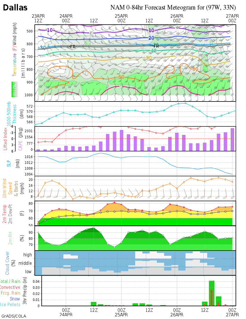
Extremeweatherguy wrote:The 00z NAM is showing the following liquid equivalents during this event (7am Mon - 7am Wed):
Oklahoma City, OK = 0.28" (all of which falls while temperatures are below 32F)
Norman, OK = 0.32" (all of which falls while temperatures are below 32F)
Tulsa, OK = 0.41" (all of which falls while temperatures are below 32F)
Wichita Falls, TX = 0.25" (all of which falls while temperatures are below 32F)
Dallas, TX = 0.59" (about 0.31 to 0.35" of which falls while temperatures are below 32F)
These numbers will be pretty nasty if the precipitation falls solely as freezing rain. Usually 0.25" is considered the cutoff for when you start to see power/tree problems, so all the cities mentioned above could potentially be at risk. One thing I am still watching closely though, especially in the northern cities, is the possibility of a precipitation-type changeover during the event. If the NAM is correct, then some of the areas may see a changeover to all sleet or perhaps even snow toward the end of the event. This changeover, IF it happens, may help to A) Reduce the icing threat and B) Provide higher ground accumulations (aka 0.10" of liquid = ~1.00" of snow). For the sake of our power supply and our trees, lets hope and pray that the changeover does indeed take place.
So right now do you trust the NAM model the most? If I remember correctly it has been the one that has been more accurate this winter, right?