Texas Winter 2012-2013

Winter Weather Discussion

Moderator: S2k Moderators

Forum rules

The posts in this forum are NOT official forecast and should not be used as such. They are just the opinion of the poster and may or may not be backed by sound meteorological data. They are NOT endorsed by any professional institution or STORM2K.

Help Support Storm2K
Message
Author
weatherdude1108
Category 5
Category 5
Posts: 4228
Joined: Tue Dec 13, 2011 1:04 pm
Location: Northwest Austin/Cedar Park, TX

#1041 Postby weatherdude1108 » Tue Dec 18, 2012 4:20 pm

82 degrees at Camp Mabry at 2:51 CST. :grrr: :roll:

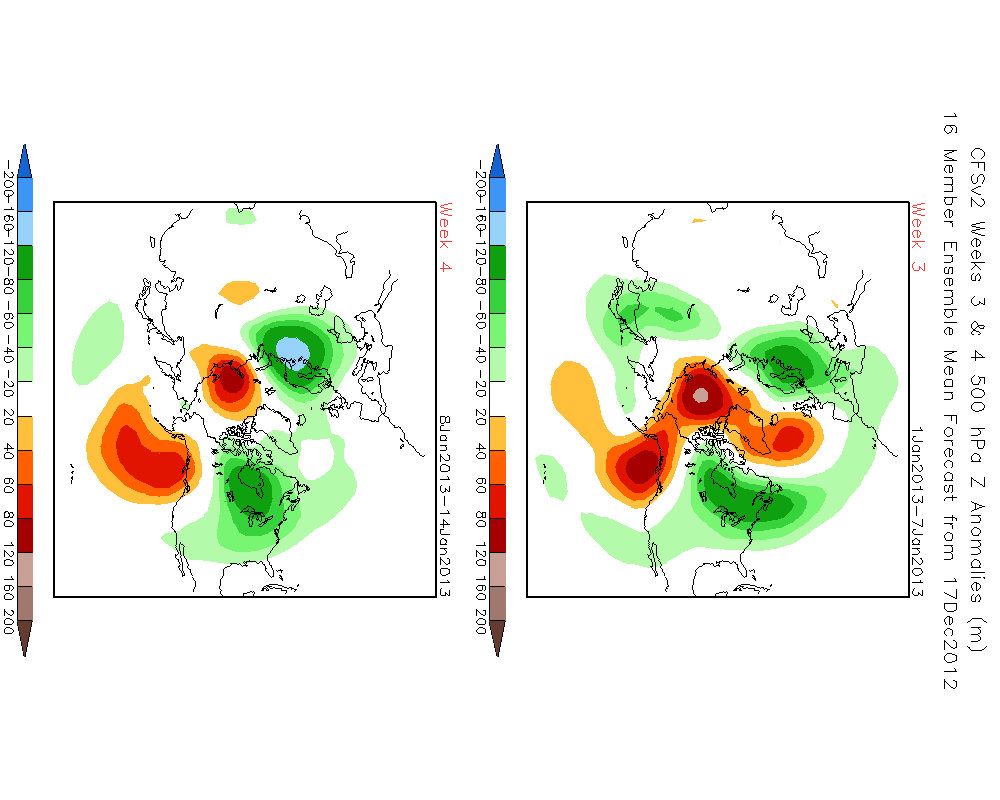
The CPC's 10 day to two week outlook. Their forecasts score a "2" out of their highest forecast confidence of "5":

"
Prognostic Discussions
Valid: Dec 24 - 28, 2012 (6-10 Day Outlook)
Valid: Dec 26 - Jan 01, 2012-13 (8-14 Day Outlook)
Issued: Dec 18, 2012

--------------------------------------------------------------------------------

PROGNOSTIC DISCUSSION FOR 6 TO 10 AND 8 TO 14 DAY OUTLOOKS
NWS CLIMATE PREDICTION CENTER COLLEGE PARK, MD
300 PM EST TUE DECEMBER 18 2012

6-10 DAY OUTLOOK FOR DEC 24 - 28 2012

SEVERAL KEY UNCERTAINTIES REMAIN AS TO THE EVOLUTION OF A POTENTIALLY
HIGH-IMPACT STORM SYSTEM OVER THE THE EASTERN TWO THIRDS OF THE CONUS.
CONFIDENCE REMAINS FAIRLY HIGH IN THE OVERALL LONGWAVE STRUCTURE DISCUSSED
YESTERDAY: A SLOWLY WEAKENING BLOCK CENTERED OVER THE NORTHERN PART OF THE
CONTINENT, A TROUGH NEAR THE WEST COAST, AND A TROUGH OFF THE EAST COAST. THE
ENSEMBLE MEANS ARE IN GOOD AGREEMENT ON THESE KEY FEATURES. IN TODAY'S MANUAL
BLEND, A BLOCK OVER NORTHERN CANADA IS MORE EVIDENT THAN FROM YESTERDAY'S
FORECAST, AS THE MODEL SOLUTIONS ARE IN BETTER AGREEMENT THAT HEIGHT RISES OVER
ALASKA BEFORE THE PERIOD WILL CUT OFF NORTH OF THE MEAN FLOW, WHICH WILL IN
TURN PUSH COLDER AIR SOUTH TOWARD THE CONUS. HOWEVER, RECENT MODEL PERFORMANCE
PRECLUDES A HIGH-CONFIDENCE OUTLOOK.

SUPERIMPOSED ON THE POOR MODEL PERFORMANCE IS THE CONFOUNDING ISSUE OF A
POTENTIAL PATTERN CHANGE. THIS PATTERN CHANGE MIGHT BE SUBTLE IN TERMS OF
CHANGES TO SOME OF THE DOMINANT TELECONNECTIONS. THE PNA, NAO, AND AO ARE NOT
CURRENTLY FORECAST TO HAVE MAJOR SIGN CHANGES OVER THE NEXT COUPLE OF WEEKS.
HOWEVER, THE POSITION OF THE ANOMALIES THAT GIVES RISE TO THE OBSERVED VALUES
MAY BE SHIFTING, WITH HIGHER HEIGHTS DEVELOPING IN NORTHERN NORTH AMERICA.
THE
OBSERVED POSITIVE HEIGHT ANOMALIES SOUTH OF THE ALEUTIANS ARE FORECAST TO
WEAKEN CONSIDERABLY, WHILE STRONGER POSITIVE HEIGHT ANOMALIES ARE MORE LIKELY
TO DOMINATE FROM NEAR HUDSON BAY TO THE POLE.

ABOVE NORMAL TEMPERATURES ARE FAVORED ACROSS THE NORTHERN GREAT LAKES WHERE
ARCTIC AIR IS SLOW TO BUILD EARLY IN THE PERIOD AND IS THEN MODIFIED BY
EASTERLY FLOW AHEAD OF A POTENTIAL STORM SYSTEM LATER IN THE PERIOD. TODAY'S
OUTLOOK IS SIMILAR TO THE ONE ISSUED YESTERDAY ACROSS THE NORTHWEST AND
NORTHERN ROCKIES. COLDER THAN NORMAL TEMPERATURES ARE FAVORED FARTHER SOUTH
AND EAST AS AN ARCTIC HIGH CONTINUES TO PUSH SOUTH FROM CANADA. ABOVE NORMAL
TEMPERATURES EARLY IN THE PERIOD IN THE SOUTH-CENTRAL AND SOUTHEASTERN CONUS
SHOULD BE BALANCED BY COLDER AIR BEHIND ANY STORM SYSTEM LATER, ALTHOUGH WITH
HIGH UNCERTAINTY.
THE LARGEST WEATHER-MAKER DURING THE PERIOD IS LIKELY TO BE A WINTER STORM THAT
OCCURS FROM THE CENTRAL CONUS EASTWARD. THE TRACK AND STRENGTH OF THIS SYSTEM
REMAINS VERY UNCERTAIN. AN ACTIVE STORM TRACK FROM CENTRAL CALIFORNIA THROUGH
THE MIDDLE OF THE COUNTRY STILL SEEMS PROBABLE, ENHANCING PROBABILITIES OF
ABOVE-MEDIAN PRECIPITATION ACROSS MOST OF THE CONUS.
SOME UPSLOPING ON THE
SOUTHERN SIDE OF A BUILDING HIGH PRESSURE SYSTEM INCREASES ODDS OF ABOVE-MEDIAN
PRECIPITATION OVER THE NORTHERN ROCKIES. THE ONLY AREA WHERE DRIER-THAN-MEDIAN
CONDITIONS ARE FAVORED IS ACROSS WEST TEXAS, WHICH SHOULD REMAIN JUST SOUTH OF
AN ACTIVE STORM TRACK.

TODAY'S OFFICIAL 500-HPA BLEND CONSISTS OF 15 PERCENT OF TODAY'S OPERATIONAL 0Z GFS CENTERED ON DAY 8...15 PERCENT OF TODAY'S OPERATIONAL 6Z GFS CENTERED ON
DAY 8...10 PERCENT OF TODAY'S 0Z GFS ENSEMBLE MEAN CENTERED ON DAY 8...20
PERCENT OF TODAY'S 6Z GFS ENSEMBLE MEAN CENTERED ON DAY 8...20 PERCENT OF
TODAY'S OPERATIONAL 0Z ECMWF CENTERED ON DAY 8...AND 20 PERCENT OF TODAY'S 0Z
EUROPEAN ENSEMBLE MEAN CENTERED ON DAY 8.

MODEL OF THE DAY: TODAY'S 00Z ECMWF ENSEMBLE MEAN

FORECAST CONFIDENCE FOR THE 6-10 DAY PERIOD: BELOW AVERAGE, 2 OUT OF 5, DUE TO
GOOD AGREEMENT AMONG ENSEMBLE MEANS OFFSET BY HIGH UNCERTAINTY ASSOCIATED WITH
A SUPPRESSED ZONAL FLOW AND THE FATE OF THE STORM TRACK SOUTH OF POSITIVE
HEIGHT ANOMALIES IN NORTHEASTERN CANADA.

8-14 DAY OUTLOOK FOR DEC 26, 2012 - JAN 01, 2013

THE GFS AND ECMWF ENSEMBLE MEANS REMAIN IN REASONABLY GOOD AGREEMENT ON THE
LONGWAVE PATTERN, WHICH IS SIMILAR TO THE 6-10 PERIOD. THE ECMWF ENSEMBLE
MEMBERS CONTINUE TO EXHIBIT LOW SPREAD IN AGREEING UPON BELOW NORMAL 500-HPA
HEIGHTS ACROSS THE CONUS. HIGH-LATITUDE, POSITIVE HEIGHT ANOMALIES OVER NORTH
AMERICA SEEM TO BE THE DOMINANT FEATURE, TELECONNECTING TO SLIGHTLY LOWER THAN
NORMAL HEIGHTS OVER MOST OF THE CONUS.

AN ACTIVE STORM TRACK ACROSS THE CONUS APPEARS TO BE A CHARACTERISTIC FEATURE
OF THIS PERIOD. AS SUCH, ABOVE-MEDIAN PRECIPITATION PROBABILITIES REMAIN HIGH
OVER MOST OF THE CONUS, WITH VERY LITTLE CHANGE FROM YESTERDAY'S FORECAST. THE
TEMPERATURE FORECAST REMAINS UNCERTAIN EAST OF THE MISSISSIPPI RIVER, AS IT
DEPENDS ON TWO KEY DEVELOPMENTS: THE STRENGTH OF ARCTIC HIGH PRESSURE FORECAST
TO PUSH INTO THE PLAINS AND NORTHERN ROCKIES, AND THE PATH OF AT LEAST ONE
(POSSIBLY TWO) SIGNIFICANT STORM SYSTEM. THE FORECAST IN THE EAST STILL FAVORS
A BALANCE BETWEEN SLIGHTLY MILDER TEMPERATURES EARLY, FOLLOWED BY COLDER
TEMPERATURES LATER. BELOW NORMAL TEMPERATURES ARE FAVORED FROM THE NORTHERN
ROCKIES TO THE CENTRAL CONUS AND ALONG THE WEST COAST WHERE UPPER-LEVEL HEIGHTS
ARE EXPECTED TO REMAIN SIGNIFICANTLY BELOW NORMAL AND ARCTIC HIGH PRESSURE FROM
THE NORTH BECOMES AN IMPORTANT FACTOR.
THE QUESTION POSED YESTERDAY OF WHETHER POSITIVE HEIGHT ANOMALIES PERSISTENTLY
BUILD OVER ALASKA DURING THE PERIOD IS HEADED TOWARD A SOLUTION. THE GFS
ENSEMBLES HAVE BEEN HINTING AT THIS FOR A COUPLE OF DAYS AND THE ECMWF
ENSEMBLES ARE HEADING IN THAT DIRECTION. WARMER THAN NORMAL TEMPERATURES ARE
FAVORED OVER THE WESTERN PART OF ALASKA IN RESPONSE TO THIS. SHOULD HEIGHTS
RISE OVER ALASKA, THAT COULD POINT TOWARD A DISCHARGE OF ARCTIC AIR TOWARD THE
CONUS, FIRST IN THE NORTHERN ROCKIES. THIS SEEMS MORE LIKELY THAN IT DID
YESTERDAY AND THE WESTERN TWO THIRDS OF THE CONUS WOULD BE IMPACTED FIRST.

THE OFFICIAL 8-14 DAY HEIGHT PROG CONSISTS OF: 15 PERCENT OF TODAY'S 0Z GFS
ENSEMBLE MEAN CENTERED ON DAY 11...20 PERCENT OF TODAY'S 6Z GFS ENSEMBLE MEAN
CENTERED ON DAY 11...50 PERCENT OF TODAY'S 0Z EUROPEAN ENSEMBLE MEAN CENTERED
ON DAY 11...AND 15 PERCENT OF TODAY'S 0Z CANADIAN ENSEMBLE MEAN CENTERED ON DAY
11.

FORECAST CONFIDENCE FOR THE 8-14 DAY PERIOD IS: BELOW AVERAGE, 2 OUT OF 5, DUE
TO HIGH UNCERTAINTY ASSOCIATED WITH A SUPPRESSED ZONAL FLOW, SOME LARGE
DISAGREEMENT BETWEEN FORECAST TOOLS, AND PERSISTENTLY POOR MODEL PERFORMANCE.

FORECASTER: STEPHEN BAXTER
"
0 likes   
The preceding post is NOT an official forecast, and should not be used as such. It is only the opinion of the poster and may or may not be backed by sound meteorological data. It is NOT endorsed by any professional institution including storm2k.org. For Official Information please refer to the NHC and NWS products.

User avatar
wxman57
Moderator-Pro Met
Moderator-Pro Met
Posts: 22980
Age: 67
Joined: Sat Jun 21, 2003 8:06 pm
Location: Houston, TX (southwest)

Re: Texas Winter 2012-2013

#1042 Postby wxman57 » Tue Dec 18, 2012 4:49 pm

Comanche wrote:Wxman, what do you expect to transpire in the coming two-weeks? Do you think we indeed flip this pattern over to a cold pattern?


Oh, definitely, cold is coming. How long it will last beyond the first few days of January is the question.
0 likes   

weatherdude1108
Category 5
Category 5
Posts: 4228
Joined: Tue Dec 13, 2011 1:04 pm
Location: Northwest Austin/Cedar Park, TX

#1043 Postby weatherdude1108 » Tue Dec 18, 2012 4:53 pm

Hmmm. I don't like the last sentence that our New Braunfels folks threw in there. Dry and warm Christmas? What else is new?

AREA FORECAST DISCUSSION
NATIONAL WEATHER SERVICE AUSTIN/SAN ANTONIO TX
330 PM CST TUE DEC 18 2012

.DISCUSSION...
NEAR RECORD HIGHS TODAY ARE EXPECTED TO BE MATCHED FOR WEDNESDAY
AS DRY SW WINDS MIX TO THE SURFACE. GOOD MOISTURE ADVECTION
TONIGHT COULD RESULT IN PATCHY DRIZZLE OR LIGHT STREAMER SHOWERS
LATE TONIGHT INTO LATE WEDNESDAY MORNING...BUT THE SW WINDS ABOVE
THE BOUNDARY LAYER SHOULD MIX OUT THE MOISTURE IN WESTERN AND
CENTRAL COUNTIES AND PRECLUDE THE POTENTIAL FOR THUNDERSTORMS OVER
EASTERN COUNTIES THROUGH SUNSET. BY WEDNESDAY EVENING...THE FRONT
MOVING EAST OF I-35 COULD SUPPORT A FEW THUNDERSTORMS GENERALLY
EAST OF A TAYLOR TO KENEDY LINE. 12Z MODEL RUNS SHOW THAT THE
POTENTIAL FOR THUNDERSTORMS ARE ON THE ORDER OF 10 PERCENT. WOULD
NORMALLY LEAVE THE THUNDERSTORM POTENTIAL OUT OF THE FORECAST
WITH THE LOW PROBABILITIES...BUT HAVE NOTICED A SLIGHT SLOWING AND
DEEPENING RUN-TO-RUN TREND OF THE GFS MODEL REGARDING THE UPPER
TROUGH. THIS TREND ALSO PUTS FIRE WEATHER CONCERNS IN LOW
CONFIDENCE AS NOTED BELOW.

LATER SHIFTS WILL ALSO NEED TO CONSIDER WINDS STRONG ENOUGH TO
REACH WIND ADVISORY CRITERIA WEDNESDAY NIGHT INTO EARLY THURSDAY.
THE VERY DRY AIR TO SETTLE OVER THE AREA FOR THURSDAY NIGHT MEANS
A NEAR WIDESPREAD FREEZE FRIDAY MORNING...WITH MUCH AND THE
CENTRAL AND NORTHERN AREAS GETTING A HARD FREEZE. A FLAT ZONAL
PATTERN IS EXPECTED FOR THE WEEKEND...WITH THE DRY AIR ALLOWING
FOR A QUICK RETURN TO NEAR OR ABOVE NORMAL TEMPERATURES BY SUNDAY.
SOME OF THE MODEL DATA SUGGESTED MOISTURE RETURN TO BE FAST ENOUGH
TO PRODUCE FOG OR DRIZZLE BY SUNDAY MORNING...BUT WILL KEEP WITH
THE DRY WEATHER TRENDS AND HOLD MENTION OF THIS CHANCE UNTIL MONDAY
MORNING. THE GFS HAS BEEN DEPICTING A HIGH AMPLITUDE STORM SYSTEM
TO AFFECT THE SOUTHERN PLAINS FOR CHRISTMAS DAY AND/OR THE DAY
AFTER
...BUT A LOWER AMPLITUDE AND DRIER SCENARIO SUGGESTED BY THE
ECMWF IS PREFERRED GIVEN THE DRY PATTERN WE ARE IN.
:grr:
0 likes   
The preceding post is NOT an official forecast, and should not be used as such. It is only the opinion of the poster and may or may not be backed by sound meteorological data. It is NOT endorsed by any professional institution including storm2k.org. For Official Information please refer to the NHC and NWS products.

User avatar
Ntxw
Storm2k Moderator
Storm2k Moderator
Posts: 22786
Joined: Wed Oct 21, 2009 6:34 pm
Location: DFW, Texas

#1044 Postby Ntxw » Tue Dec 18, 2012 5:15 pm

I sense a lot of anxiety and emotions, we're going to need some chill pills this week :cheesy:. Maybe hyping this up a week early wasn't such a good idea for the sensitive folks :wink:. Last winter we couldn't even buy two days worth of it!
0 likes   
The above post and any post by Ntxw is NOT an official forecast and should not be used as such. It is just the opinion of the poster and may or may not be backed by sound meteorological data. It is NOT endorsed by any professional institution including Storm2k. For official information, please refer to NWS products.

  Help support Storm2K!
Help Support Storm2K

User avatar
iorange55
Category 5
Category 5
Posts: 2388
Joined: Thu Nov 13, 2008 9:47 pm
Location: Big D

Re:

#1045 Postby iorange55 » Tue Dec 18, 2012 5:22 pm

Ntxw wrote:I sense a lot of anxiety and emotions, we're going to need some chill pills this week :cheesy:. Maybe hyping this up a week early wasn't such a good idea for the sensitive folks :wink:. Last winter we couldn't even buy two days worth of it!


We might have some rookies in here that weren't around a couple of years ago. I remember letting my emotions go wild with each model run, and we did A LOT of model watching back then with all the storms.

Like I said earlier, it just feels nice to be model watching again. It's just important to remember with a storm this big and this far out, things will change rapidly. Models are celebrating this warm weather right now by wearing their favorite pair of flip-flops.
0 likes   

User avatar
Rgv20
S2K Supporter
S2K Supporter
Posts: 2466
Age: 39
Joined: Wed Jan 05, 2011 5:42 pm
Location: Edinburg/McAllen Tx

Re:

#1046 Postby Rgv20 » Tue Dec 18, 2012 5:23 pm

weatherdude1108 wrote:Hmmm. I don't like the last sentence that our New Braunfels folks threw in there. Dry and warm Christmas? What else is new?


Dont get to down Christmas is still 7 days away...we will see many flip flops with the models until then. 12zGFS Ensembles are all over the place with this feature so there are still many possible outcomes!

In the meantime we had a high of 88F after a low of 48F lol!!!!
0 likes   
The following post is NOT an official forecast and should not be used as such. It is just the opinion of the poster and may or may not be backed by sound meteorological data. It is NOT endorsed by any professional institution including storm2k.org For Official Information please refer to the NHC and NWS products.

Dallasaggie01
Tropical Low
Tropical Low
Posts: 34
Joined: Thu Dec 24, 2009 10:36 am
Location: Dallas

Re: Texas Winter 2012-2013

#1047 Postby Dallasaggie01 » Tue Dec 18, 2012 5:27 pm

From afternoon DFW NWS:


"...WIDELY VARYING SOLUTIONS CONTINUE REGARDING THE YULETIDE STORM
SYSTEM. WHILE THE STORM REMAINS OVER THE NORTH PACIFIC...MESSY
SPAGHETTI PLOTS AND TREMENDOUS ENSEMBLE MEMBER SPREAD SHOULD
CONTINUE. IT IS IMPORTANT TO EMPHASIZE THAT AN OPERATIONAL RUN
REPRESENTS ONLY ONE POTENTIAL OUTCOME...BELYING THE UNCERTAINTY.
EXPECT LITTLE INTERMODEL AGREEMENT OR RUN-TO-RUN CONSISTENCY
UNTIL THE FEATURE MOVES INLAND AND IS SAMPLED BY THE UPPER AIR
NETWORK. REGARDLESS OF THE INHERENT ISSUES WITH SUCH A SYSTEM...
THE LIKELY FRONTAL PASSAGE IS NOW WITHIN THE 7-DAY FORECAST. IT
STILL APPEARS THAT IF ANY WINTRY PRECIPITATION OCCURS IN NORTH
TEXAS...IT WOULD BE CHRISTMAS NIGHT INTO DECEMBER 26. EVEN WITHOUT
WINTRY PRECIPITATION...A COLD RAIN COULD KEEP TEMPERATURES IN
THE 30S THROUGHOUT THE DAY ON DECEMBER 26. THIS PORTION OF THE
FORECAST WILL BE INTRODUCED WITH THE EARLY MORNING PACKAGE."

Funny, sounds like they're reading the forum! :D
0 likes   

User avatar
Ntxw
Storm2k Moderator
Storm2k Moderator
Posts: 22786
Joined: Wed Oct 21, 2009 6:34 pm
Location: DFW, Texas

#1048 Postby Ntxw » Tue Dec 18, 2012 5:27 pm

Who needs the euro when you have the 18z GFS! What's a thousand miles between the super models?

Image

Even tries to pop the PNA a little positive for us :P
0 likes   
The above post and any post by Ntxw is NOT an official forecast and should not be used as such. It is just the opinion of the poster and may or may not be backed by sound meteorological data. It is NOT endorsed by any professional institution including Storm2k. For official information, please refer to NWS products.


  Help support Storm2K!

Help Support Storm2K


HockeyTx82
S2K Supporter
S2K Supporter
Posts: 2540
Joined: Tue Oct 27, 2009 11:17 am
Location: Ponder, TX

Re: Texas Winter 2012-2013

#1049 Postby HockeyTx82 » Tue Dec 18, 2012 5:33 pm

How long has it been since we have had so many people on the board at once, be it lurking or signed in?

So is the 18z showing good or bad? I am good at reading Twisterdata models, not sure what you are seeing in the one you posted. :uarrow:
0 likes   
Don't hold me accountable for anything I post on this forum. Leave the real forecasting up to the professionals.

Location: Ponder, TX (all observation posts are this location unless otherwise noted)

User avatar
Ntxw
Storm2k Moderator
Storm2k Moderator
Posts: 22786
Joined: Wed Oct 21, 2009 6:34 pm
Location: DFW, Texas

Re: Texas Winter 2012-2013

#1050 Postby Ntxw » Tue Dec 18, 2012 5:34 pm

HockeyTx82 wrote:How long has it been since we have had so many people on the board at once, be it lurking or signed in?

So is the 18z showing good or bad? I am good at reading Twisterdata models, not sure what you are seeing in the one you posted. :uarrow:


It's the furthest south solution yet, and it's a very very big storm.

Image
0 likes   
The above post and any post by Ntxw is NOT an official forecast and should not be used as such. It is just the opinion of the poster and may or may not be backed by sound meteorological data. It is NOT endorsed by any professional institution including Storm2k. For official information, please refer to NWS products.


  Help support Storm2K!

Help Support Storm2K


Turtle
Category 1
Category 1
Posts: 285
Joined: Wed Jan 20, 2010 9:02 pm
Location: East Texas

#1051 Postby Turtle » Tue Dec 18, 2012 5:45 pm

Wow I would love for the 18z GFS to come true! ;)
0 likes   

orangeblood
S2K Supporter
S2K Supporter
Posts: 3714
Joined: Tue Dec 15, 2009 6:14 pm
Location: Fort Worth, TX

Re: Texas Winter 2012-2013

#1052 Postby orangeblood » Tue Dec 18, 2012 6:22 pm

When it comes to models forecasting winter storms, I've found that more often than not they pick up on the system in the 8-10 day range but then lose it and slowly start to come back to their original solution within 72 hours. Patience!!!
0 likes   

User avatar
Portastorm
Storm2k Moderator
Storm2k Moderator
Posts: 9914
Age: 63
Joined: Fri Jul 11, 2003 9:16 am
Location: Round Rock, TX
Contact:

Re: Texas Winter 2012-2013

#1053 Postby Portastorm » Tue Dec 18, 2012 6:36 pm

As some of us continue to remind folks ... look at the ensembles. Both the GFS and Euro ensembles continue to remain consistent about next week's storm. And was wxman57 reminded us this morning, the operational runs probably won't accurately latch on to this event until 2-3 days before it occurs. Everyone relax ... we have a lot of long days and nights ahead! :wink:

Look at the bright side ... we didn't have squat to watch last "winter." I think this winter already has exceeded last winter in terms of model watching excitement.
0 likes   
Any forecasts under my name are to be taken with a grain of salt. Get your best forecasts from the National Weather Service and National Hurricane Center.

User avatar
GaryHughes
S2K Supporter
S2K Supporter
Posts: 88
Joined: Tue Dec 18, 2012 12:39 am
Location: Parker County, near Springtown

Re: Texas Winter 2012-2013

#1054 Postby GaryHughes » Tue Dec 18, 2012 7:19 pm

Boy do I love Winter storms, but, I sure hope you guys are wrong about what is headed towards North Texas .

Guess I should explain that I work for TXDOT and I really don't want to spend my Christmas Holiday working a nasty Winter Weather event, but you can rest assured that we will do everything possible to make your travel as safe as possible.


:flag:
0 likes   
The above post and any post by GaryHughes is NOT an official forecast and should not be used as such. It is just the opinion of the poster and may or may not be backed by sound meteorological data. It is NOT endorsed by any professional institution including storm2k.org. For official information, please refer to NWS products.

User avatar
Rgv20
S2K Supporter
S2K Supporter
Posts: 2466
Age: 39
Joined: Wed Jan 05, 2011 5:42 pm
Location: Edinburg/McAllen Tx

#1055 Postby Rgv20 » Tue Dec 18, 2012 7:29 pm

Before anyone gets to down on the 12zECMWF run.........The 12zECMWF EPS Control Run (Ensemble Control Run) by 174hrs has the Storm in North Texas compared to the operational which has it in Kansas at the same time.
0 likes   
The following post is NOT an official forecast and should not be used as such. It is just the opinion of the poster and may or may not be backed by sound meteorological data. It is NOT endorsed by any professional institution including storm2k.org For Official Information please refer to the NHC and NWS products.

User avatar
Ntxw
Storm2k Moderator
Storm2k Moderator
Posts: 22786
Joined: Wed Oct 21, 2009 6:34 pm
Location: DFW, Texas

Re: Texas Winter 2012-2013

#1056 Postby Ntxw » Tue Dec 18, 2012 7:35 pm

GaryHughes wrote:Boy do I love Winter storms, but, I sure hope you guys are wrong about what is headed towards North Texas .

Guess I should explain that I work for TXDOT and I really don't want to spend my Christmas Holiday working a nasty Winter Weather event, but you can rest assured that we will do everything possible to make your travel as safe as possible.


Welcome to the board!

Hopefully we can provide ample time for people to prepare and get word out to just stay home should it be so.
0 likes   
The above post and any post by Ntxw is NOT an official forecast and should not be used as such. It is just the opinion of the poster and may or may not be backed by sound meteorological data. It is NOT endorsed by any professional institution including Storm2k. For official information, please refer to NWS products.


  Help support Storm2K!

Help Support Storm2K


User avatar
Rgv20
S2K Supporter
S2K Supporter
Posts: 2466
Age: 39
Joined: Wed Jan 05, 2011 5:42 pm
Location: Edinburg/McAllen Tx

#1057 Postby Rgv20 » Tue Dec 18, 2012 7:56 pm

A little off topic for today........but I took a quick look at the today's run of the CFSv2 and look at the 500mb Height Anomalies it is forecasting for Week 3&4!! A strong Polar Vortex over Hudson Bay and Blocking all the way up to Alaska. The CFSv2 has been trending colder and colder as we head until January and with this kind of pattern is no surprise as to why! :D :cold:

Image
0 likes   
The following post is NOT an official forecast and should not be used as such. It is just the opinion of the poster and may or may not be backed by sound meteorological data. It is NOT endorsed by any professional institution including storm2k.org For Official Information please refer to the NHC and NWS products.

User avatar
GaryHughes
S2K Supporter
S2K Supporter
Posts: 88
Joined: Tue Dec 18, 2012 12:39 am
Location: Parker County, near Springtown

Re: Texas Winter 2012-2013

#1058 Postby GaryHughes » Tue Dec 18, 2012 8:11 pm

What kind of temperatures Are you talking about? And any frozen precip?
0 likes   
The above post and any post by GaryHughes is NOT an official forecast and should not be used as such. It is just the opinion of the poster and may or may not be backed by sound meteorological data. It is NOT endorsed by any professional institution including storm2k.org. For official information, please refer to NWS products.

User avatar
Ntxw
Storm2k Moderator
Storm2k Moderator
Posts: 22786
Joined: Wed Oct 21, 2009 6:34 pm
Location: DFW, Texas

Re: Texas Winter 2012-2013

#1059 Postby Ntxw » Tue Dec 18, 2012 8:38 pm

GaryHughes wrote:What kind of temperatures Are you talking about? And any frozen precip?


Some ensembles of the GFS had 15-25F degrees below normal. Given that it's January when normal is at it's yearly minimum one would need substantial Arctic outbreaks to achieve what the CFSv2 and GEFS are showing. In short they are predicting 1-3 week period of severe cold (think a few days near/below freezing for highs). But this is a monthly forecast and that is too far in advance to confidently say, and this is if the PNA is going + as they are showing.
Last edited by Ntxw on Tue Dec 18, 2012 8:40 pm, edited 1 time in total.
0 likes   
The above post and any post by Ntxw is NOT an official forecast and should not be used as such. It is just the opinion of the poster and may or may not be backed by sound meteorological data. It is NOT endorsed by any professional institution including Storm2k. For official information, please refer to NWS products.


  Help support Storm2K!

Help Support Storm2K


User avatar
NDG
S2K Supporter
S2K Supporter
Posts: 15446
Joined: Sun Jul 09, 2006 10:14 pm
Location: Orlando, FL

Re:

#1060 Postby NDG » Tue Dec 18, 2012 8:39 pm

Rgv20 wrote:A little off topic for today........but I took a quick look at the today's run of the CFSv2 and look at the 500mb Height Anomalies it is forecasting for Week 3&4!! A strong Polar Vortex over Hudson Bay and Blocking all the way up to Alaska. The CFSv2 has been trending colder and colder as we head until January and with this kind of pattern is no surprise as to why! :D :cold:

http://i61.photobucket.com/albums/h62/c ... 8abe3d.jpg


How has the CFSv2 verified in the past, is it that accurate?
0 likes   


Return to “Winter Weather”

Who is online

Users browsing this forum: No registered users and 5 guests