NWS TPC/NATIONAL HURRICANE CENTER MIAMI FL
200 PM EDT THU OCT 8 2009
FOR THE NORTH ATLANTIC...CARIBBEAN SEA AND THE GULF OF MEXICO...
THE NATIONAL HURRICANE CENTER IS ISSUING ADVISORIES ON TROPICAL
DEPRESSION HENRI...LOCATED ABOUT 130 MILES NORTH-NORTHEAST OF THE
NORTHERN LEEWARD ISLANDS.
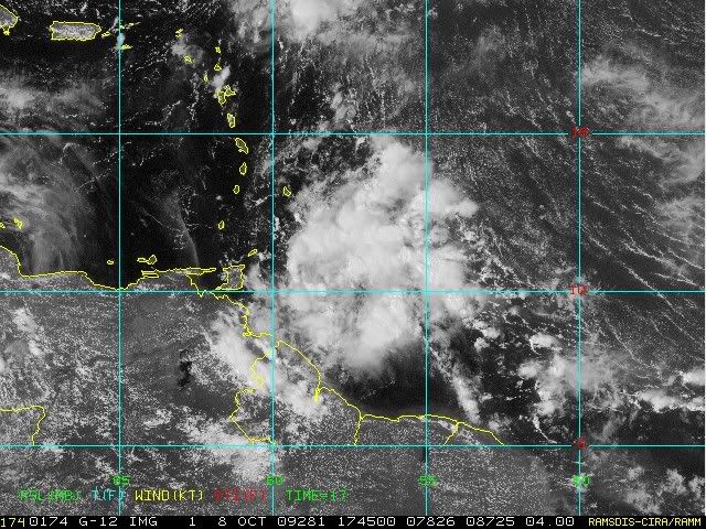
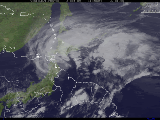
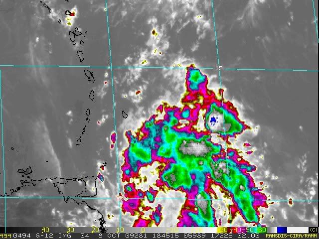
A VIGOROUS TROPICAL WAVE CENTERED ABOUT 250 MILES EAST OF THE
SOUTHERN WINDWARD ISLANDS IS PRODUCING A LARGE AREA OF SHOWERS AND
THUNDERSTORMS. ALTHOUGH THIS SYSTEM IS SHOWING SOME SIGNS OF
ORGANIZATION...DEVELOPMENT IS NOT ANTICIPATED BEFORE IT INTERACTS
WITH LAND LATER THIS EVENING. THERE IS A LOW CHANCE...LESS THAN 30
PERCENT...OF THIS SYSTEM BECOMING A TROPICAL CYCLONE DURING THE
NEXT 48 HOURS AS IT MOVES TO THE WEST-NORTHWEST AT 20 TO 25 MPH.
REGARDLESS OF DEVELOPMENT...LOCALLY HEAVY RAINFALL AND GUSTY WINDS
ARE POSSIBLE IN THE WINDWARD ISLANDS AND NORTHERN VENEZUELA LATER
THIS AFTERNOON THROUGH EARLY FRIDAY.
ELSEWHERE...TROPICAL CYCLONE FORMATION IS NOT EXPECTED DURING THE
NEXT 48 HOURS.
$$
FORECASTER BLAKE