
WPAC: DORA - Post-Tropical - Discussion
Moderator: S2k Moderators
-
Sciencerocks
- Category 5

- Posts: 7287
- Age: 38
- Joined: Thu Jul 06, 2017 1:51 am

Re: CPAC: DORA - Hurricane - Discussion
With the relative warmer SSTs and OHC, wonder if her wind field and size will expand after ERC.
Dora is now 40.5 units of ACE with the 125kts.
Dora is now 40.5 units of ACE with the 125kts.
0 likes
The above post and any post by Ntxw is NOT an official forecast and should not be used as such. It is just the opinion of the poster and may or may not be backed by sound meteorological data. It is NOT endorsed by any professional institution including Storm2k. For official information, please refer to NWS products.
Help support Storm2K!

-
cycloneye

- Admin

- Posts: 139327
- Age: 67
- Joined: Thu Oct 10, 2002 10:54 am
- Location: San Juan, Puerto Rico
Re: CPAC: DORA - Hurricane - Discussion
Dora will be in a select group of three with Genevive and John in WPAC.
https://twitter.com/MatthewCuyugan/status/1689420083121053697
https://twitter.com/MatthewCuyugan/status/1689420083121053697
1 likes
Visit the Caribbean-Central America Weather Thread where you can find at first post web cams,radars
and observations from Caribbean basin members Click Here
and observations from Caribbean basin members Click Here

Re: CPAC: DORA - Hurricane - Discussion
Ntxw wrote:With the relative warmer SSTs and OHC, wonder if her wind field and size will expand after ERC.
Dora is now 40.5 units of ACE with the 125kts.
Dora's convective envelope is expanding very fast currently. Her transition to a typhoon-looking girl is well underway!
I think at 23z Dora looked her best, a 5.
2 likes
-
cycloneye
- Admin
- Posts: 139327
- Age: 67
- Joined: Thu Oct 10, 2002 10:54 am
- Location: San Juan, Puerto Rico
Re: CPAC: DORA - Hurricane - Discussion
Hurricane Dora Discussion Number 39
NWS Central Pacific Hurricane Center Honolulu HI EP052023
500 PM HST Wed Aug 09 2023
Dora has begun to slowly gain latitude this afternoon, as forecast,
but has strengthened once again within a low-shear and marginally
warm sea surface temperature environment. Satellite presentation
has improved from late this morning, with a clearly defined 8 nm
wide eye and a symmetrical central structure. The central dense
overcast feature around the core is less than 100 nm wide, giving
Dora an increasingly annular appearance. This intense but compact
system is only about 240 nm wide from north to south, including all
banding features. All three fix agencies derived subjective Dvorak
intensity estimates of 6.5, corresponding to 127 kt. Latest UW-CIMSS
ADT is 122 kt. Given these derived intensity values, Dora is given
an initial intensity of 125 kt for this advisory, keeping her as a
solid category 4 tropical cyclone.
Initial motion with this advisory is 275/19 kt, unchanged from the
last two advisories. Like before, track guidance remains remarkably
tight through tau 72, with spread only becoming significant at tau
96 and beyond, long after this system has passed out of the basin
into the western North Pacific. The larger synoptic environment
around Dora remains unchanged. Strong ridging north of Dora, and
the westward migration of this ridging, accounts for this system's
prolonged westward movement. However, the slow and recent increase
in latitude indicates that Dora is reaching the southwest flank of
this ridging. Dora is forecast to continue gaining latitude and
assume a northwest motion Thursday and Friday. The forecast track,
closely following the previous track and TVCN model consensus,
continues to become more northerly after Dora passes west of the
date line.
Warm water, with temperatures of 28 degrees C or above, lies along
the entire forecast track and shear will remain less than 20 kt
through tau 60. With 00Z ECMWF SHIPS showing almost no Dora
intensity drop through tau 24, this advisory will only slowly
weaken this system through tau 36, with more pronounced weakening
introduced afterwards as Dora gains latitude and shear increases.
The 00Z GFS SHIPS shows a similar slow weakening trend through tau
24, with more rapid weakening afterwards. As before, both SHIPS
versions keep Dora stronger at all tau than most intensity model
guidance. However, given that Dora insists on strengthening within
the environment it is in, forecasting a slower weakening trend, at
least initially, seems reasonable. Dora will eventually weaken to a
post-tropical/remnant low, but after tau 120.
FORECAST POSITIONS AND MAX WINDS
INIT 10/0300Z 11.8N 167.9W 125 KT 145 MPH
12H 10/1200Z 12.0N 170.8W 120 KT 140 MPH
24H 11/0000Z 13.1N 174.4W 115 KT 130 MPH
36H 11/1200Z 14.4N 177.9W 115 KT 130 MPH
48H 12/0000Z 15.3N 179.1E 110 KT 125 MPH
60H 12/1200Z 16.1N 176.2E 105 KT 120 MPH
72H 13/0000Z 16.8N 173.2E 95 KT 110 MPH
96H 14/0000Z 18.1N 168.0E 70 KT 80 MPH
120H 15/0000Z 20.7N 164.2E 50 KT 60 MPH
$$
Forecaster Powell
0 likes
Visit the Caribbean-Central America Weather Thread where you can find at first post web cams,radars
and observations from Caribbean basin members Click Here
and observations from Caribbean basin members Click Here
-
cycloneye
- Admin
- Posts: 139327
- Age: 67
- Joined: Thu Oct 10, 2002 10:54 am
- Location: San Juan, Puerto Rico
Re: CPAC: DORA - Hurricane - Discussion
Hurricane Dora Discussion Number 40
NWS Central Pacific Hurricane Center Honolulu HI EP052023
1100 PM HST Wed Aug 09 2023
Infrared satellite this evening shows the eye of Hurricane Dora has
filled in since this afternoon. The annular structure has broken
down with a banding feature setting up along the northeast
periphery. Dvorak intensity estimates indicate a DT of 5.5 with a CI
of 6.5, a decrease from earlier this afternoon and ADT and AiDT
show 5.7/122 kt and 111 kt respectively. With a slight weakening off
the peak intensity earlier today, Dora is given an initial intensity
of 120 kt for this advisory, keeping it as a solid category 4
tropical cyclone.
Initial motion with this advisory is 275/19 kt, unchanged from the
last three advisories. The track guidance remains remarkably tight
through the next 48 hours becoming spread out after this point,
particularly after 96 hours. Models indicate a slight decrease in
forward motion from previous forecasts, and the updated official
forecast has been nudged toward the model consensus TVCE. The
larger synoptic environment around Dora remains unchanged. Strong
ridging north of Dora, and the westward migration of this ridging,
accounts for this system's prolonged westward movement. However, the
slow and recent increase in latitude indicates that Dora is reaching
the southwest flank of this ridging. Dora is forecast to continue
gaining latitude and assume a northwest motion Thursday and Friday,
becoming more northerly after Dora passes west of the date line
late in the day Friday into the weekend.
Warm water, with temperatures of 28 degrees C or above, lies along
the entire forecast track and shear will remain less than 20 kt
through tau 48. The 06Z GFS and ECMWF SHIPS shows a slight
weakening in intensity over the next 48 hours, then a more dramatic
decrease after 60 hours as Dora gains latitude and shear increases.
The updated forecast closely follows this guidance.
FORECAST POSITIONS AND MAX WINDS
INIT 10/0900Z 12.1N 169.8W 120 KT 140 MPH
12H 10/1800Z 12.6N 172.4W 115 KT 130 MPH
24H 11/0600Z 13.7N 175.8W 110 KT 125 MPH
36H 11/1800Z 14.9N 178.8W 110 KT 125 MPH
48H 12/0600Z 16.1N 178.2E 105 KT 120 MPH
60H 12/1800Z 16.9N 175.5E 95 KT 110 MPH
72H 13/0600Z 17.4N 173.1E 85 KT 100 MPH
96H 14/0600Z 18.3N 168.3E 60 KT 70 MPH
120H 15/0600Z 20.0N 164.0E 35 KT 40 MPH
$$
Forecaster Foster/Birchard
0 likes
Visit the Caribbean-Central America Weather Thread where you can find at first post web cams,radars
and observations from Caribbean basin members Click Here
and observations from Caribbean basin members Click Here
-
Kingarabian

- S2K Supporter

- Posts: 15451
- Joined: Sat Aug 08, 2009 3:06 am
- Location: Honolulu, Hawaii
Re: EPAC: DORA - Hurricane - Discussion
Kingarabian wrote:Dora is extremely impressive. But almost as impressive is that sprawling STR to its NE.
https://i.postimg.cc/G34gVvF7/Untitled.jpg
Probably will be some studies on Dora and just how much it influenced the Maui wildfires. 36 confirmed dead so far with many unaccounted for.
0 likes
RIP Kobe Bryant

Re: CPAC: DORA - Hurricane - Discussion
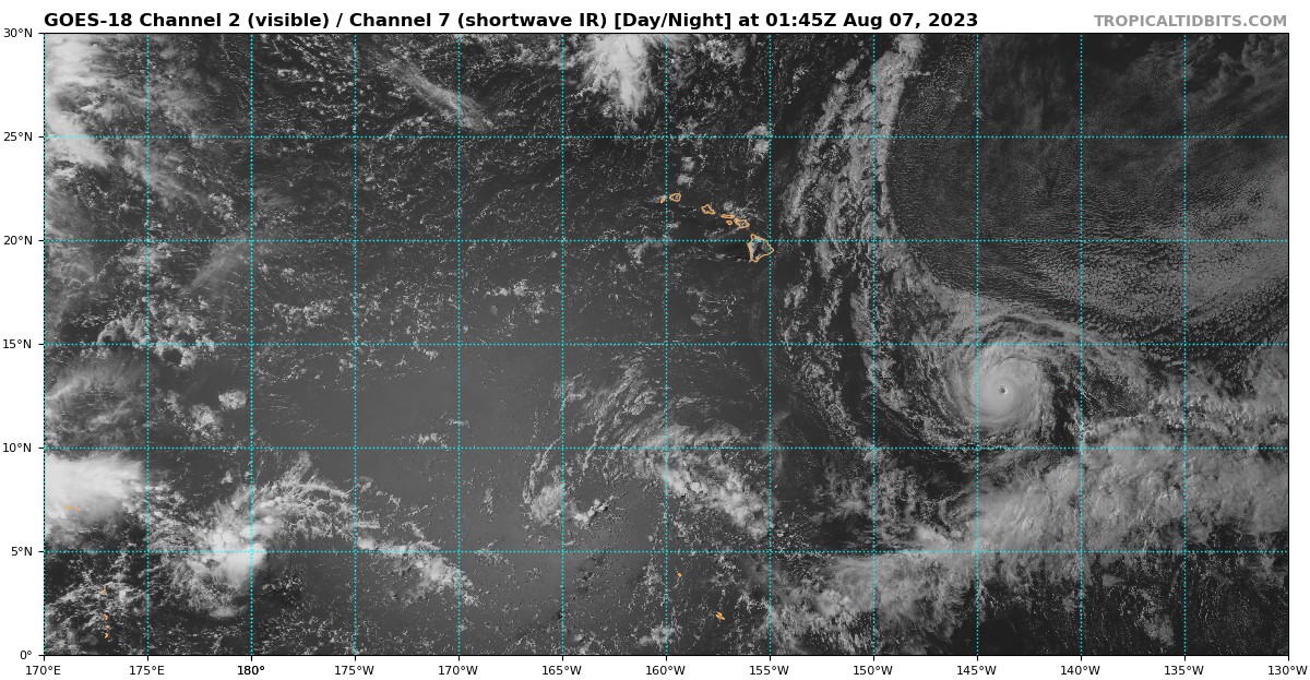
Dora might be able to squeeze out one last phase of re-intensification in the next 36-48 hrs. HWRF shows shear sharply increasing around 03z-06z Saturday, but until that, the system’s structure looks pretty good. There might be enough time left for it to recover from this EWRC and try for official Cat 5 status one last time.
I think Dora has weakened to 110 kt tops. The 12z BT data hasn’t appear on Tropical Tidbits.
I think Dora has weakened to 110 kt tops. The 12z BT data hasn’t appear on Tropical Tidbits.
0 likes
Irene '11 Sandy '12 Hermine '16 5/15/2018 Derecho Fay '20 Isaias '20 Elsa '21 Henri '21 Ida '21
I am only a meteorology enthusiast who knows a decent amount about tropical cyclones. Look to the professional mets, the NHC, or your local weather office for the best information.
I am only a meteorology enthusiast who knows a decent amount about tropical cyclones. Look to the professional mets, the NHC, or your local weather office for the best information.
-
cheezyWXguy

- Category 5
- Posts: 5556
- Joined: Mon Feb 13, 2006 12:29 am
- Location: Dallas, TX
Re: CPAC: DORA - Hurricane - Discussion
Took quite a hit in the appearance department with this ERC, but looks to be back on the upswing now
0 likes
-
Sciencerocks
- Category 5
- Posts: 7287
- Age: 38
- Joined: Thu Jul 06, 2017 1:51 am

-
Extratropical94

- Professional-Met

- Posts: 3535
- Age: 29
- Joined: Wed Oct 20, 2010 6:36 am
- Location: Hamburg, Germany
- Contact:
Re: CPAC: DORA - Hurricane - Discussion
Hurricane Dora Discussion Number 41
NWS Central Pacific Hurricane Center Honolulu HI EP052023
500 AM HST Thu Aug 10 2023
Infrared satellite early this morning shows Hurricane Dora
continuing to weaken since the annular structure of the cyclone
diminished yesterday. Dvorak intensity estimates indicate a DT of
5.0
with a CI of 6.5. ADT and AiDT indicate a current intensity of
4.9/102 kt and 89 kt respectively. Dora is given an initial
intensity of 105 kt for this advisory, a category 3 tropical
cyclone. Dora has weakened 15 kt from the last advisory based on
a change in storm structure allowing for the ingestion of drier
air.
Initial motion with this advisory is 275/18 kt, only a slight
decrease in forward speed. The track guidance remains tight through
the next 36 hours, then spreads out after this point, particularly
after 72 hours. Shifted the forecast track to the north of previous
track and slowed it down, nudging toward the model consensus TVCE.
Slow and recent increase in latitude indicates that Dora is reaching
the southwest flank of the subtropical high to far to the north.
Dora is forecast to continue gaining latitude and assume a
northwest motion later today into Friday, becoming more northerly
after Dora passes west of the date line late Friday into the
weekend.
Warm water, with temperatures of 28 degrees C or above, lies along
the entire forecast track and shear will remain less than 20 kt
through tau 36. The 12Z GFS and ECMWF SHIPS shows a gradual
weakening in intensity over the next 48 hours, then a more dramatic
decrease after 48 hours as Dora gains latitude and shear increases.
The updated forecast closely follows this guidance.
FORECAST POSITIONS AND MAX WINDS
INIT 10/1500Z 12.3N 171.5W 105 KT 120 MPH
12H 11/0000Z 13.0N 173.9W 100 KT 115 MPH
24H 11/1200Z 14.2N 176.9W 95 KT 110 MPH
36H 12/0000Z 15.6N 179.6W 95 KT 110 MPH
48H 12/1200Z 16.7N 177.7E 85 KT 100 MPH
60H 13/0000Z 17.7N 175.2E 70 KT 80 MPH
72H 13/1200Z 18.2N 172.8E 60 KT 70 MPH
96H 14/1200Z 19.1N 168.5E 45 KT 50 MPH
120H 15/1200Z 20.9N 164.6E 30 KT 35 MPH...POST-TROP/REMNT LOW
$$
Forecaster Foster/Birchard
https://tgftp.nws.noaa.gov/data/raw/wt/ ... cd.cp2.txt
0 likes
54° 11' 59'' N, 9° 9' 20'' E
Boomer Sooner!
Go Broncos! Go Cards! Go Niners!
- Daniel
Boomer Sooner!
Go Broncos! Go Cards! Go Niners!
- Daniel

Re: CPAC: DORA - Hurricane - Discussion
Lan with Dora

5 likes
ヤンデレ女が寝取られるているのを見たい!!!
ECMWF ensemble NWPAC plots: https://ecmwfensnwpac.imgbb.com/
Multimodel NWPAC plots: https://multimodelnwpac.imgbb.com/
GFS Ensemble NWPAC plots (16 & 35 day forecast): https://gefsnwpac.imgbb.com/
Plots updated automatically
ECMWF ensemble NWPAC plots: https://ecmwfensnwpac.imgbb.com/
Multimodel NWPAC plots: https://multimodelnwpac.imgbb.com/
GFS Ensemble NWPAC plots (16 & 35 day forecast): https://gefsnwpac.imgbb.com/
Plots updated automatically

-
Sciencerocks
- Category 5
- Posts: 7287
- Age: 38
- Joined: Thu Jul 06, 2017 1:51 am
Re: CPAC: DORA - Hurricane - Discussion

First frame suggest = 105 knts
Last frame suggest = 115 knts
Thickening of the eyewall + warming of the eye itself as it becomes better defined.
So maybe some restrengthening occurring.
0 likes

Re: CPAC: DORA - Hurricane - Discussion
Fancy1002 wrote:Why isn’t Dora showing up on tropical tidbits?
Probably connected with the NHC outage earlier.
0 likes
-
Sciencerocks
- Category 5
- Posts: 7287
- Age: 38
- Joined: Thu Jul 06, 2017 1:51 am

-
cycloneye
- Admin
- Posts: 139327
- Age: 67
- Joined: Thu Oct 10, 2002 10:54 am
- Location: San Juan, Puerto Rico
Re: CPAC: DORA - Hurricane - Discussion
abajan wrote:Fancy1002 wrote:Why isn’t Dora showing up on tropical tidbits?
Probably connected with the NHC outage earlier.
All connected. The site of the Best Tracks has been also out.
1 likes
Visit the Caribbean-Central America Weather Thread where you can find at first post web cams,radars
and observations from Caribbean basin members Click Here
and observations from Caribbean basin members Click Here
-
cycloneye
- Admin
- Posts: 139327
- Age: 67
- Joined: Thu Oct 10, 2002 10:54 am
- Location: San Juan, Puerto Rico
Re: CPAC: DORA - Hurricane - Discussion
Hurricane Dora Discussion Number 42
NWS Central Pacific Hurricane Center Honolulu HI EP052023
1100 AM HST Thu Aug 10 2023
After weakening overnight, a well-defined eye of Hurricane Dora
briefly reemerged around and just after agencies conducted Dvorak
fixes. HFO, JTWC, and SAB all found a current intensity of 5.5/102
kt, but given the recent slight improvement in satellite
presentation, the initial intensity was held at 105 kt for this
advisory.
The initial motion for this advisory is 285/17 kt. The forecast
track remains in the middle of a tightly clustered guidance envelope
through the next two days. During this time, Dora will move toward
the west-northwest and gradually slow its forward motion, as it
travels along the southwest flank of the subtropical high far to
the north. Guidance spread increases beyond 48 hours, when Dora
will approach the end of the ridge and loses more speed of forward
motion. The official track was altered little from the prior
package and is within the middle of the guidance envelope near the
TVCN.
With relatively warm water of 28-29C and light vertical wind shear,
only slow weakening is forecast through the next 24 hours,
especially given Dora's history of exceeding intensity predictions.
At about 36 hours and beyond, the GFS and ECMWF SHIPS show a steady
increase in southwesterly vertical wind shear, and steady weakening
is expected. The intensity guidance shows considerable spread
during this time of steady weakening, and the forecast closely
follows the consensus through 72 hours and remains slightly more
aggressive than the consensus beyond.
FORECAST POSITIONS AND MAX WINDS
INIT 10/2100Z 12.7N 173.0W 105 KT 120 MPH
12H 11/0600Z 13.6N 175.4W 100 KT 115 MPH
24H 11/1800Z 14.9N 178.5W 100 KT 115 MPH
36H 12/0600Z 16.2N 178.8E 90 KT 105 MPH
48H 12/1800Z 17.2N 176.5E 80 KT 90 MPH
60H 13/0600Z 17.9N 174.0E 70 KT 80 MPH
72H 13/1800Z 18.4N 171.8E 60 KT 70 MPH
96H 14/1800Z 19.6N 167.8E 45 KT 50 MPH
120H 15/1800Z 21.9N 164.6E 30 KT 35 MPH...POST-TROP/REMNT LOW
$$
Forecaster Wroe
0 likes
Visit the Caribbean-Central America Weather Thread where you can find at first post web cams,radars
and observations from Caribbean basin members Click Here
and observations from Caribbean basin members Click Here
-
Yellow Evan

- Professional-Met
- Posts: 15956
- Age: 25
- Joined: Fri Jul 15, 2011 12:48 pm
- Location: Henderson, Nevada/Honolulu, HI
- Contact:
Re: CPAC: DORA - Hurricane - Discussion

Recovering from apparent easterly shear earlier. A lot of convection still stuck upshear though.
3 likes

Re: EPAC: DORA - Hurricane - Discussion
Kingarabian wrote:Kingarabian wrote:Dora is extremely impressive. But almost as impressive is that sprawling STR to its NE.
https://i.postimg.cc/G34gVvF7/Untitled.jpg
Probably will be some studies on Dora and just how much it influenced the Maui wildfires. 36 confirmed dead so far with many unaccounted for.
I'm curious about this and if it's possible to quantify Dora's influence. The STR you mentioned was quite burly and pushed Dora's track WSW for an usually long time. The gif posted by Yellow Evan back on page 18 showed the full scope:
https://media.discordapp.net/attachment ... G_9347.gif
I imagine the islands would have experienced gusty winds due to that alone. Perhaps Dora enhanced the pressure gradient just enough to reach a tipping point.
0 likes
Who is online
Users browsing this forum: No registered users and 15 guests