
EPAC: HILARY - Post-Tropical - Discussion
Moderator: S2k Moderators
-
tolakram
- Admin

- Posts: 19171
- Age: 60
- Joined: Sun Aug 27, 2006 8:23 pm
- Location: Florence, KY (name is Mark)
Re: EPAC: HILARY - Hurricane - Discussion: TS Warning for part of Southern California
Rain already making it well north of the storm.
1 likes
M a r k
- - - - -
Join us in chat: Storm2K Chatroom Invite. Android and IOS apps also available.
The posts in this forum are NOT official forecasts and should not be used as such. Posts are NOT endorsed by any professional institution or STORM2K.org. For official information and forecasts, please refer to NHC and NWS products.
-
gatorcane

- S2K Supporter

- Posts: 23499
- Age: 46
- Joined: Sun Mar 13, 2005 3:54 pm
- Location: Boca Raton, FL
Re: EPAC: HILARY - Hurricane - Discussion: TS Warning for part of Southern California
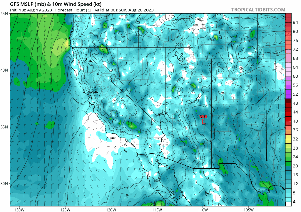
18Z GFS track:
0 likes
-
Yellow Evan

- Professional-Met

- Posts: 15956
- Age: 25
- Joined: Fri Jul 15, 2011 12:48 pm
- Location: Henderson, Nevada/Honolulu, HI
- Contact:
Re: EPAC: HILARY - Hurricane - Discussion: TS Warning for part of Southern California
Cyclenall wrote:Hurricane Hilary Discussion Number 14
NWS National Hurricane Center Miami FL EP092023
300 PM MDT Sat Aug 19 2023
...
[b]There is high
confidence that Hilary will move into southern California as a
tropical storm.
Why? I'd be very surprised if there is still a surface llc left when she gets to SoCal. Its unraveling fast right now and it hasn't gotten far north yet.
It's a large circulation that takes a while to spin down and it'll have baroclinic support from the interaction with the ULL so a slower than usual decay rate makes sense. All global models have the LLC intact until landfall at the very least. This isn't the 1990s or 2000s where global models would spin down systems in this area of the world way too slowly.
2 likes
-
Yellow Evan
- Professional-Met
- Posts: 15956
- Age: 25
- Joined: Fri Jul 15, 2011 12:48 pm
- Location: Henderson, Nevada/Honolulu, HI
- Contact:
Re: EPAC: HILARY - Hurricane - Discussion: TS Warning for part of Southern California
GCANE wrote:Yellow Evan wrote:Why would a large Category 4 hurricane have minimal WISHE?
Great question.
Microwave soundings are showing anomalous high temperatures above the ocean indicating low heat transfer to the troposphere and minimal lapse rate into the core.
Only thing I can think of is a large ingestion of extremely high CAPE air from its surroundings.
Post?
If true, this would probably be due to the ULAC's influence altering the surrounding environment to be less barotropic in nature.
0 likes

Re: EPAC: HILARY - Hurricane - Discussion: TS Warning for part of Southern California
There will also be topographical features that enter into the risk assessment.
Lots of wind in the valleys that run south to north and rain accumulation from hill down slopes enhance flooding.
Some sheltered areas won't feel the tropical storm winds.
The power outages are the main thing to prepare for, at least freeze a gallon of water ahead of time to keep your refrigerator cool and give you something to drink.
1 likes
-
Sciencerocks
- Category 5

- Posts: 7287
- Age: 38
- Joined: Thu Jul 06, 2017 1:51 am

-
cycloneye

- Admin
- Posts: 139328
- Age: 67
- Joined: Thu Oct 10, 2002 10:54 am
- Location: San Juan, Puerto Rico
Re: EPAC: HILARY - Hurricane - Discussion
Hurricane Hilary Discussion Number 15
NWS National Hurricane Center Miami FL EP092023
900 PM MDT Sat Aug 19 2023
Hilary's cloud pattern has continued to gradually decay this
evening. The eye is no longer discernible and the convective cloud
tops have warmed near the center. However, there are plenty of
curved bands around the circulation, and these continue to spread
well northward into the Baja California Peninsula. Subjective and
objective satellite intensity estimates have continued to decrease
and the initial intensity has been reduced to 80 kt. Another Air
Force Reserve reconnaissance mission is schedule overnight which
should provide better information about the structure and intensity
of the cyclone.
The initial motion estimate is north-northwestward or 345/15 kt.
The flow between a strong mid-level ridge over the south-central
United States and a mid- to upper-level low over off the central
coast of California will steer Hilary north-northwestward at an
increasingly faster pace during the next 12 to 24 hours. This will
bring the center of Hilary near the west-central coast of the Baja
California peninsula late tonight or early Sunday and into southern
California by late Sunday afternoon. The NHC track forecast is
again very similar to the previous advisory and lies near the
middle of the tightly clustered guidance envelope. Users are
reminded that the exact details of the track forecast, including
where Hilary might make landfall, are of little overall importance
since strong winds and heavy rainfall will extend far from the
center. These hazards are already spreading northward over the
Baja California Peninsula well in advance of the arrival of the
center.
Cooler waters, drier air, and increasing vertical wind will continue
to cause a decrease in intensity as Hillary moves northward.
However, the cyclone is expected to still be a hurricane when it
moves near or over the west-central coast of the Baja California
Peninsula overnight, and confidence remains high that Hilary will
move into southern California as a tropical storm.
KEY MESSAGES:
1. Preparations for flooding impacts associated with Hilary should
be completed as soon as possible, as heavy rainfall will begin well
in advance of the center. In the Southwestern United States, the
potentially historic amount of rainfall is expected to cause flash,
urban, and arroyo flooding including landslides, mudslides, and
debris flows. Dangerous to locally catastrophic flooding impacts are
expected early Sunday through early Monday.
2. Hurricane conditions are expected along the west-central coast of
the Baja California Peninsula within the hurricane warning area
tonight and Sunday morning, and are possible in the Hurricane Watch
area on Sunday.
3. Tropical storm conditions are expected to begin Sunday in
portions of the southwestern U.S. within the Tropical Storm
Warning area. Winds could be particularly strong and gusty in and
near areas of higher terrain. Gusty winds are expected to spread
well inland across the western United States.
4. Large swells generated by Hilary will affect portions of the
Baja California Peninsula and southern California over the next
couple of days. These swells are likely to cause life-threatening
surf and rip current conditions.
FORECAST POSITIONS AND MAX WINDS
INIT 20/0300Z 25.3N 114.6W 80 KT 90 MPH
12H 20/1200Z 28.3N 115.4W 65 KT 75 MPH
24H 21/0000Z 33.6N 117.2W 45 KT 50 MPH...INLAND
36H 21/1200Z 39.5N 118.3W 30 KT 35 MPH...POST-TROP/INLAND
48H 22/0000Z...DISSIPATED
$$
Forecaster Brown
0 likes
Visit the Caribbean-Central America Weather Thread where you can find at first post web cams,radars
and observations from Caribbean basin members Click Here
and observations from Caribbean basin members Click Here

Re: EPAC: HILARY - Hurricane - Discussion

Excessive Rainfall Discussion
NWS Weather Prediction Center College Park MD
427 PM EDT Sat Aug 19 2023
Day 2
Valid 12Z Sun Aug 20 2023 - 12Z Mon Aug 21 2023
...A HIGH RISK OF EXCESSIVE RAINFALL EXISTS FOR PORTIONS OF
SOUTHERN CALIFORNIA...
...2030Z Update...
Made a slight expansion northward of the High Risk area into
portions of Nevada...in part due to an uptick in amounts and
expansion of the areal coverage both by in the WPC deterministic
QPF and model guidance. Based on the latest WPC QPF...40 km
neighborhood probabilities had a swath along the axis of the High
Risk where Annual Recurrence Intervals in excess of 70 percent at
the 100 year ARI. Admittedly...there could be some blossoming of
areal coverage resulting for being a 40 km neighborhood but the
magnitude of signal at that interval is impressive. Latest QPF
placement was good for a typical land falling tropical cyclone
followed by expansion and growing areal coverage during the day
given the moisture stream interacting with the terrain and the
increasing dynamics. Moisture streaming northward should lead to
increasing coverage of convection capable of producing heavy
rainfall amounts/rates which spreads into parts of the Northwest
U.S.. Remainder of the outlook was in good shape and largely
unchanged.
Bann
...Previous Excessive Rainfall Discussion...
Portions of the West...
The guidance is unanimous in merging Hilary with an upper low
stuck near central CA this period, and has picked up the pace on
its acceleration into/across the area. Normally for a tropical
cyclone this would be a problem as convective lows would circle
the periphery parallel to 1000-500 hPa thickness lines, which
would otherwise
turn it more north or north-northeast, but since Hilary should be
strongly shearing while moving over cold waters and interacting
with the Peninsular Ranges of the Baja California Peninsula and
southern CA, it should be transitioning to a post-tropical or
remnant low in the process and have diminishing convection in its
vicinity; the guidance probably isn't displaying its typical model
bias (this time). A large area of precipitable water values of
1.75-2.25" will approach if not exceed all-time records across
portions of the Southwest, so there will be moisture to spare. In
the Southwest in particular, flow at 750 hPa is expected to reach
or exceed 65 kts, so heavy upslope rains on the atypical sides of
the southern Sierra Nevada and Peninsula Ranges of CA are
anticipated. If the flow is more southerly than expected due to a
slightly more westerly track of Hilary, there's a chance that both
sides of the Peninsular Ranges of southern CA could get heavy
rainfall. The 19/12z NAEFS is indicating IVT values 19.1 sigmas
above the mean; it should be noted that it is using a dataset that
does not include the rash of tropical cyclones that impacted the
Southwest in the 1970's, so this value is likely a bit too high.
Even assuming a non-standard distribution and standard deviations
half as large, this is extreme. There is a very real potential
for 3" amounts in an hour in this environment should sufficient
instability be present. Even if instability was completely
eroded, 0.5" an hour totals would be possible; heavy rain appears
inevitable. The 00z Canadian Regional shows local amounts of
towards 10", which would be exceeding rare for the region from a
tropical cyclone, potentially unique for Nevada. The 100 year ARI
is forecast to be exceeded. Some locations within this arid
region are slated to get 1-2 years worth of rain in one day. If a
7"+ maximum materialized over Mount Charleston Sunday into early
Monday, it would challenge Nevada's 24 hour rainfall record, set
in 2004.
The heavy rainfall combined with high winds expected at elevation
could lead to mudslides and landslides, which would be exacerbated
where trees uproot within saturating soils. Debris flows and rock
slides are a given considering the volume of rainfall expected.
The overall combination of effects could block and undermine
roads, particularly sensitive areas such as sections of U.S. 50 in
NV. Towns could get cut off. Given the overall uniqueness of
this event and expected impacts, the High Risk for areas of
southern CA remains justified. The main change was the joining of
the two separate High Risk areas and some slight westward shift of
the risk areas in CA, NV, UT, and AZ and some northward stretching
of the threat areas to account for the slightly accelerated
guidance.
...
0 likes
-
Bocadude85

- Category 5
- Posts: 2941
- Age: 37
- Joined: Mon Apr 18, 2005 2:20 pm
- Location: Honolulu,Hi
Re: EPAC: HILARY - Hurricane - Discussion
Interesting that some of the 0z models are farther east 6-12 hours from now then Hilary’s current position,doesn’t make much difference impact wise but she has been running west of forecast all day.
1 likes
-
cycloneye
- Admin
- Posts: 139328
- Age: 67
- Joined: Thu Oct 10, 2002 10:54 am
- Location: San Juan, Puerto Rico
Re: EPAC: HILARY - Hurricane - Discussion
Hurricane Hilary Discussion Number 16
NWS National Hurricane Center Miami FL EP092023
200 AM PDT Sun Aug 20 2023
The coverage and intensity of deep convection associated with
Hilary has gradually diminished. However, numerous convective
bands over the eastern semicircle of the circulation continue to
spread northward over the Baja California peninsula and the Gulf of
California, and into the extreme southwestern United States. Air
Force Hurricane Hunter aircraft observations indicate that Hilary
is slowly weakening as evidenced by flight-level winds and
dropsonde measurements of the central pressure. The advisory
intensity estimate is set at 75 kt, although this might be a little
generous.
Hilary is beginning to accelerate toward the north-northwest and the
initial motion estimate is now 345/18 kt. Over the next day or two,
the cyclone should continue to accelerate within the flow between a
strong mid-level ridge over the south-central United States and a
mid- to upper-level low near the central California coast. This
motion will bring the center of Hilary near the northern Baja
California peninsula and then into southern California later today.
The official track forecast is similar to the previous one, albeit
a little faster in accord with the latest consensus model guidance.
Users are reminded that the exact details of the track forecast,
including where Hilary might make landfall, are of little overall
importance since strong winds and heavy rainfall extend far from the
center. These hazards are already spreading northward well in
advance of the arrival of the center.
Hilary should continue to weaken due to cooler waters, the intrusion
of drier air into the circulation, and increasing vertical shear.
However, confidence remains high that the system will still be of
tropical storm intensity when it moves into southern California.
KEY MESSAGES:
1. Preparations for flooding impacts associated with Hilary should
be completed as soon as possible, as heavy rainfall is about to
begin. In the Southwestern United States, the potentially historic
amount of rainfall is expected to cause flash, urban, and arroyo
flooding including landslides, mudslides, and debris flows.
Dangerous to locally catastrophic flooding impacts are expected
through Monday morning.
2. Hurricane conditions are expected along the west-central coast of
the Baja California Peninsula within the hurricane warning area
during the next few hours, and are possible in the Hurricane Watch
area a little later today.
3. Tropical storm conditions are expected to begin later today in
portions of the southwestern U.S. within the Tropical Storm Warning
area. Winds could be particularly strong and gusty in and near
areas of higher terrain. Gusty winds are expected to spread
well inland across the western United States.
4. Large swells generated by Hilary will affect portions of the
Baja California Peninsula and southern California over the next
couple of days. These swells are likely to cause life-threatening
surf and rip current conditions.
FORECAST POSITIONS AND MAX WINDS
INIT 20/0900Z 27.4N 115.0W 75 KT 85 MPH
12H 20/1800Z 30.8N 116.3W 60 KT 70 MPH
24H 21/0600Z 36.5N 117.6W 30 KT 35 MPH...INLAND
36H 21/1800Z 42.3N 118.5W 20 KT 25 MPH...POST-TROP/INLAND
48H 22/0600Z...DISSIPATED
$$
Forecaster Pasch
0 likes
Visit the Caribbean-Central America Weather Thread where you can find at first post web cams,radars
and observations from Caribbean basin members Click Here
and observations from Caribbean basin members Click Here

Re: EPAC: HILARY - Hurricane - Discussion
No way Hilary is a Hurricane this morning. The center of it is tracking right over Cedros Island, the highest reported winds has been wind gusts of 66 mph, pressure down to 980mb.
This is confirmed by the recon so far this morning, 55 knots has been the highest flight level winds.
https://www.weather.gov/wrh/timeseries? ... 1&hours=72

This is confirmed by the recon so far this morning, 55 knots has been the highest flight level winds.
https://www.weather.gov/wrh/timeseries? ... 1&hours=72
0 likes
-
wxman57

- Moderator-Pro Met

- Posts: 22484
- Age: 66
- Joined: Sat Jun 21, 2003 8:06 pm
- Location: Houston, TX (southwest)
Re: EPAC: HILARY - Hurricane - Discussion
NDG wrote:No way Hilary is a Hurricane this morning. The center of it is tracking right over Cedros Island, the highest reported winds has been wind gusts of 66 mph, pressure down to 980mb.
This is confirmed by the recon so far this morning, 55 knots has been the highest flight level winds.
https://www.weather.gov/wrh/timeseries? ... 1&hours=72
https://i.imgur.com/p1pPofI.png
I agree. Plane did find 70kt FL wind, but without any squalls to bring wind to the surface, SFMR indicated 35 kts. Wind may be as high as 50 kts east of the center. It is now in the process of decoupling and turning ET. Those higher FL winds will translate to strong wind in higher elevations across California.
0 likes
-
tolakram
- Admin
- Posts: 19171
- Age: 60
- Joined: Sun Aug 27, 2006 8:23 pm
- Location: Florence, KY (name is Mark)
Re: EPAC: HILARY - Hurricane - Discussion
saved loop

0 likes
M a r k
- - - - -
Join us in chat: Storm2K Chatroom Invite. Android and IOS apps also available.
The posts in this forum are NOT official forecasts and should not be used as such. Posts are NOT endorsed by any professional institution or STORM2K.org. For official information and forecasts, please refer to NHC and NWS products.
- - - - -
Join us in chat: Storm2K Chatroom Invite. Android and IOS apps also available.
The posts in this forum are NOT official forecasts and should not be used as such. Posts are NOT endorsed by any professional institution or STORM2K.org. For official information and forecasts, please refer to NHC and NWS products.
Re: EPAC: HILARY - Hurricane - Discussion
wxman57 wrote:NDG wrote:No way Hilary is a Hurricane this morning. The center of it is tracking right over Cedros Island, the highest reported winds has been wind gusts of 66 mph, pressure down to 980mb.
This is confirmed by the recon so far this morning, 55 knots has been the highest flight level winds.
https://www.weather.gov/wrh/timeseries? ... 1&hours=72
https://i.imgur.com/p1pPofI.png
I agree. Plane did find 70kt FL wind, but without any squalls to bring wind to the surface, SFMR indicated 35 kts. Wind may be as high as 50 kts east of the center. It is now in the process of decoupling and turning ET. Those higher FL winds will translate to strong wind in higher elevations across California.
Those 70kt fl winds was when it was descending in altitude, highest winds since then at flight level have been under 60 knots.

1 likes
-
wxman57
- Moderator-Pro Met
- Posts: 22484
- Age: 66
- Joined: Sat Jun 21, 2003 8:06 pm
- Location: Houston, TX (southwest)
Re: EPAC: HILARY - Hurricane - Discussion
NDG wrote:wxman57 wrote:NDG wrote:No way Hilary is a Hurricane this morning. The center of it is tracking right over Cedros Island, the highest reported winds has been wind gusts of 66 mph, pressure down to 980mb.
This is confirmed by the recon so far this morning, 55 knots has been the highest flight level winds.
https://www.weather.gov/wrh/timeseries? ... 1&hours=72
https://i.imgur.com/p1pPofI.png
I agree. Plane did find 70kt FL wind, but without any squalls to bring wind to the surface, SFMR indicated 35 kts. Wind may be as high as 50 kts east of the center. It is now in the process of decoupling and turning ET. Those higher FL winds will translate to strong wind in higher elevations across California.
Those 70kt fl winds was when it was descending in altitude, highest winds since then at flight level have been under 60 knots.
https://i.imgur.com/qubo9Kf.png
Ah, didn't look at FL details. Busy issuing advisories for Gulf disturbance and East Caribbean system.
2 likes
Re: EPAC: HILARY - Hurricane - Discussion
Real decoupling seems to be taking place this morning, based on the recon fixes Hilary has been moving NW while the mid level circulation has been moving north if not NNE.
The LLC could continue moving parallel to the coast and never make landfall, we shall see as the day goes.
The LLC could continue moving parallel to the coast and never make landfall, we shall see as the day goes.
1 likes
-
tolakram
- Admin
- Posts: 19171
- Age: 60
- Joined: Sun Aug 27, 2006 8:23 pm
- Location: Florence, KY (name is Mark)
Re: EPAC: HILARY - Hurricane - Discussion
saved loop

0 likes
M a r k
- - - - -
Join us in chat: Storm2K Chatroom Invite. Android and IOS apps also available.
The posts in this forum are NOT official forecasts and should not be used as such. Posts are NOT endorsed by any professional institution or STORM2K.org. For official information and forecasts, please refer to NHC and NWS products.
- - - - -
Join us in chat: Storm2K Chatroom Invite. Android and IOS apps also available.
The posts in this forum are NOT official forecasts and should not be used as such. Posts are NOT endorsed by any professional institution or STORM2K.org. For official information and forecasts, please refer to NHC and NWS products.
-
Sciencerocks
- Category 5
- Posts: 7287
- Age: 38
- Joined: Thu Jul 06, 2017 1:51 am

-
Sciencerocks
- Category 5
- Posts: 7287
- Age: 38
- Joined: Thu Jul 06, 2017 1:51 am

-
tolakram
- Admin
- Posts: 19171
- Age: 60
- Joined: Sun Aug 27, 2006 8:23 pm
- Location: Florence, KY (name is Mark)
Re: EPAC: HILARY - Tropical Storm - Discussion
saved loop

0 likes
M a r k
- - - - -
Join us in chat: Storm2K Chatroom Invite. Android and IOS apps also available.
The posts in this forum are NOT official forecasts and should not be used as such. Posts are NOT endorsed by any professional institution or STORM2K.org. For official information and forecasts, please refer to NHC and NWS products.
- - - - -
Join us in chat: Storm2K Chatroom Invite. Android and IOS apps also available.
The posts in this forum are NOT official forecasts and should not be used as such. Posts are NOT endorsed by any professional institution or STORM2K.org. For official information and forecasts, please refer to NHC and NWS products.
Who is online
Users browsing this forum: No registered users and 24 guests