
ATL: INVEST 96L - Discussion
Moderator: S2k Moderators
-
Sciencerocks
- Category 5

- Posts: 7294
- Age: 38
- Joined: Thu Jul 06, 2017 1:51 am
-
cycloneye

- Admin

- Posts: 139492
- Age: 67
- Joined: Thu Oct 10, 2002 10:54 am
- Location: San Juan, Puerto Rico
Re: ATL: INVEST 96L - Discussion
And down it goes.
Central Tropical Atlantic (AL96):
Showers and thunderstorms remain disorganized in association with a
gale-force low pressure area located about 700 miles northeast of
the northern Leeward Islands. Environmental conditions still could
support tropical cyclone formation during the next few days while
the system moves northwestward and then northward at 10 to 15 mph
over the central subtropical Atlantic. Additional information on
this system, including gale warnings, can be found in High Seas
Forecasts issued by the National Weather Service.
* Formation chance through 48 hours...medium...40 percent.
* Formation chance through 7 days...medium...50 percent
2 likes
Visit the Caribbean-Central America Weather Thread where you can find at first post web cams,radars
and observations from Caribbean basin members Click Here
and observations from Caribbean basin members Click Here


Re: ATL: INVEST 96L - Discussion
2nd underperforming wave in a row. Definitely didnt live out those early gfs 946 mb off Carolinas runs.
2 likes


Re: ATL: INVEST 96L - Discussion
Excerpt from 2 AM Tropical Weather Outlook:
Excerpt from 8 AM Tropical Weather Update:
Central Tropical Atlantic (AL96):
Showers and thunderstorms remain disorganized in association with a
low pressure area located about 700 miles northeast of the northern
Leeward Islands. Environmental conditions still could support
tropical cyclone formation during the next few days while the
system moves northwestward and then northward at 10 to 15 mph
over the central subtropical Atlantic.
* Formation chance through 48 hours...medium...40 percent.
* Formation chance through 7 days...medium...50 percent.
Excerpt from 8 AM Tropical Weather Update:
Central Tropical Atlantic (AL96):
Showers and thunderstorms remain disorganized in association with a
low pressure area located about 750 miles northeast of the northern
Leeward Islands. Environmental conditions still could support
tropical cyclone formation during the next two to three days while
the system moves northwestward and then northward at 10 to 15 mph
over the central subtropical Atlantic.
* Formation chance through 48 hours...medium...40 percent.
* Formation chance through 7 days...medium...50 percent.
0 likes
-
Sciencerocks
- Category 5
- Posts: 7294
- Age: 38
- Joined: Thu Jul 06, 2017 1:51 am

-
cycloneye
- Admin
- Posts: 139492
- Age: 67
- Joined: Thu Oct 10, 2002 10:54 am
- Location: San Juan, Puerto Rico
Re: ATL: INVEST 96L - Discussion
Down to 30%.
Central Subtropical Atlantic (AL96):
Showers and thunderstorms remain disorganized in association with
a low pressure area located about 800 miles north-northeast of the
northern Leeward Islands. Environmental conditions are becoming
less favorable for tropical cyclone formation, and the low
is expected to merge with a frontal system over the north
central Atlantic in about two to three days.
* Formation chance through 48 hours...low...30 percent.
* Formation chance through 7 days...low...30 percent.
1 likes
Visit the Caribbean-Central America Weather Thread where you can find at first post web cams,radars
and observations from Caribbean basin members Click Here
and observations from Caribbean basin members Click Here
-
Sciencerocks
- Category 5
- Posts: 7294
- Age: 38
- Joined: Thu Jul 06, 2017 1:51 am

-
cycloneye
- Admin
- Posts: 139492
- Age: 67
- Joined: Thu Oct 10, 2002 10:54 am
- Location: San Juan, Puerto Rico
Re: ATL: INVEST 96L - Discussion
1 likes
Visit the Caribbean-Central America Weather Thread where you can find at first post web cams,radars
and observations from Caribbean basin members Click Here
and observations from Caribbean basin members Click Here
-
cycloneye
- Admin
- Posts: 139492
- Age: 67
- Joined: Thu Oct 10, 2002 10:54 am
- Location: San Juan, Puerto Rico
Re: ATL: INVEST 96L - Discussion
Tropical Weather Outlook
NWS National Hurricane Center Miami FL
800 PM EDT Tue Aug 1 2023
For the North Atlantic...Caribbean Sea and the Gulf of Mexico:
1. Central Subtropical Atlantic (AL96):
Showers and thunderstorms remain disorganized in association with a
low pressure area located about 600 miles southeast of Bermuda.
Environmental conditions are becoming less favorable for tropical
cyclone formation, and the low is expected to move northward
and merge with a frontal system over the north-central Atlantic in
about two to three days.
* Formation chance through 48 hours...low...20 percent.
* Formation chance through 7 days...low...20 percent.
Forecaster Blake
0 likes
Visit the Caribbean-Central America Weather Thread where you can find at first post web cams,radars
and observations from Caribbean basin members Click Here
and observations from Caribbean basin members Click Here

Re: ATL: INVEST 96L - Discussion
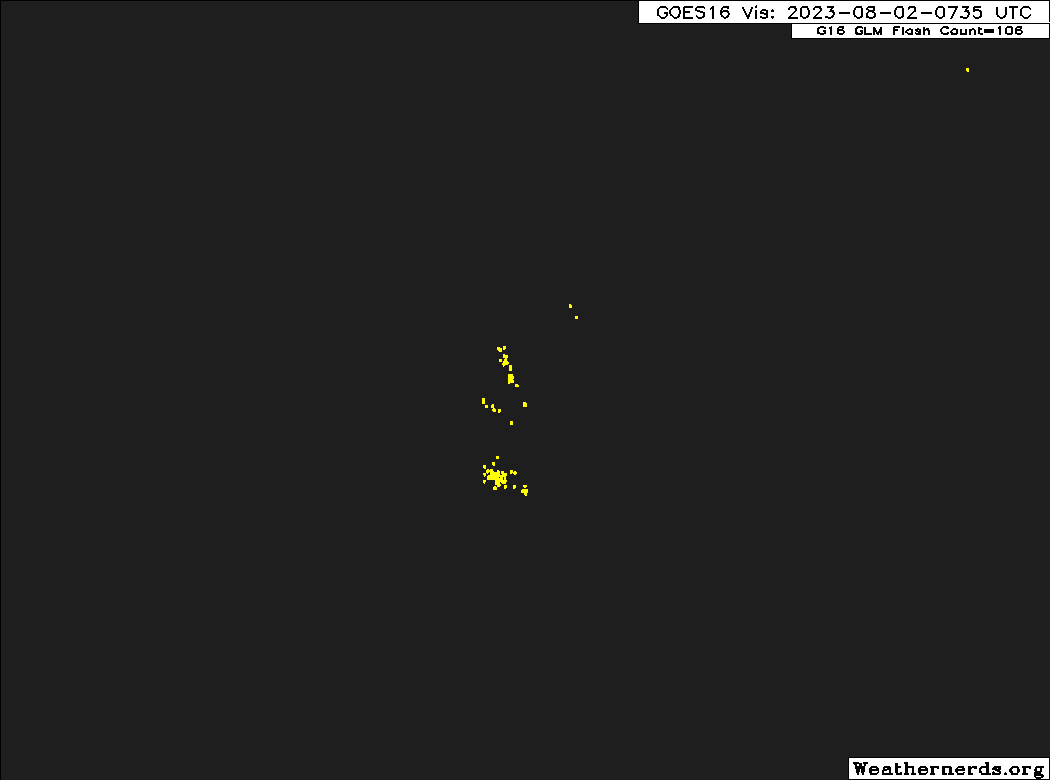
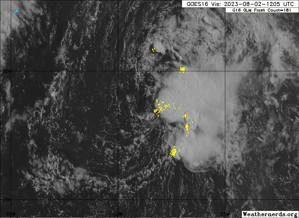
Sciencerocks wrote:https://imagizer.imageshack.com/img922/7355/alSvoi.gif
Hey look a naked swirl. There was an attempt at least.
0 likes
Irene '11 Sandy '12 Hermine '16 5/15/2018 Derecho Fay '20 Isaias '20 Elsa '21 Henri '21 Ida '21
I am only a meteorology enthusiast who knows a decent amount about tropical cyclones. Look to the professional mets, the NHC, or your local weather office for the best information.
I am only a meteorology enthusiast who knows a decent amount about tropical cyclones. Look to the professional mets, the NHC, or your local weather office for the best information.
Re: ATL: INVEST 96L - Discussion
Down to 10% in the 2 AM Tropical Weather Outlook:
Stays at 10% in the 8 AM update:
Central Subtropical Atlantic (AL96):
Showers and thunderstorms remain disorganized in association with a
low pressure area located about 500 miles southeast of Bermuda.
Environmental conditions are becoming increasingly less favorable
for tropical cyclone formation, and the low is expected to move
northward and merge with a frontal system over the north-central
Atlantic in a couple of days.
* Formation chance through 48 hours...low...10 percent.
* Formation chance through 7 days...low...10 percent.
Stays at 10% in the 8 AM update:
Central Subtropical Atlantic (AL96):
Showers and thunderstorms remain disorganized in association with a
low pressure area located about 475 miles southeast of Bermuda.
Environmental conditions are becoming increasingly less favorable
for tropical cyclone formation, and the low is expected to move
northward and merge with a frontal system over the north-central
Atlantic in a couple of days.
* Formation chance through 48 hours...low...10 percent.
* Formation chance through 7 days...low...10 percent.
Forecaster Beven
0 likes
-
cycloneye
- Admin
- Posts: 139492
- Age: 67
- Joined: Thu Oct 10, 2002 10:54 am
- Location: San Juan, Puerto Rico
Re: ATL: INVEST 96L - Discussion
AL, 96, 2023080212, , BEST, 0, 285N, 586W, 30, 1015, LO
1 likes
Visit the Caribbean-Central America Weather Thread where you can find at first post web cams,radars
and observations from Caribbean basin members Click Here
and observations from Caribbean basin members Click Here
-
wxman57

- Moderator-Pro Met

- Posts: 22489
- Age: 66
- Joined: Sat Jun 21, 2003 8:06 pm
- Location: Houston, TX (southwest)
Re: ATL: INVEST 96L - Discussion
Naked swirl dissipated in the past hour. It's now moving into higher shear near the front.
1 likes
-
Sciencerocks
- Category 5
- Posts: 7294
- Age: 38
- Joined: Thu Jul 06, 2017 1:51 am
-
cycloneye
- Admin
- Posts: 139492
- Age: 67
- Joined: Thu Oct 10, 2002 10:54 am
- Location: San Juan, Puerto Rico
Re: ATL: INVEST 96L - Discussion
Tropical Weather Outlook
NWS National Hurricane Center Miami FL
200 PM EDT Wed Aug 2 2023
For the North Atlantic...Caribbean Sea and the Gulf of Mexico:
1. Central Subtropical Atlantic (AL96):
Showers and thunderstorms remain disorganized in association with a
low pressure area located about 400 miles east-southeast of
Bermuda. Environmental conditions are becoming increasingly less
favorable for tropical cyclone formation, and the low is expected
to move northward and merge with a frontal system over the
north-central Atlantic in the next day or two.
* Formation chance through 48 hours...low...10 percent.
* Formation chance through 7 days...low...10 percent.
Forecaster Beven
0 likes
Visit the Caribbean-Central America Weather Thread where you can find at first post web cams,radars
and observations from Caribbean basin members Click Here
and observations from Caribbean basin members Click Here
-
cycloneye
- Admin
- Posts: 139492
- Age: 67
- Joined: Thu Oct 10, 2002 10:54 am
- Location: San Juan, Puerto Rico
Re: ATL: INVEST 96L - Discussion
I think this will be the last best track for 96L as it is acelerating to the NNE.
AL, 96, 2023080218, , BEST, 0, 301N, 585W, 30, 1015, LO
0 likes
Visit the Caribbean-Central America Weather Thread where you can find at first post web cams,radars
and observations from Caribbean basin members Click Here
and observations from Caribbean basin members Click Here
-
Sciencerocks
- Category 5
- Posts: 7294
- Age: 38
- Joined: Thu Jul 06, 2017 1:51 am

-
cycloneye
- Admin
- Posts: 139492
- Age: 67
- Joined: Thu Oct 10, 2002 10:54 am
- Location: San Juan, Puerto Rico
Re: ATL: INVEST 96L - Discussion
Tropical Weather Outlook
NWS National Hurricane Center Miami FL
800 PM EDT Wed Aug 2 2023
For the North Atlantic...Caribbean Sea and the Gulf of Mexico:
1. Central Subtropical Atlantic (AL96):
A trough of low pressure located a few hundred miles east-southeast
of Bermuda has become less organized since yesterday. Development
of this system is not anticipated due to strong upper-level winds.
The trough is expected to move northward and merge with a frontal
system over the north-central Atlantic during the next day or so.
* Formation chance through 48 hours...low...near 0 percent.
* Formation chance through 7 days...low...near 0 percent.
Forecaster Blake
1 likes
Visit the Caribbean-Central America Weather Thread where you can find at first post web cams,radars
and observations from Caribbean basin members Click Here
and observations from Caribbean basin members Click Here
Who is online
Users browsing this forum: No registered users and 7 guests