ATL: BILL - Post-Tropical - Discussion
Moderator: S2k Moderators
-
cycloneye

- Admin

- Posts: 139327
- Age: 67
- Joined: Thu Oct 10, 2002 10:54 am
- Location: San Juan, Puerto Rico
Re: ATL: INVEST 93L - Discussion
I am surprised they dont go up to TS Bill with the Microwave and the dvorak at 3.5.
6 likes
Visit the Caribbean-Central America Weather Thread where you can find at first post web cams,radars
and observations from Caribbean basin members Click Here
and observations from Caribbean basin members Click Here
-
Aric Dunn
- Category 5

- Posts: 21228
- Age: 41
- Joined: Sun Sep 19, 2004 9:58 pm
- Location: Ready for the Chase.
- Contact:
Re: ATL: INVEST 93L - Discussion
cycloneye wrote:I am surprised they dont go up to TS Bill with the Microwave and the dvorak at 3.5.
you know the NHC.. they like to follow the process..
0 likes
Note: If I make a post that is brief. Please refer back to previous posts for the analysis or reasoning. I do not re-write/qoute what my initial post said each time.
If there is nothing before... then just ask
Space & Atmospheric Physicist, Embry-Riddle Aeronautical University,
I believe the sky is falling...
If there is nothing before... then just ask
Space & Atmospheric Physicist, Embry-Riddle Aeronautical University,
I believe the sky is falling...
-
Stormybajan

- Category 1

- Posts: 428
- Joined: Thu May 20, 2021 3:21 pm
- Location: Windward Islands
Re: ATL: INVEST 93L - Discussion
These systems really do pop up "Out of nowhere" Aric seems to call these types of system everytime! This reminds me totally of Bertha last year when everyone randomly woke up to a tropical storm! But in anycase im very surprised they didnt just go straight to Bill, I mean it looks atleast 45 mph 
5 likes
Sad West Indies and Manchester United fan ⚽️

Re: ATL: INVEST 93L - Discussion
Somewhat surprised the NHC didn’t go straight for TS Bill, considering that the bigger question throughout the morning seemed to be the remaining degree of frontal attachment rather than intensity threshold. Regardless, we’ll probably see Bill by 21z.
0 likes
-
Aric Dunn
- Category 5
- Posts: 21228
- Age: 41
- Joined: Sun Sep 19, 2004 9:58 pm
- Location: Ready for the Chase.
- Contact:
Re: ATL: INVEST 93L - Discussion
Beef Stew wrote:Somewhat surprised the NHC didn’t go straight for TS Bill, considering that the bigger question throughout the morning seemed to be the remaining degree of frontal attachment rather than intensity threshold. Regardless, we’ll probably see Bill by 21z.
The NHC really likes to follow the process, especially when there is no threat to land. its forward motion alone gives enough credence to this being Bill right now. They are probably just waiting a few more hours to watch the convection. if by this afternoon convection is holding the upgrade will come at 5.
1 likes
Note: If I make a post that is brief. Please refer back to previous posts for the analysis or reasoning. I do not re-write/qoute what my initial post said each time.
If there is nothing before... then just ask
Space & Atmospheric Physicist, Embry-Riddle Aeronautical University,
I believe the sky is falling...
If there is nothing before... then just ask
Space & Atmospheric Physicist, Embry-Riddle Aeronautical University,
I believe the sky is falling...
-
Hypercane_Kyle

- Category 5
- Posts: 2900
- Joined: Sat Mar 07, 2015 7:58 pm
- Location: Cape Canaveral, FL
Re: ATL: INVEST 93L - Discussion
Beef Stew wrote:Somewhat surprised the NHC didn’t go straight for TS Bill, considering that the bigger question throughout the morning seemed to be the remaining degree of frontal attachment rather than intensity threshold. Regardless, we’ll probably see Bill by 21z.
Probably waiting for a microwave pass or even a recon.
0 likes
My posts are my own personal opinion, defer to the National Hurricane Center (NHC) and other NOAA products for decision making during hurricane season.
-
OuterBanker
- S2K Supporter

- Posts: 1704
- Joined: Wed Feb 26, 2003 10:53 am
- Location: Nags Head, NC
- Contact:
Re: ATL: INVEST 93L - Discussion
NHC will initiate advisories on Tropical Depression Two, located offshore of the coast of North Carolina and moving away from the United States, at 1100 AM EDT (1500 UTC).
Statement from NHC.
TD 2 now.
Statement from NHC.
TD 2 now.
0 likes
-
Sciencerocks
- Category 5
- Posts: 7287
- Age: 38
- Joined: Thu Jul 06, 2017 1:51 am


-
wxman57

- Moderator-Pro Met

- Posts: 22484
- Age: 66
- Joined: Sat Jun 21, 2003 8:06 pm
- Location: Houston, TX (southwest)
Re: ATL: TWO - Tropical Depression - Discussion
Looked more impressive 2-3 hours ago. Maybe it won't make it to "Bill".
2 likes
-
Shell Mound
- Category 5
- Posts: 2434
- Age: 31
- Joined: Thu Sep 07, 2017 3:39 pm
- Location: St. Petersburg, FL → Scandinavia
Re: ATL: TWO - Tropical Depression - Discussion
wxman57 wrote:Looked more impressive 2-3 hours ago. Maybe it won't make it to "Bill".
It may have briefly attained low-end TS status several hours ago, but perhaps the mid- and low-level centres were insufficiently “stacked” then. Clearly the Gulf Stream (GS) played a pivotal role in fomenting temporal improvement, but upon encountering lower heat content to the north of the GS, spatially and structurally TD Two has since undergone steady degradation. Given increasing VWS, TS status is currently becoming less probable.
https://twitter.com/splillo/status/1404464310248566784
https://twitter.com/pppapin/status/1404474224429895681
https://twitter.com/webberweather/status/1404480558487392256
1 likes
CVW / MiamiensisWx / Shell Mound
The posts in this forum are NOT official forecasts and should not be used as such. They are just the opinion of the poster and may or may not be backed by sound meteorological data. They are NOT endorsed by any professional institution or STORM2K. For official information, please refer to products from the NHC and NWS.

Re: ATL: INVEST 93L - Discussion
Kazmit wrote:Well, this came out of nowhere! Reminds me of last year's B storm as well.
The models were hinting at something forming here for days....it just was largely ignored because of 92L down in the Gulf.
That said, it is probably a storm. Hopefully we can get some observations from ships traversing the area so there is no doubt.
I understand the lack of urgency to name this one, it is a minimal storm that will be short lived that poses no threat to land and a minor concern for shipping interests.
After last year, why waste a name on a short lived minimal storm that will not make landfall?
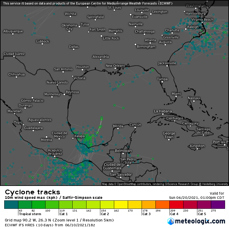
This map was from the June 10th, it definitely was picking up on the development of TD 2.
Last edited by Jr0d on Mon Jun 14, 2021 12:23 pm, edited 1 time in total.
0 likes
-
MHC Tracking

- Tropical Storm

- Posts: 170
- Joined: Mon Mar 15, 2021 10:05 am
Re: ATL: TWO - Tropical Depression - Discussion
In my opinion, this might have briefly been a TS earlier today, but as ASCAT missed, we won't know. Chances are decreasing for Bill later though, at least to me.
1 likes

Re: ATL: TWO - Tropical Depression - Discussion
Shell Mound wrote:wxman57 wrote:Looked more impressive 2-3 hours ago. Maybe it won't make it to "Bill".
It may have briefly attained low-end TS status several hours ago, but perhaps the mid- and low-level centres were insufficiently “stacked” then. Clearly the Gulf Stream (GS) played a pivotal role in fomenting temporal improvement, but upon encountering lower heat content to the north of the GS, spatially and structurally TD Two has since undergone steady degradation. Given increasing VWS, TS status is currently becoming less probable.
https://twitter.com/splillo/status/1404464310248566784
https://twitter.com/pppapin/status/1404474224429895681
https://twitter.com/webberweather/status/1404480558487392256
Modeling has peak intensity from 12 - 20 hours from now. Hurricane models are especially enthusiastic with a small area of 50-60kt winds. With that said the next convective upswing should push this over to TS status.
1 likes
Kendall -> SLO -> PBC
Memorable Storms: Katrina (for its Florida landfall...) Wilma Matthew Irma
Memorable Storms: Katrina (for its Florida landfall...) Wilma Matthew Irma
-
CyclonicFury

- Category 5
- Posts: 1975
- Age: 25
- Joined: Sun Jul 02, 2017 12:32 pm
- Location: NC
- Contact:
Re: ATL: TWO - Tropical Depression - Discussion
I think its overall appearance might have peaked but I think increasing forward speed will still get this to TS status.
1 likes
NCSU B.S. in Meteorology Class of 2021. Tropical weather blogger at http://www.cyclonicfury.com. My forecasts and thoughts are NOT official, for official forecasts please consult the National Hurricane Center.

Re: ATL: INVEST 93L - Discussion
Aric Dunn wrote:Beef Stew wrote:Somewhat surprised the NHC didn’t go straight for TS Bill, considering that the bigger question throughout the morning seemed to be the remaining degree of frontal attachment rather than intensity threshold. Regardless, we’ll probably see Bill by 21z.
The NHC really likes to follow the process, especially when there is no threat to land. its forward motion alone gives enough credence to this being Bill right now. They are probably just waiting a few more hours to watch the convection. if by this afternoon convection is holding the upgrade will come at 5.
Radar velocities earlier didn't support tropical storm intensity--the highest I could find was 33kt.
0 likes
The above post is not official and should not be used as such. It is the opinion of the poster and may or may not be backed by sound meteorological data. It is not endorsed by any professional institution or storm2k.org. For official information, please refer to the NHC and NWS products.
-
MHC Tracking
- Tropical Storm
- Posts: 170
- Joined: Mon Mar 15, 2021 10:05 am
Re: ATL: TWO - Tropical Depression - Discussion
Radar velocities earlier didn't support tropical storm intensity--the highest I could find was 33kt.
Interesting, so close yet so far from being a TS
0 likes
-
Aric Dunn
- Category 5
- Posts: 21228
- Age: 41
- Joined: Sun Sep 19, 2004 9:58 pm
- Location: Ready for the Chase.
- Contact:
Re: ATL: TWO - Tropical Depression - Discussion
As it moves faster it will begin to strengthen. although it likely is a TS now. radar was looking to far up to get any useful data. should see a burst of convection soon and overnight is when it will be in a better environment .
2 likes
Note: If I make a post that is brief. Please refer back to previous posts for the analysis or reasoning. I do not re-write/qoute what my initial post said each time.
If there is nothing before... then just ask
Space & Atmospheric Physicist, Embry-Riddle Aeronautical University,
I believe the sky is falling...
If there is nothing before... then just ask
Space & Atmospheric Physicist, Embry-Riddle Aeronautical University,
I believe the sky is falling...
-
cycloneye
- Admin
- Posts: 139327
- Age: 67
- Joined: Thu Oct 10, 2002 10:54 am
- Location: San Juan, Puerto Rico
Re: ATL: TWO - Tropical Depression - Discussion
Still a TD.
AL, 02, 2021061418, , BEST, 0, 349N, 731W, 30, 1006, TD
0 likes
Visit the Caribbean-Central America Weather Thread where you can find at first post web cams,radars
and observations from Caribbean basin members Click Here
and observations from Caribbean basin members Click Here
-
Sciencerocks
- Category 5
- Posts: 7287
- Age: 38
- Joined: Thu Jul 06, 2017 1:51 am

Who is online
Users browsing this forum: No registered users and 18 guests