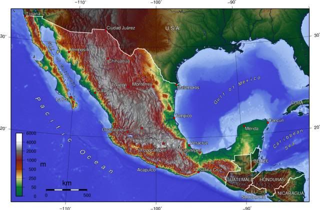
ATL: INVEST 94L - Discussion

Moderator: S2k Moderators

Message
Author
User avatar
Hurricaneman
Category 5
Category 5
Posts: 7284
Age: 43
Joined: Tue Aug 31, 2004 3:24 pm
Location: central florida

Re: ATL: INVEST 94L - Discussion

#21 Postby Hurricaneman » Fri Jul 05, 2013 3:34 pm

vbhoutex wrote:
Hurricaneman wrote:this has potential to become a 40kt ts before landfall on sunday, but if the shear drops more than expected then it could get as high as 50kts so this indeed needs to be watched for surprises, if nothing else there could be much needed rain for Texas

Why do you think it has that potential?

Also please add the disclaimer when posting "forecasts". I am adding it for you now.


The posts in this forum are NOT official forecast and should not be used as such. They are just the opinion of the poster and may or may not be backed by sound meteorological data. They are NOT endorsed by any professional institution or storm2k.org. For official information, please refer to the NHC and NWS products.


sorry, brain cramp

As for why, smaller systems in this area tend to spin up fast but as said in the above post 50kts is more if the shear relaxes more than expected

The posts in this forum are NOT official forecast and should not be used as such. They are just the opinion of the poster and may or may not be backed by sound meteorological data. They are NOT endorsed by any professional institution or storm2k.org. For official information, please refer to the NHC and NWS products
0 likes   

User avatar
ROCK
Category 5
Category 5
Posts: 9254
Age: 53
Joined: Tue Aug 17, 2004 7:30 am
Location: Kemah, Texas

Re: ATL: INVEST 94L - Discussion

#22 Postby ROCK » Fri Jul 05, 2013 3:37 pm

0 likes   

User avatar
crazy4disney
Tropical Storm
Tropical Storm
Posts: 100
Age: 57
Joined: Tue May 20, 2003 2:16 pm
Location: Pearland/Friendswood line, TX

Re: ATL: INVEST 94L - Discussion

#23 Postby crazy4disney » Fri Jul 05, 2013 3:39 pm

I sure hope this pans out for us, precip-wise... We have gone from "sure would be nice to have some rain" to "we really REALLY need some rain." A nice swath of tropical moisture without the damaging winds would be just perfect!
0 likes   

User avatar
Tireman4
S2K Supporter
S2K Supporter
Posts: 5674
Age: 58
Joined: Fri Jun 30, 2006 1:08 pm
Location: Humble, Texas
Contact:

#24 Postby Tireman4 » Fri Jul 05, 2013 3:43 pm

Please do not be like "Don" of 2011 and go poof before you hit the coast ( not that it will, but...LOL)
0 likes   

JonathanBelles
Professional-Met
Professional-Met
Posts: 11430
Age: 33
Joined: Sat Dec 24, 2005 9:00 pm
Location: School: Florida State University (Tallahassee, FL) Home: St. Petersburg, Florida
Contact:

#25 Postby JonathanBelles » Fri Jul 05, 2013 3:43 pm

Be careful what you all wish for out west. This environment is downright soggy. A lot of Floridians on the gulf coast have had more than a foot of rain in the last week. Going straight from drought to flooding would be a possibility if the pattern holds.
0 likes   

User avatar
HurricaneBrain
S2K Supporter
S2K Supporter
Posts: 430
Joined: Thu Jun 30, 2011 2:07 pm
Location: Beaumont, TX

#26 Postby HurricaneBrain » Fri Jul 05, 2013 3:44 pm

Can we get a model thread running?
0 likes   

User avatar
Dave
Retired Staff
Retired Staff
Posts: 13442
Age: 73
Joined: Tue Aug 01, 2006 3:57 pm
Location: Milan Indiana
Contact:

ATL: INVEST 94L - Models

#27 Postby Dave » Fri Jul 05, 2013 3:49 pm

Model thread for invest 94L in place...all yours!
0 likes   

User avatar
cycloneye
Admin
Admin
Posts: 139329
Age: 67
Joined: Thu Oct 10, 2002 10:54 am
Location: San Juan, Puerto Rico

Re: ATL: INVEST 94L - Models

#28 Postby cycloneye » Fri Jul 05, 2013 3:50 pm

CHGHUR
TROPICAL CYCLONE GUIDANCE MESSAGE
NWS NATIONAL HURRICANE CENTER MIAMI FL
1913 UTC FRI JUL 5 2013

DISCLAIMER...NUMERICAL MODELS ARE SUBJECT TO LARGE ERRORS.
PLEASE REFER TO NHC OFFICIAL FORECASTS FOR TROPICAL CYCLONE
AND SUBTROPICAL CYCLONE INFORMATION.

ATLANTIC OBJECTIVE AIDS FOR

DISTURBANCE INVEST (AL942013) 20130705 1800 UTC

...00 HRS... ...12 HRS... ...24 HRS. .. ...36 HRS...
130705 1800 130706 0600 130706 1800 130707 0600

LAT LON LAT LON LAT LON LAT LON
BAMS 22.9N 96.0W 23.8N 97.2W 24.8N 98.3W 25.6N 99.6W
BAMD 22.9N 96.0W 24.1N 95.6W 25.0N 95.7W 25.7N 96.5W
BAMM 22.9N 96.0W 23.9N 96.3W 24.7N 96.9W 25.4N 97.9W
LBAR 22.9N 96.0W 23.9N 96.0W 25.2N 96.8W 26.6N 97.9W
SHIP 20KTS 23KTS 26KTS 29KTS
DSHP 20KTS 23KTS 26KTS 26KTS

...48 HRS... ...72 HRS... ...96 HRS. .. ..120 HRS...
130707 1800 130708 1800 130709 1800 130710 1800

LAT LON LAT LON LAT LON LAT LON
BAMS 26.6N 101.0W 27.9N 103.8W 28.8N 106.1W 29.2N 108.0W
BAMD 26.3N 97.9W 27.3N 101.6W 27.8N 105.5W 27.9N 109.5W
BAMM 26.1N 99.5W 26.8N 103.1W 27.1N 106.9W 27.0N 110.6W
LBAR 27.9N 99.3W 29.9N 102.0W 31.3N 104.9W 31.4N 107.8W
SHIP 31KTS 38KTS 44KTS 47KTS
DSHP 26KTS 27KTS 27KTS 30KTS

...INITIAL CONDITIONS...
LATCUR = 22.9N LONCUR = 96.0W DIRCUR = 355DEG SPDCUR = 4KT
LATM12 = 22.1N LONM12 = 96.0W DIRM12 = 353DEG SPDM12 = 4KT
LATM24 = 21.4N LONM24 = 95.7W
WNDCUR = 20KT RMAXWD = 70NM WNDM12 = 20KT
CENPRS = 1011MB OUTPRS = 1013MB OUTRAD = 150NM SDEPTH = S
RD34NE = 0NM RD34SE = 0NM RD34SW = 0NM RD34NW = 0NM

0 likes   
Visit the Caribbean-Central America Weather Thread where you can find at first post web cams,radars
and observations from Caribbean basin members Click Here

User avatar
cycloneye
Admin
Admin
Posts: 139329
Age: 67
Joined: Thu Oct 10, 2002 10:54 am
Location: San Juan, Puerto Rico

Re:

#29 Postby cycloneye » Fri Jul 05, 2013 3:50 pm

HurricaneBrain wrote:Can we get a model thread running?


There is a thread now.

viewtopic.php?f=59&t=115186&p=2315529#p2315529
0 likes   
Visit the Caribbean-Central America Weather Thread where you can find at first post web cams,radars
and observations from Caribbean basin members Click Here

User avatar
Dave
Retired Staff
Retired Staff
Posts: 13442
Age: 73
Joined: Tue Aug 01, 2006 3:57 pm
Location: Milan Indiana
Contact:

#30 Postby Dave » Fri Jul 05, 2013 4:02 pm

94L AVN

Image
0 likes   
This post is NOT AN OFFICIAL FORECAST and should not be used as such. It is just the opinion of the poster and may or may not be backed by sound meteorological data. It is NOT endorsed by any professional institution including storm2k.org. For Official Information please refer to the NHC and NWS products.

User avatar
MississippiWx
S2K Supporter
S2K Supporter
Posts: 1535
Joined: Sat Aug 14, 2010 1:44 pm
Location: Hattiesburg, Mississippi

Re: ATL: INVEST 94L - Discussion

#31 Postby MississippiWx » Fri Jul 05, 2013 4:07 pm

I hate to be a party pooper for you Texans, but with westerly shear not forecast to abate throughout 94L's life, it's more likely that Louisiana receives the majority of the rain from 94L. Hope my hunch is wrong.
0 likes   
This post is not an official forecast and should not be used as such. It is just the opinion of MississippiWx and may or may not be backed by sound meteorological data. It is not endorsed by any professional institution including storm2k.org. For Official Information please refer to the NHC and NWS products.

User avatar
Tireman4
S2K Supporter
S2K Supporter
Posts: 5674
Age: 58
Joined: Fri Jun 30, 2006 1:08 pm
Location: Humble, Texas
Contact:

#32 Postby Tireman4 » Fri Jul 05, 2013 4:13 pm

From the HGX NWS this afternoon...

HIS WEEKEND`S WEATHER PATTERN WILL UNDERGO CHANGE...JUST HOW
MUCH CHANGE IS STILL IN DISCUSSION. EACH SUBSEQUENT MODEL RUN
CONTINUES TO ADVERTISE A WEAK WESTERN GULF INVERTED TROUGH MOVING
ONSHORE SUNDAY INTO MONDAY...DRAGGING A VERY MOIST AIR MASS INTO
THE REGION OF NEAR TWO STANDARD DEVIATIONS (GREATER THAN 2 INCH
PWATS). WHETHER THIS FEATURE REMAINS A WEAK TROPICAL WAVE OR
BECOMES A DEPRESSION WILL BE DETERMINED BY THE ENVIRONMENT IT
ENTERS...THERE IS A SLIGHT CHANCE THAT IT WILL DEVELOP INTO AT A
CYCLONE AS IT MOVES INTO A LESS-SHEARED WESTERN GULF SATURDAY INTO
SUNDAY. THE STRENGTH OF WEST/NORTHERN TEXAS UPPER RIDGING WILL BE
THE DETERMINING FACTOR OF THE LOCATION OF THIS FEATURE AND THE
AMOUNT OF MOISTURE PRESENT ALONG OUR COASTLINE BY SUNDAY. AS OF
NOW...HAVE CONTINUED THIS TREND OF BITING ON THE THREAT FOR HEAVY
RAINFALL PRIMARILY CONFINED TO THE COASTLINE...OR POINTS GENERALLY
SOUTH OF THE I-10 (HIGHWAY 59) CORRIDOR(S). A SLOWER MOVEMENT OF
THIS FEATURE TO THE COAST...WITH ITS AXIS WEST OF US BY EARLY
TUESDAY...PLACES 72 HOUR QPF TOTALS IN THE 3-4 INCH RANGE...1.5 TO
2.5 INCHES AROUND THE I-10 CORRIDOR/SOUTHERN HOUSTON METRO. THE
BULK OF THIS RAIN IS TIMED TO FALL DURING SUNDAY INTO EARLY MONDAY
WITH (NEAR) COASTAL RAINFALL BEGINNING AS EARLY AS TOMORROW MORNING.
0 likes   

ozonepete
Professional-Met
Professional-Met
Posts: 4743
Joined: Mon Sep 07, 2009 3:23 pm
Location: From Ozone Park, NYC / Now in Brooklyn, NY

Re: ATL: INVEST 94L - Discussion

#33 Postby ozonepete » Fri Jul 05, 2013 4:19 pm

:uarrow: Hi Dave!

Erick's influence will be limited to only highest levels pretty soon since there will be the huge mountains of Mexico in between these two systems from here on. So minimally it won't be stealing moisture from the low and mid levels from 94L. And for now its high-level outflow combined with the upper trough flow (west to southwesterly) is a double edged sword for 94L. It's causing some shear but it's also helping to allow outflow over 94L.

Image
0 likes   

User avatar
Dave
Retired Staff
Retired Staff
Posts: 13442
Age: 73
Joined: Tue Aug 01, 2006 3:57 pm
Location: Milan Indiana
Contact:

#34 Postby Dave » Fri Jul 05, 2013 4:22 pm

Hey there OzonePete! Ready to go again around here. ;)

Image

Now it's working correctly. Apologies for the blank screen for a few minutes.
0 likes   

User avatar
HurricaneBrain
S2K Supporter
S2K Supporter
Posts: 430
Joined: Thu Jun 30, 2011 2:07 pm
Location: Beaumont, TX

#35 Postby HurricaneBrain » Fri Jul 05, 2013 4:24 pm

Models look to be heading north and then west
0 likes   

User avatar
Ptarmigan
Category 5
Category 5
Posts: 5273
Joined: Wed Aug 16, 2006 9:06 pm

Re: ATL: INVEST 94L - Discussion

#36 Postby Ptarmigan » Fri Jul 05, 2013 4:30 pm

MississippiWx wrote:I hate to be a party pooper for you Texans, but with westerly shear not forecast to abate throughout 94L's life, it's more likely that Louisiana receives the majority of the rain from 94L. Hope my hunch is wrong.


The wind shear is lessening.


JonathanBelles wrote:Be careful what you all wish for out west. This environment is downright soggy. A lot of Floridians on the gulf coast have had more than a foot of rain in the last week. Going straight from drought to flooding would be a possibility if the pattern holds.


That is how must droughts usually end.
0 likes   

User avatar
LaBreeze
Category 5
Category 5
Posts: 1497
Joined: Thu Sep 04, 2003 1:57 pm
Location: SW Louisiana

Re: ATL: INVEST 94L - Discussion

#37 Postby LaBreeze » Fri Jul 05, 2013 4:34 pm

Is this "system" more likely to go inland south of Corpus Christi, between Corpus and Galveston, or between Galveston and Sabine Pass?
0 likes   

ozonepete
Professional-Met
Professional-Met
Posts: 4743
Joined: Mon Sep 07, 2009 3:23 pm
Location: From Ozone Park, NYC / Now in Brooklyn, NY

Re: ATL: INVEST 94L - Discussion

#38 Postby ozonepete » Fri Jul 05, 2013 4:42 pm

LaBreeze wrote:Is this "system" more likely to go inland south of Corpus Christi, between Corpus and Galveston, or between Galveston and Sabine Pass?


Not too many model runs yet and it's early in its life with not enough data yet, but some initial model runs are taking it into the Brownsville area. I wouldn't make too much of it yet. There'll be a much better consensus later tonight or tomorrow morning. You can follow the model guidance for track in the 94L Model thread.
0 likes   

User avatar
HurricaneBrain
S2K Supporter
S2K Supporter
Posts: 430
Joined: Thu Jun 30, 2011 2:07 pm
Location: Beaumont, TX

Re: ATL: INVEST 94L - Discussion

#39 Postby HurricaneBrain » Fri Jul 05, 2013 4:42 pm

LaBreeze wrote:Is this "system" more likely to go inland south of Corpus Christi, between Corpus and Galveston, or between Galveston and Sabine Pass?

Models show the low moving south of Corpus Christi, which I don't quite understand. I see the ridge allowing the low to continue it's northward trek, but models disagree as of now.
0 likes   

PauleinHouston
Tropical Storm
Tropical Storm
Posts: 102
Joined: Mon Aug 13, 2007 10:23 am
Location: League City, TX
Contact:

Re: ATL: INVEST 94L - Discussion

#40 Postby PauleinHouston » Fri Jul 05, 2013 4:43 pm

LaBreeze wrote:Is this "system" more likely to go inland south of Corpus Christi, between Corpus and Galveston, or between Galveston and Sabine Pass?


There is no "likely" to be honest. It could quite easily go any direction, but models have been hinting at a Northerly component and then a N/NW component Saturday/Sat evening. If it skirts the coast and remains over the 30C Gulf temps and shear lessens as hinted, there is a chance of development into a weak depression at best. Shear reduction is the key here. If if goes toward Central Texas coast, I'll have to give some kudo's to the new Navgem (Nogaps replacement) as it's hinted/shown this system for a few consistent days now.
0 likes   
The posts in this forum are NOT official forecasts and should not be used as such. They are just the opinion of this amateur poster and may or may not be backed by sound meteorological data. They are NOT endorsed by any professional institution or storm2k.org. For official information, please refer to NWS products.


Return to “2013”

Who is online

Users browsing this forum: No registered users and 7 guests