ATL: MICHAEL - Post-Tropical - Discussion
Moderator: S2k Moderators


-
SouthDadeFish

- Professional-Met

- Posts: 2835
- Joined: Thu Sep 23, 2010 2:54 pm
- Location: Miami, FL
- Contact:


Re: ATL: MICHAEL - Tropical Storm - Discussion
got a great look....might make cat 1 before said and done...Kirk was in the same area not to long ago....better conditions..
0 likes
-
SouthDadeFish
- Professional-Met
- Posts: 2835
- Joined: Thu Sep 23, 2010 2:54 pm
- Location: Miami, FL
- Contact:


Re: ATL: MICHAEL - Tropical Storm - Discussion
Looks like a 50 kt tropical storm to me, very nice structure.
0 likes
-
CrazyC83
- Professional-Met
- Posts: 33393
- Joined: Tue Mar 07, 2006 11:57 pm
- Location: Deep South, for the first time!
Personal Forecast Disclaimer:
The posts in this forum are NOT official forecast and should not be used as such. They are just the opinion of the poster and may or may not be backed by sound meteorological data. They are NOT endorsed by any professional institution or storm2k.org. For official information, please refer to the NHC and NWS products.
Dvorak tends to do poorly with small storms, so yes I agree it is probably stronger than we believe.
0 likes
-
Hurricane_Luis

- Category 2

- Posts: 723
- Age: 26
- Joined: Sat Jun 23, 2012 3:14 pm
- Location: Tiptree, Essex, United Kingdom
- Contact:


-
cycloneye

- Admin

- Posts: 139199
- Age: 67
- Joined: Thu Oct 10, 2002 10:54 am
- Location: San Juan, Puerto Rico
Re: ATL: MICHAEL - Tropical Storm - Discussion
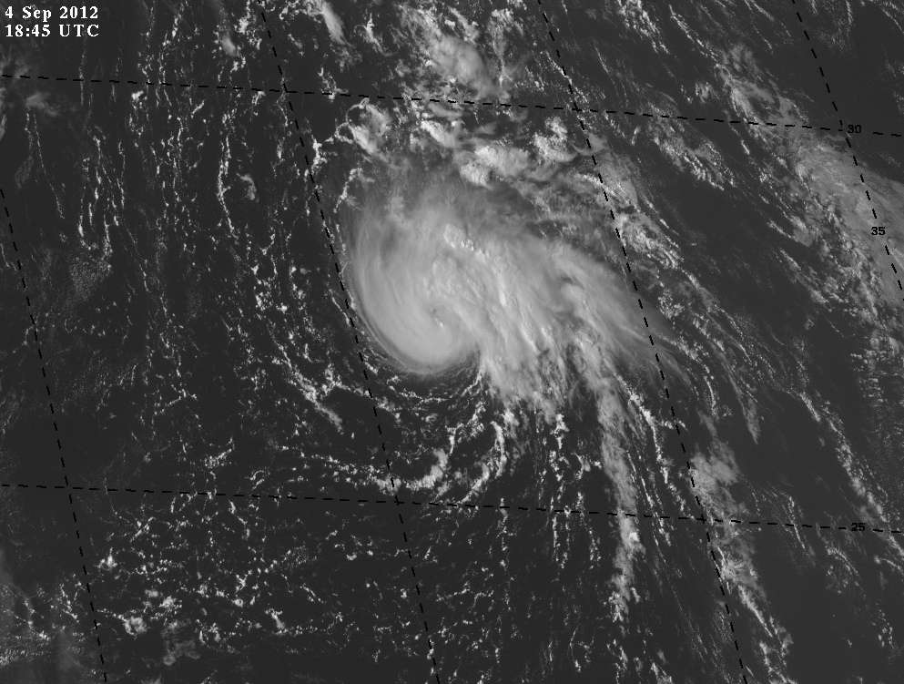
Michael seems to be getting stronger. SSD Dvorak up to 3.0.
04/1745 UTC 27.3N 43.5W T3.0/3.0 MICHAEL -- Atlantic
04/1745 UTC 27.3N 43.5W T3.0/3.0 MICHAEL -- Atlantic
0 likes
Visit the Caribbean-Central America Weather Thread where you can find at first post web cams,radars
and observations from Caribbean basin members Click Here
and observations from Caribbean basin members Click Here
-
cycloneye
- Admin
- Posts: 139199
- Age: 67
- Joined: Thu Oct 10, 2002 10:54 am
- Location: San Juan, Puerto Rico
Re: ATL: MICHAEL - Tropical Storm - Discussion
18z Best Track also goes up in intensity (45kts)
AL, 13, 2012090418, , BEST, 0, 273N, 436W, 45, 1006, TS
ftp://ftp.nhc.noaa.gov/atcf/tcweb/inves ... 012.invest
AL, 13, 2012090418, , BEST, 0, 273N, 436W, 45, 1006, TS
ftp://ftp.nhc.noaa.gov/atcf/tcweb/inves ... 012.invest
0 likes
Visit the Caribbean-Central America Weather Thread where you can find at first post web cams,radars
and observations from Caribbean basin members Click Here
and observations from Caribbean basin members Click Here
Re: ATL: MICHAEL - Tropical Storm - Discussion
45 kt? I really doubt it, an eye like feature is trying to appear in satellite imagery, shallow systems usually develop an "eye" when they are 55 or 60 kt.
0 likes
-
SouthDadeFish
- Professional-Met
- Posts: 2835
- Joined: Thu Sep 23, 2010 2:54 pm
- Location: Miami, FL
- Contact:
Re: ATL: MICHAEL - Tropical Storm - Discussion
Macrocane wrote:45 kt? I really doubt it, an eye like feature is trying to appear in satellite imagery, shallow systems usually develop an "eye" when they are 55 or 60 kt.
I completely agree. EDIT: Here are some recent microwave passes:


Note that they are taken at different times. A mid-level eye feature is developing.
0 likes
Re: ATL: MICHAEL - Tropical Storm - Discussion
hey is making a run at a cane now...I think he will make it....IMO...
0 likes
-
tolakram
- Admin
- Posts: 19167
- Age: 60
- Joined: Sun Aug 27, 2006 8:23 pm
- Location: Florence, KY (name is Mark)
Re: ATL: MICHAEL - Tropical Storm - Discussion
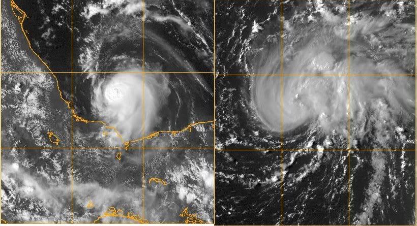
Latest
0 likes
M a r k
- - - - -
Join us in chat: Storm2K Chatroom Invite. Android and IOS apps also available.
The posts in this forum are NOT official forecasts and should not be used as such. Posts are NOT endorsed by any professional institution or STORM2K.org. For official information and forecasts, please refer to NHC and NWS products.

-
CrazyC83
- Professional-Met
- Posts: 33393
- Joined: Tue Mar 07, 2006 11:57 pm
- Location: Deep South, for the first time!
I agree, with the Dvorak bias, I would put it at 60 kt personally.
Personal Forecast Disclaimer:
The posts in this forum are NOT official forecast and should not be used as such. They are just the opinion of the poster and may or may not be backed by sound meteorological data. They are NOT endorsed by any professional institution or storm2k.org. For official information, please refer to the NHC and NWS products.
0 likes
-
SouthDadeFish
- Professional-Met
- Posts: 2835
- Joined: Thu Sep 23, 2010 2:54 pm
- Location: Miami, FL
- Contact:

-
somethingfunny

- ChatStaff

- Posts: 3926
- Age: 35
- Joined: Thu May 31, 2007 10:30 pm
- Location: McKinney, Texas
Re: ATL: MICHAEL - Tropical Storm - Discussion
SouthDadeFish wrote:Cloud tops are warming now:
[img]http://img194.imageshack.us/img194/7184/191uwo.jpg[/ img]
Normally I'd say to wait for DMAX, but I don't know if a storm of Michael's size would follow the same general rules.
0 likes
I am not a meteorologist, and any posts made by me are not official forecasts or to be interpreted as being intelligent. These posts are just my opinions and are probably silly opinions.
Re: ATL: MICHAEL - Tropical Storm - Discussion
I think it tried to form an eye wall earlier but that got squashed...might be trying to rebuild though....
0 likes
-
hurricanes1234
- Category 5

- Posts: 2903
- Joined: Sat Jul 28, 2012 6:19 pm
- Location: Trinidad and Tobago
Re: ATL: MICHAEL - Tropical Storm - Discussion
Compact little storm going about his business. I like storms like these.
0 likes
PLEASE NOTE: With the exception of information from weather agencies that I may copy and paste here, my posts will NEVER be official, since I am NOT a meteorologist. They are solely my amateur opinion, and may or may not be accurate. Therefore, please DO NOT use them as official details, particularly when making important decisions. Thank you.
Who is online
Users browsing this forum: No registered users and 12 guests