The NW Caribbean disturbance gets invest status. There is too much shear to allow anything to develop,but for being Febuary,is very interesting to see this.
Thread that was the topic for this area of interest at Talking Tropics forum.
viewtopic.php?f=31&t=112459&hilit=&p=2212987#p2212987
ATL: INVEST 90L
Moderator: S2k Moderators
-
cycloneye

- Admin

- Posts: 139184
- Age: 67
- Joined: Thu Oct 10, 2002 10:54 am
- Location: San Juan, Puerto Rico
ATL: INVEST 90L
0 likes
Visit the Caribbean-Central America Weather Thread where you can find at first post web cams,radars
and observations from Caribbean basin members Click Here
and observations from Caribbean basin members Click Here
-
cycloneye
- Admin
- Posts: 139184
- Age: 67
- Joined: Thu Oct 10, 2002 10:54 am
- Location: San Juan, Puerto Rico
Re: ATL: INVEST 90L
However,nothing at NRL nor atcf sites.hmmm.

0 likes
Visit the Caribbean-Central America Weather Thread where you can find at first post web cams,radars
and observations from Caribbean basin members Click Here
and observations from Caribbean basin members Click Here
-
KyleEverett
- Tropical Low

- Posts: 36
- Joined: Sun Jun 27, 2010 9:13 pm
Re: ATL: INVEST 90L
Ah February, time for the Super Bowl, Valentine's Day, and tropical invests!
Lots going against our little buddy though. He's in the only part of the basin with shear under 50kts.

Also, dry air a plenty.

Lots going against our little buddy though. He's in the only part of the basin with shear under 50kts.
Also, dry air a plenty.
0 likes

-
SouthFloridawx

- S2K Supporter

- Posts: 8344
- Age: 45
- Joined: Tue Jul 26, 2005 1:16 am
- Location: Sarasota, FL
- Contact:
-
dixiebreeze
- S2K Supporter
- Posts: 5140
- Joined: Wed Sep 03, 2003 5:07 pm
- Location: crystal river, fla.
-
TropicalAnalystwx13

- Category 5

- Posts: 2109
- Age: 26
- Joined: Tue Jul 19, 2011 8:20 pm
- Location: Wilmington, NC
- Contact:
-
cycloneye
- Admin
- Posts: 139184
- Age: 67
- Joined: Thu Oct 10, 2002 10:54 am
- Location: San Juan, Puerto Rico
ATL: INVEST 90L - Models
TROPICAL CYCLONE GUIDANCE MESSAGE
NWS NATIONAL HURRICANE CENTER MIAMI FL
1619 UTC SUN FEB 5 2012
DISCLAIMER...NUMERICAL MODELS ARE SUBJECT TO LARGE ERRORS.
PLEASE REFER TO NHC OFFICIAL FORECASTS FOR TROPICAL CYCLONE
AND SUBTROPICAL CYCLONE INFORMATION.
ATLANTIC OBJECTIVE AIDS FOR
DISTURBANCE INVEST (AL902012) 20120205 1200 UTC
...00 HRS... ...12 HRS... ...24 HRS. .. ...36 HRS...
120205 1200 120206 0000 120206 1200 120207 0000
LAT LON LAT LON LAT LON LAT LON
BAMS 22.0N 86.0W 22.7N 86.4W 23.0N 86.5W 23.3N 86.4W
BAMD 22.0N 86.0W 24.0N 84.7W 26.3N 82.3W 29.0N 77.5W
BAMM 22.0N 86.0W 22.9N 85.7W 23.7N 84.7W 24.9N 83.0W
LBAR 22.0N 86.0W 22.9N 85.3W 24.2N 83.8W 25.2N 80.8W
SHIP 25KTS 31KTS 34KTS 31KTS
DSHP 25KTS 31KTS 34KTS 31KTS
...48 HRS... ...72 HRS... ...96 HRS. .. ..120 HRS...
120207 1200 120208 1200 120209 1200 120210 1200
LAT LON LAT LON LAT LON LAT LON
BAMS 23.8N 86.2W 25.5N 84.5W 28.1N 82.1W 31.9N 76.4W
BAMD 31.3N 68.8W 29.7N 50.6W 25.6N 45.5W 20.8N 45.2W
BAMM 26.7N 80.2W 30.1N 69.6W 32.3N 55.5W 30.6N 48.2W
LBAR 26.1N 77.0W 25.9N 68.9W 26.3N 63.5W 23.5N 60.6W
SHIP 20KTS 0KTS 0KTS 0KTS
DSHP 24KTS 0KTS 0KTS 0KTS
...INITIAL CONDITIONS...
LATCUR = 22.0N LONCUR = 86.0W DIRCUR = 0DEG SPDCUR = 0KT
LATM12 = 22.0N LONM12 = 86.0W DIRM12 = 360DEG SPDM12 = 0KT
LATM24 = 22.0N LONM24 = 86.0W
WNDCUR = 25KT RMAXWD = 100NM WNDM12 = 25KT
CENPRS = 1014MB OUTPRS = 1016MB OUTRAD = 150NM SDEPTH = M
RD34NE = 0NM RD34SE = 0NM RD34SW = 0NM RD34NW = 0NM

Uploaded by imageshack.us
NWS NATIONAL HURRICANE CENTER MIAMI FL
1619 UTC SUN FEB 5 2012
DISCLAIMER...NUMERICAL MODELS ARE SUBJECT TO LARGE ERRORS.
PLEASE REFER TO NHC OFFICIAL FORECASTS FOR TROPICAL CYCLONE
AND SUBTROPICAL CYCLONE INFORMATION.
ATLANTIC OBJECTIVE AIDS FOR
DISTURBANCE INVEST (AL902012) 20120205 1200 UTC
...00 HRS... ...12 HRS... ...24 HRS. .. ...36 HRS...
120205 1200 120206 0000 120206 1200 120207 0000
LAT LON LAT LON LAT LON LAT LON
BAMS 22.0N 86.0W 22.7N 86.4W 23.0N 86.5W 23.3N 86.4W
BAMD 22.0N 86.0W 24.0N 84.7W 26.3N 82.3W 29.0N 77.5W
BAMM 22.0N 86.0W 22.9N 85.7W 23.7N 84.7W 24.9N 83.0W
LBAR 22.0N 86.0W 22.9N 85.3W 24.2N 83.8W 25.2N 80.8W
SHIP 25KTS 31KTS 34KTS 31KTS
DSHP 25KTS 31KTS 34KTS 31KTS
...48 HRS... ...72 HRS... ...96 HRS. .. ..120 HRS...
120207 1200 120208 1200 120209 1200 120210 1200
LAT LON LAT LON LAT LON LAT LON
BAMS 23.8N 86.2W 25.5N 84.5W 28.1N 82.1W 31.9N 76.4W
BAMD 31.3N 68.8W 29.7N 50.6W 25.6N 45.5W 20.8N 45.2W
BAMM 26.7N 80.2W 30.1N 69.6W 32.3N 55.5W 30.6N 48.2W
LBAR 26.1N 77.0W 25.9N 68.9W 26.3N 63.5W 23.5N 60.6W
SHIP 20KTS 0KTS 0KTS 0KTS
DSHP 24KTS 0KTS 0KTS 0KTS
...INITIAL CONDITIONS...
LATCUR = 22.0N LONCUR = 86.0W DIRCUR = 0DEG SPDCUR = 0KT
LATM12 = 22.0N LONM12 = 86.0W DIRM12 = 360DEG SPDM12 = 0KT
LATM24 = 22.0N LONM24 = 86.0W
WNDCUR = 25KT RMAXWD = 100NM WNDM12 = 25KT
CENPRS = 1014MB OUTPRS = 1016MB OUTRAD = 150NM SDEPTH = M
RD34NE = 0NM RD34SE = 0NM RD34SW = 0NM RD34NW = 0NM
Uploaded by imageshack.us
0 likes
Visit the Caribbean-Central America Weather Thread where you can find at first post web cams,radars
and observations from Caribbean basin members Click Here
and observations from Caribbean basin members Click Here
-
AdamFirst

- S2K Supporter
- Posts: 2487
- Age: 35
- Joined: Thu Aug 14, 2008 10:54 am
- Location: Port Saint Lucie, FL
Hoping this dumps more rain than expected on the peninsula - fill the coffers up during this dry season
0 likes
Dolphins Marlins Canes Golden Panthers HEAT
Andrew 1992 - Irene 1999 - Frances 2004 - Jeanne 2004 - Wilma 2005 - Fay 2008 - Isaac 2012 - Matthew 2016 - Irma 2017 - Dorian 2019 - Ian 2022 - Nicole 2022
Andrew 1992 - Irene 1999 - Frances 2004 - Jeanne 2004 - Wilma 2005 - Fay 2008 - Isaac 2012 - Matthew 2016 - Irma 2017 - Dorian 2019 - Ian 2022 - Nicole 2022
-
cycloneye
- Admin
- Posts: 139184
- Age: 67
- Joined: Thu Oct 10, 2002 10:54 am
- Location: San Juan, Puerto Rico
Re: ATL: INVEST 90L
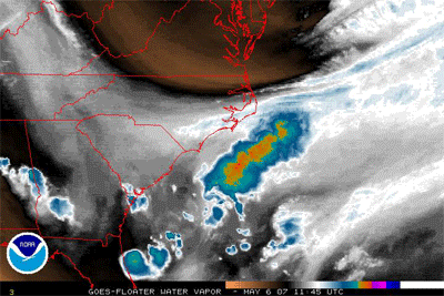
Low level convergence is good.

Uploaded by imageshack.us
Uploaded by imageshack.us
0 likes
Visit the Caribbean-Central America Weather Thread where you can find at first post web cams,radars
and observations from Caribbean basin members Click Here
and observations from Caribbean basin members Click Here
-
northjaxpro

- S2K Supporter
- Posts: 8900
- Joined: Mon Sep 27, 2010 11:21 am
- Location: Jacksonville, FL
Well, the way this weather has been with virtually a non-winter, why not have a February invest down in the NW Caribbean uh?
If anything, I hope this invest will help bring some much needed rain to the peninsula in the short term. We really need it badly up here in the northeast portion of the state.
If anything, I hope this invest will help bring some much needed rain to the peninsula in the short term. We really need it badly up here in the northeast portion of the state.
0 likes
NEVER, EVER SAY NEVER in the tropics and weather in general, and most importantly, with life itself!!
________________________________________________________________________________________
Fay 2008 Beryl 2012 Debby 2012 Colin 2016 Hermine 2016 Julia 2016 Matthew 2016 Irma 2017 Dorian 2019
________________________________________________________________________________________
Fay 2008 Beryl 2012 Debby 2012 Colin 2016 Hermine 2016 Julia 2016 Matthew 2016 Irma 2017 Dorian 2019
-
Ivanhater

- Storm2k Moderator

- Posts: 10852
- Age: 37
- Joined: Fri Jul 01, 2005 8:25 am
- Location: Pensacola
Re: ATL: INVEST 90L
Winter has been non existent on the Gulf coast so I'm not surprised by this.
0 likes
Michael
-
northjaxpro
- S2K Supporter
- Posts: 8900
- Joined: Mon Sep 27, 2010 11:21 am
- Location: Jacksonville, FL
Re: ATL: INVEST 90L
Ivanhater wrote:Winter has been non existent on the Gulf coast so I'm not surprised by this.
Exactly!
I am hoping this system brings some much needed rain to the peninsula in the short-term.
0 likes
NEVER, EVER SAY NEVER in the tropics and weather in general, and most importantly, with life itself!!
________________________________________________________________________________________
Fay 2008 Beryl 2012 Debby 2012 Colin 2016 Hermine 2016 Julia 2016 Matthew 2016 Irma 2017 Dorian 2019
________________________________________________________________________________________
Fay 2008 Beryl 2012 Debby 2012 Colin 2016 Hermine 2016 Julia 2016 Matthew 2016 Irma 2017 Dorian 2019


-
Hurricanehink

- S2K Supporter
- Posts: 2023
- Joined: Sun Nov 16, 2003 2:05 pm
- Location: New Jersey
Re: ATL: INVEST 90L
From the latest TWO:
THIS UPPER RIDGE IS DRAWING TROPICAL
MOISTURE N OVER THE E GULF OF MEXICO GENERATING SCATTERED
SHOWERS WITH POSSIBLE ISOLATED THUNDERSTORMS ARE S OF 27N E OF
THE SURFACE TROUGH TO OVER THE FLORIDA PENINSULA. THIS AREA IS
BEING CLOSELY MONITORED FOR POSSIBLE FURTHER DEVELOPMENT.
0 likes

-
TropicalAnalystwx13
- Category 5
- Posts: 2109
- Age: 26
- Joined: Tue Jul 19, 2011 8:20 pm
- Location: Wilmington, NC
- Contact:

-
Evil Jeremy

- S2K Supporter
- Posts: 5459
- Age: 30
- Joined: Mon Apr 10, 2006 2:10 pm
- Location: Los Angeles, CA
Re: ATL: INVEST 90L
My off-season hibernation ended too quickly. Well, I guess it is that time of year. Every good hurricane season starts in February.
I would expect a STWO at some point today. If I remember correctly, during the off season they tend to issue STWOs at 2 and 8, like they would during the season.
I would expect a STWO at some point today. If I remember correctly, during the off season they tend to issue STWOs at 2 and 8, like they would during the season.
0 likes
Frances 04 / Jeanne 04 / Katrina 05 / Wilma 05 / Fay 08 / Debby 12 / Andrea 13 / Colin 16 / Hermine 16 / Matthew 16 / Irma 17
-
Hurricaneman

- Category 5
- Posts: 7282
- Age: 43
- Joined: Tue Aug 31, 2004 3:24 pm
- Location: central florida
Who is online
Users browsing this forum: No registered users and 50 guests