ATL: Ex INVEST 92L - Discussion

Moderator: S2k Moderators

Message
Author
User avatar
gatorcane
S2K Supporter
S2K Supporter
Posts: 23499
Age: 46
Joined: Sun Mar 13, 2005 3:54 pm
Location: Boca Raton, FL

Re: ATL: INVEST 92L - Models

#81 Postby gatorcane » Sun Aug 07, 2011 3:37 pm

cycloneye wrote:
i trust none of them...


Certainly Jesse, this year has been not normal the performance so far. Let's see when the real peak of the season comes after mid August and see if things change. (Except the Euro with Don that was very good)


The ECMWF did well with Emily also. When the invest that spawned Emily was between the Lesser Antilles and Africa, it consistently showed it traversing the Northern Caribbean towards Eastern Cuba and Hispaniola where it disintegrated her, never really deepening it.

Out of all of the models, the ECMWF is the one I would pick if forced to pick. It's not doing much with this wave.
0 likes   

User avatar
gatorcane
S2K Supporter
S2K Supporter
Posts: 23499
Age: 46
Joined: Sun Mar 13, 2005 3:54 pm
Location: Boca Raton, FL

#82 Postby gatorcane » Sun Aug 07, 2011 4:28 pm

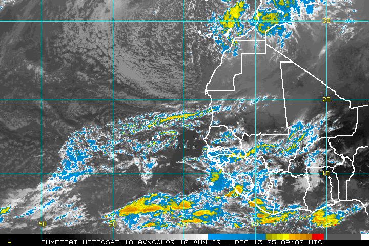
Latest EAST Atlantic IR image:

Image
0 likes   

User avatar
wxman57
Moderator-Pro Met
Moderator-Pro Met
Posts: 22484
Age: 66
Joined: Sat Jun 21, 2003 8:06 pm
Location: Houston, TX (southwest)

Re: ATL: INVEST 92L - Discussion

#83 Postby wxman57 » Sun Aug 07, 2011 4:40 pm

12Z GFS has 25-35 kt 850mb winds across the tropical Atlantic near Africa now. The strong wing burst tracks westward with 92L. Lack of low-level convergence should not allow for development over the next 3-4 days. It needs to slow down first.
0 likes   

User avatar
Blown Away
S2K Supporter
S2K Supporter
Posts: 9867
Joined: Wed May 26, 2004 6:17 am

Re: ATL: INVEST 92L - Discussion

#84 Postby Blown Away » Sun Aug 07, 2011 4:43 pm

wxman57 wrote:12Z GFS has 25-35 kt 850mb winds across the tropical Atlantic near Africa now. The strong wing burst tracks westward with 92L. Lack of low-level convergence should not allow for development over the next 3-4 days. It needs to slow down first.


What is your development chances for 92L? Enough weakness to recurve 92L before the islands if it develops?
0 likes   
Hurricane Eye Experience: David 79, Irene 99, Frances 04, Jeanne 04, Wilma 05... EYE COMING MY WAY IN 2024…
Hurricane Brush Experience: Andrew 92, Erin 95, Floyd 99, Matthew 16, Irma 17, Ian 22, Nicole 22…

User avatar
Fyzn94
Tropical Storm
Tropical Storm
Posts: 190
Joined: Thu Jul 07, 2011 10:00 pm
Location: Central AR, USA

Re: ATL: INVEST 92L - Discussion

#85 Postby Fyzn94 » Sun Aug 07, 2011 4:58 pm

NHC isn't showing this on their Tropical Cyclone Activity Map. I'd expect to at least see a yellow circle indicating it.
0 likes   
NOTICE: I cannot give an expert analysis. Most of my "observations" are made visually with the help of only vital information provided by public advisories.

User avatar
wxman57
Moderator-Pro Met
Moderator-Pro Met
Posts: 22484
Age: 66
Joined: Sat Jun 21, 2003 8:06 pm
Location: Houston, TX (southwest)

Re: ATL: INVEST 92L - Discussion

#86 Postby wxman57 » Sun Aug 07, 2011 5:09 pm

Blown Away wrote:
wxman57 wrote:12Z GFS has 25-35 kt 850mb winds across the tropical Atlantic near Africa now. The strong wing burst tracks westward with 92L. Lack of low-level convergence should not allow for development over the next 3-4 days. It needs to slow down first.


What is your development chances for 92L? Enough weakness to recurve 92L before the islands if it develops?


I'm not thinking that it has much chance of developing until west of 50W. That farther west development would decrease chances of recurve and out to sea. Hard to say what it's chances are 4-5 days from now. Not too good the next 2-3 days at least.
0 likes   

User avatar
Hylian Auree
Tropical Storm
Tropical Storm
Posts: 150
Age: 31
Joined: Thu Dec 02, 2010 7:01 pm
Location: Willemstad, Curaçao
Contact:

#87 Postby Hylian Auree » Sun Aug 07, 2011 6:22 pm

The reason the NHC isn't giving this any chances of development yet is because development isn't likely until after 48 hours. Too much dry air, and everything else noted by wxman57
0 likes   

lebron23
Category 1
Category 1
Posts: 389
Age: 31
Joined: Sat May 24, 2008 11:58 am
Contact:

Re: ATL: INVEST 92L - Discussion

#88 Postby lebron23 » Sun Aug 07, 2011 6:47 pm

Nothing on TWO
0 likes   

User avatar
cycloneye
Admin
Admin
Posts: 139334
Age: 67
Joined: Thu Oct 10, 2002 10:54 am
Location: San Juan, Puerto Rico

Re: ATL: INVEST 92L - Discussion

#89 Postby cycloneye » Sun Aug 07, 2011 6:50 pm

8 PM TWD:

A TROPICAL WAVE IS MOVING ACROSS THE FAR EAST ATLC FROM 19N19W
TO 11N22W...MOVING W 10 KT. SATELLITE IMAGERY REVEALS A LOW TO
MID LEVEL CYCLONIC CIRCULATION IN THE SOUTHERN EXTENSION OF THE
WAVE AXIS. THE WAVE IS EMBEDDED IN A SURGE OF DEEP MOISTURE ON
THE TOTAL PRECIPITABLE WATER PRODUCT. SCATTERED SHOWERS ARE
WITHIN 90 NM ON EITHER SIDE OF THE WAVE AXIS. SCATTERED MODERATE
TO STRONG CONVECTION IS FURTHER S ALONG THE MONSOON TROUGH.
0 likes   
Visit the Caribbean-Central America Weather Thread where you can find at first post web cams,radars
and observations from Caribbean basin members Click Here

AHS2011
Tropical Storm
Tropical Storm
Posts: 134
Joined: Sun Jun 05, 2011 7:39 am

Re: ATL: INVEST 92L - Discussion

#90 Postby AHS2011 » Sun Aug 07, 2011 7:15 pm

I'm not liking this year so far. It looks worse than 2010 did at the beginning. Does anyone know why NOAA raised their Hurricane Season numbers? Sorry to be slightly off topic.
0 likes   
"People might not get all they work for in this world, but they must certainly work for all they get."- Frederick Douglass

HurricaneFan
Tropical Storm
Tropical Storm
Posts: 192
Age: 40
Joined: Tue Jan 18, 2011 6:16 pm
Location: Anguilla,Leeward Islands 18.3N 63.0W

Re: ATL: INVEST 92L - Discussion

#91 Postby HurricaneFan » Sun Aug 07, 2011 7:42 pm

Isn't the wave behind 92L getting very close to 92L?
0 likes   

User avatar
gatorcane
S2K Supporter
S2K Supporter
Posts: 23499
Age: 46
Joined: Sun Mar 13, 2005 3:54 pm
Location: Boca Raton, FL

#92 Postby gatorcane » Sun Aug 07, 2011 8:48 pm

The posts in this forum are NOT official forecast and should not be used as such. They are just the opinion of the poster and may or may not be backed by sound meteorological data. They are NOT endorsed by any professional institution or storm2k.org. For official information, please refer to the NHC and NWS products.


Model support is on the weak side for this system.

I agree with WxMan57. If it develops we are talking 3 to 4 days at least, if at all.

The ECMWF does not develop it at all. Seems reasonable to me as there is a lot if sinking air and dry air over the MDR.

Probably going to need to wait a bit more for Atlantic development. Aug. 17th keeps coming to mind as far as a when we will have a system that has a good chance of development with good model support.
0 likes   

User avatar
cycloneye
Admin
Admin
Posts: 139334
Age: 67
Joined: Thu Oct 10, 2002 10:54 am
Location: San Juan, Puerto Rico

Re: ATL: INVEST 92L - Discussion

#93 Postby cycloneye » Sun Aug 07, 2011 8:55 pm

Aug. 17th keeps coming to mind....


Interesting that I posted at the Global Models Discussion thread the factor that will ignite the peak of the season after mid August.
0 likes   
Visit the Caribbean-Central America Weather Thread where you can find at first post web cams,radars
and observations from Caribbean basin members Click Here

User avatar
LaBreeze
Category 5
Category 5
Posts: 1497
Joined: Thu Sep 04, 2003 1:57 pm
Location: SW Louisiana

Re: Re:

#94 Postby LaBreeze » Sun Aug 07, 2011 9:02 pm

ROCK wrote:
KWT wrote:Heading due west for now, I suspect it'll probably try to lfit up somewhat once it tries to develop but its when that occurs that will be key, if it takes long enough a track like Emily seems reasonable, maybe a little east...


that is what happened in 05.....the TW's didnt develope until past 50W due to a lower pressures in the carib and favorable conditions aloft.......I wouldnt discount a Katrina nor Rita type track as we go into August....

As far as the death ridge here in TX....cant foressee that far in the future with certainty that it will hold 2 weeks from now....

I just don't see a Katrina or Rita type of track with this hold that the High pressure has on us. It will be our saving grace from hurricanes and storms, but certainly not from the drought and heat!
0 likes   

User avatar
wxman57
Moderator-Pro Met
Moderator-Pro Met
Posts: 22484
Age: 66
Joined: Sat Jun 21, 2003 8:06 pm
Location: Houston, TX (southwest)

Re: Re:

#95 Postby wxman57 » Sun Aug 07, 2011 9:10 pm

LaBreeze wrote:I just don't see a Katrina or Rita type of track with this hold that the High pressure has on us. It will be our saving grace from hurricanes and storms, but certainly not from the drought and heat!


Yep, I agree. If it reaches the NW Caribbean then a west track toward Mexico or perhaps the lower TX coast would be possible, but that ridge should hold firm over SE TX/LA/MS.
0 likes   

User avatar
Rgv20
S2K Supporter
S2K Supporter
Posts: 2456
Age: 37
Joined: Wed Jan 05, 2011 5:42 pm
Location: Edinburg/McAllen Tx

#96 Postby Rgv20 » Sun Aug 07, 2011 9:32 pm

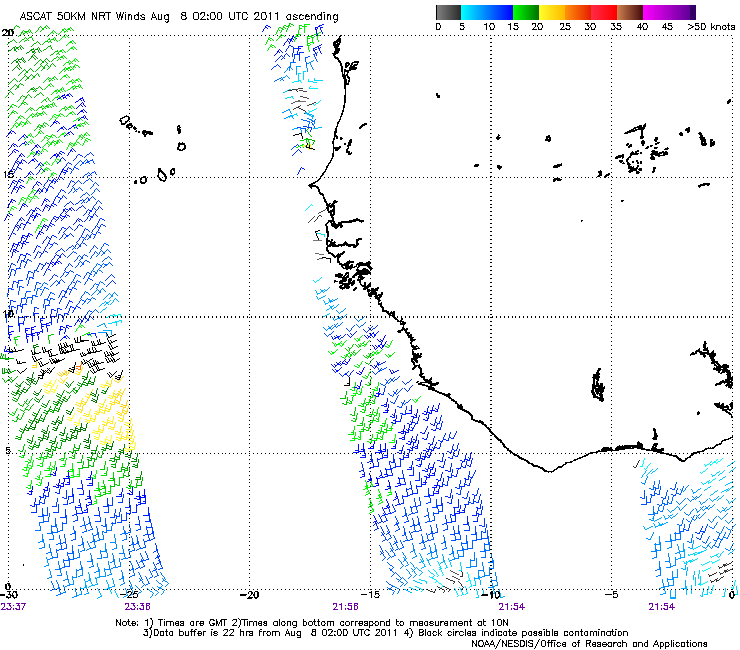
ASCAT did a pass at 2z08-08-2011 and the center of 92L looks a bit elongated around 8N-9N 27W-26W.

Image
0 likes   
The following post is NOT an official forecast and should not be used as such. It is just the opinion of the poster and may or may not be backed by sound meteorological data. It is NOT endorsed by any professional institution including storm2k.org For Official Information please refer to the NHC and NWS products.

User avatar
Kohlecane
Category 2
Category 2
Posts: 566
Age: 32
Joined: Sun Jul 31, 2011 11:03 pm
Location: Beaufort, SC

Re: ATL: INVEST 92L - Discussion

#97 Postby Kohlecane » Sun Aug 07, 2011 11:12 pm

Link for GFS loops/models
0 likes   
Once I see the REDS and GREENS Converge on a Base Velocity. ... I'm There!!

This is NOT an Official Forecast....Just my Opinion. For official information, please refer to the NHC and NWS products.
HIGHLIGHTS : '13 El Reno Tornado : 2013 Storm Chaser Tour, Joaquin; SC flood event, Matthew '16, Lowcountry Snow storm Jan '18

User avatar
ROCK
Category 5
Category 5
Posts: 9254
Age: 53
Joined: Tue Aug 17, 2004 7:30 am
Location: Kemah, Texas

Re: Re:

#98 Postby ROCK » Sun Aug 07, 2011 11:33 pm

wxman57 wrote:
LaBreeze wrote:I just don't see a Katrina or Rita type of track with this hold that the High pressure has on us. It will be our saving grace from hurricanes and storms, but certainly not from the drought and heat!


Yep, I agree. If it reaches the NW Caribbean then a west track toward Mexico or perhaps the lower TX coast would be possible, but that ridge should hold firm over SE TX/LA/MS.


for 2 weeks this ridge is going to hold firm? we shall see....I have doubts...
0 likes   

User avatar
ROCK
Category 5
Category 5
Posts: 9254
Age: 53
Joined: Tue Aug 17, 2004 7:30 am
Location: Kemah, Texas

Re: ATL: INVEST 92L - Models

#99 Postby ROCK » Sun Aug 07, 2011 11:36 pm

18z NOGAPS- approaching the islands at 180hr

https://www.fnmoc.navy.mil/wxmap_cgi/cg ... t=Tropical
0 likes   

User avatar
ROCK
Category 5
Category 5
Posts: 9254
Age: 53
Joined: Tue Aug 17, 2004 7:30 am
Location: Kemah, Texas

Re: ATL: INVEST 92L - Models

#100 Postby ROCK » Sun Aug 07, 2011 11:40 pm

0Z GFS- ridge placement - curious vortex showing up at the 500mb level...and 850mb

http://www.nco.ncep.noaa.gov/pmb/nwprod ... 0_180l.gif


http://www.nco.ncep.noaa.gov/pmb/nwprod ... v_180l.gif
0 likes   


Return to “2011”

Who is online

Users browsing this forum: No registered users and 3 guests