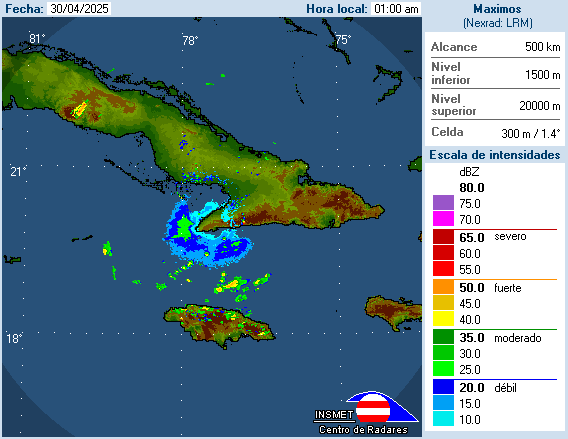
SouthDadeFish wrote:Anyone know the Jamaican radar site? I googled it but the website I found isn't displaying anything.
The radar is not working, I already was trying to find it
Moderator: S2k Moderators


SouthDadeFish wrote:Anyone know the Jamaican radar site? I googled it but the website I found isn't displaying anything.


SouthDadeFish wrote:Anyone know the Jamaican radar site? I googled it but the website I found isn't displaying anything.


KWT wrote:These broad systems tend to be a bit of a pain for the models, esp when you have such a broad gyre present.
just a wait and see job now!
Code: Select all
The posts in this forum are NOT official forecast and should not be used as such. They are just the opinion of the poster and may or may not be backed by sound meteorological data. They are NOT endorsed by any professional institution or storm2k.org. For official information, please refer to the NHC and NWS products. 


Macrocane wrote::uarrow: Yep, monsoon gyres/troughs take longer to develop, sometimes they may look well organized but they're too broad to be considered tropical cyclones, remember Nicole last year? it was very hard to find a LLC there were several small circulations rotating around a bigger one and I think that even the NHC doubts it was a tropical storm. Anyway I think that we may see a TD by Sunday if the trend continues.

Users browsing this forum: No registered users and 14 guests


