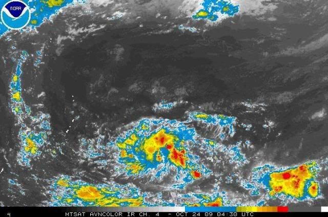
AN AREA OF CONVECTION HAS PERSISTED NEAR 6.2N 162.6E,
APPROXIMATELY 275 NM EAST-SOUTHEAST OF POHNPEI. ANIMATED
MULTISPECTRAL SATELLITE IMAGERY SHOWS A BROAD AREA OF CIRCULATION
WITH PERSISTENT CONVECTION HAS DEVELOPED OVER THE PAST 12 HOURS. A
221910Z QUIKSCAT PASS SHOWED THE CIRCULATION IS LOCATED IN THE
EASTERN EXTENT OF THE MONSOON TROUGH WITH UNFLAGGED WINDS BETWEEN 10
TO 15 KNOTS. THE QUIKSCAT PASS ALSO SHOWS THAT THE LOW LEVEL
CIRCULATION CENTER (LLCC) REMAINS ELONGATED ALONG AN EAST-WEST AXIS.
A WESTERLY WIND BURST LOCATED ALONG THE EQUATOR IS ENHANCING THE
WESTERLY FLOW ALONG THE SOUTHERN PORTION OF THE LLCC. UPPER LEVEL
ANALYSIS INDICATES THE LLCC IS LOCATED UNDER A REGION OF FAVORABLE
DIVERGENCE, HOWEVER VERTICAL WIND SHEAR (VWS) IS ALSO MODERATE TO
HIGH IN THE VICINITY OF THE LLCC. MAXIMUM SUSTAINED SURFACE WINDS
ARE ESTIMATED AT 10 TO 15 KNOTS. MINIMUM SEA LEVEL PRESSURE IS
ESTIMATED TO BE NEAR 1008 MB. BASED ON THE LLCC STILL ATTEMPTING TO
ORGANIZE AND THE MODERATE TO HIGH VWS, THE POTENTIAL FOR THE
DEVELOPMENT OF A SIGNIFICANT TROPICAL CYCLONE WITHIN THE NEXT 24
HOURS IS POOR.