NW Australia: BILLY - Tropical Cyclone: Discussion

Moderator: S2k Moderators

Message
Author
User avatar
HURAKAN
Professional-Met
Professional-Met
Posts: 46086
Age: 37
Joined: Thu May 20, 2004 4:34 pm
Location: Key West, FL
Contact:

#21 Postby HURAKAN » Thu Dec 18, 2008 7:04 pm

Australian Government Bureau of Meteorology
Northern Territory
Darwin Regional Forecasting Centre

TOP PRIORITY FOR IMMEDIATE BROADCAST

Media: The Standard Emergency Warning Signal should NOT be used with this
warning.

TROPICAL CYCLONE WARNING

TROPICAL CYCLONE ADVICE NUMBER 10
Issued by the BUREAU OF METEOROLOGY, DARWIN
at 8:00 am CST [7:30 am WDT] Friday 19 December 2008

A Cyclone WARNING continues for coastal communities from Kalumburu in WA to Port
Keats in the NT.

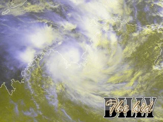
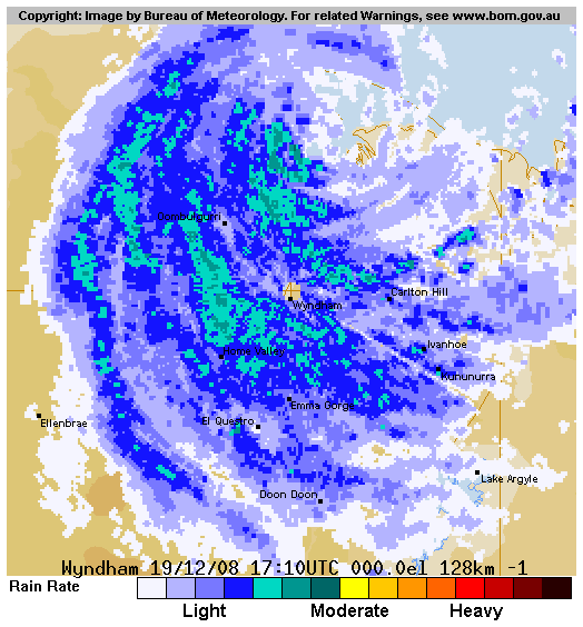
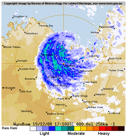
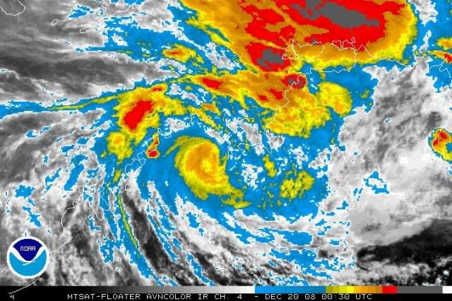
At 6:30 am CST [6:00 am WDT] Tropical Cyclone Billy, Category 1 was estimated to
be 130 kilometres northeast of Wyndham and 85 kilometres west southwest of Port
Keats, moving southeast at 2 kilometres per hour, but is expected to begin
moving towards the southwest later.

The cyclone may intensify further before landfall.

Tropical Cyclone Billy is expected to cross the coast between Wyndham and the
NT/WA border later today.

GALES with gusts to 110 kilometres per hour are expected to affect coastal areas
between Kalumburu and Port Keats this morning and may increase to DESTRUCTIVE
WINDS with gusts to 140 kilometres per hour later in the afternoon. GALES may
extend further inland in the east Kimberley region later today or early
Saturday.

Abnormally high tides could cause minor flooding at the coast between Wyndham
and Port Keats later today.

Widespread heavy rainfall is likely over the southern Darwin-Daly district, the
northern Victoria River district and northern parts of the Kimberley over the
next 3 days. Significant stream rises and local flooding are expected in these
areas today, extending westwards to the north Kimberley over the weekend.

Details of Tropical Cyclone Billy at 6:30 am CST [6:00 am WDT]:
.Centre located near...... 14.5 degrees South 128.8 degrees East
.Location accuracy........ within 28 kilometres
.Recent movement.......... towards the southeast at 2 kilometres per hour
.Wind gusts near centre... 120 kilometres per hour
.Severity category........ 1
.Central pressure......... 988 hectoPascals

The next advice will be issued by 11:00 am CST Friday 19 December [10:30 am WDT
Friday 19 December].

This advice is available on telephone NT-1300 659 211 and WA-1300 659 210

DARWIN Tropical Cyclone Warning Centre

MEDIA: the following message is only for broadcast in Western Australia

FESA-State Emergency Service advises of the following community alerts:

A YELLOW ALERT is current between the NT/WA border and Kalumburu, including the
communities of Wyndham, Kununurra, Oombulgurri and Kalumburu. People in or near
these communities should start taking precautions.

Image
0 likes   

CrazyC83
Professional-Met
Professional-Met
Posts: 33397
Joined: Tue Mar 07, 2006 11:57 pm
Location: Deep South, for the first time!

#22 Postby CrazyC83 » Thu Dec 18, 2008 7:36 pm

Seems to be strengthening ahead of landfall...
0 likes   

User avatar
HURAKAN
Professional-Met
Professional-Met
Posts: 46086
Age: 37
Joined: Thu May 20, 2004 4:34 pm
Location: Key West, FL
Contact:

#23 Postby HURAKAN » Thu Dec 18, 2008 10:32 pm

Image

WTXS32 PGTW 190300
MSGID/GENADMIN/NAVMARFCSTCEN PEARL HARBOR HI/JTWC//
SUBJ/TROPICAL CYCLONE 05S (BILLY) WARNING NR 002//
RMKS/
1. TROPICAL CYCLONE 05S (BILLY) WARNING NR 002
02 ACTIVE TROPICAL CYCLONES IN SOUTHIO
MAX SUSTAINED WINDS BASED ON ONE-MINUTE AVERAGE
---
WARNING POSITION:
190000Z --- NEAR 14.7S 128.8E
MOVEMENT PAST SIX HOURS - 225 DEGREES AT 01 KTS
POSITION ACCURATE TO WITHIN 060 NM
POSITION BASED ON CENTER LOCATED BY SATELLITE
PRESENT WIND DISTRIBUTION:
MAX SUSTAINED WINDS - 045 KT, GUSTS 055 KT
WIND RADII VALID OVER OPEN WATER ONLY
RADIUS OF 034 KT WINDS - 040 NM NORTHEAST QUADRANT
050 NM SOUTHEAST QUADRANT
045 NM SOUTHWEST QUADRANT
040 NM NORTHWEST QUADRANT
REPEAT POSIT: 14.7S 128.8E
---
FORECASTS:
12 HRS, VALID AT:
191200Z --- 14.9S 128.2E
MAX SUSTAINED WINDS - 050 KT, GUSTS 065 KT
WIND RADII VALID OVER OPEN WATER ONLY
RADIUS OF 034 KT WINDS - 045 NM NORTHEAST QUADRANT
055 NM SOUTHEAST QUADRANT
050 NM SOUTHWEST QUADRANT
045 NM NORTHWEST QUADRANT
VECTOR TO 24 HR POSIT: 255 DEG/ 04 KTS
---
24 HRS, VALID AT:
200000Z --- 15.1S 127.4E
MAX SUSTAINED WINDS - 035 KT, GUSTS 045 KT
WIND RADII VALID OVER OPEN WATER ONLY
DISSIPATING AS A SIGNIFICANT TROPICAL CYCLONE OVER LAND
VECTOR TO 36 HR POSIT: 260 DEG/ 05 KTS
---
36 HRS, VALID AT:
201200Z --- 15.3S 126.3E
MAX SUSTAINED WINDS - 030 KT, GUSTS 040 KT
WIND RADII VALID OVER OPEN WATER ONLY
DISSIPATED AS A SIGNIFICANT TROPICAL CYCLONE OVER LAND
---
REMARKS:
190300Z POSITION NEAR 14.7S 128.6E.
TROPICAL CYCLONE (TC) 05S (BILLY), LOCATED APPROXIMATELY 175 NM
SOUTHWEST OF DARWIN, AUSTRALIA, HAS REMAINED QUASISTATIONARY OVER
THE PAST 06 HOURS. TC 05S HAS MEANDERED AROUND THE SOUTHERN JOSEPH
BONAPARTE GULF DURING THE PAST 12 HOURS AS THE PRIMARY STEERING
INFLUENCE SHIFTS FROM A NEAR EQUATORIAL RIDGE TO THE NORTHEAST TO A
SUBTROPICAL RIDGE BUILDING ALONG THE POLEWARD SIDE OF THE SYSTEM.
THE CYCLONE WILL SOON BEGIN TO ACCELERATE WESTWARD AS THIS
SUBTROPICAL RIDGING BUILDS. RECENT ANIMATED MULTISPECTRAL AND WATER
VAPOR SATELLITE IMAGERY AND RADAR DATA FROM WYNDHAM SHOW A MARKED
INCREASE IN DEEP CONVECTION AND IMPROVED ORGANIZATION OF THE LOW
LEVEL CIRCULATION CENTER. FAVORABLE POLEWARD OUTFLOW AND PASSAGE
OVER FAVORABLY WARM WATER WILL ALLOW THE CURRENT INTENSIFICATION
TREND TO CONTINUE PRIOR TO LANDFALL. HOWEVER, THE RATE OF
INTENSIFICATION WILL LIKELY BE LIMITED BY LAND INTERACTION ALONG THE
WESTERN AND SOUTHERN PERIPHERIES OF THE LOW LEVEL CIRCULATION
CENTER. AS THE CYCLONE MOVES INLAND AFTER TAU 12, STEADY DISSIPATION
WILL OCCUR. MAXIMUM SIGNIFICANT WAVE HEIGHT AT 190000Z IS 10 FEET.
NEXT WARNINGS AT 191500Z AND 200300Z. REFER TO TROPICAL CYCLONE 04S
(CINDA) WARNINGS (WTXS31 PGTW) FOR TWELVE-HOURLY UPDATES.//
0 likes   

User avatar
HURAKAN
Professional-Met
Professional-Met
Posts: 46086
Age: 37
Joined: Thu May 20, 2004 4:34 pm
Location: Key West, FL
Contact:

#24 Postby HURAKAN » Thu Dec 18, 2008 10:41 pm

Image
0 likes   

User avatar
HURAKAN
Professional-Met
Professional-Met
Posts: 46086
Age: 37
Joined: Thu May 20, 2004 4:34 pm
Location: Key West, FL
Contact:

#25 Postby HURAKAN » Thu Dec 18, 2008 11:56 pm

Image

Eye-like feature.
0 likes   

Sanibel
Category 5
Category 5
Posts: 10348
Joined: Mon Aug 30, 2004 11:06 pm
Location: Offshore SW Florida

Re: NW Australia: BILLY - Tropical Cyclone: Discussion

#26 Postby Sanibel » Fri Dec 19, 2008 1:10 am

That's cool! I see the eye too. Excellent near-shore developer.
0 likes   

User avatar
Chacor
Category 5
Category 5
Posts: 10229
Joined: Mon Oct 02, 2006 10:43 pm
Location: Singapore

#27 Postby Chacor » Fri Dec 19, 2008 3:35 am

AXAU01 ADRM 190805
IDD20020
TROPICAL CYCLONE TECHNICAL BULLETIN: AUSTRALIA - NORTHERN REGION
Issued by DARWIN TROPICAL CYCLONE WARNING CENTRE
at: 0804 UTC 19/12/2008
Name: Billy
Data At: 0600 UTC
Latitude: 14.5S
Longitude: 128.7E
Location Accuracy: within 15 nm [28 km]
Movement Towards: southwest [235 deg]
Speed of Movement: 1 knots [2 km/h]
Maximum 10-Minute Wind: 50 knots [95 km/h]
Maximum 3-Second Wind Gust: 70 knots [130 km/h]
Central Pressure: 983 hPa
Radius of 34-knot winds NE quadrant: 40 nm [75 km]
Radius of 34-knot winds SE quadrant: 40 nm [75 km]
Radius of 34-knot winds SW quadrant: 40 nm [75 km]
Radius of 34-knot winds NW quadrant: 40 nm [75 km]
Radius of 48-knot winds NE quadrant: 20 nm [37 km]
Radius of 48-knot winds SE quadrant: 20 nm [37 km]
Radius of 48-knot winds SW quadrant: 20 nm [37 km]
Radius of 48-knot winds NW quadrant: 20 nm [37 km]
Radius of 64-knot winds:
Radius of Maximum Winds:
Dvorak Intensity Code: T3.5/3.5/D1.0/24HRS
Pressure of outermost isobar: 1002 hPa
Radius of outermost closed isobar: 90 nm [165 km]
Storm Depth: Deep
FORECAST DATA
Date/Time : Location : Loc. Accuracy: Max Wind : Central Pressure
[UTC] : degrees : nm [km]: knots[km/h]: hPa
+12: 19/1800: 14.8S 128.4E: 045 [085]: 050 [095]: 984
+24: 20/0600: 15.0S 127.6E: 075 [140]: 035 [065]: 994
+36: 20/1800: 15.2S 126.8E: 110 [200]: 035 [065]: 994
+48: 21/0600: 15.5S 125.9E: 140 [260]: 030 [055]: 996
+60: 21/1800: 15.8S 125.1E: 190 [350]: 030 [055]: 997
+72: 22/0600: 16.4S 124.0E: 235 [435]: 030 [055]: 997
REMARKS:
Tropical Cyclone 'Billy' is moving slowly west southwest. Dvorak analysis at
0600 UTC based on central dense overcast pattern with radar-derived LLCC centred
under area of deep cold cloud. FT based on DT=3.5 MET=3.5. It is expected to
continue moving towards the southwest under the influence of a mid-level ridge
to the southwest.
==
The next bulletin for this system will be issued by: 19/1330 UTC by Darwin TCWC.
0 likes   

User avatar
HURAKAN
Professional-Met
Professional-Met
Posts: 46086
Age: 37
Joined: Thu May 20, 2004 4:34 pm
Location: Key West, FL
Contact:

#28 Postby HURAKAN » Fri Dec 19, 2008 8:58 am

UW - CIMSS
ADVANCED DVORAK TECHNIQUE
ADT-Version 7.2.3
Tropical Cyclone Intensity Algorithm

----- Current Analysis -----
Date : 19 DEC 2008 Time : 120000 UTC
Lat : 14:49:28 S Lon : 128:08:01 E

CI# /Pressure/ Vmax
3.5 / 986.8mb/ 55.0kt

Final T# Adj T# Raw T#
(3hr avg)
3.5 3.6 3.6

Latitude bias adjustment to MSLP : +2.8mb

Center Temp : -82.4C Cloud Region Temp : -80.5C

Scene Type : UNIFORM CDO CLOUD REGION

Positioning Method : LINEAR EXTRAPOLATION

Ocean Basin : INDIAN
Dvorak CI > MSLP Conversion Used : PACIFIC

Tno/CI Rules : Constraint Limits : NO LIMIT
Weakening Flag : OFF
Rapid Dissipation Flag : OFF
0 likes   

User avatar
Chacor
Category 5
Category 5
Posts: 10229
Joined: Mon Oct 02, 2006 10:43 pm
Location: Singapore

#29 Postby Chacor » Fri Dec 19, 2008 8:59 am

AXAU01 ADRM 191318
IDD20020
TROPICAL CYCLONE TECHNICAL BULLETIN: AUSTRALIA - NORTHERN REGION
Issued by DARWIN TROPICAL CYCLONE WARNING CENTRE
at: 1318 UTC 19/12/2008
Name: Billy
Data At: 1200 UTC
Latitude: 14.6S
Longitude: 128.6E
Location Accuracy: within 15 nm [28 km]
Movement Towards: south southwest [213 deg]
Speed of Movement: 1 knots [1 km/h]
Maximum 10-Minute Wind: 50 knots [95 km/h]
Maximum 3-Second Wind Gust: 70 knots [130 km/h]
Central Pressure: 982 hPa
Radius of 34-knot winds NE quadrant: 60 nm [110 km]
Radius of 34-knot winds SE quadrant: 40 nm [75 km]
Radius of 34-knot winds SW quadrant: 40 nm [75 km]
Radius of 34-knot winds NW quadrant: 60 nm [110 km]
Radius of 48-knot winds NE quadrant: 20 nm [37 km]
Radius of 48-knot winds SE quadrant: 20 nm [37 km]
Radius of 48-knot winds SW quadrant: 20 nm [37 km]
Radius of 48-knot winds NW quadrant: 20 nm [37 km]
Radius of 64-knot winds:
Radius of Maximum Winds:
Dvorak Intensity Code: D3.5/3.5/D0.5/24HRS
Pressure of outermost isobar: 1002 hPa
Radius of outermost closed isobar: 70 nm [130 km]
Storm Depth: Deep
FORECAST DATA
Date/Time : Location : Loc. Accuracy: Max Wind : Central Pressure
[UTC] : degrees : nm [km]: knots[km/h]: hPa
+12: 20/0000: 14.8S 128.1E: 045 [085]: 050 [090]: 985
+24: 20/1200: 14.9S 127.2E: 075 [140]: 030 [060]: 994
+36: 21/0000: 14.8S 126.7E: 110 [200]: 025 [045]: 998
+48: 21/1200: 14.9S 125.9E: 140 [260]: 030 [050]: 997
+60: 22/0000: 15.1S 124.8E: 190 [350]: 030 [055]: 996
+72: 22/1200: 15.9S 123.7E: 235 [435]: 035 [065]: 993
REMARKS:
Tropical Cyclone 'Billy' has remained near stationary for the past 6 hours and
has tightly wrapped spiral banding evident on Wyndham radar. Animated IR
satellite imagery shows persistent cold dense cloud over the system centre and
symmetric outflow. Dvorak analysis at 1200 UTC based on MET=3.5 and PAT=3.5. The
cyclone is forecast to commence a SW or W drift early Saturday under the
influence of a strengthening mid-level ridge to the southwest. A consensus of
NWP forecasts indicates weakening during passage across the north Kimberley then
redevelopment off the west Kimberley coast between 48 and 72 hours.
==
The next bulletin for this system will be issued by: 19/1930 UTC by Darwin TCWC.
0 likes   

User avatar
HURAKAN
Professional-Met
Professional-Met
Posts: 46086
Age: 37
Joined: Thu May 20, 2004 4:34 pm
Location: Key West, FL
Contact:

#30 Postby HURAKAN » Fri Dec 19, 2008 9:00 am

Australian Government Bureau of Meteorology
Northern Territory
Darwin Regional Forecasting Centre

TOP PRIORITY FOR IMMEDIATE BROADCAST

Media: The Standard Emergency Warning Signal should NOT be used with this
warning.

TROPICAL CYCLONE WARNING

TROPICAL CYCLONE ADVICE NUMBER 15
Issued by the BUREAU OF METEOROLOGY, DARWIN
at 11:11 pm CST [10:41 pm WDT] Friday 19 December 2008

A Cyclone WARNING continues for coastal areas from Mitchell Plateau in WA to
Port Keats in NT.
A Cyclone WATCH continues for coastal and island areas from Cockatoo Island to
Mitchell Plateau.

At 9:30 pm CST [9:00 pm WDT] Tropical Cyclone Billy, Category 2 was estimated to
be 115 kilometres north northeast of Wyndham and 105 kilometres west southwest
of Port Keats, slow moving. The cyclone may intensify further before landfall.

The destructive core of Tropical Cyclone Billy is expected to cross the coast
north of Wyndham during Saturday morning.

DESTRUCTIVE WINDS with gusts to 140 kilometres per hour are expected to affect
coastal areas north of Wyndham tonight and Saturday morning.

GALES with gusts to 110 kilometres per hour are currently being experienced on
the coast of the southern Joseph Boneparte Gulf and are expected to extend west
to the Mitchell Plateau during Saturday.

The cyclone is expected to temporaily weaken later on Saturday as it crosses the
north Kimberley region.

Gales may redevelop between Kalumburu and Cockatoo Island late in the weekend if
the low moves off the west Kimberley coast.

Abnormally high tides could cause minor flooding at the coast between Kalumburu
and Port Keats tonight and on Saturday.

Widespread heavy rainfall is likely over the southern Darwin-Daly district, the
northern Victoria River district and northern parts of the Kimberley over the
next 3 days. Significant stream rises and local flooding are expected in these
areas today, extending westwards to the north Kimberley over the weekend.

Details of Tropical Cyclone Billy at 9:30 pm CST [9:00 pm WDT]:
.Centre located near...... 14.6 degrees South 128.6 degrees East
.Location accuracy........ within 28 kilometres
.Recent movement.......... slow moving
.Wind gusts near centre... 130 kilometres per hour
.Severity category........ 2
.Central pressure......... 982 hectoPascals

The next advice will be issued by 2:00 am CST Saturday 20 December [1:30 am WDT
Saturday 20 December].

This advice is available on telephone NT-1300 659 211 and WA-1300 659 210

DARWIN Tropical Cyclone Warning Centre


MEDIA: the following message is only for broadcast in Western Australia

FESA-State Emergency Service advises of the following community alerts:

A RED ALERT has been declared for Wyndham to Kalumburu, including Wyndham,
Oombulgurri, Kalumburu and surrounding communities. People in or near these
communities should move to shelter.

A YELLOW ALERT is current for Kununurra and surrounding communities. People in
or near Kununurra should be taking action in preparation for the cyclone's
arrival.

A BLUE ALERT is current for Mitchell Plateau area and surrounding communities.
People in or near these communities should start taking precautions.
0 likes   

User avatar
HURAKAN
Professional-Met
Professional-Met
Posts: 46086
Age: 37
Joined: Thu May 20, 2004 4:34 pm
Location: Key West, FL
Contact:

#31 Postby HURAKAN » Fri Dec 19, 2008 9:41 am

Image
0 likes   

User avatar
HURAKAN
Professional-Met
Professional-Met
Posts: 46086
Age: 37
Joined: Thu May 20, 2004 4:34 pm
Location: Key West, FL
Contact:

Re: Australia: BILLY - Tropical Cyclone: Discussion - Landfall

#32 Postby HURAKAN » Fri Dec 19, 2008 12:07 pm

Australian Government Bureau of Meteorology
Northern Territory
Darwin Regional Forecasting Centre

TOP PRIORITY FOR IMMEDIATE BROADCAST

Media: The Standard Emergency Warning Signal should NOT be used with this
warning.

TROPICAL CYCLONE WARNING

TROPICAL CYCLONE ADVICE NUMBER 16
Issued by the BUREAU OF METEOROLOGY, DARWIN
at 2:00 am CST [1:30 am WDT] Saturday 20 December 2008

A Cyclone WARNING continues for coastal areas from Mitchell Plateau in WA to
Port Keats in NT.
A Cyclone WATCH continues for coastal and island areas from Cockatoo Island to
Mitchell Plateau.

At 12:30 am CST [12:00 am WDT] Tropical Cyclone Billy, Category 2, was estimated
to be 80 kilometres north northeast of Wyndham and 135 kilometres west southwest
of Port Keats, moving southwest at 8 kilometres per hour.

The destructive core of Tropical Cyclone Billy is currently crossing the coast
north of Wyndham.


DESTRUCTIVE WINDS with gusts to 130 kilometres per hour currently being
experienced within 35 kilometres of the cyclone centre will extend further
inland during the morning and weaken slowly.

GALES with gusts to 100 kilometres per hour currently being experienced
elsewhere along the coast of the southern Joseph Bonaparte Gulf are expected to
extend west to Mitchell Plateau later on Saturday.

The cyclone is expected to weaken into a tropical low by Saturday night as it
crosses the north Kimberley region but may redevelop into a tropical cyclone
late in the weekend if it moves off the west Kimberley coast, causing gales
between Kalumburu and Cockatoo Island.

Abnormally high tides could cause minor flooding at the coast between Kalumburu
and Port Keats on Saturday.

Widespread heavy rainfall is likely over the southern Darwin-Daly District, the
northern Victoria River District and northern parts of the Kimberley over the
next 3 days. Significant stream rises and local flooding are expected in these
areas today, extending westwards to the north Kimberley over the weekend.

Details of Tropical Cyclone Billy at 12:30 am CST [12:00 am WDT]:
.Centre located near...... 14.8 degrees South 128.4 degrees East
.Location accuracy........ within 28 kilometres
.Recent movement.......... towards the southwest at 8 kilometres per hour
.Wind gusts near centre... 130 kilometres per hour
.Severity category........ 2
.Central pressure......... 984 hectoPascals

The next advice will be issued by 5:00 am CST Saturday 20 December [4:30 am WDT
Saturday 20 December].

This advice is available on telephone NT-1300 659 211 and WA-1300 659 210

DARWIN Tropical Cyclone Warning Centre

MEDIA: the following message is only for broadcast in Western Australia

FESA-State Emergency Service advises of the following community alerts:

A RED ALERT has been declared for Wyndham to Kalumburu, including Wyndham,
Oombulgurri, Kalumburu and surrounding communities. People in or near these
communities should move to shelter.

A YELLOW ALERT is current for Kununurra and surrounding communities. People in
or near Kununurra should be taking action in preparation for the cyclone's
arrival.

A BLUE ALERT is current for Mitchell Plateau area and surrounding communities.
People in or near these communities should start taking precautions.
0 likes   

User avatar
HURAKAN
Professional-Met
Professional-Met
Posts: 46086
Age: 37
Joined: Thu May 20, 2004 4:34 pm
Location: Key West, FL
Contact:

#33 Postby HURAKAN » Fri Dec 19, 2008 12:16 pm

Image

Image
0 likes   

Sanibel
Category 5
Category 5
Posts: 10348
Joined: Mon Aug 30, 2004 11:06 pm
Location: Offshore SW Florida

Re: Australia: BILLY - Tropical Cyclone: Discussion - Landfall

#34 Postby Sanibel » Fri Dec 19, 2008 1:10 pm

That thing was on its way! If it had more time over water...


100kph is tropical storm force near 62mph.
0 likes   

User avatar
P.K.
Professional-Met
Professional-Met
Posts: 5149
Joined: Thu Sep 23, 2004 5:57 pm
Location: Watford, England
Contact:

Re: Australia: BILLY - Tropical Cyclone: Discussion - Landfall

#35 Postby P.K. » Fri Dec 19, 2008 2:18 pm

Making landfall now as a cat 2.

AXAU01 ADRM 191903
IDD20020
TROPICAL CYCLONE TECHNICAL BULLETIN: AUSTRALIA - NORTHERN REGION
Issued by DARWIN TROPICAL CYCLONE WARNING CENTRE
at: 1903 UTC 19/12/2008
Name: Billy
Data At: 1800 UTC
Latitude: 14.9S
Longitude: 128.1E
Location Accuracy: within 15 nm [28 km]
Movement Towards: west southwest [245 deg]
Speed of Movement: 6 knots [11 km/h]
Maximum 10-Minute Wind: 50 knots [95 km/h]
Maximum 3-Second Wind Gust: 70 knots [130 km/h]
Central Pressure: 986 hPa
Radius of 34-knot winds NE quadrant: 60 nm [110 km]
Radius of 34-knot winds SE quadrant: 40 nm [75 km]
Radius of 34-knot winds SW quadrant: 40 nm [75 km]
Radius of 34-knot winds NW quadrant: 60 nm [110 km]
Radius of 48-knot winds NE quadrant: 20 nm [37 km]
Radius of 48-knot winds SE quadrant: 20 nm [37 km]
Radius of 48-knot winds SW quadrant: 20 nm [37 km]
Radius of 48-knot winds NW quadrant: 20 nm [37 km]
Radius of 64-knot winds:
Radius of Maximum Winds:
Dvorak Intensity Code: T3.5/3.5/D0.5/24HRS
Pressure of outermost isobar: 1003 hPa
Radius of outermost closed isobar: 150 nm [280 km]
Storm Depth: Deep
FORECAST DATA
Date/Time : Location : Loc. Accuracy: Max Wind : Central Pressure
[UTC] : degrees : nm [km]: knots[km/h]: hPa
+12: 20/0600: 15.1S 127.5E: 045 [085]: 030 [055]: 997
+24: 20/1800: 15.4S 126.7E: 075 [140]: 025 [045]: 1000
+36: 21/0600: 15.5S 125.8E: 110 [200]: 025 [045]: 1000
+48: 21/1800: 15.7S 124.9E: 140 [260]: 025 [045]: 1000
+60: 22/0600: 16.2S 124.3E: 190 [345]: 030 [055]: 997
+72: 22/1800: 17.1S 122.7E: 235 [435]: 030 [055]: 999
REMARKS:
Tropical Cyclone 'Billy' has moved steadily WSW during the past 3-6 hours and is
now crossing the east Kimberley coast north of Wyndham. Tightly wrapped spiral
banding is evident on Wyndham radar and animated IR satellite imagery continues
to show persistent cold dense cloud over the LLCC. The central cold cover cloud
pattern indicates arrested development probably due to interaction with the
coast. Dvorak analysis at 1800 UTC based on MET/PAT=3.5. A consensus of NWP
forecasts indicates continued W or WSW movement across the Kimberley region.
There is the possibility of redevelopment off the west Kimberley coast between
48 and 72 hours, if the system maintains a generally WSW track..
==
The next bulletin for this system will be issued by: 20/0130 UTC by Darwin TCWC.
0 likes   

User avatar
HURAKAN
Professional-Met
Professional-Met
Posts: 46086
Age: 37
Joined: Thu May 20, 2004 4:34 pm
Location: Key West, FL
Contact:

#36 Postby HURAKAN » Fri Dec 19, 2008 8:27 pm

Image

Australian Government Bureau of Meteorology
Northern Territory
Darwin Regional Forecasting Centre

TOP PRIORITY FOR IMMEDIATE BROADCAST

Media: The Standard Emergency Warning Signal should NOT be used with this
warning.

TROPICAL CYCLONE WARNING

TROPICAL CYCLONE ADVICE NUMBER 18
Issued by the BUREAU OF METEOROLOGY, DARWIN
at 8:00 am CST [7:30 am WDT] Saturday 20 December 2008

A Cyclone WARNING continues for coastal and island areas from Mitchell Plateau
in WA to Port Keats in the NT.
A Cyclone WATCH continues for coastal and island areas from Cockatoo Island to
Mitchell Plateau.

At 6:30 am CST [6:00 am WDT] Tropical Cyclone Billy, Category 2 was estimated to
be 65 kilometres north northwest of Wyndham and 180 kilometres west southwest of
Port Keats, moving west southwest at 7 kilometres per hour.

The destructive core of Tropical Cyclone Billy is currently crossing the coast
north of Wyndham.

DESTRUCTIVE WINDS with gusts to 130 kilometres per hour currently being
experienced within 25 kilometres of the cyclone centre will extend further
inland during the morning and weaken.

GALES with gusts to 100 kilometres per hour currently being experienced
elsewhere along the coast of the southern Joseph Bonaparte Gulf are expected to
extend west to Mitchell Plateau later today.

The cyclone is expected to weaken into a tropical low by tonight as it crosses
the north Kimberley region, but may redevelop into a tropical cyclone late in
the weekend if it moves off the west Kimberley coast, causing gales between
Kalumburu and Cockatoo Island.

Abnormally high tides could cause minor flooding at the coast between Kalumburu
and Port Keats today.

Widespread heavy rainfall is likely over the southern Darwin-Daly district, the
northern Victoria River district and northern parts of the Kimberley over the
next 2 to 3 days. Significant stream rises and local flooding are expected in
these areas today, extending westwards across the north Kimberley later today.

Details of Tropical Cyclone Billy at 6:30 am CST [6:00 am WDT]:
.Centre located near...... 14.9 degrees South 128.0 degrees East
.Location accuracy........ within 37 kilometres
.Recent movement.......... towards the west southwest at 7 kilometres per hour
.Wind gusts near centre... 130 kilometres per hour
.Severity category........ 2
.Central pressure......... 987 hectoPascals

The next advice will be issued by 11:00 am CST Saturday 20 December [10:30 am
WDT Saturday 20 December].

This advice is available on telephone NT-1300 659 211 and WA-1300 659 210

DARWIN Tropical Cyclone Warning Centre

MEDIA: the following message is only for broadcast in Western Australia

FESA-State Emergency Service advises of the following community alerts:

A RED ALERT is current for Wyndham to Kalumburu, including Wyndham, Oombulgurri,
Kalumburu and surrounding communities. People in or near these communities
should move to shelter.

A YELLOW ALERT is current for Kununurra and surrounding communities. People in
or near Kununurra should be taking action in preparation for the cyclone's
arrival.

A BLUE ALERT is current for Mitchell Plateau area and surrounding communities.
People in or near these communities should start taking precautions.
0 likes   

User avatar
HURAKAN
Professional-Met
Professional-Met
Posts: 46086
Age: 37
Joined: Thu May 20, 2004 4:34 pm
Location: Key West, FL
Contact:

#37 Postby HURAKAN » Fri Dec 19, 2008 8:36 pm

Image
0 likes   

User avatar
HURAKAN
Professional-Met
Professional-Met
Posts: 46086
Age: 37
Joined: Thu May 20, 2004 4:34 pm
Location: Key West, FL
Contact:

#38 Postby HURAKAN » Fri Dec 19, 2008 11:57 pm

Australian Government Bureau of Meteorology
Northern Territory
Darwin Regional Forecasting Centre

TOP PRIORITY FOR IMMEDIATE BROADCAST

Media: The Standard Emergency Warning Signal should NOT be used with this
warning.

TROPICAL CYCLONE WARNING

TROPICAL CYCLONE ADVICE NUMBER 20
Issued by the BUREAU OF METEOROLOGY, DARWIN
at 2:00 pm CST [1:30 pm WDT] Saturday 20 December 2008

A Cyclone WARNING is current for coastal and island areas from Mitchell Plateau
to WA/NT Border.
A Cyclone WATCH is current for coastal and island areas from Beagle Bay to
Mitchell Plateau, NOT including Derby.

At 12:30 pm CST [12:00 pm WDT] Tropical Cyclone Billy, Category 1 was estimated
to be 75 kilometres northwest of Wyndham and 205 kilometres east of Mitchell
Plateau, moving west southwest at 7 kilometres per hour.

GALES with gusts to 100 kilometres per hour currently being experienced between
KALUMBURU to the NT/WA BORDER are expected to persist for the next few hours
then GRADUALLY EASE.

The cyclone is expected to weaken into a Tropical Low this afternoon as it
continues to move inland, but may redevelop into a Tropical Cyclone on Monday
if it moves off the west Kimberley coast, causing gales between KALUMBURU and
BEAGLE BAY [NOT including DERBY].

Widespread heavy rainfall is likely over the southern Darwin-Daly district, the
northern Victoria River district and northern parts of the Kimberley over the
next few days. Significant stream rises and local flooding are expected in these
areas today, extending westwards across the north Kimberley.

Details of Tropical Cyclone Billy at 12:30 pm CST [12:00 pm WDT]:
.Centre located near...... 15.0 degrees South 127.6 degrees East
.Location accuracy........ within 55 kilometres
.Recent movement.......... towards the west southwest at 7 kilometres per hour
.Wind gusts near centre... 100 kilometres per hour
.Severity category........ 1
.Central pressure......... 992 hectoPascals

The next advice will be issued by 5:00 pm CST Saturday 20 December [4:30 pm WDT
Saturday 20 December].

This advice is available on telephone NT-1300 659 211 and WA-1300 659 210

DARWIN Tropical Cyclone Warning Centre


Image
0 likes   

User avatar
HURAKAN
Professional-Met
Professional-Met
Posts: 46086
Age: 37
Joined: Thu May 20, 2004 4:34 pm
Location: Key West, FL
Contact:

#39 Postby HURAKAN » Fri Dec 19, 2008 11:58 pm

Australian Government Bureau of Meteorology
Western Australia

TROPICAL CYCLONE OUTLOOK FOR NORTHWESTERN AUSTRALIA
Issued at 2:00pm WDT on Friday the 19th of December 2008
For the area south of LATITUDE 10 SOUTH between LONGITUDES 110 - 125 EAST

A cyclone advice is current for Tropical Cyclone Billy, located in the Joseph
Bonaparte Gulf, outside the region. Over the weekend TC Billy is expected to
move west over land and weaken. It may move off the northwest Kimberley coast
into the region on Sunday or Monday and then redevelop. Please refer to the
latest cyclone advice.

Full details available from Bureau of Meteorology
Ph 1300 659 210 or visit http://www.bom.gov.au

There are no other significant tropical lows evident and the likelihood of a
tropical cyclone occurring in the region in the next three days is:
Saturday : Low
Sunday : Moderate
Monday : High

** NOTE: Development potential is an estimate of the probability of **
** tropical cyclone development within a 24 hour period. **
** LOW = 10% or less MODERATE = 20-40% HIGH = 50% or more **
0 likes   

User avatar
HURAKAN
Professional-Met
Professional-Met
Posts: 46086
Age: 37
Joined: Thu May 20, 2004 4:34 pm
Location: Key West, FL
Contact:

#40 Postby HURAKAN » Sat Dec 20, 2008 8:58 am

Australian Government Bureau of Meteorology
Northern Territory
Darwin Regional Forecasting Centre

TOP PRIORITY FOR IMMEDIATE BROADCAST

Media: The Standard Emergency Warning Signal should NOT be used with this
warning.

TROPICAL CYCLONE WARNING

TROPICAL CYCLONE ADVICE NUMBER 21
Issued by the BUREAU OF METEOROLOGY, DARWIN
at 5:11 pm CST [4:41 pm WDT] Saturday 20 December 2008

A Cyclone WARNING continues for Kalumburu to Mitchell Plateau and has been
declared for coastal and island areas from Mitchell Plateau to Cockatoo Island.
A Cyclone WATCH is now current for coastal and island areas from Broome to
Cockatoo Island.
The Cyclone WARNING from Kalumburu to WA/NT Border has been cancelled.

At 3:30 pm CST [3:00 pm WDT] Ex-Tropical Cyclone Billy was estimated to be over
land 100 kilometres west northwest of Wyndham and 175 kilometres east southeast
of Mitchell Plateau and moving west southwest at 11 kilometres per hour

TROPICAL CYCLONE Billy has weakened into a Tropical Low. Winds near the centre
have eased below gale force. The Tropical Low is expected to cross the north
Kimberley region and move off the west Kimberley coast later on Sunday. A
TROPICAL CYCLONE may redevelop overnight Sunday or on Monday causing GALES
between KALUMBURU and COCKATOO ISLAND.

Widespread heavy rainfall is likely over northern parts of the Kimberley over
the few days. Significant stream rises and local flooding are expected in these
areas today, extending westwards across the north Kimberley.

Details of Ex-Tropical Cyclone Billy at 3:30 pm CST [3:00 pm WDT]:
.Centre located near...... 15.1 degrees South 127.3 degrees East
.Location accuracy........ within 55 kilometres
.Recent movement.......... towards the west southwest at 11 kilometres per hour
.Wind gusts near centre... 85 kilometres per hour
.Severity category........ below cyclone intensity
.Central pressure......... 998 hectoPascals

The next advice will be issued from Perth TCWC by 8:00 pm CST Saturday 20
December [7:30 pm WDT Saturday 20 December].

This advice is available on telephone NT-1300 659 211 and WA-1300 659 210

DARWIN Tropical Cyclone Warning Centre

MEDIA: the following message is only for broadcast in Western Australia

FESA-State Emergency Service advises of the following community alerts:

ALL CLEAR WITH CAUTION: People in communities at WYNDHAM, OOMBULGURRI, KALUMBURU
and Mitchell Plateau area and surrounding communities are advised to proceed
with caution.


Image
0 likes   


Return to “2009”

Who is online

Users browsing this forum: No registered users and 9 guests