Ex Invest 90L

Moderator: S2k Moderators

Message
Author
User avatar
Gustywind
Category 5
Category 5
Posts: 12334
Joined: Mon Sep 03, 2007 7:29 am
Location: Baie-Mahault, GUADELOUPE

Re: ATL: Invest 90L SW of Cape Verde Islands

#81 Postby Gustywind » Sat Aug 02, 2008 3:20 pm

Nimbus wrote:Well if there is a 1010 mb low and the environment is semi favorable for development, I wonder how long it will be before they upgrade 90L to TD status?

:uarrow:
Yeah Nimbus that's a good question, i bet for Monday but if convection can be sustained like that why not for classification tommorow afternoon?!Who knows? The structure is nice compared to the recents waves flizzing in the same area, whereas this one is souther and has better or conducives conditions to bring something ...let's watch it....
0 likes   

RL3AO
Moderator-Pro Met
Moderator-Pro Met
Posts: 16308
Joined: Thu Jun 14, 2007 10:03 pm
Location: NC

#82 Postby RL3AO » Sat Aug 02, 2008 3:23 pm

New quikscat data should be here in an hour or so.
0 likes   

User avatar
cycloneye
Admin
Admin
Posts: 139492
Age: 67
Joined: Thu Oct 10, 2002 10:54 am
Location: San Juan, Puerto Rico

Re:

#83 Postby cycloneye » Sat Aug 02, 2008 3:23 pm

RL3AO wrote:New quikscat data should be here in an hour or so.


Lets see if this time it does not miss 90L.
0 likes   

User avatar
littlevince
S2K Supporter
S2K Supporter
Posts: 768
Joined: Fri Oct 21, 2005 10:45 am
Location: Portugal

Re: ATL: Invest 90L SW of Cape Verde Islands

#84 Postby littlevince » Sat Aug 02, 2008 3:27 pm

Last visible loop (1615-1945z)

Image
0 likes   

User avatar
HURAKAN
Professional-Met
Professional-Met
Posts: 46086
Age: 37
Joined: Thu May 20, 2004 4:34 pm
Location: Key West, FL
Contact:

#85 Postby HURAKAN » Sat Aug 02, 2008 3:55 pm

AL, 90, 2008080218, , BEST, 0, 115N, 296W, 25, 1009,
0 likes   

User avatar
wxmann_91
Category 5
Category 5
Posts: 8013
Age: 33
Joined: Fri Jul 15, 2005 2:49 pm
Location: Southern California
Contact:

Re:

#86 Postby wxmann_91 » Sat Aug 02, 2008 4:11 pm

cycloneye wrote:Losing visible as its getting dark in the Eastern Atlantic,but you can see how good 90L looks.

Image

That's a beautiful satellite image. Notice the little boundary running NW-SE... that separates the tropical, unstable airmass to the south and the SAL-filled, dry, stable air to the NE. You can actually see the haze associated with the Saharan dust.

Gustywind wrote:http://cimss.ssec.wisc.edu/tropic/real-time/wavetrak/winds/m8split.jpg
SAL does not seems a problem, ahead no SAL and surely a window of oportunity. If you look further east on Africa a new train of waves is slightly appearing :eek: interresting things to watch....

Waves can't outrun SAL...that's going to be a huge problem over the coming days for this Invest. The 12Z Dakar sounding shows the mid-level dry air well.
0 likes   

JonathanBelles
Professional-Met
Professional-Met
Posts: 11430
Age: 33
Joined: Sat Dec 24, 2005 9:00 pm
Location: School: Florida State University (Tallahassee, FL) Home: St. Petersburg, Florida
Contact:

#87 Postby JonathanBelles » Sat Aug 02, 2008 4:18 pm

I am a believer in MJO, and if nobody noticed there is a slight wet phase over the eastern two invests right now.
0 likes   

fasterdisaster
Category 5
Category 5
Posts: 1868
Joined: Mon Sep 19, 2005 4:41 pm
Location: Miami, Florida

#88 Postby fasterdisaster » Sat Aug 02, 2008 4:23 pm

Anyone else strangely reminded of Ivan by this thing?
0 likes   

User avatar
Gustywind
Category 5
Category 5
Posts: 12334
Joined: Mon Sep 03, 2007 7:29 am
Location: Baie-Mahault, GUADELOUPE

Re:

#89 Postby Gustywind » Sat Aug 02, 2008 4:26 pm

fasterdisaster wrote:Anyone else strangely reminded of Ivan by this thing?

Why do you say that ??? And Dean ??? :roll:
0 likes   

User avatar
Gustywind
Category 5
Category 5
Posts: 12334
Joined: Mon Sep 03, 2007 7:29 am
Location: Baie-Mahault, GUADELOUPE

Re: Re:

#90 Postby Gustywind » Sat Aug 02, 2008 4:29 pm

wxmann_91 wrote:
cycloneye wrote:Losing visible as its getting dark in the Eastern Atlantic,but you can see how good 90L looks.

Image

That's a beautiful satellite image. Notice the little boundary running NW-SE... that separates the tropical, unstable airmass to the south and the SAL-filled, dry, stable air to the NE. You can actually see the haze associated with the Saharan dust.

Gustywind wrote:http://cimss.ssec.wisc.edu/tropic/real-time/wavetrak/winds/m8split.jpg
SAL does not seems a problem, ahead no SAL and surely a window of oportunity. If you look further east on Africa a new train of waves is slightly appearing :eek: interresting things to watch....

Waves can't outrun SAL...that's going to be a huge problem over the coming days for this Invest. The 12Z Dakar sounding shows the mid-level dry air well.

I don't tkink that i have see worst SAL conditions i'm much more confident given the latest sat pic but if you're a pro met i believe you i'm just an amateur.... :) with untrained eyes :wink:
http://cimss.ssec.wisc.edu/tropic/real- ... 8split.jpg
0 likes   

User avatar
GeneratorPower
S2K Supporter
S2K Supporter
Posts: 1648
Age: 44
Joined: Sun Dec 18, 2005 11:48 pm
Location: Huntsville, AL

Re:

#91 Postby GeneratorPower » Sat Aug 02, 2008 4:31 pm

fasterdisaster wrote:Anyone else strangely reminded of Ivan by this thing?


Ivan was a classic Cape Verde system. Therefore any classic Cape Verde scenario at this point in the game could look like Ivan. That said, you are right.
0 likes   

fasterdisaster
Category 5
Category 5
Posts: 1868
Joined: Mon Sep 19, 2005 4:41 pm
Location: Miami, Florida

Re: Re:

#92 Postby fasterdisaster » Sat Aug 02, 2008 4:32 pm

GeneratorPower wrote:
fasterdisaster wrote:Anyone else strangely reminded of Ivan by this thing?


Ivan was a classic Cape Verde system. Therefore any classic Cape Verde scenario at this point in the game could look like Ivan. That said, you are right.


True, I was just referring to how low in latitude this thing is and it's still moving slightly south of west.
0 likes   

User avatar
MGC
S2K Supporter
S2K Supporter
Posts: 5795
Joined: Sun Mar 23, 2003 9:05 pm
Location: Pass Christian MS, or what is left.

Re: ATL: Invest 90L SW of Cape Verde Islands

#93 Postby MGC » Sat Aug 02, 2008 4:38 pm

Impressive satellite signature, however the dry air to its NE might get entrained into the circulation and evaporate this disturbance. I doubt it can outrun the dry air, the dry air is spreading west like a plague.....MGC
0 likes   

User avatar
GeneratorPower
S2K Supporter
S2K Supporter
Posts: 1648
Age: 44
Joined: Sun Dec 18, 2005 11:48 pm
Location: Huntsville, AL

Re: Re:

#94 Postby GeneratorPower » Sat Aug 02, 2008 4:41 pm

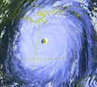
fasterdisaster wrote:True, I was just referring to how low in latitude this thing is and it's still moving slightly south of west.


Ivan began at about 9.7 deg N. This is clearly about 12-13 deg N. Now that's still plenty low, but Ivan was a good deal lower. Again, I think you're right about the movement and the classical Cape Verde look.

I like it when storms develop, and I'm encouraged to see it look as good as it does. The pro mets I'm reading don't seem to think that SAL behind the wave is going to be a big problem. If anything, any supression of the wave at this point will cause it to be steered by the low level flow and that should currently take it slightly south of due west. It could lose latitude.

In short, this has about as good a chance as most early season Cape Verde waves and it may very well develop. With the current high pressure over the south central U.S., anything entering the Gulf would seem to be steered more west than north. However, the high pressure currently in control over the southern U.S. probably won't be there in a week's time. It's been a pretty progressive pattern for the south this summer, and whatever is there now isn't likely to hang around long. We've had a lot of cool fronts penetrating deep into the south, the latest one all the way to the coast. That's not typical for a summer time pattern. Active and changeable seems to be norm so far. That said, I think steering of any potential Cape Verde systems is not as certain as it might usually be based on climatology for the time of year.

A very interesting tropical season is ahead, and I think also a very interesting winter storm season if the oddities continue.


Personal Forecast Disclaimer:
The posts in this forum are NOT official forecast and should not be used as such. They are just the opinion of the poster and may or may not be backed by sound meteorological data. They are NOT endorsed by any professional institution or storm2k.org. For official information, please refer to the NHC and NWS products.
0 likes   

User avatar
SouthFloridawx
S2K Supporter
S2K Supporter
Posts: 8344
Age: 45
Joined: Tue Jul 26, 2005 1:16 am
Location: Sarasota, FL
Contact:

Re: Re:

#95 Postby SouthFloridawx » Sat Aug 02, 2008 4:44 pm

Gustywind wrote:
wxmann_91 wrote:
cycloneye wrote:Losing visible as its getting dark in the Eastern Atlantic,but you can see how good 90L looks.

http://rammb.cira.colostate.edu/ramsdis ... al/427.JPG

That's a beautiful satellite image. Notice the little boundary running NW-SE... that separates the tropical, unstable airmass to the south and the SAL-filled, dry, stable air to the NE. You can actually see the haze associated with the Saharan dust.

Gustywind wrote:http://cimss.ssec.wisc.edu/tropic/real-time/wavetrak/winds/m8split.jpg
SAL does not seems a problem, ahead no SAL and surely a window of oportunity. If you look further east on Africa a new train of waves is slightly appearing :eek: interresting things to watch....

Waves can't outrun SAL...that's going to be a huge problem over the coming days for this Invest. The 12Z Dakar sounding shows the mid-level dry air well.

I don't tkink that i have see worst SAL conditions i'm much more confident given the latest sat pic but if you're a pro met i believe you i'm just an amateur.... :) with untrained eyes :wink:
http://cimss.ssec.wisc.edu/tropic/real- ... 8split.jpg


SAL
Image
0 likes   

User avatar
GeneratorPower
S2K Supporter
S2K Supporter
Posts: 1648
Age: 44
Joined: Sun Dec 18, 2005 11:48 pm
Location: Huntsville, AL

#96 Postby GeneratorPower » Sat Aug 02, 2008 5:05 pm

Man, I'm sorry, but looking at the GFS at 72 hours it looks like high pressure will keep this puppy WELL to the south if it develops. Now the GFS does NOT develop it at all, but it does forecast what looks to be a massive ridge to the north all the way to FL and beyond.

Image
0 likes   

User avatar
blp
Category 5
Category 5
Posts: 2807
Age: 45
Joined: Thu Sep 09, 2004 7:51 pm
Location: Miami, FL
Contact:

Re: Re:

#97 Postby blp » Sat Aug 02, 2008 5:28 pm

That looks like a good SAL surge :uarrow: ... I am wondering if the Globals are picking up on this and not forecasting development. I would think we would have some model support from the Globals by now. Oh well let's see what happens.....
0 likes   

User avatar
Matt-hurricanewatcher
Category 5
Category 5
Posts: 11649
Age: 38
Joined: Fri Nov 26, 2004 11:09 pm
Location: Portland,OR
Contact:

Re: Re:

#98 Postby Matt-hurricanewatcher » Sat Aug 02, 2008 5:35 pm

blp wrote:That looks like a good SAL surge :uarrow: ... I am wondering if the Globals are picking up on this and not forecasting development. I would think we would have some model support from the Globals by now. Oh well let's see what happens.....


The sal is really going to hurt its chances. Even now you can see the upper levels being forced east of the lower levels because of it. I would not watch for this to develop in the short term. Maybe after 35-40 west this could become something more.
0 likes   

User avatar
Extremeweatherguy
Category 5
Category 5
Posts: 11095
Joined: Mon Oct 10, 2005 8:13 pm
Location: Houston, TX

Re:

#99 Postby Extremeweatherguy » Sat Aug 02, 2008 5:35 pm

GeneratorPower wrote:Man, I'm sorry, but looking at the GFS at 72 hours it looks like high pressure will keep this puppy WELL to the south if it develops. Now the GFS does NOT develop it at all, but it does forecast what looks to be a massive ridge to the north all the way to FL and beyond.

Image


By the time this system reaches the central Caribbean in about a week, the 18z GFS shows a pretty significant trough starting to sink southward across the eastern United States. If this plays out, then the trough will likely erode the western edge of the ridge...

http://www.nco.ncep.noaa.gov/pmb/nwprod ... 0_168s.gif
0 likes   

User avatar
cycloneye
Admin
Admin
Posts: 139492
Age: 67
Joined: Thu Oct 10, 2002 10:54 am
Location: San Juan, Puerto Rico

Re: ATL: Invest 90L SW of Cape Verde Islands

#100 Postby cycloneye » Sat Aug 02, 2008 5:46 pm

Anyone who may have questions about 90L,can post them at the thread at Tropical Analysis forum,and the pro mets will answer them as soon as possible.

viewtopic.php?f=29&t=102254&p=1755410#p1755410
0 likes   


Return to “2008”

Who is online

Users browsing this forum: No registered users and 6 guests