Tropical Depression TEN: Discussions & Images
Moderator: S2k Moderators
-
Sean in New Orleans

- Category 5

- Posts: 1794
- Joined: Thu Aug 28, 2003 7:26 pm
- Location: New Orleans, LA 30.0N 90.0W
- Contact:


-
jaxfladude
- Category 5
- Posts: 1246
- Joined: Wed Aug 24, 2005 9:36 pm
- Location: Jacksonville, Fla
Re: Tropical Depression TEN: Discussions & Images,7 PM page 96
Well folks the season is now on the decline...for good reason....
0 likes
-
JonathanBelles
- Professional-Met

- Posts: 11430
- Age: 33
- Joined: Sat Dec 24, 2005 9:00 pm
- Location: School: Florida State University (Tallahassee, FL) Home: St. Petersburg, Florida
- Contact:
-
PTrackerLA

- Category 5
- Posts: 5248
- Age: 40
- Joined: Thu Oct 10, 2002 8:40 pm
- Location: Lafayette, LA
-
cycloneye

- Admin

- Posts: 139169
- Age: 67
- Joined: Thu Oct 10, 2002 10:54 am
- Location: San Juan, Puerto Rico
Re:
chadtm80 wrote:They still forecast it to be a TS.. Why then would they drop the TS warnings?
RADAR AND SURFACE OBSERVATIONS INDICATE THAT THE DEPRESSION HAS NOT
STRENGTHENED AND MAXIMUM SUSTAINED WINDS REMAIN NEAR 35 MPH...55
KM/HR...IN A FEW SQUALLS...WITH HIGHER GUSTS. A GRADUAL WEAKENING
SHOULD BEGIN TONIGHT AFTER THE CENTER MOVES FARTHER INLAND.
The above from the 7 PM CDT advisory.
0 likes
Re:
chadtm80 wrote:They still forecast it to be a TS.. Why then would they drop the TS warnings?
Since they don't issue forecasts at the intermediate. So the last forecast (at 5 pm) was forecasting a TS, but they must no longer be. I probably botched that sentence up somewhere, so the English majors can keep it to themselves.
0 likes
-
Sean in New Orleans
- Category 5
- Posts: 1794
- Joined: Thu Aug 28, 2003 7:26 pm
- Location: New Orleans, LA 30.0N 90.0W
- Contact:
Re:
chadtm80 wrote:They still forecast it to be a TS.. Why then would they drop the TS warnings?
Carl A. just came on and said it is dying..no TS. Forecast at 5:00 is now invalid. NHC has dropped all Tropical Storm warnings...I saw it on http://www.nhc.noaa.gov before the alert even came on the news. I think we can expect a pretty Saturday now in New Orleans with just scattered storms. Awesome. And no weather to effect LSU at 2:30. Hopefully this is it for the GOM this season.
0 likes
-
chadtm80
- Category 5
- Posts: 20381
- Age: 43
- Joined: Tue Oct 08, 2002 8:35 am
- Location: East Central Florida
- Contact:
Re: Re:
RL3AO wrote:chadtm80 wrote:They still forecast it to be a TS.. Why then would they drop the TS warnings?
Since they don't issue forecasts at the intermediate. So the last forecast (at 5 pm) was forecasting a TS, but they must no longer be. I probably botched that sentence up somewhere, so the English majors can keep it to themselves.
Thanks for the explanation.. However when you have a storm near/at landfall why oh why would they not updated the forecast at every update?
0 likes
-
miamicanes177
- Category 5
- Posts: 1131
- Joined: Tue Aug 01, 2006 10:53 pm
Re: Tropical Depression TEN: Discussions & Images,7 PM page 96
Now the debate must begin if this was indeed a TS when the pressure was 1004mb with a ton of FL wind readings in the 45-47kt range and SFMR of 38kts earlier today. My bet is indeed we had the 10th named tropical storm of the season at one time today and this error will be corrected in the post season analysis.cycloneye wrote:Jerry will have to wait for another system to be named.
0 likes

chadtm80 wrote:RL3AO wrote:chadtm80 wrote:They still forecast it to be a TS.. Why then would they drop the TS warnings?
Since they don't issue forecasts at the intermediate. So the last forecast (at 5 pm) was forecasting a TS, but they must no longer be. I probably botched that sentence up somewhere, so the English majors can keep it to themselves.
Thanks for the explanation.. However when you have a storm near/at landfall why oh why would they not updated the forecast at every update?
Why should they? If they're issuing intermediate advisories they usually have more on their hands (warnings and watches up, land is threatened) than to adjust a forecast that is already wrong as they themselves state int he text bulletin.
0 likes
-
sphelps8681
- Category 2

- Posts: 673
- Joined: Thu Aug 16, 2007 5:37 pm
- Location: Somewhere over the rainbow
Re: Tropical Depression TEN: Discussions & Images,4 PM page 94
eaglegirl wrote:attallaman wrote:I heard Lyons say that as well; he didn't elaborate except to say the system would have to be watched and it would head towards the LA/TX border within a few days. He didn't go so far as to say the system would become another Humberto. Does anyone know what JB has to say about the system in the Caribbean?sphelps8681 wrote:Was just curious if anyone else heard Steve Lyons just say the thing in the Car. will make it's way to the Tx/La border within 72 hrs. If so what kinda of storm will this be? Any takers.
Posted this on another forum put it never would post. Sorry if this is off topic.
If I remember correctly, his blog last night said he was thinking about it because it appeared to be warm cored.
Although I subscribe to the JB's Pro service, I don't check it often.
I can go look and see what he has said recently.
Edit: I just checked his blog. There is nothing new from last night when he stated he was as courious as could be about it. (I did not watch his Big Dog Video, so I don't know if he mentioned it there. I may watch his videos later.)
It was on the Tropical Update around 5:00.
0 likes
-
HURAKAN

- Professional-Met
- Posts: 46086
- Age: 37
- Joined: Thu May 20, 2004 4:34 pm
- Location: Key West, FL
- Contact:
This is what hype gives you:
Many people expecting so much from Ingrid, and nothing happened.
Many people expected a hurricane for the Carolinas with Gabrielle, they got a moderately strong, ill-defined tropical storm.
Many talked about a possible significant storm with 93L for Texas or Louisiana, Florida's panhandle got a TD.
On the other side:
Most people disregarded 90L, and it became a hurricane!!!
Bottomline:
It's better to take everything day by day, than to make a 5-7 day prediction that most of the time doesn't hold. It's something that Pro-Mets try to pass on after every storm. Computer models may say something, the NHC may say something, Pro-Mets may say something, but at the end Mother Nature has the final word. It's better to watch and react, than to react and then watch what happens.
This is not for anyone in particular, but just a reflection after what we have seen during the season and I hope we can learn from it. Please, don't make an invest a beast before noticing that it will be just a little cat.
Nevertheless, even weak systems can be dangerous by producing lots of rainfall and severe weather, including tornadoes. Chad can talk about his close encounter!!!
0 likes
-
chadtm80
- Category 5
- Posts: 20381
- Age: 43
- Joined: Tue Oct 08, 2002 8:35 am
- Location: East Central Florida
- Contact:
Re:
Chacor wrote:
Why should they? If they're issuing intermediate advisories they usually have more on their hands (warnings and watches up, land is threatened) than to adjust a forecast that is already wrong as they themselves state int he text bulletin.
Cause there forecast track maps show Tropical Storm in LA etc.. how much more time would it take them to update that to reflect TD instead
0 likes
-
Opal storm
Re: Tropical Depression TEN: Discussions & Images,7 PM page 96
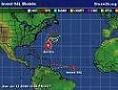
This thing was not even a TD at landfall...no surface obs have even come close to 35mph winds sustained. This was a surfer's storm and boy did we need some surf! Strong SE winds will bring us some more action tomorrow and even more to come from that disturbance in the Caribbean.
0 likes
-
attallaman
Re: Re:
Dr. Steve Lyons on TWC mentioned this afternoon something about an area of showers in the Caribbean which was being watched that could eventually enter the GOM and possibly pose a threat to the coastlines of TX/LA within 72 hours. Now that doesn't sound like the GOM is closed for tropical season but he could be wrong.Sean in New Orleans wrote:chadtm80 wrote:They still forecast it to be a TS.. Why then would they drop the TS warnings?
Carl A. just came on and said it is dying..no TS. Forecast at 5:00 is now invalid. NHC has dropped all Tropical Storm warnings...I saw it on http://www.nhc.noaa.gov before the alert even came on the news. I think we can expect a pretty Saturday now in New Orleans with just scattered storms. Awesome. And no weather to effect LSU at 2:30. Hopefully this is it for the GOM this season.
0 likes
-
Category 5

- Category 5
- Posts: 10074
- Age: 34
- Joined: Sun Feb 11, 2007 10:00 pm
- Location: New Brunswick, NJ
- Contact:
Re: Tropical Depression TEN: Discussions & Images,4 PM page 94
Thunder44 wrote:Category 5 wrote:Landfall has occured
Not quite, until the center of the low moves onshore, which it should do over the next hour. The models were terrible on this one.
It's scary when the most accurate model on a storm is the LBAR.
0 likes
-
oyster_reef

- Tropical Storm

- Posts: 123
- Joined: Tue Aug 14, 2007 3:05 pm
- Location: Alabama
Re: Tropical Depression TEN: Discussions & Images,4 PM page 94
Category 5 wrote:Thunder44 wrote:Category 5 wrote:Landfall has occured
Not quite, until the center of the low moves onshore, which it should do over the next hour. The models were terrible on this one.
It's scary when the most accurate model on a storm is the LBAR.
not so fast dis'n LBAR... she forcast Katrina correctly when she was still over Fla. 4 days out and all alone..
0 likes
Who is online
Users browsing this forum: No registered users and 83 guests