Subtropical Storm GABRIELLE (ATL): Recon Discussion
Moderator: S2k Moderators

Re: Invest 99L Recon Discussion
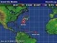
It looks like they are trying to close of a center near 29.5N and 70.5W
They just turned back NW. I don't think they found a center there.
They just turned back NW. I don't think they found a center there.
Last edited by Thunder44 on Fri Sep 07, 2007 3:24 pm, edited 1 time in total.
0 likes
-
WindRunner

- Category 5

- Posts: 5806
- Age: 33
- Joined: Fri Jul 29, 2005 8:07 pm
- Location: Warrenton, VA, but Albany, NY for school
- Contact:
Be careful with the automatically extrapolated pressures here, cycloneye. In this situation, when we have relatively high pressure values (a weak low), the pressures will read a millibar or two too low, and even occasionally a little too high. A drop or estimated extrap pressure from a VDM are the only reliable methods of estimation for actual official use.
0 likes


-
Air Force Met
- Military Met

- Posts: 4372
- Age: 55
- Joined: Tue Jul 08, 2003 9:30 am
- Location: Roan Mountain, TN
Re:
KWT wrote:Just looking for a west wind now, found everything else bar that right now, got thorugh to 323 degrees right at the end of the last set so I can only assume that by the next set well see something close to that west wind we need.
Don't stress out over finding a west wind with recon. There is no doubt this has a closed circulation. It is obvious just from satellite. This isn't one of those invests where recon is trying to see if it is a closed low. We know it is. What we really need to know is if it is warm care and what the pressure/winds are. For that, they need to fly in the center and then they need to fly north a little bit (near 31/32n) and check out the area where the gradient is strongest and where the tstms are. That is where the strongest winds are going to be...not where they are flying now. Hopefully they will do that.
0 likes
-
Air Force Met
- Military Met
- Posts: 4372
- Age: 55
- Joined: Tue Jul 08, 2003 9:30 am
- Location: Roan Mountain, TN
Re:
x-y-no wrote:OK, maybe it has a closed circulation after all. But I really can't see upgrading this mess yet.
Maybe later tonight.
Its had a closed circulation for a long while. Upgrading it is a different story. I probably would since I think it's going to be a TS eventually. Why wait. I also think there are probably some TS force winds well north of the center due to the gradient...a ship had sustained 33 kts earlier today.
0 likes
Oh I know its got a LLC, I've been wathcing the thing since probably 3AM your time!
However its nice to have that west wind found just to toally confirm its closed, as you say finding the highest winds will be more important and as you say the pressure gradient wil lbe tighter further north as the high to the north continues to develop. Given al lthe data I agree i think it probably should be upgraded, as i said to Derek systems less organised have been upgraded in the past on the sole evidence of it being warm cored and having a closed circulation.
However its nice to have that west wind found just to toally confirm its closed, as you say finding the highest winds will be more important and as you say the pressure gradient wil lbe tighter further north as the high to the north continues to develop. Given al lthe data I agree i think it probably should be upgraded, as i said to Derek systems less organised have been upgraded in the past on the sole evidence of it being warm cored and having a closed circulation.
0 likes
-
x-y-no

- Category 5
- Posts: 8359
- Age: 63
- Joined: Wed Aug 11, 2004 12:14 pm
- Location: Fort Lauderdale, FL
Re: Re:
Air Force Met wrote:x-y-no wrote:OK, maybe it has a closed circulation after all. But I really can't see upgrading this mess yet.
Maybe later tonight.
Its had a closed circulation for a long while. Upgrading it is a different story. I probably would since I think it's going to be a TS eventually. Why wait. I also think there are probably some TS force winds well north of the center due to the gradient...a ship had sustained 33 kts earlier today.
Well I knew it had a closed circulation earlier, but they were having a heck of a time finding any NW or W winds now ...
I guess I can see your point - it's likely to improve from here on so even though it's awfully weak for a TD now one may as well call it.
0 likes
-
Derek Ortt
-
miamicanes177
- Category 5
- Posts: 1131
- Joined: Tue Aug 01, 2006 10:53 pm
Re: Invest 99L Recon Discussion
0 likes
-
Air Force Met
- Military Met
- Posts: 4372
- Age: 55
- Joined: Tue Jul 08, 2003 9:30 am
- Location: Roan Mountain, TN
Re: Re:
x-y-no wrote:Air Force Met wrote:x-y-no wrote:OK, maybe it has a closed circulation after all. But I really can't see upgrading this mess yet.
Maybe later tonight.
Its had a closed circulation for a long while. Upgrading it is a different story. I probably would since I think it's going to be a TS eventually. Why wait. I also think there are probably some TS force winds well north of the center due to the gradient...a ship had sustained 33 kts earlier today.
Well I knew it had a closed circulation earlier, but they were having a heck of a time finding any NW or W winds now ...
I guess I can see your point - it's likely to improve from here on so even though it's awfully weak for a TD now one may as well call it.
That's because they weren't flying in the right place to get the west winds. All of their time has been spent up near 29N. If you look at the vis, the stronger westerly flow is down near 28N. If they had started down there...you would have west winds no problem. But they are up near the center and it's hard to find west winds in a broad ill defined center.
0 likes

-
cycloneye

- Admin

- Posts: 139168
- Age: 67
- Joined: Thu Oct 10, 2002 10:54 am
- Location: San Juan, Puerto Rico
Re: Invest 99L Recon Discussion
AFM,they are going up passed 30n.Found 32kts.Wind picking up.
0 likes
Who is online
Users browsing this forum: No registered users and 80 guests