
>>It looks like JB is pretty set on a hit somewhere along the Texas coastline on Sunday. That's what he pretty much said in 'Long Ranger' video this morning.
It really seems like the most reasonable solution. I'm not married to the idea because everything is just in the formative stages, but with high pressure building in, it's gonna go west for a while. Wipha is about to hit China and should head north and recurve even north of Seoul, so 7 days (Tuesday) there will likely be strong ridging in the SE US (also goes for days 5 and 6 based on what we saw with the WPAC pattern. <--- Assuming teleconnection verifies, and FWIW, Wipha has some 185mph gusts. We're not going to see that kind of intensity, but it could be an indication that we're going to see something stronger than many people are considering.
>>Good post Steve. Thanks for doing that. Did not feel like going through all that detail like you did. Great post. Thanks for helping me out!! Hope I did not confuse anyone.
No problem freak. It's way more complicated than what I posted, but the general idea is there. It really depends on the position, what the upper feature is, and how is it interacting with the pattern. There are a lot of variables. In some cases, the an ULL/TUTT can both hinder and help development. In some cases (more likely in the early fall/October), upper systems can even be involved in baroclinic development and phasing of tropical moisture into Nor'easters.
My main point is just that I hope people consider broader ideas than what some amateurs present on the site. "This is not going to form because there are 25 knots of shear in the way. Stamp foot." LOL
Steve
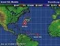
Tropical Depression TEN: Discussions & Images
Moderator: S2k Moderators
-
Ed Mahmoud
Re: INVEST 93L (ATL): Discussion & Images
The Trend is My Friend
Maybe not the friend of posters in Houma, Terrebonne and Port Fourchon, but my friend.
The models started out pointing South Texas, and have slowly been coming farther East, with latest GFS into SE Louisiana. For everyone, further East probably means less time to intensify, and, of course, Texas has already had its hurricane this year and doesn't need another. Plus, past mid-September, while not a guarantee, as shown by Cat 1 conditions (PM Derek Ortt, not me, he said it, although in his defense, I went looking and 82 knots is highest sustained 1 minute wind, despite 941 mb pressure) in Texas from Rita, the 1949 October storm and 1989's Jerry, climatology is also my friend.
Too early to ignore it in Texas and say I have no worries this weekend, but, in my unoffical opinion, if this forms, Louisiana to Alabama is the likely target.
0 likes
-
Weatherboy1

- Category 5

- Posts: 1167
- Age: 48
- Joined: Mon Jul 05, 2004 1:50 pm
- Location: Jupiter, FL
http://www.ndbc.noaa.gov/station_page.php?station=SPGF1
Settlement Point station on Grand Bahama Island reporting an uptick in winds as well. 25 knots, in fact. Could just be a random wind recording in a storm, but worth noting if the trend continues over a span of time.
Settlement Point station on Grand Bahama Island reporting an uptick in winds as well. 25 knots, in fact. Could just be a random wind recording in a storm, but worth noting if the trend continues over a span of time.
0 likes
-
micktooth

- S2K Supporter

- Posts: 391
- Joined: Mon Jul 11, 2005 3:47 pm
- Location: PreK:New Orleans,PostK:Colorado
Re: INVEST 93L (ATL): Discussion & Images
Sanibel wrote:Just struck me that this is a Katrina-type track. However the atmosphere is much different than Katrina with more shear and drier air.
I was thinking the same thing. Obviously, the climatology is different now, but if this does develop, it will bring back memories for many folks.
0 likes

Re: INVEST 93L (ATL): Discussion & Images
Football forecast says it NEVER rains in Tiger Stadium on a Saturday night. so therefore the GFS is wrong. So the saying goes, I've been there when the liquid sunshine was really coming down hard though.
0 likes
-
micktooth
- S2K Supporter
- Posts: 391
- Joined: Mon Jul 11, 2005 3:47 pm
- Location: PreK:New Orleans,PostK:Colorado
Re: INVEST 93L (ATL): Discussion & Images
tailgater wrote:Football forecast says it NEVER rains in Tiger Stadium on a Saturday night. so therefore the GFS is wrong. So the saying goes, I've been there when the liquid sunshine was really coming down hard though.
I remember evacuating NOLA for Georges and got stuck in BR for traffic for an LSU game. NOLA was evacuating but the game went on! Geaux Tigers!
0 likes

Re: Re:
Chacor wrote:CrazyC83 wrote:Recon already flying out? Maybe TD10 today?
Far as I know, not scheduled until Thursday.
This is close enough to the NHC that maybe Bill Read could hop in a cigar boat and go check it out....
0 likes

Re: Re:
HollynLA wrote:'CaneFreak wrote:ok, before the server crashes....EVERYONE CALM DOWN....there IS a BROAD circulation starting to form east of Florida. Its not that big of a deal RIGHT NOW...we have plenty of time to watch it. Things could change later in the forecast period. I think we are up to about 3 or 4 posts per minute right now....so just...CALM DOWN.
This happens everytime a new invest/storm forms, especially one that is only days from landfall. We really don't need the finger wagging.
Thank you Holly.
We really do not need a lecture on how to react.
0 likes
-
Ivanhater

- Storm2k Moderator

- Posts: 10853
- Age: 37
- Joined: Fri Jul 01, 2005 8:25 am
- Location: Pensacola
Re: INVEST 93L (ATL): Discussion & Images
Wow, looks like the northern gulfcoast could be in for it
0 likes
-
'CaneFreak

- Category 5
- Posts: 1475
- Joined: Mon Jun 05, 2006 10:50 am
- Location: New Bern, NC
Re: Re:
fci wrote:HollynLA wrote:'CaneFreak wrote:ok, before the server crashes....EVERYONE CALM DOWN....there IS a BROAD circulation starting to form east of Florida. Its not that big of a deal RIGHT NOW...we have plenty of time to watch it. Things could change later in the forecast period. I think we are up to about 3 or 4 posts per minute right now....so just...CALM DOWN.
This happens everytime a new invest/storm forms, especially one that is only days from landfall. We really don't need the finger wagging.
Thank you Holly.
We really do not need a lecture on how to react.
Ok, thank you to the four or five people that have reprimanded me now. GEEZ. Give me a break.
0 likes
>>Maybe not the friend of posters in Houma, Terrebonne and Port Fourchon, but my friend.
Hahaha. I'm in the Parish just east of there (north of Fourchon). I live in Lafourche. But Ed, it's possible we've got a coast runner too, especially if high pressure backs in from the NE as many of the last months' highs have done. It's really too early to tell. It would seem likely that even if there was a landfall in Plaquemines Parish/Mouth of the MS River, it wouldn't be on a NNE recurve as a W-WSW bend would be more likely as the system was forced toward the Gulf based on the building high and clockwise flow around it. Wow. And on a day when I'm buried in work.
Steve
0 likes

Our ol buddy Tedler runs a nice realtime list of weather obs on this site for se fla
http://www.myacc.net/~tedler64/weather/indexmml.html
might be interesting as this crosses....
http://www.myacc.net/~tedler64/weather/indexmml.html
might be interesting as this crosses....
0 likes

Re: INVEST 93L (ATL): Discussion & Images
Steve wrote:
In defense to Derek and AFM; their end game was not a weak or sheared TD/TS in the end zone. They were thinking that it would be a sheared system in the eastern gulf. Once in the central gulf, conditions would improve.
I wasn't and am still not buying "weak, sheared TD/TS" at the end.
In defense to Derek and AFM; their end game was not a weak or sheared TD/TS in the end zone. They were thinking that it would be a sheared system in the eastern gulf. Once in the central gulf, conditions would improve.
0 likes
Re: INVEST 93L (ATL): Discussion & Images
micktooth wrote:tailgater wrote:Football forecast says it NEVER rains in Tiger Stadium on a Saturday night. so therefore the GFS is wrong. So the saying goes, I've been there when the liquid sunshine was really coming down hard though.
I remember evacuating NOLA for Georges and got stuck in BR for traffic for an LSU game. NOLA was evacuating but the game went on! Geaux Tigers!
Yeah we kinda got our priorities mixed up down here. But it's home.
I'm surprised at how fast this thing is coming together east of Ft. Lauderdale.
http://radar.weather.gov/radar.php?prod ... X&loop=yes
0 likes


Re: INVEST 93L (ATL): Discussion & Images
chadtm80 wrote:
The BAM hasn't been anywhere close to right this season. Therefore, I spit on it! *pa-tooie!*
0 likes

Re: INVEST 93L (ATL): Discussion & Images
Really starting to crank up on this radar loop:
http://www.intellicast.com/National/Radar/Current.aspx?location=USFL0438&animate=true
http://www.intellicast.com/National/Radar/Current.aspx?location=USFL0438&animate=true
0 likes
-
Stormcenter
- S2K Supporter
- Posts: 6617
- Joined: Wed Sep 03, 2003 11:27 am
- Location: Houston, TX
One last thought...there was some questioning about lack of notice and such during the storm last week in the gulf. I would think that it could have played a factor in this being declared an invest now....very close to shore and a large population area with large flooding potential...now bringing on Max Mayfield for an invest is a little like using a sledgehammer on a 1penny nail I will suspect that it will happen down here in sofla...grin!
Now to get that precip over over Lake O before it trucks out to Tampa Bay and the gulf.....come on baby...get nice and juicey and slow.....and fill that lake!!!!!!!!!
Now to get that precip over over Lake O before it trucks out to Tampa Bay and the gulf.....come on baby...get nice and juicey and slow.....and fill that lake!!!!!!!!!
0 likes
-
Derek Ortt
Who is online
Users browsing this forum: No registered users and 5 guests