EX INVEST 94L Thread

Moderator: S2k Moderators

Message
Author
User avatar
BigA
Professional-Met
Professional-Met
Posts: 1317
Joined: Sun Jul 24, 2005 10:56 pm

Re: INVEST 94L : NW Caribbean : Discussions & Images

#321 Postby BigA » Mon Oct 08, 2007 4:00 pm

Thunder44 wrote:
The trough is going to hang around for very long. It will be moving out by next week.

Take a look at the 12z GFS and ECMWF 8 to 10 day ensemble means:

http://www.meteo.psu.edu/~gadomski/ECMW ... tcomp.html


I really dont want to be picky about typos, but do you mean that it "is going to stay around for very long" or that it "isn't going to stay around for very long" ? Thank you much.

In any event, the 8-10 day ensembles dont really show a digging trough across the eastern US and GOM, but my interpretation could be faulty.
0 likes   

User avatar
alienstorm
Category 1
Category 1
Posts: 496
Joined: Tue Jul 31, 2007 1:29 pm
Location: Miami Fla western suburb

Re: INVEST 94L : NW Caribbean : 5:30 PM TWO Shortly

#322 Postby alienstorm » Mon Oct 08, 2007 4:05 pm

Afternoon visible loop shows a little tighter Low moving every so slowly to the NNE.

http://weather.msfc.nasa.gov/cgi-bin/post-goes
0 likes   

User avatar
cycloneye
Admin
Admin
Posts: 139339
Age: 67
Joined: Thu Oct 10, 2002 10:54 am
Location: San Juan, Puerto Rico

Re: INVEST 94L Models Thread

#323 Postby cycloneye » Mon Oct 08, 2007 4:06 pm

18z NAM Loop

For those interested in the NAM model here is the 18z run.
0 likes   

User avatar
Tampa Bay Hurricane
Category 5
Category 5
Posts: 5594
Age: 36
Joined: Fri Jul 22, 2005 7:54 pm
Location: St. Petersburg, FL

#324 Postby Tampa Bay Hurricane » Mon Oct 08, 2007 4:07 pm

thanks derek for the explanation to my
questions earlier...that explains it :D
0 likes   

User avatar
Thunder44
Category 5
Category 5
Posts: 5922
Age: 43
Joined: Mon Jun 09, 2003 7:53 pm
Location: New York City

Re: INVEST 94L : NW Caribbean : Discussions & Images

#325 Postby Thunder44 » Mon Oct 08, 2007 4:09 pm

BigA wrote:
Thunder44 wrote:
The trough is going to hang around for very long. It will be moving out by next week.

Take a look at the 12z GFS and ECMWF 8 to 10 day ensemble means:

http://www.meteo.psu.edu/~gadomski/ECMW ... tcomp.html


I really dont want to be picky about typos, but do you mean that it "is going to stay around for very long" or that it "isn't going to stay around for very long" ? Thank you much.

In any event, the 8-10 day ensembles dont really show a digging trough across the eastern US and GOM, but my interpretation could be faulty.


Your interpretation is correct. I edited to say "is not going to stay around for very long".
0 likes   

User avatar
BigA
Professional-Met
Professional-Met
Posts: 1317
Joined: Sun Jul 24, 2005 10:56 pm

Re: INVEST 94L : NW Caribbean : 5:30 PM TWO Shortly

#326 Postby BigA » Mon Oct 08, 2007 4:10 pm

alienstorm wrote:Afternoon visible loop shows a little tighter Low moving every so slowly to the NNE.

http://weather.msfc.nasa.gov/cgi-bin/post-goes


I sorta agree. I dont really see a movement east or west...maybe an ever so slow drift to the north. Does look a little less broad.
0 likes   

User avatar
Thunder44
Category 5
Category 5
Posts: 5922
Age: 43
Joined: Mon Jun 09, 2003 7:53 pm
Location: New York City

Re: INVEST 94L : NW Caribbean : 5:30 PM TWO Shortly

#327 Postby Thunder44 » Mon Oct 08, 2007 4:14 pm

360
ABNT20 KNHC 082112
TWOAT
TROPICAL WEATHER OUTLOOK
NWS TPC/NATIONAL HURRICANE CENTER MIAMI FL
530 PM EDT MON OCT 8 2007

FOR THE NORTH ATLANTIC...CARIBBEAN SEA AND THE GULF OF MEXICO...

AN AREA OF LOW PRESSURE IS CENTERED OVER THE NORTHWESTERN CARIBBEAN
SEA ABOUT 150 MILES EAST-NORTHEAST OF BELIZE CITY. SURFACE
PRESSURES REMAIN LOW IN THE AREA AND SATELLITE IMAGERY INDICATES
THAT THE LOW HAS BECOME A LITTLE BETTER DEFINED TODAY...WITH AN
INCREASE IN THUNDERSTORM ACTIVITY. CONDITIONS APPEAR FAVORABLE FOR
ADDITIONAL DEVELOPMENT OF THIS SYSTEM...AND IT COULD BECOME A
TROPICAL DEPRESSION DURING THE NEXT DAY OR TWO AS IT MOVES SLOWLY
WESTWARD OR NORTHWESTWARD. INTERESTS IN THE NORTHWESTERN CARIBBEAN
SEA SHOULD MONITOR THE PROGRESS OF THIS SYSTEM. AN AIR FORCE
HURRICANE HUNTER AIRCRAFT IS SCHEDULED TO INVESTIGATE THIS LOW
PRESSURE AREA ON TUESDAY...IF NECESSARY.

ELSEWHERE...TROPICAL CYCLONE FORMATION IS NOT EXPECTED DURING THE
NEXT 48 HOURS.

$$

FORECASTER BROWN
0 likes   

Derek Ortt

#328 Postby Derek Ortt » Mon Oct 08, 2007 4:14 pm

not moving to the NNE... still crawling to the west
0 likes   

User avatar
Nimbus
Category 5
Category 5
Posts: 4928
Joined: Mon Jul 19, 2004 10:54 am

Re: INVEST 94L : NW Caribbean : 5:30 PM TWO Shortly

#329 Postby Nimbus » Mon Oct 08, 2007 4:17 pm

Its too early to be sure about the direction of motion, if anyone could say for sure they should be working at the NHC.
Based on just the last few hours observation from the visible loop, It looks like some of the circulation will pass over the tip of the Yucatan inhibiting development. Otherwise if this were really going to track NNE Key West and south Florida are going to be in for some trouble in a hurry.
Last edited by Nimbus on Mon Oct 08, 2007 4:20 pm, edited 2 times in total.
0 likes   

Derek Ortt

#330 Postby Derek Ortt » Mon Oct 08, 2007 4:18 pm

its not too early at all to have a good idea of the motion. It is a fairly easy forecast... into the Yucatan and a flooding threat
0 likes   

User avatar
cycloneye
Admin
Admin
Posts: 139339
Age: 67
Joined: Thu Oct 10, 2002 10:54 am
Location: San Juan, Puerto Rico

Re: 94L : NW Caribbean :5:30 PM TWO at page 13=Better Defined

#331 Postby cycloneye » Mon Oct 08, 2007 4:20 pm

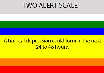
RL3AO it has been a long time that the scale chart has not been posted.Looks like a good moment with this TWO. :)
0 likes   

RL3AO
Moderator-Pro Met
Moderator-Pro Met
Posts: 16308
Joined: Thu Jun 14, 2007 10:03 pm
Location: NC

#332 Postby RL3AO » Mon Oct 08, 2007 4:22 pm

Image
0 likes   

User avatar
wxman57
Moderator-Pro Met
Moderator-Pro Met
Posts: 22484
Age: 66
Joined: Sat Jun 21, 2003 8:06 pm
Location: Houston, TX (southwest)

Re: 94L : NW Caribbean :5:30 PM TWO at page 13=Better Defined

#333 Postby wxman57 » Mon Oct 08, 2007 4:23 pm

Yeah, most models move it inland into the Yucatan during the day tomorrow, so not much time offshore remaining. Such a weak system may maintain an LLC inland for a few days. What's left could be drawn northeastward (not north) ahead of the cold front across Cuba and the Bahamas late Thursday. But the moisture should stay east of Florida, as stated in the south Florida discussions above.
0 likes   

User avatar
cycloneye
Admin
Admin
Posts: 139339
Age: 67
Joined: Thu Oct 10, 2002 10:54 am
Location: San Juan, Puerto Rico

Re: 94L : NW Caribbean :5:30 PM TWO at page 13=Better Defined

#334 Postby cycloneye » Mon Oct 08, 2007 4:45 pm

The Latest at 21:15 UTC

Looking better by the hour.

Image
0 likes   

cpdaman
Category 5
Category 5
Posts: 3131
Joined: Sat Jun 10, 2006 11:44 am
Location: SPB county (gulf stream)

Re: 94L : NW Caribbean :5:30 PM TWO at page 13=Better Defined

#335 Postby cpdaman » Mon Oct 08, 2007 4:51 pm

sure does

http://www.ssd.noaa.gov/goes/east/carb/loop-vis.html

especially when you turn the speed up and watch it spin

good thing it is headed westward otherwise this would become a problem potentially fast IMO
0 likes   

mightyerick
Tropical Depression
Tropical Depression
Posts: 79
Joined: Mon Sep 10, 2007 6:14 pm

Re: 94L : NW Caribbean :5:30 PM TWO at page 13=Better Defined

#336 Postby mightyerick » Mon Oct 08, 2007 5:01 pm

Again!!!! Another system aiming to Central America!!!
however, it is so near to land!! That should prevent it for gain hurricane status, cutting its time over warm waters. looks like another false-alarm invest in this really weird season.
0 likes   

mightyerick
Tropical Depression
Tropical Depression
Posts: 79
Joined: Mon Sep 10, 2007 6:14 pm

Re: INVEST 94L : NW Caribbean : Discussions & Images

#337 Postby mightyerick » Mon Oct 08, 2007 5:08 pm

i just dont understand this season... we have a niña evenet... but... it looks like a Niño shearing everything!!! Dry air everywhere, a lot of subtropical systems, short-living storms. IT IS A NIÑO!!!!

:wink: ACE value is falling down for first time ever!!!! Systems are generating negative ACE values!!! 8-) 8-) 8-) 8-) 8-) 8-)

(Another invest and I would cry)
0 likes   

User avatar
Vortex
S2K Supporter
S2K Supporter
Posts: 4644
Age: 52
Joined: Fri Aug 01, 2003 9:34 pm
Location: Hilton Head, SC

#338 Postby Vortex » Mon Oct 08, 2007 5:10 pm

Becoming much better organized...Would not be surprised if it gets kicked to the ene(ahead of deepening trough) to a position just south of western/central cuba in 3-4 days. We may see it stall or meander near the caymans for several days....Thereafter, well ahve to see how the pattern evolves after the deep trough begins to lift to the NE..
0 likes   

User avatar
DESTRUCTION5
Category 5
Category 5
Posts: 4391
Age: 42
Joined: Wed Sep 03, 2003 11:25 am
Location: Stuart, FL

#339 Postby DESTRUCTION5 » Mon Oct 08, 2007 5:18 pm

http://www.ssd.noaa.gov/goes/flt/t1/loop-vis.html

Spin is evident..No Questions asked..
0 likes   

User avatar
gatorcane
S2K Supporter
S2K Supporter
Posts: 23499
Age: 46
Joined: Sun Mar 13, 2005 3:54 pm
Location: Boca Raton, FL

Re: INVEST 94L : NW Caribbean : Discussions & Images

#340 Postby gatorcane » Mon Oct 08, 2007 5:25 pm

Reading through this discussion, I see some opinions that South Florida has nothing to worry about here. Based on the NWS discussion I posted, it would seem the moisture will stay SE of South Florida

Question for discussion:

If this thing develops can we say south Florida is in the clear?
0 likes   


Return to “2007”

Who is online

Users browsing this forum: No registered users and 3 guests