

One last observation before the commute home --
I noticed on the last few frames of the visibles some crisp, fresh new storms popping near the center. Expect the infrared to show cooling cloud tops soon.
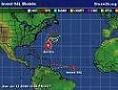
Tropical Depression HUMBERTO Discussion & Images
Moderator: S2k Moderators

Yo schlitz, remember Frances 98? Looks similar although I don't think it's tapped into moisture all the way down to the Yucatan. Of course Hermine came in two weeks later with some 15mph winds as Georges was on his long-track across the Atlantic finally settling on Jackson County, MS. Not saying we're in a similar pattern as we were in 1998, because we're not at the present time. But we've all seen the fallout from weak storms off the South Texas Coast that weren't progged to be anything and ended up flooding people out of house and home.
Steve
Steve
0 likes
-
Ed Mahmoud
Re: Invest 90L up again,West GOM-Discussion & Images
North winds both sides of the front, but the boundary itself doesn't seem to be moving very fast, and as I theorized when 90L was ex-90L, seems like the circulation around the trough or low seems to have deprived it of much convergence.
But while winds are about 10 to 15 mph from the North at both ACT and IAH, a 10ºF dewpoint difference, and even if the front does lose identity, dry air pulled in from the West might make this one of those half naked systems, with a low cloud swirl center with all the storms mainly East of the center.
If this does form.
0 likes
-
Extremeweatherguy

- Category 5

- Posts: 11095
- Joined: Mon Oct 10, 2005 8:13 pm
- Location: Houston, TX
Re: Invest 90L up again,West GOM-Discussion & Images
This certainly does have the "look" of a tropical system this evening..
http://www.ssd.noaa.gov/goes/east/gmex/loop-vis.html
..If it continues organizing at this rate, then I think we could easily be looking at a possible depression/TS being named tomorrow. JMO.
http://www.ssd.noaa.gov/goes/east/gmex/loop-vis.html
..If it continues organizing at this rate, then I think we could easily be looking at a possible depression/TS being named tomorrow. JMO.
0 likes
-
Ed Mahmoud
Re: Invest 90L up again,West GOM-Discussion & Images
Finally getting a narrow line of storms to form near HOU, although the line, if anything, is drifting inland, and the individual cells look to be drifting to the Southwest. I guess the sea-breeze front.
I'll have to go outside and look for myself.
I'll have to go outside and look for myself.
0 likes
-
HouTXmetro

- Category 5
- Posts: 3949
- Joined: Sun Jun 13, 2004 6:00 pm
- Location: District of Columbia, USA
Re: Invest 90L up again,West GOM-Discussion & Images
So can we expect a Wednesday lanfall of whatever this is?
0 likes


Re: Invest 90L up again,West GOM-Discussion & Images
I wonder will the NHC issue a STDS on this system.
0 likes
-
Extremeweatherguy
- Category 5
- Posts: 11095
- Joined: Mon Oct 10, 2005 8:13 pm
- Location: Houston, TX
Re: Invest 90L up again,West GOM-Discussion & Images
Possible. But I would say that Thursday or Friday is more likely...especially if the system remains stalled/drifting.HouTXmetro wrote:So can we expect a Wednesday lanfall of whatever this is?
Last edited by Extremeweatherguy on Tue Sep 11, 2007 6:30 pm, edited 1 time in total.
0 likes
-
srainhoutx

- S2K Supporter

- Posts: 6919
- Age: 66
- Joined: Sun Jan 14, 2007 11:34 am
- Location: Haywood County, NC
- Contact:
Re: Invest 90L up again,West GOM-Discussion & Images
Extremeweatherguy wrote:This certainly does have the "look" of a tropical system this evening..
http://www.ssd.noaa.gov/goes/east/gmex/loop-vis.html
..If it continues organizing at this rate, then I think we could easily be looking at a possible depression/TS being named tomorrow. JMO.
Agree EWG. It certainly is beginning to get that "look". Will be interesting to see what DMAX can produce for 90L.
0 likes

Re: Invest 90L up again,West GOM-Discussion & Images
The models, both GFS and NAM want to slowly drift this system northward along the Tx coast as far as the LA border over the next two to three days. If it stays offshore, it could be one of those pesky 50 mph tropical storms that dumps 10 to 15 inches of rain along the coast.
0 likes
-
Ed Mahmoud
Re: Invest 90L up again,West GOM-Discussion & Images
HouTXmetro wrote:So can we expect a Wednsday lanfall of whater this is?
Not according to JB.
Crisp, clear skies to the North, generally, and some impressive cu towers, one or two starting to anvil out, going up to the South, and a noticeably fresh North breeze, maybe the freshest outside a t-storm since Spring.
Since the dewpoint up I-45 (IAH, CXO, DWH) all the way to UTS is 72 or 73ºF, I'm guessing the fresh North breeze isn't the true front.
Maybe an outflow from the earlier storms to the North that have seemed to fizzle, and when it reached the seabreeze boundary, weak as it was, it finally fired up some storms.
Interesting visual loop Texas and NW GOMEX...
0 likes

Re: Invest 90L up again,West GOM-Discussion & Images
Extremeweatherguy wrote:Possible. But I would say that Thursday or Friday is more likely...especially if the system remains stalled.HouTXmetro wrote:So can we expect a Wednesday lanfall of whatever this is?
I don't see anything at the surface at the moment as covention has waned....
http://cimss.ssec.wisc.edu/tropic/real- ... 8conv.html
seems to have done this now for 2 straight days.....looks good in the afternoon but as soon as the sun sets "poof"......sure looks good with a MLC but again nothing at the surface......will be watching tonight though for the d-max....
0 likes
Re: Invest 90L up again,West GOM-Discussion & Images
Ed Mahmoud wrote:HouTXmetro wrote:So can we expect a Wednsday lanfall of whater this is?
Not according to JB.
Crisp, clear skies to the North, generally, and some impressive cu towers, one or two starting to anvil out, going up to the South, and a noticeably fresh North breeze, maybe the freshest outside a t-storm since Spring.
Since the dewpoint up I-45 (IAH, CXO, DWH) all the way to UTS is 72 or 73ºF, I'm guessing the fresh North breeze isn't the true front.
Maybe an outflow from the earlier storms to the North that have seemed to fizzle, and when it reached the seabreeze boundary, weak as it was, it finally fired up some storms.
Interesting visual loop Texas and NW GOMEX...
I agree the front is washing out to our north attm.....
0 likes
-
destruction92
- Category 1

- Posts: 312
- Joined: Sun Jul 22, 2007 10:43 pm
Re: Re:
jschlitz wrote:rockyman wrote:Looks like the cold front is approaching the Texas coast...I can't see this system moving ashore in Texas...possibly Louisiana
Front lifts out/washes out tomorrow. Steering flow is nill and if anything, increases from S-N as the next front approaches this weekend.
whatever the case, don't expect anything more than a rainmaker...I don't see this going anywhere...look at the latest shear map...it looks like it is getting sheared right now...this is the kind of system the Carolinas and other drought-stricken areas of the Southeast could have really used.
Poof?!

0 likes
Re: Invest 90L up again,West GOM-Discussion & Images
yeah, Destruction92----it will never make it into the GOM either... 
0 likes
-
HouTXmetro
- Category 5
- Posts: 3949
- Joined: Sun Jun 13, 2004 6:00 pm
- Location: District of Columbia, USA


Re: Invest 90L up again,West GOM-Discussion & Images
HouTXmetro wrote:So can we expect a Wednesday lanfall of whatever this is?
Umm...Thursday evening...yeah, definately Thursday evening. Why am I so sure, you ask? Because that's when my son is suppose to start in his first ever football game!
0 likes
-
wxman57

- Moderator-Pro Met

- Posts: 22506
- Age: 66
- Joined: Sat Jun 21, 2003 8:06 pm
- Location: Houston, TX (southwest)
Re: Invest 90L up again,West GOM-Discussion & Images
Winds at the buoys are decreasing, and pressures rising slightly. Winds down to 5-10 kts at all buoys. Don't see much evidence of an LLC, just a MLC. Trof axis nearing the TX coast.
Last edited by wxman57 on Tue Sep 11, 2007 7:10 pm, edited 1 time in total.
0 likes
Who is online
Users browsing this forum: No registered users and 7 guests