Hurricane NOEL : Discussions & Images
Moderator: S2k Moderators
-
bvigal

- S2K Supporter

- Posts: 2275
- Joined: Sun Jul 24, 2005 8:49 am
- Location: British Virgin Islands
- Contact:
Re: INVEST 90L Models Thread
Thanks, wxman57!  That's good to know. I'll just keep watching for them.
0 likes
-
AJC3

- Admin

- Posts: 3876
- Age: 60
- Joined: Tue Aug 31, 2004 7:04 pm
- Location: West Melbourne, Florida
- Contact:
Re: INVEST 90L Models Thread
The 18Z GFDL output hit the wire a few minutes ago...
HXX04 KWBC 252330
CHGQLM
ATTENTION...NATIONAL HURRICANE CENTER
NCEP COUPLED GFDL HURRICANE MODEL FORECAST MADE FOR
TROPICAL DEPRESSION INVEST 90L
INITIAL TIME 18Z OCT 25
DISCLAIMER ... THIS INFORMATION IS PROVIDED AS GUIDANCE. IT
REQUIRES INTERPRETATION BY HURRICANE SPECIALISTS AND SHOULD
NOT BE CONSIDERED AS A FINAL PRODUCT. PLEASE SEE THE TPC/NHC
OFFICIAL FORECAST.
FORECAST STORM POSITION
HOUR LATITUDE LONGITUDE HEADING/SPEED(KT)
0 18.7 64.2 265./ 8.0
6 17.8 65.7 238./16.5
12 18.2 65.8 341./ 4.6
18 17.7 67.6 254./17.8
24 16.6 69.9 244./24.1
30 16.6 71.1 270./11.9
36 16.6 71.9 274./ 7.7
42 16.7 73.1 271./11.6
48 16.9 74.3 283./11.7
54 17.0 75.4 274./10.1
STORM DISSIPATED AT 54 HRS AT THE ABOVE PSN.
0 likes
-
cycloneye

- Admin
- Posts: 139479
- Age: 67
- Joined: Thu Oct 10, 2002 10:54 am
- Location: San Juan, Puerto Rico
Re: INVEST 90L Models Thread
0 likes
-
gatorcane

- S2K Supporter
- Posts: 23499
- Age: 46
- Joined: Sun Mar 13, 2005 3:54 pm
- Location: Boca Raton, FL
Re: INVEST 90L Models Thread
any models runs towards the NW Caribbean in late October should be watched by those in the GOM and Florida.....(especially eastern GOM and the southern half of the FL peninsula)
I HIGHLY, HIGHLY, HIGHLY doubt this thing if it goes W will end up smashing into Central America....not with the fronts starting to come down the way they are....
I am watching....
I HIGHLY, HIGHLY, HIGHLY doubt this thing if it goes W will end up smashing into Central America....not with the fronts starting to come down the way they are....
I am watching....
0 likes
-
bvigal
- S2K Supporter
- Posts: 2275
- Joined: Sun Jul 24, 2005 8:49 am
- Location: British Virgin Islands
- Contact:
Re: INVEST 90L Models Thread
Obviously the humans think it looks better than 12hrs ago, but maybe the models are not cooperating?
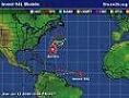
Anyway, here's the UKMET 18z cyg:

Anyway, here's the UKMET 18z cyg:
0 likes
-
brunota2003

- S2K Supporter
- Posts: 9476
- Age: 33
- Joined: Sat Jul 30, 2005 9:56 pm
- Location: Stanton, KY...formerly Havelock, NC
- Contact:
Re: INVEST 90L Near U.S Virgin Islands : Discussions & Images
I dont know about you guys, but I'm actually impressed, look at the tight swirl:
[img=http://img206.imageshack.us/img206/7990/ir2tx8.th.jpg]
Sure, being able to see it is a bad thing for tropical development, but look at it!
[img=http://img206.imageshack.us/img206/7990/ir2tx8.th.jpg]
Sure, being able to see it is a bad thing for tropical development, but look at it!
0 likes

Re: INVEST 90L Near U.S Virgin Islands : Discussions & Images
Oh Luis...this is what we worried about. Sad news 
0 likes
-
cycloneye
- Admin
- Posts: 139479
- Age: 67
- Joined: Thu Oct 10, 2002 10:54 am
- Location: San Juan, Puerto Rico
Re: INVEST 90L Near U.S Virgin Islands : Discussions & Images
25/2345 UTC 18.8N 64.9W T1.5/1.5 90L -- Atlantic Ocean
http://www.ssd.noaa.gov/PS/TROP/positions.html
Almost a TD.
http://www.ssd.noaa.gov/PS/TROP/positions.html
Almost a TD.
0 likes
-
MiamiensisWx
Re: INVEST 90L Near U.S Virgin Islands : Discussions & Images
This is NOT an official forecast. It is a synopsis of the current UA environment.
Personally, I don't believe 90L will develop. The upper low in the central Atlantic will remain in the area over the next few days, thus producing strong UL divergence (westerly shear) over the system. The remnant energy may move into the Caribbean Sea, and the picture becomes more complex. Currently, there is a s/w trough producing baroclinic forcing via an UL jet streak over the western Caribbean Sea. Broad rotation can be discerned in the area, indicating a possible sfc low S of Cuba per GOES visible imagery. This is a good setup for possible subtropical/hybrid development (transitioning from an initial tropical cyclone) that may eventually move toward southern FL, as supported by the UA pattern and model guidance. I think this region (S of Cuba) should be monitored, as the largest sfc pressure falls may occur in this region over the next several days. Shear should relax, too.
Regardless, 90L should be closely monitored in the islands. "Training" could produce some heavy precipitation over portions of the Leeward Islands/NE Caribbean and Puerto Rico. Stay dry over there!
Edit: Additionally, I think the central Atlantic upper low should be monitored for a transition to a possible subtropical system.
0 likes
-
Weatherfreak14

- Category 5

- Posts: 1383
- Joined: Sat Sep 24, 2005 3:40 pm
- Location: Beaufort, SC
- Contact:
Re: INVEST 90L Near U.S Virgin Islands : Discussions & Images
Wow, it looks pretty good with all that shear, i say come on baby give us something to track but please stay tame.
0 likes

Re: INVEST 90L Models Thread
gatorcane wrote:any models runs towards the NW Caribbean in late October should be watched by those in the GOM and Florida.....(especially eastern GOM and the southern half of the FL peninsula)
I HIGHLY, HIGHLY, HIGHLY doubt this thing if it goes W will end up smashing into Central America....not with the fronts starting to come down the way they are....
I am watching....
Yeah, I think this is probably the last "hurrah" out there for the Tropics this season.
IF it remains in tact and gets to the W. Carib; most likely whatever is there will train on up here to South Fla. The rains we have had most recently have been coming up the "railroad" from the South and/or Southwest.
For now though, we watch and wait and see and hope the best for our friends in PR and The Islands not to have terrible flooding and damage from the rains
If Jeff Masters possible scenario takes place this could be the one time we get "into the cone".
Or..... like everything else this season so far (at least from the South Florida standpoint) shear makes it go poof and I see y'all back here in June!!
I hope it remains an Invest with no appreciable winds and comes up here next week (not on Halloween though) and dumps 6-10 inches on us and the Lake.

For now, we wait and see and hope that our friends in PR and The Islands do not have terrible floods and damage from the rains
0 likes
-
cycloneye
- Admin
- Posts: 139479
- Age: 67
- Joined: Thu Oct 10, 2002 10:54 am
- Location: San Juan, Puerto Rico
Re: INVEST 90L Models Thread
The 00:00 UTC model suite.
WHXX01 KWBC 260022
CHGHUR
TROPICAL CYCLONE GUIDANCE MESSAGE
NWS TPC/NATIONAL HURRICANE CENTER MIAMI FL
0022 UTC FRI OCT 26 2007
DISCLAIMER...NUMERICAL MODELS ARE SUBJECT TO LARGE ERRORS.
PLEASE REFER TO NHC OFFICIAL FORECASTS FOR TROPICAL CYCLONE
AND SUBTROPICAL CYCLONE INFORMATION.
ATLANTIC OBJECTIVE AIDS FOR
DISTURBANCE INVEST (AL902007) 20071026 0000 UTC
...00 HRS... ...12 HRS... ...24 HRS. .. ...36 HRS...
071026 0000 071026 1200 071027 0000 071027 1200
LAT LON LAT LON LAT LON LAT LON
BAMS 18.8N 64.8W 18.8N 67.4W 18.8N 70.2W 19.0N 73.5W
BAMD 18.8N 64.8W 18.1N 65.8W 17.5N 67.1W 17.5N 68.6W
BAMM 18.8N 64.8W 18.3N 66.7W 18.0N 68.9W 17.9N 71.4W
LBAR 18.8N 64.8W 18.4N 66.0W 18.4N 67.6W 18.8N 69.8W
SHIP 25KTS 27KTS 29KTS 31KTS
DSHP 25KTS 24KTS 28KTS 27KTS
...48 HRS... ...72 HRS... ...96 HRS. .. ..120 HRS...
071028 0000 071029 0000 071030 0000 071031 0000
LAT LON LAT LON LAT LON LAT LON
BAMS 19.0N 76.7W 18.4N 82.2W 16.2N 84.7W 13.4N 85.9W
BAMD 17.9N 69.9W 19.0N 71.6W 20.6N 72.9W 22.8N 72.9W
BAMM 18.1N 73.6W 18.4N 77.5W 19.2N 80.3W 20.0N 82.0W
LBAR 19.9N 72.2W 22.4N 75.1W 25.4N 76.0W 28.7N 71.0W
SHIP 34KTS 40KTS 47KTS 47KTS
DSHP 33KTS 33KTS 44KTS 43KTS
...INITIAL CONDITIONS...
LATCUR = 18.8N LONCUR = 64.8W DIRCUR = 260DEG SPDCUR = 6KT
LATM12 = 19.2N LONM12 = 63.4W DIRM12 = 270DEG SPDM12 = 6KT
LATM24 = 18.8N LONM24 = 62.3W
WNDCUR = 25KT RMAXWD = 100NM WNDM12 = 25KT
CENPRS = 1005MB OUTPRS = 1008MB OUTRAD = 200NM SDEPTH = M
RD34NE = 0NM RD34SE = 0NM RD34SW = 0NM RD34NW = 0NM
Moving 260 degrees at 6 kts.
0 likes

Here's the full SHIPS run.
Code: Select all
                    *   ATLANTIC SHIPS INTENSITY FORECAST       *
                    *        GOES/OHC INPUT INCLUDED            *
                    *  INVEST      AL902007  10/26/07  00 UTC   *

TIME (HR)          0     6    12    18    24    36    48    60    72    84    96   108   120
V (KT) NO LAND    25    26    27    28    29    31    34    37    40    43    47    49    47
V (KT) LAND       25    26    24    27    28    27    33    35    33    40    44    46    43
V (KT) LGE mod    25    25    25    27    27    24    26    26    23    29    30    32    32

SHEAR (KTS)       35    35    31    23    25    27    24    28    20    24    19    26    28
SHEAR DIR        279   289   303   313   294   288   279   288   295   278   253   244   232
SST (C)         29.0  29.1  29.1  29.1  29.0  29.1  29.2  29.2  29.2  29.3  29.4  29.4  29.5
POT. INT. (KT)   151   153   153   154   152   154   155   155   154   155   157   156   158
ADJ. POT. INT.   140   144   145   146   146   147   148   146   144   143   142   140   141
200 MB T (C)   -54.8 -54.8 -54.8 -54.5 -54.3 -54.7 -54.5 -54.5 -54.0 -54.2 -54.1 -54.4 -54.2
TH_E DEV (C)      10    10     9     9     9     9    10     9    10     8     8     7     8
700-500 MB RH     58    57    58    55    58    56    58    57    58    61    67    69    69
GFS VTEX (KT)     10    11     9     8     8     6     6     5     5     6     5     5  LOST
850 MB ENV VOR    42    46    52    59    72    66    75    78    85   100   112   102   102
200 MB DIV         8    23    25    30     7    11     5    12    25    33    27    23    12
LAND (KM)        109    19   -22    63    22   -19    11    66    -2    92   238   265   233
LAT (DEG N)     18.8  18.6  18.3  18.2  18.0  17.9  18.1  18.2  18.4  18.7  19.2  19.6  20.0
LONG(DEG W)     64.8  65.8  66.7  67.8  68.9  71.4  73.6  75.7  77.5  79.0  80.3  81.2  82.0
STM SPEED (KT)     8     9    10    11    11    11    10     9     8     7     6     4     4
HEAT CONTENT      85    80  9999    78    90    97   107    89    88    97   100    98   100

  FORECAST TRACK FROM BAMM      INITIAL HEADING/SPEED (DEG/KT):260/  6      CX,CY:  -5/  0
  T-12 MAX WIND:  25            PRESSURE OF STEERING LEVEL (MB):  693  (MEAN=625)
  GOES IR BRIGHTNESS TEMP. STD DEV. 100-300 KM RAD:  30.7 (MEAN=20.0)
  % GOES IR PIXELS WITH T < -20 C    50-200 KM RAD:  21.0 (MEAN=69.0)

                        INDIVIDUAL CONTRIBUTIONS TO INTENSITY CHANGE
                         6   12   18   24   36   48   60   72   84   96  108  120
                        ----------------------------------------------------------
  SAMPLE MEAN CHANGE     1.   2.   3.   4.   6.   8.   9.  10.  11.  11.  12.  13.
  SST POTENTIAL          0.   0.   0.   1.   5.  11.  18.  23.  28.  32.  35.  37.
  VERTICAL SHEAR         0.   0.   1.   0.  -2.  -7. -13. -17. -21. -22. -23. -25.
  PERSISTENCE            0.  -1.  -1.  -1.  -1.  -1.  -1.  -1.  -1.  -1.   0.   0.
  200/250 MB TEMP.       0.   1.   1.   1.   1.   2.   3.   3.   3.   4.   4.   5.
  THETA_E EXCESS         0.   0.   0.   0.  -1.  -1.  -1.  -2.  -2.  -3.  -4.  -5.
  700-500 MB RH          0.   0.   0.   0.   0.   0.   0.   0.   0.   0.  -1.  -1.
  GFS VORTEX TENDENCY    0.   0.  -1.  -1.  -2.  -4.  -4.  -5.  -4.  -5.  -5.  -5.
  850 MB ENV VORTICITY   0.   0.   1.   1.   1.   2.   3.   4.   4.   5.   6.   7.
  200 MB DIVERGENCE      0.   0.   0.   0.   0.  -1.  -1.  -1.   0.   0.   0.   0.
  ZONAL STORM MOTION     0.   0.   0.   0.   0.   0.   0.   0.   0.   0.   0.   0.
  STEERING LEVEL PRES    0.   0.   0.  -1.  -1.  -1.  -1.  -2.  -2.  -2.  -2.  -2.
  DAYS FROM CLIM. PEAK   0.   0.   0.  -1.  -1.  -2.  -2.  -2.  -3.  -3.  -3.  -4.
                        ----------------------------------------------------------
  SUB-TOTAL CHANGE       1.   2.   3.   4.   5.   7.   8.  10.  13.  17.  19.  19.

  SATELLITE ADJUSTMENTS ----------------------------------------------------------
  MEAN ADJUSTMENT        0.   0.   0.   0.  -1.  -1.  -1.  -1.  -1.  -1.  -1.  -2.
  GOES IR STD DEV        0.   1.   1.   1.   1.   1.   1.   0.   0.   0.   0.   0.
  GOES IR PIXEL COUNT   -1.  -1.  -1.  -2.  -1.  -1.   0.   1.   2.   1.   1.  -1.
  OCEAN HEAT CONTENT     0.   0.   0.   1.   2.   3.   4.   4.   5.   6.   6.   6.
                        ----------------------------------------------------------
  TOTAL ADJUSTMENT       0.   0.   0.   0.   1.   2.   4.   5.   5.   5.   5.   3.
                        ----------------------------------------------------------
  TOTAL CHANGE (KT)      1.   2.   3.   4.   6.   9.  12.  15.  18.  22.  24.  22.

   ** 2007 ATLANTIC RAPID INTENSITY INDEX   AL902007 INVEST     10/26/07  00 UTC **
                    ( 25 KT OR MORE MAX WIND INCREASE IN NEXT 24 HR)

 12 HR PERSISTENCE (KT):   0.0 Range:-45.0 to  30.0 Scaled/Wgted Val:  0.6/  0.9
 850-200 MB SHEAR (KT) :  29.8 Range: 35.1 to   3.2 Scaled/Wgted Val:  0.2/  0.1
 D200 (10**7s-1)       :  18.6 Range:-20.0 to 149.0 Scaled/Wgted Val:  0.2/  0.2
 POT = MPI-VMAX (KT)   : 119.4 Range:  8.1 to 130.7 Scaled/Wgted Val:  0.9/  1.8
 850-700 MB REL HUM (%):  74.2 Range: 57.0 to  88.0 Scaled/Wgted Val:  0.6/  0.2
 % area w/pixels <-30 C:  17.0 Range: 17.0 to 100.0 Scaled/Wgted Val:  0.0/  0.0
 STD DEV OF IR BR TEMP :  30.7 Range: 37.5 to   5.3 Scaled/Wgted Val:  0.2/  0.2

 Scaled RI index=    2.7 Prob of RI=   3% is   0.3 times the sample mean(12%)
 Discrim RI index=   3.4 Prob of RI=   9% is   0.8 times the sample mean(12%)
0 likes


-
Evil Jeremy

- S2K Supporter
- Posts: 5459
- Age: 31
- Joined: Mon Apr 10, 2006 2:10 pm
- Location: Los Angeles, CA
Re: INVEST 90L Near U.S Virgin Islands : Discussions & Images
Yes! Finally something else to track, and this time, the Florida might be in the path of this!
Also, Derek, do you really think this is already a TD?
Also, Derek, do you really think this is already a TD?
0 likes

![[img=http://img206.imageshack.us/img206/7990/ir2tx8.th.jpg]](http://img206.imageshack.us/my.php?image=ir2tx8.jpg)
Who is online
Users browsing this forum: No registered users and 5 guests