Earl Advisories
Moderator: S2k Moderators
-
cycloneye

- Admin

- Posts: 139505
- Age: 67
- Joined: Thu Oct 10, 2002 10:54 am
- Location: San Juan, Puerto Rico
As chad said it will be Earl.
0 likes
Visit the Caribbean-Central America Weather Thread where you can find at first post web cams,radars
and observations from Caribbean basin members Click Here
and observations from Caribbean basin members Click Here
-
opera ghost

- Category 4

- Posts: 909
- Joined: Mon Sep 08, 2003 4:40 pm
- Location: Houston, Texas

-
HURAKAN

- Professional-Met

- Posts: 46086
- Age: 37
- Joined: Thu May 20, 2004 4:34 pm
- Location: Key West, FL
- Contact:
Recon to Investigate Earl's Remnants
WEATHER RECONNAISSANCE FLIGHTS
CARCAH, TPC/NATIONAL HURRICANE CENTER, MIAMI,FL.
1100 AM EDT MON 16 AUGUST 2004
SUBJECT: TROPICAL CYCLONE PLAN OF THE DAY (TCPOD)
VALID 17/1100Z TO 18/1100Z AUG 2004
TCPOD NUMBER.....04-079
I. ATLANTIC REQUIREMENTS
1. REMNANTS OF TROPICAL STORM EARL
FLIGHT ONE FLIGHT TWO
A. 17/1200Z A. 18/0000,0600Z
B. AFXXX 0405A INVEST B. AFXXX 0505A EARL
C. 17/0900Z C. 17/2230Z
D. 15.0N 78.0W D. 16.0N 82.0W
E. 17/1100Z TO 17/1730Z E. 17/2300Z TO 18/0630Z
F. SFC TO 10,000 FT. F. SFC TO 10,000 FT.
2. OUTLOOK FOR SUCCEEDING DAY: CONTINUE 6-HRLY FIXES
IF SYSTEM REGENERATES AND IS A THREAT.
0 likes
-
cycloneye
- Admin
- Posts: 139505
- Age: 67
- Joined: Thu Oct 10, 2002 10:54 am
- Location: San Juan, Puerto Rico
Yes tommorow morning at 8 AM.
0 likes
Visit the Caribbean-Central America Weather Thread where you can find at first post web cams,radars
and observations from Caribbean basin members Click Here
and observations from Caribbean basin members Click Here
-
CaluWxBill

- Category 2

- Posts: 577
- Joined: Sun Dec 21, 2003 8:31 pm
- Location: Southwest PA
- Contact:
-
Air Force Met
- Military Met

- Posts: 4372
- Age: 55
- Joined: Tue Jul 08, 2003 9:30 am
- Location: Roan Mountain, TN
My vote is no. I think he is still moving too fast. Looking at the steering flow for the next 48 hours remains west - wnw and pretty strong due to the high to it's north. I think it will not slow down...and push into central america. If it does come back it will more than likely remain a weak TS and continue into Honduras or Belieze.
I say a weak TS because it has the winds to be a TS due to the strong gradient, which is why it is moving so fast. But...it is very hard for systems that are moving this fast to close off a circulation.
I say a weak TS because it has the winds to be a TS due to the strong gradient, which is why it is moving so fast. But...it is very hard for systems that are moving this fast to close off a circulation.
0 likes
-
corpusbreeze
- Category 1

- Posts: 386
- Joined: Fri Jan 02, 2004 3:57 pm
Earl Reports
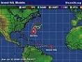
where would it be? I'm having a tough time find the center.Earl still has a spin to it, and does not look have bad. But where is the LLC? Is it the nw side, or sw side? Where it is or forms will have great implications on where it will go.
0 likes
-
Anonymous
The only spin it has is a mid level center, its located where the newest burst of convection is occuring.
http://www.ssd.noaa.gov/PS/TROP/DATA/RT ... -loop.html
http://www.ssd.noaa.gov/PS/TROP/DATA/RT ... -loop.html
0 likes

-
opera ghost
- Category 4
- Posts: 909
- Joined: Mon Sep 08, 2003 4:40 pm
- Location: Houston, Texas
-
rockythehusky

- Tropical Depression

- Posts: 80
- Joined: Wed Jun 23, 2004 9:50 pm
- Location: The scary house on the corner
- Contact:
-
Anonymous

-
PurdueWx80
- Professional-Met
- Posts: 2720
- Joined: Fri Aug 13, 2004 8:33 pm
- Location: Madison, WI
- Contact:
DEEP convection over Earl's MCV!
Extremely deep convection just popped over the MCV, and there appears to be a pseudo-feeder band to the SW of it. Here comes Earl from the dead. It's very much evident on the 20:31 image, just trust me for now because posting an image w/ a URL will not work. Go to http://wwwghcc.msfc.nasa.gov/GOES/goeseastconus.html then click on animate and 100% and then over Earl and you'll see.
Last edited by PurdueWx80 on Mon Aug 16, 2004 3:54 pm, edited 2 times in total.
0 likes
-
lilbump3000

- Category 4
- Posts: 918
- Age: 36
- Joined: Sat Sep 20, 2003 10:09 am
- Location: New Orleans, Louisiana
- Contact:
Who is online
Users browsing this forum: No registered users and 4 guests