FXUS62 KILM 171917
AFDILM
AREA FORECAST DISCUSSION
NATIONAL WEATHER SERVICE WILMINGTON NC
317 PM EDT MON JUL 17 2006
.SHORT TERM /TONIGHT THROUGH WEDNESDAY/...
UPPER RIDGE CENTERED JUST NORTHWEST OF THE CAROLINAS CONTINUES TO
DRAG HOT AIR THROUGH THE OHIO VALLEY...ACROSS THE CENTRAL
APPALACHIANS...AND THEN DOWN INTO THE CAROLINAS. LOTS OF DRY AIR IN
THE MID LEVELS AND AS FAR DOWN AS THE UPPER REGIONS OF THE BOUNDARY
LAYER IS DOING TWO THINGS: LIMITING HEAT INDEX VALUES BY LOWERING
AFTERNOON DEWPOINTS....AND LIMITING POTENTIAL INSTABILITY BY
WATERING DOWN CAPE VALUES. AS A RESULT HEAT INDEX SHOULD PEAK OUT
FROM 100 TO 103 OVER THE NEXT COUPLE OF DAYS...WITH CHANCES OF
PRECIPITATION GENERALLY LESS THAN 15 PERCENT.
THE BIG STORY WILL BE THE HOT TEMPERATURES. WE ARE FORECASTING THE
FIRST 100 DEGREE READING OF THE YEAR TOMORROW IN LUMBERTON...WITH
LOTS OF UPPER 90S EXTENDING EAST AND SOUTH OF THERE TO NEAR THE
COAST. ONLY A RECURRING SEABREEZE WITHIN 15 MILES OF THE COASTLINE
WILL KEEP READINGS IN THE LOWER TO MID 90S. THE WARMEST FORECAST 850
MB TEMPERATURES LUCKILY REMAIN JUST NORTH AND WEST OF OUR FORECAST
AREA.
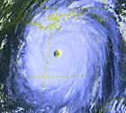
OF SOME INTEREST IS A PERSISTENT CLUSTER OF THUNDERSTORMS WELL OFF
THE CAROLINA COAST THIS AFTERNOON. THE HURRICANE CENTER BELIEVES THE
OVERALL ENVIRONMENT SURROUNDING THIS SYSTEM IS CONDUCIVE TO SOME
DEVELOPMENT. A SHORTWAVE TROUGH APPROACHING FROM THE NORTH BY MID
WEEK SHOULD TAKE ANYTHING THAT CAN DEVELOP OUT OF THIS OUT TO SEA...
WITH LITTLE DIRECT IMPACT EXPECTED ON OUR AREA.
Well it looks like they are saying it will be pushed out of here by Wed. Nothing for the coast to worry about.
Tropical Storm Beryl
Moderator: S2k Moderators
-
storms in NC

- S2K Supporter

- Posts: 2338
- Joined: Thu Jul 28, 2005 2:58 pm
- Location: Wallace,NC 40 miles NE of Wilm
- Contact:
-
brunota2003

- S2K Supporter
- Posts: 9476
- Age: 33
- Joined: Sat Jul 30, 2005 9:56 pm
- Location: Stanton, KY...formerly Havelock, NC
- Contact:
000
FXUS62 KMHX 171854
AFDMHX
AREA FORECAST DISCUSSION
NATIONAL WEATHER SERVICE NEWPORT/MOREHEAD CITY NC
254 PM EDT MON JUL 17 2006
.SHORT TERM /TONIGHT THROUGH THURSDAY NIGHT/...QUIET CONDITIONS IN
STORE THROUGH AT LEAST TUESDAY NIGHT WITH RIDGING SURFACE/ALOFT
ACROSS THE AREA. AFTERNOON HEAT INDEX VALUES WILL REMAIN JUST UNDER
ADVISORY CRITERIA. THE WEATHER PICTURE GETS HARDER TO FIGURE OUT IN
THE MIDWEEK PERIOD DUE TO THE LOW OFF THE SOUTHEAST COAST. NEITHER
GFS/NAM HANDLES THE SYSTEM VERY WELL BUT IF HAD TO CHOOSE
ONE...WOULD PROBABLY LEAN TOWARD THE NAM. AT LEAST IT SHOWS UP IN
THE PRESSURE PATTERN AND HAS A WELL-DEFINED WIND FIELD WHEREAS THE
GFS HAS ONLY A WEAK REFLECTION IN THE WIND FIELD WITH NO CLOSED
ISOBARS. KEPT SLIGHT CHANCE POPS IN FOR WEDNESDAY BUT BUMPED UP POPS
ON THURSDAY TO CHANCE.
&&
.LONG TERM /FRIDAY THROUGH MONDAY/...WHATEVER DEVELOPS IN THE
ATLANTIC WILL MOVE NORTHEAST OF HERE DUE TO THE DEEPENING UPPER
TROF. THE TROF WILL DRIVE A FRONTAL SYSTEM INTO THE AREA ON LATE
FRIDAY WHICH BECOMES STATIONARY EAST-WEST ACROSS OUR NORTHERN
COUNTIES...THEN MOVES A TAD FURTHER SOUTH ON MONDAY. KEPT IN CHANCE
POPS EACH DAY FOR THE EXTENDED. MOISTURE WILL BE IN PLENTIFUL SUPPLY
WITH A DEEP SOUTHWEST FLOW WITH THE TROF ALOFT AND THE AXIS OF THE
BERMUDA HIGH TO OUR SOUTH.
0 likes
-
Rainband
-
storms in NC
- S2K Supporter
- Posts: 2338
- Joined: Thu Jul 28, 2005 2:58 pm
- Location: Wallace,NC 40 miles NE of Wilm
- Contact:
Rainband wrote:Just wanted to let the NC/SC posters know that we Floridians weren't down playing this. We were just going by the facts.I understand how systems in that area can behave. Lucky this time that the conditions weren't there and the front is coming through. Stay safe this season.
I don't think anyone was thinking it would come onto the coast. Just that it could develop to a Td or a TS. and it still may happen. It will be sitting out there with nothing to do and would say hey I can wine up some wind. LOL
But for real now there is some that really down plays our East coast. I know that the Gulf and FL has been hot for a few years now but that has been very unusual. Back in the 90's it was the east coast that was down playing FL and the gulf. cause it seem like they all were comeing this way. So you see everyone has done it one time or another.
I don't beleave that we can't take a cat 4or 5. It will happen one day here when only God knows. Our waters are alot wamer then they use to be and will wamer even more over the next 50 years.
I learned some thing the hard way one time Never say never
0 likes
-
Matt-hurricanewatcher
- Category 5

- Posts: 11649
- Age: 38
- Joined: Fri Nov 26, 2004 11:09 pm
- Location: Portland,OR
- Contact:
-
Aric Dunn
- Category 5
- Posts: 21228
- Age: 41
- Joined: Sun Sep 19, 2004 9:58 pm
- Location: Ready for the Chase.
- Contact:
We have a little bit of convection starting to pop around what looks to be the center.. http://weather.msfc.nasa.gov/GOES/goeseastconus.html
it has been having trouble getting any better organized since the NE quad has not been closed off.. but as of late that looks as though it has .. with more banding type cloud patterns on the SE and east side but we need to watch very closely tonight ... really close
it has been having trouble getting any better organized since the NE quad has not been closed off.. but as of late that looks as though it has .. with more banding type cloud patterns on the SE and east side but we need to watch very closely tonight ... really close
0 likes
-
'CaneFreak

- Category 5
- Posts: 1475
- Joined: Mon Jun 05, 2006 10:50 am
- Location: New Bern, NC
-
Aric Dunn
- Category 5
- Posts: 21228
- Age: 41
- Joined: Sun Sep 19, 2004 9:58 pm
- Location: Ready for the Chase.
- Contact:
193
ABNT20 KNHC 172108
TWOAT
TROPICAL WEATHER OUTLOOK
NWS TPC/NATIONAL HURRICANE CENTER MIAMI FL
530 PM EDT MON JUL 17 2006
FOR THE NORTH ATLANTIC...CARIBBEAN SEA AND THE GULF OF MEXICO...
A BAND OF SHOWERS AND THUNDERSTORMS PRIMARILY ASSOCIATED WITH A LOW
PRESSURE AREA IN A FRONTAL ZONE EXTENDS FROM NORTHERN FLORIDA
NORTHEASTWARD OVER THE ATLANTIC. THERE ARE NO SIGNS OF TROPICAL
CYCLONE FORMATION AT THIS TIME...HOWEVER...ENVIRONMENTAL CONDITIONS
APPEAR SOMEWHAT FAVORABLE FOR THIS SYSTEM TO GRADUALLY ACQUIRE
TROPICAL CHARACTERISTICS...AND A POSSIBILITY EXISTS FOR A TROPICAL
DEPRESSION TO FORM DURING THE NEXT DAY OR TWO. AN AIR FORCE RESERVE
RECONNAISSANCE AIRCRAFT IS SCHEDULED TO INVESTIGATE THE SYSTEM
TOMORROW...IF NECESSARY. INTERESTS ALONG THE SOUTHEASTERN U.S.
COAST SHOULD CLOSELY MONITOR THE PROGRESS OF THIS SYSTEM.
A NON-TROPICAL LOW PRESSURE SYSTEM AND GALE AREA IS RAPIDLY MOVING
NORTHEASTWARD AND IS PASSING A COUPLE OF HUNDRED MILES SOUTH OF
NOVA SCOTIA. THIS SYSTEM IS MOVING OVER COOLER WATERS AND TROPICAL
CYCLONE DEVELOPMENT IS NOT ANTICIPATED. ADDITIONAL INFORMATION ON
THIS GALE AREA CAN BE FOUND IN HIGH SEAS FORECASTS ISSUED BY THE
OCEAN PREDICTION CENTER UNDER WMO HEADER FZNTO1 KWBC AND UNDER
AWIPS HEADER NFDHSFAT1.
CLOUDINESS AND SHOWERS BETWEEN THE NORTHERN LEEWARD ISLANDS AND
BERMUDA ARE ASSOCIATED WITH A TROPICAL WAVE INTERACTING WITH AN
UPPER LOW. SURFACE PRESSURES REMAIN HIGH IN THE AREA AND TROPICAL
CYCLONE FORMATION IS NOT EXPECTED.
ELSEWHERE...TROPICAL STORM FORMATION IS NOT EXPECTED THROUGH
TUESDAY.
$$
FORECASTER AVILA/MAINELLI
0 likes
-
Matt-hurricanewatcher
- Category 5
- Posts: 11649
- Age: 38
- Joined: Fri Nov 26, 2004 11:09 pm
- Location: Portland,OR
- Contact:
Winds under 5 knots coming out of the northwest...The hurricane hunters would never find it if its even true. In lower then 9 knots quickscat has a hard time...Its 9 to 49 knots range it doe's good in at 10 meters or about 30 feet off the surface,
Also see that converging wind one from the southeast on the south side of the trough axis...And northwest winds on the northern side. Maybe a little vort max around 31.5/76.5. With not very deep convectoin but yes this is a start. I would watch it very closely for that convection to develop...Which will force the vort max/unclosed surface trough to close off.
Also see that converging wind one from the southeast on the south side of the trough axis...And northwest winds on the northern side. Maybe a little vort max around 31.5/76.5. With not very deep convectoin but yes this is a start. I would watch it very closely for that convection to develop...Which will force the vort max/unclosed surface trough to close off.
0 likes


-
OuterBanker
- S2K Supporter
- Posts: 1704
- Joined: Wed Feb 26, 2003 10:53 am
- Location: Nags Head, NC
- Contact:
NAM has it backing toward Hatteras then taking off to NE. Then there may be a piece that stays off Fla. I think that things are going to really wind up here shortly. I also think that the secnario for US hits is also setting up. The fact that the waters in eastern and mid atlantic are cooler is bad news. It allows these well formed systems that exit the African coast and then die out regenerate when they get in the west Atlantic instead of curving out to sea. What a beauty exiting Africa this am eh?
0 likes

Some interesting model runs from this evening. Two of them, the BAMM and BAMS take the system west into either North FL or coastal GA; the LBAR takes it into SC; the others out to sea.........
http://euler.atmos.colostate.edu/~vigh/ ... early1.png
http://euler.atmos.colostate.edu/~vigh/ ... early1.png
0 likes
Who is online
Users browsing this forum: No registered users and 3 guests