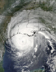
Hurricane Rita pictures
Moderator: S2k Moderators
-
HurricaneBill
- Category 5

- Posts: 3420
- Joined: Sun Apr 11, 2004 5:51 pm
- Location: East Longmeadow, MA, USA
the damage gets more catastrophic as you go down it goes from trees and power lines down .in the middle there are shades of Andrew with homes shreeded to pieces.The trees likes like its been clear cut by some timber company.go down a little further its very Katrina like nothing but debris and slabs
0 likes
Rita hasn't been "forgotten" around here......but that is because we were at ground zero!!! The National media still is enthralled with Katrina, which we can understand, but they completely dropped the ball with any coverage of Rita. They(the media) were all waiting around in Galveston and Houston waiting for her to arrive but when she came our way, they reported that Texas had dodged another bullet. Wrong. The only place in worst shape than Southeast Texas was Southwest Louisiana which caught the storm surge plus the northeast quadrant of the storm. Thanks to Southerngale for posting the familiar sights to us in Southeast Texas!
0 likes
-
LAwxrgal

- S2K Supporter

- Posts: 1756
- Joined: Tue Jul 06, 2004 1:05 pm
- Location: Reserve, LA (30 mi west of NOLA)
Those pictures are incredible and thanks for sharing.
There isn't a single area of the Gulf Coast, almost, that hasn't been affected by a storm this season.
How are things in SE TX, Kelly? I reckon that it's probably like things here, not even close to normal and won't be for awhile.
There isn't a single area of the Gulf Coast, almost, that hasn't been affected by a storm this season.
How are things in SE TX, Kelly? I reckon that it's probably like things here, not even close to normal and won't be for awhile.
0 likes
Andrew 92/Isidore & Lili 02/Bill 03/Katrina & Rita 05/Gustav & Ike 08/Isaac 12 (flooded my house)/Harvey 17/Barry 19/Cristobal 20/Claudette 21/Ida 21 (In the Eye)
Wake me up when November ends
Wake me up when November ends
-
southerngale

- Retired Staff

- Posts: 27420
- Joined: Thu Oct 10, 2002 1:27 am
- Location: Southeast Texas (Beaumont area)
Sorry LAwxrgal...I just saw your post.
Things probably won't be "normal" for years, and even then...you can't bring back the homes and businesses that are gone. Some places are getting repaired, like Target - they replaced everything inside and obviously a new roof and finally opened in December. Central Mall is still closed, except for a couple of stores like JCPenney...which looks like a 3rd world store. There's no such thing as a 24-hour Walmart anymore. Some places look much better...others about like they did right after the storm hit.
Traffic is HORRIBLE - how is it that the businesses that are open need employees, yet there's so much traffic...it's infuriating to drive anywhere?
Anyway, we're getting there. Most everyone has a strong spirit and it's like everyone is just "nicer" or something - it's like a continuous "I know what you've been through and my thoughts are with you" attitude that everyone seems to carry around...if that makes any sense. lol - I dunno.
Rita has forever changed the landscape here - we can only pray that no other hurricanes have an eye on this area. I'm afraid some of us might lose it, then.
0 likes
-
Extremeweatherguy

- Category 5
- Posts: 11095
- Joined: Mon Oct 10, 2005 8:13 pm
- Location: Houston, TX
People in Houston are blind to the force of a hurricane. Houston has not felt hurricane force winds since 1983, so I am afraid of what will happen when we finally see the real deal. Being from Florida I already know what it is like to see the winds and daamge of a hurricane, but many I have met here do not. In fact, many refer to Alison as a hurricane and many think Rita was really weak for everyone when it made landfall. The only winds/damage we saw in Houston from Rita was of the tropical storm variety. I am scared to think what will happen when Houston gets hit by a REAL hurricane again... 
0 likes
-
jasons2k

- Storm2k Executive

- Posts: 8088
- Age: 50
- Joined: Wed Jul 06, 2005 12:32 pm
- Location: The Woodlands, TX
~Floydbuster wrote:Very damaging storm, but much worse for Louisiana than Texas. I still don't think the people in Texas, mainly Corpus to Galveston know how lucky they have been.
This is true. I drove around both the Texas and LA side for an entire day about 3 weeks after the storm.
On the Texas side, I thought it was some of the most horrible, amazing damage I had ever seen after a storm. That was until I crossed into LA and went over to Vinton, Sulphur, and Lake Charles. It was like night and day. The difference between the western eyewall vs. the eastern eyewall was about as stark as I've seen anywhere.
Yes, some of the damage in Texas is as severe as what you see in LA, but the major difference is how widespread it was. For example, in Beamont/Orange maybe about 1/2 the store signs were blown out - and seeing that alone was jaw-dropping. But on the LA side it was 100%, and in some cases the metal pole that held up the sign would be snapped or ripped out of the ground completely.
On the Texas side, most of the billboards were blown out. On the LA side, not only were the signs gone, the poles themselves were snapped or blown over. I can't imagine the force it would take to snap a steel pole that's 3 or 4 feet in diameter.
Lot's of blue tarps in Texas too. On the LA side, it was every single house - if it had a roof at all. Also when going through the eyewall, every tree on the eastern side (if it was still standing) had turned brown due to the salt spray. I noticed the change the moment I drove across the border, right where the eye was centered.
And the amount of sheer debris in Lake Charles was appaling. When Sean from New Orleans first put his thread out "This is a Lake Charles Storm" a day before it hit, I thought he was crazy. Let me tell you, Rita was a Lake Charles storm and then some.
I'm not trying to sound like it wasn't bad for Texas; believe me it was. But I have to say after seeing both TX and LA firsthand, and witnessing how destructive the eastern eyewall was on the LA side, LA got it so much worse. And yes if it had come ashore in in Freeport/Galveston instead of Sabine Pass I guarantee Rita would not be considered the "forgotten hurricane" by any means. Luckily most of extreme SW LA which took the brunt, besides Cameron/Holly Beach, is largely uninhabited.
Last edited by jasons2k on Thu Jan 19, 2006 3:15 pm, edited 1 time in total.
0 likes
-
Extremeweatherguy
- Category 5
- Posts: 11095
- Joined: Mon Oct 10, 2005 8:13 pm
- Location: Houston, TX
jschlitz wrote:~Floydbuster wrote:Very damaging storm, but much worse for Louisiana than Texas. I still don't think the people in Texas, mainly Corpus to Galveston know how lucky they have been.
This is true. I drove around both the Texas and LA side for an entire day about 3 weeks after the storm.
On the Texas side, I thought it was some of the most horrible, amazing damage I had ever seen after a storm. That was until I crossed into LA and went over to Vinton, Sulphur, and Lake Charles. It was like night and day. The difference between the western eyewall vs. the eastern eyewall was about as stark as I've seen anywhere.
Yes, some of the damage in Texas is as severe as what you see in LA, but the major difference is how widespread it was. For example, in Beamont/Orange maybe about 1/2 the store signs were blown out - and seeing that alone was jaw-dropping. But on the LA side it was 100%, and in some cases the metal pole that held up the sign would be snapped or ripped out of the ground completely.
On the Texas side, most of the billboards were blown out. On the LA side, not only were the signs gone, the poles themselves were snapped or blown over. I can't imagine the force it would take to snap a steel pole that's 3 or 4 feet in diameter.
Lot's of blue tarps in Texas too. On the LA side, it was every single house - if it had a roof at all. Also when going through the eyewall, every tree on the eastern side (if it was still standing) had turned brown due to the salt spray. I noticed the change the moment I drove across the border, right where the eye was centered.
And the amount of sheer debris in Lake Charles was appaling. When Sean from New Orleans first put his thread out "This is a Lake Charles Storm" a day before it hit, I thought he was crazy. Let me tell you, Rita was a Lake Charles storm and then some.
I'm not trying to sound like it wasn't bad for Texas; believe me it was. But I have to say after seeing both TX and LA firsthand, and witnessing how destructive the eastern eyewall was on the LA side, LA got it so much worse. And yes if it had come ashore in in Freeport/Galveston instead of Sabine Pass I guarantee Rita would not be considered the "forgotten hurricane" by any means. Luckily most of extreme SW LA which took the brunt, besides Cameron/Holly Beach, is largely uninhabited.
The damage in Lake Charles is right in line with what 105-115mph gusts can do, so I am guessing that they saw borderline Cat. 1/2 winds in the city of Lake Charles and with 100-110mph gusts in Beaumont they also saw borderline Cat. 1/2 conditions. The damage meets up exactly with what I saw from Hurricane Charley in Orlando. During Charley we got 100-110mph wind gusts and at the end; huge metal billboards were twisted and snapped to the ground and all standing ones were blown out...also about 1/2 to 3/4 of store signs were blown out, and most shingled homes lost over 1/2 of thier shingles. We also had about 1/2 of the foliage stripped from most trees with some trees uprooted and many street signs were bent or knocked over. This just shows that Cat. 1/2 hurricane force winds are a lot more than people take them for. So my estimate on winds from Rita would be 100-115mph sustained at the immediate landfall coast with gusts to 130mph. I think that Lake Charles saw 80mph sustained and gusts to 105-115mph; I think that Beaumont saw 75mph sustained with gusts to 100-105mph; I think that Houston saw 45mph sustained with gusts to 60mph. So in reality it could have been much worse...if Rita would have been strengthening at landfall, then I think that these wind speeds would have 5-15mph added to them...and if it was a Cat. 4, then these speeds could have been 25-35mph higher!
Here is a pic. of the billboard damage in Orlando after Charley:

Here is a link to that picture if you can not see it above (some computers can not): http://i43.photobucket.com/albums/e371/ ... 0_0638.jpg
Last edited by Extremeweatherguy on Fri Jan 20, 2006 4:37 pm, edited 3 times in total.
0 likes
-
southerngale
- Retired Staff
- Posts: 27420
- Joined: Thu Oct 10, 2002 1:27 am
- Location: Southeast Texas (Beaumont area)
I don't really have the energy to make yet another post about the winds and damage around here but the winds in the Beaumont/Port Arthur area were not only 75mph. They recorded winds higher than that before the equipment failed, and then it got worse. Gusts well exceeded 100mph, even all the way to Jasper. A lot of the billboard signs were blown out or knocked down as well and some of those thick, metal poles that hold them up were also knocked down or snapped in two. There's one a few miles from my house that was still laying there the last time I noticed, snapped in two. I'll try to remember to take a picture since a few people mistakenly think that a trip down I-10 tells the whole story. You don't even see 99% of Beaumont or any of Port Arthur, Sabine Pass, etc. when you travel through on I-10. I've never doubted it was worse a little to my east, except for Sabine Pass (wiped out is wiped out) and I know it could have been even worse. It can always be worse. I don't mean to sound defensive, but when the worst hurricane to hit your area (at least in your lifetime) hits you and changes everything, you have to deal with the aftermath which seems to be neverending and adjust to a new way of life (physically and/or financially), then you come onto a weather board that you call home and see it downplayed over and over is a bit unsettling. Now see...I don't want to downplay Charley in Orlando because I wasn't there. I haven't lived through the damage there and I'm not there right now to see them rebuilding but I guess I haven't seen enough pics to think it was as bad there as it was in SE Tx, but I don't know. I have no desire to guess either. Closer to the coast where it made landfall...yes. I don't know how many days/weeks Orlando was shut down with no utilitites and all that and I don't know how many years they're projecting it will take to rebuild Orlando. I just know about all that for here. I'm very familiar with the ongoing efforts here and most people have a great spirit and are looking forward with hope. On a board where so many people are intrigued by hurricanes, maybe guessing that results in minimizing others' tragedies isn't such a great idea. I dunno...I guess I should just stop reading certain posts.
0 likes
-
Extremeweatherguy
- Category 5
- Posts: 11095
- Joined: Mon Oct 10, 2005 8:13 pm
- Location: Houston, TX
southerngale wrote:I don't really have the energy to make yet another post about the winds and damage around here but the winds in the Beaumont/Port Arthur area were not only 75mph. They recorded winds higher than that before the equipment failed, and then it got worse. Gusts well exceeded 100mph, even all the way to Jasper. A lot of the billboard signs were blown out or knocked down as well and some of those thick, metal poles that hold them up were also knocked down or snapped in two. There's one a few miles from my house that was still laying there the last time I noticed, snapped in two. I'll try to remember to take a picture since a few people mistakenly think that a trip down I-10 tells the whole story. You don't even see 99% of Beaumont or any of Port Arthur, Sabine Pass, etc. when you travel through on I-10. I've never doubted it was worse a little to my east, except for Sabine Pass (wiped out is wiped out) and I know it could have been even worse. It can always be worse. I don't mean to sound defensive, but when the worst hurricane to hit your area (at least in your lifetime) hits you and changes everything, you have to deal with the aftermath which seems to be neverending and adjust to a new way of life (physically and/or financially), then you come onto a weather board that you call home and see it downplayed over and over is a bit unsettling. Now see...I don't want to downplay Charley in Orlando because I wasn't there. I haven't lived through the damage there and I'm not there right now to see them rebuilding but I guess I haven't seen enough pics to think it was as bad there as it was in SE Tx, but I don't know. I have no desire to guess either. Closer to the coast where it made landfall...yes. I don't know how many days/weeks Orlando was shut down with no utilitites and all that and I don't know how many years they're projecting it will take to rebuild Orlando. I just know about all that for here. I'm very familiar with the ongoing efforts here and most people have a great spirit and are looking forward with hope. On a board where so many people are intrigued by hurricanes, maybe guessing that results in minimizing others' tragedies isn't such a great idea. I dunno...I guess I should just stop reading certain posts.
I'm not saying it was as bad in Orlando as on the immediate TX/Louisiana coasts (where Cat. 3 force winds were probably felt), I am only comparing Orlando's damage to that of some of the inland cities such as Beaumont and Lake Charles (from the pics. I have seen) and giving a good estimate on what kind of winds it would take to do the damage I saw. From some of the video and pictures I have seen I would predict 100-105mph gusts in Beaumont and 105-115mph in Lake Charles. Once inland a storm's sustained winds usually die off significantly (hard to find a sustained wind over 100mph once the storm is 25+ miles inland), but the gusts do not die as fast and can be a whole category or two higher. Yes, I think you saw Cat. 2/3 force gusts, but probably only Cat. 1/2 force sustained winds. The gusts are what does most of the wind damage though, so having gusts in that range will give you damage about a Category higher than what the sustained winds were. I am not downplaying the damage you saw, but I am simply trying to analyze it and better understand the type of winds you saw. I know with Charley we had 80mph sustained (at airport) and gusts to 100-110mph and that was enough to give us damage similar to some of those inland locations of SE Texas and SW Louisiana, so that is why I think you guys probably saw near the same.
0 likes
-
Extremeweatherguy
- Category 5
- Posts: 11095
- Joined: Mon Oct 10, 2005 8:13 pm
- Location: Houston, TX
southerngale...here is a good link from the NWS that has a nice graphic with top wind gusts from Rita:
http://www.srh.noaa.gov/lch/rita/images ... awinds.png
http://www.srh.noaa.gov/lch/rita/images ... awinds.png
0 likes
-
beachbum_al

- Category 5
- Posts: 2163
- Age: 54
- Joined: Thu Jul 14, 2005 9:23 pm
- Location: South Alabama Coast
- Contact:
Thanks for showing those. My great aunt and cousin live in Beaumont. They were the lucky ones though. Very minor damage to their house. My mom and I are planning a trip out there this summer to see her. I have not seen in since 1991 and she has never seen her great great neices. Just pictures and videos.
0 likes

I live in Lake Charles and had 2 sons and my husband on lock down here. Who had the most damage is not what we count around here. It's who is helping who and how fast can we rebuild our beautiful city. I lost my home and my business was damaged but the greatest feeling in the world is knowing that there is help nationwide here to help. My contractor is from Arkansas and another from Pennsylvannia who came down to help. Their prices are fair and reasonable and other than the few snakes the majority are hard-working, honest folks here to help someone else through this and make a living. As for the question of Beaumont or Lake Charles being worse than the other................I've seen both immediately following the storm and all I can say is that I had to go to Beaumont to purchase clothes and matresses to sleep on because we had nothing available here. The single most important factor is the lives that were spared due to the majority of people GETTING OUT when the evac was ordered. JMHO 
0 likes
-
southerngale
- Retired Staff
- Posts: 27420
- Joined: Thu Oct 10, 2002 1:27 am
- Location: Southeast Texas (Beaumont area)
Thanks...yeah, I've seen that graphic. It sure shows what I was talking about all the way to Jasper. Since the last wind I was able to hear on the radio from Jasper was 87mph and then it got worse...they said afterward 100-120 mph so that would fall in range for the most part. Keep in mind that Beaumont isn't a dot though.
extreme...you can guess the winds, but I'm more inclined to just go by what the locals here say, the ones who rode it out and/or recorded winds, etc. They said we had cat.3 winds...in Beaumont, yes they were gusts. I have no problem with you guessing 100-105mph winds though if you'd like. It just seems more logical for me to go by what the officials here say. Some of the damage here is worse than other damage, but it seems just about everything has something. I guess I should be more clear when I say "here" though. Beaumont is pretty big and the damage varies. It's somewhat worse in Port Arthur and much worse in Sabine Pass. Orange, Vidor, Nederland, Port Neches, Groves, Lumberton, etc. hit hard too. We're all one big community in one sense though - we make up the Golden Triangle.
jagno...sorry to hear about your home. I was fortunate that I didn't lose mine...when I saw how bad it was when we were hit up in Jasper, I knew it was a goner. My grandparent's house was crushed by a few trees and the rest of us have damage, but we're still standing. I wish I could say that for everyone from SE TX to SW LA. I'm glad you found some stuff here after the storm. Beaumont is a lot bigger than Lake Charles. And thank God that help was in here quickly. When we finally started getting power flowing through here after a few weeks, some of the stores that could, opened. Unfortunately, there are still a lot of places closed...some forever. It's always weird to pass Central Mall and not see a full parking lot. No clue when they'll open. Still surreal I guess. I agree about the most important factor - many lives were saved because almost everyone got out of harm's way!!!
One of the most sobering things for me to think about is that as bad as this was here, it wasn't what some would call the "Big One" for us. If Rita had tracked even 25 miles further to the west, we would have gotten the storm surge that Holly Beach and Cameron got. For Sabine Pass folks, that isn't very comforting however. I was watching the Hurricane Rita - Disaster in Southeast Texas DVD the other day and they went to Sabine Pass and Holly Beach. They said the difference was in Sabine Pass, you can see the tops of roofs to know where the house was...in Holly Beach, you can't tell where the houses were. The surge there went over the houses. In Sabine Pass, high enough to collapse the houses. Same difference to them...their house is still gone, but had Rita tracked just 25 or so miles more west, the higher surge would have breached the levees in Port Arthur and a huge area would have been underwater. As it stands, only portions of Port Arthur were underwater. The damage across Southeast Texas would be even worse. Dear God, I hope nothing else comes this way.
Btw, today is exactly 4 months since Rita hit.
extreme...you can guess the winds, but I'm more inclined to just go by what the locals here say, the ones who rode it out and/or recorded winds, etc. They said we had cat.3 winds...in Beaumont, yes they were gusts. I have no problem with you guessing 100-105mph winds though if you'd like. It just seems more logical for me to go by what the officials here say. Some of the damage here is worse than other damage, but it seems just about everything has something. I guess I should be more clear when I say "here" though. Beaumont is pretty big and the damage varies. It's somewhat worse in Port Arthur and much worse in Sabine Pass. Orange, Vidor, Nederland, Port Neches, Groves, Lumberton, etc. hit hard too. We're all one big community in one sense though - we make up the Golden Triangle.
jagno...sorry to hear about your home.
One of the most sobering things for me to think about is that as bad as this was here, it wasn't what some would call the "Big One" for us. If Rita had tracked even 25 miles further to the west, we would have gotten the storm surge that Holly Beach and Cameron got. For Sabine Pass folks, that isn't very comforting however. I was watching the Hurricane Rita - Disaster in Southeast Texas DVD the other day and they went to Sabine Pass and Holly Beach. They said the difference was in Sabine Pass, you can see the tops of roofs to know where the house was...in Holly Beach, you can't tell where the houses were. The surge there went over the houses. In Sabine Pass, high enough to collapse the houses. Same difference to them...their house is still gone, but had Rita tracked just 25 or so miles more west, the higher surge would have breached the levees in Port Arthur and a huge area would have been underwater. As it stands, only portions of Port Arthur were underwater. The damage across Southeast Texas would be even worse. Dear God, I hope nothing else comes this way.
Btw, today is exactly 4 months since Rita hit.
0 likes
-
Extremeweatherguy
- Category 5
- Posts: 11095
- Joined: Mon Oct 10, 2005 8:13 pm
- Location: Houston, TX
southerngale wrote:Thanks...yeah, I've seen that graphic. It sure shows what I was talking about all the way to Jasper. Since the last wind I was able to hear on the radio from Jasper was 87mph and then it got worse...they said afterward 100-120 mph so that would fall in range for the most part. Keep in mind that Beaumont isn't a dot though.
extreme...you can guess the winds, but I'm more inclined to just go by what the locals here say, the ones who rode it out and/or recorded winds, etc. They said we had cat.3 winds...in Beaumont, yes they were gusts. I have no problem with you guessing 100-105mph winds though if you'd like. It just seems more logical for me to go by what the officials here say. Some of the damage here is worse than other damage, but it seems just about everything has something. I guess I should be more clear when I say "here" though. Beaumont is pretty big and the damage varies. It's somewhat worse in Port Arthur and much worse in Sabine Pass. Orange, Vidor, Nederland, Port Neches, Groves, Lumberton, etc. hit hard too. We're all one big community in one sense though - we make up the Golden Triangle.
jagno...sorry to hear about your home.
One of the most sobering things for me to think about is that as bad as this was here, it wasn't what some would call the "Big One" for us. If Rita had tracked even 25 miles further to the west, we would have gotten the storm surge that Holly Beach and Cameron got. For Sabine Pass folks, that isn't very comforting however. I was watching the Hurricane Rita - Disaster in Southeast Texas DVD the other day and they went to Sabine Pass and Holly Beach. They said the difference was in Sabine Pass, you can see the tops of roofs to know where the house was...in Holly Beach, you can't tell where the houses were. The surge there went over the houses. In Sabine Pass, high enough to collapse the houses. Same difference to them...their house is still gone, but had Rita tracked just 25 or so miles more west, the higher surge would have breached the levees in Port Arthur and a huge area would have been underwater. As it stands, only portions of Port Arthur were underwater. The damage across Southeast Texas would be even worse. Dear God, I hope nothing else comes this way.
Btw, today is exactly 4 months since Rita hit.
Im not really guessing the winds. I am primarily just going by what the NWS is saying (thier graphic has 90-110mph gusts in Beaumont...may be 100-120mph in far eastern Beaumont). Yes, I am sure many locals estimated Cat. 3 winds, or even recorded them (and may be a few of those gusts were right). But we will have no way of knowing if their predictions/measurments were accuarate. BTW just because you may have had Cat. 3 force gusts dosn't mean that you had Cat. 3 force sustained winds. Either way, it was bad. It will take you guys many years to recover fully. I hope you guys are sparred for years to come and never have to deal with something like this again. As for this whole wind arguement, I guess it really does not matter, because it is in the past. What matters now is that you guys are all ready for the next one, whenever it may come..
0 likes
-
jasons2k
- Storm2k Executive
- Posts: 8088
- Age: 50
- Joined: Wed Jul 06, 2005 12:32 pm
- Location: The Woodlands, TX
Hey Southergale,
Your last paragragh is exactly what I've been trying to say. 25 miles to the east makes a huge difference, whether it is along the coast or 20 miles inland along I-10. The relative contrast is all the same.
And also, as bad as it was, count our blessings. The death toll from Rita was relatively miniscule. That's the most important thing. Thank God for that. I'm thankful all of us are still here for '06.
0 likes
-
aquaholic901
- Tropical Low

- Posts: 24
- Joined: Thu Aug 25, 2005 7:51 am
- Location: Tampa & Marathon, FL
Wow! I think the only thing I remember hearing on the news was that it missed Galveston and OMG look, people are looting in NOLA. That was about the time I gave up the last little shred of hope for our mainstream news media. I knew from reading on here and other places that the damage was understated but I didn't realize it was that bad.
0 likes

Here is some pic of Rita from the lower Terrebonne Parish area.
http://www.houmatoday.com/apps/pbcs.dll ... ogallery05
http://www.houmatoday.com/apps/pbcs.dll ... ogallery05
0 likes
-
Extremeweatherguy
- Category 5
- Posts: 11095
- Joined: Mon Oct 10, 2005 8:13 pm
- Location: Houston, TX
Just to end any debate on Rita's winds...here is a great link of her wind-field analysis. This does not show gusts, but it does show that most areas affected by Rita only saw Cat. 1 force sustained winds. This is an official graphic:
http://myweb.cableone.net/nolasue/RitaWinds.gif
http://myweb.cableone.net/nolasue/RitaWinds.gif
0 likes
-
southerngale
- Retired Staff
- Posts: 27420
- Joined: Thu Oct 10, 2002 1:27 am
- Location: Southeast Texas (Beaumont area)
Extremeweatherguy wrote:Just to end any debate on Rita's winds...here is a great link of her wind-field analysis. This does not show gusts, but it does show that most areas affected by Rita only saw Cat. 1 force sustained winds. This is an official graphic:
http://myweb.cableone.net/nolasue/RitaWinds.gif
Official by whom? Meteorologists and officials here who stayed during the storm measured sustained winds much higher than that in Beaumont and Port Arthur. The police chief in Jasper also said winds were recorded much higher than what that shows. I'm not going to start debating this again, and I know you're only posting what you saw, but that's wrong. We did not see only 60mph sustained winds over here and Jasper did not only see 30-40mph (hard to tell exactly where Jasper is on there) - that's just laughable. I was there riding it out and I've seen the damage and the reports.
0 likes
Return to “Hurricane Recovery and Aftermath”
Who is online
Users browsing this forum: No registered users and 6 guests