cycloneye wrote:Yikes, the MDR will get more warmer with the -NAO comming in March.
https://i.imgur.com/d6Ns6wo.png
Seems about right. Spring begins and with it a -NAO develops. Like clockwork in the 2020s
Moderator: S2k Moderators


cycloneye wrote:Yikes, the MDR will get more warmer with the -NAO comming in March.
https://i.imgur.com/d6Ns6wo.png


Teban54 wrote:For fun only: I was looking up a bunch of tweets, and found this from March 2013:
https://twitter.com/TropicalTidbits/status/317004456036294656?s=19
Disclaimer: by no means am I claiming this season will be like 2013 or that some other unknown factor will hold it back. Just thought it was interesting to see.
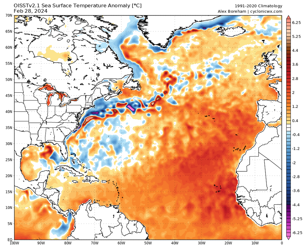
Current SSTAs for reference:
https://i.postimg.cc/j2srs22B/ssta-natl.png
ScottNAtlanta wrote:Teban54 wrote:For fun only: I was looking up a bunch of tweets, and found this from March 2013:
https://twitter.com/TropicalTidbits/status/317004456036294656?s=19
Disclaimer: by no means am I claiming this season will be like 2013 or that some other unknown factor will hold it back. Just thought it was interesting to see.
Current SSTAs for reference:
https://i.postimg.cc/j2srs22B/ssta-natl.png
As I recall...2013 had a warm signature pretty much everywhere which lead it to be slow. Currently we look to be setting up for the Atlantic Tripole with a cooler subtropical region...if it stays that way. That's another sign of a busy season


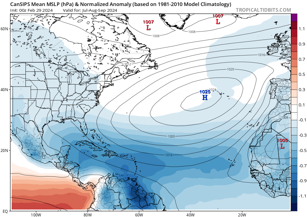
zzzh wrote:https://i.imgur.com/5OsQlb2.png
https://i.imgur.com/WOVZU30.png
https://i.imgur.com/ZPu3YH8.png
https://i.imgur.com/kKby2G5.png
Comparing Cansips forecast with the composite of the most active hurricane seasons.


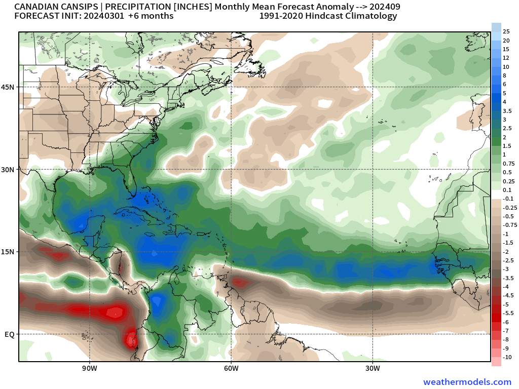

zzzh wrote:https://i.imgur.com/5OsQlb2.png
https://i.imgur.com/WOVZU30.png
https://i.imgur.com/ZPu3YH8.png
https://i.imgur.com/kKby2G5.png
Comparing Cansips forecast with the composite of the most active hurricane seasons.
Teban54 wrote:Good thread:
https://x.com/dmorris9661/status/1763383944609689755
https://x.com/dmorris9661/status/1763383957079445882
Users browsing this forum: Bing [Bot], Google [Bot], JSDS, RomP, StPeteMike and 30 guests
