The posts in this forum are NOT official forecast and should not be used as such. They are just the opinion of the poster and may or may not be backed by sound meteorological data. They are NOT endorsed by any professional institution or


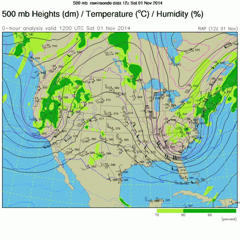
This event could surprise. Remember, the November 1, 2014 event in SC , had a very similar set up to what the GFS is showing for this weekend. A very anomalous, deep cold core upper Low which produced 6 inches of snow in Lexington, SC, The set up is not exactly the same, as this upcoming cold core upper Low is moving due east, as opposed to the 2014 event, when the cold core upper low moved in from the northwest flow with the polar jet. Also, the upper low in the 2014 event had more sufficient moisture with it, and it is still very questionable how much moisture will be left around for this upcoming system this Saturday, with the deepest moisture likely to be well to the north and east with the blizzard across the Mid Atlantic region. This will be worth watching the next couple of days. I am not saying it is definitely going to take place, but not out of the realm of possibility to see another potential snow surprise down into the Low Country of SC.
Current forecast 0Z GFS 500 mb forecast for 12Z Saturday, January 23
 ]
]November 1, 2014