SW LA/SE TX Winter 2012-2013
Moderator: S2k Moderators
Forum rules
 The posts in this forum are NOT official forecast and should not be used as such. They are just the opinion of the poster and may or may not be backed by sound meteorological data. They are NOT endorsed by any professional institution or STORM2K.

The posts in this forum are NOT official forecast and should not be used as such. They are just the opinion of the poster and may or may not be backed by sound meteorological data. They are NOT endorsed by any professional institution or STORM2K.
-
CYCLONE MIKE
- Category 5

- Posts: 2183
- Joined: Tue Aug 31, 2004 6:04 pm
- Location: Gonzales, LA
Re: SW LA/SE TX Winter 2012-2013
Well end is in sight fir at least later on this morning. Final band coming through now. Like jsds said have had pretty good rains since yesterday. Right with him at about 6 inches. 2.75 since midnight. Havent looked at any models tbis morning. What are they showing for rainfall for south la through thursday?
0 likes
-
CYCLONE MIKE
- Category 5
- Posts: 2183
- Joined: Tue Aug 31, 2004 6:04 pm
- Location: Gonzales, LA
Re: SW LA/SE TX Winter 2012-2013
Here is part of discussion from 6:30am from our local nws office about all the rains we received.
MUCH HIGHER THAN EXPECTED RAINFALL AMOUNTS OCCURRED LAST EVENING AND OVERNIGHT ACROSS THE FLASH FLOOD WATCH AREA WITH RAINFALL TOTALS NEAR 7 INCHES IN SOME AREAS. ORIGINALLY...THESE RAINFALL AMOUNTS WERE EXPECTED TO BE MORE SPREAD OUT THROUGH THURSDAY...BUT THE AMOUNTS HAVE ALREADY REACHED OR EXCEEDED EXPECTATIONS IN SOME AREAS FROM NEAR METRO BATON ROUGE TO NEAR HOUMA. NOT SURPRISINGLY...THERE HAVE BEEN REPORTS OF FLASH FLOODING IN SOME AREAS...AND RIVERS HAVE ALSO RESPONDED WITH MANY AREA RIVERS...BAYOUS...AND CANALS NEAR BANKFULL AND EXPECTED TO GO INTO MINOR FLOOD CATEGORY EITHER THIS MORNING OR OVER THE NEXT ONE TO TWO DAYS.
Didn't post tbe part where they said we could possibly get 5 more inches late tonight through tomorrow.
0 likes
-
cycloneye

- Admin

- Posts: 139480
- Age: 67
- Joined: Thu Oct 10, 2002 10:54 am
- Location: San Juan, Puerto Rico
Re: SW LA/SE TX Winter 2012-2013
A deluge for the region covered by this thread is in place for the next few hours.

0 likes
Visit the Caribbean-Central America Weather Thread where you can find at first post web cams,radars
and observations from Caribbean basin members Click Here
and observations from Caribbean basin members Click Here
-
vbhoutex

- Storm2k Executive
- Posts: 28979
- Age: 72
- Joined: Wed Oct 09, 2002 11:31 pm
- Location: Spring Branch area, Houston, TX
- Contact:
Re: SW LA/SE TX Winter 2012-2013
Heavy rains and some storms are moving across the Houston metro area from the SW-NE very slowly. Training appears to ve setting up due to the slow movement. No flooding rates yet in my area of Houston, but some areas just North of me are seeing 1.5"/hr rates. Hopefully the rates will not increase.
THE NATIONAL WEATHER SERVICE IN LEAGUE CITY HAS ISSUED A
* URBAN AND SMALL STREAM FLOOD ADVISORY FOR...
WESTERN HARRIS COUNTY IN SOUTHEAST TEXAS...
EXTREME SOUTHWESTERN MONTGOMERY COUNTY IN SOUTHEAST TEXAS...
SOUTHEASTERN WALLER COUNTY IN SOUTHEAST TEXAS...
FORT BEND COUNTY IN SOUTHEAST TEXAS...
BRAZORIA COUNTY IN SOUTHEAST TEXAS...
EASTERN MATAGORDA COUNTY IN SOUTHEAST TEXAS...
EXTREME SOUTHEASTERN AUSTIN COUNTY IN SOUTHEAST TEXAS...
EXTREME EAST CENTRAL WHARTON COUNTY IN SOUTHEAST TEXAS...
* UNTIL 215 PM CST
* AT 1112 AM CST...DOPPLER RADAR AND AUTOMATED RAIN GAUGES INDICATED
HEAVY RAIN WHICH WILL CAUSE URBAN AND SMALL STREAM FLOODING IN THE
ADVISORY AREA. RADAR ESTIMATES OF RAINFALL RATES OF 1 TO 2 INCHES
PER HOUR IS COMMON ACROSS THE ADVISORY AREA.
* SOME LOCATIONS THAT WILL EXPERIENCE MINOR FLOODING INCLUDE
HOUSTON...MISSOURI CITY...LAKE JACKSON...MISSION BEND...SUGAR
LAND...ROSENBERG...FIRST COLONY...ANGLETON...BELLAIRE...PECAN
GROVE...WEST UNIVERSITY PLACE...FREEPORT...KATY...CLUTE...
RICHMOND...STAFFORD...JERSEY VILLAGE...TOWN WEST...MEADOWS...
HUNTERS CREEK VILLAGE...WEST COLUMBIA...PRAIRIE VIEW...BUNKER HILL
VILLAGE...BROOKSHIRE...SPRING VALLEY...SWEENY...PINEY POINT
VILLAGE...FRESNO...MANVEL AND RICHWOOD.
PRECAUTIONARY/PREPAREDNESS ACTIONS...
EXCESSIVE RUNOFF FROM HEAVY RAINFALL WILL CAUSE PONDING OF WATER IN
URBAN AREAS...HIGHWAYS...STREETS AND UNDERPASSES AS WELL AS OTHER
POOR DRAINAGE AREAS AND LOW LYING SPOTS. DO NOT ATTEMPT TO TRAVEL
ACROSS FLOODED ROADS. FIND ALTERNATE ROUTES. IT TAKES ONLY A FEW
INCHES OF SWIFTLY FLOWING WATER TO CARRY VEHICLES AWAY.
DO NOT DRIVE YOUR VEHICLE INTO AREAS WHERE THE WATER COVERS THE
ROADWAY. THE WATER DEPTH MAY BE TOO GREAT TO ALLOW YOUR CAR TO CROSS
SAFELY. MOVE TO HIGHER GROUND.
0 likes
Skywarn, C.E.R.T.
Please click below to donate to STORM2K to help with the expenses of keeping the site going:

Please click below to donate to STORM2K to help with the expenses of keeping the site going:

Here's a radar rainfall estimate map for SE Texas/SW La

0 likes
The above post and any post by Ntxw is NOT an official forecast and should not be used as such. It is just the opinion of the poster and may or may not be backed by sound meteorological data. It is NOT endorsed by any professional institution including Storm2k. For official information, please refer to NWS products.
Help support Storm2K!
-
CYCLONE MIKE
- Category 5
- Posts: 2183
- Joined: Tue Aug 31, 2004 6:04 pm
- Location: Gonzales, LA
Re: SW LA/SE TX Winter 2012-2013
Amazing nobody is on here reporting about the flooding in sw/sc la tonight. Flash flood and flood warnings out all iver the place and rain not moving. Radar estimates show upwards of 12" off the coast. Over here in se la the nws put out a 10:00 pm update warning about the heavy rains and flooding to come later tonight into tomorrow. Have us in high risk threat for flooding and say we could get 4-8 more inches with next round on top of 5-8 we already recieved aroun d the area. From HPC
This is from 10:00 update from nws
ISOLATED RAINFALL RATES OF 2" AN HOUR WITH LOCAL AMOUNTS OF 4-8" ARE AGAIN POSSIBLE ACROSS SOUTH-CENTRAL AND SOUTHEAST LOUISIANA.
This is from 10:00 update from nws
IN FACT CONFIDENCE CONTINUES TO INCREASE AND WE NOW HAVE A HIGH RISK OF FLASH FLOODING OVER MUCH OF THE AREA THAT SAW RAIN LAST NIGHT. THE CURRENT LINE OF SHRA AND TSRA IS WELL OUT AHEAD OF ANY MDL GUIDANCE AND THIS IS LIKELY DUE TO THE MDLS POORLY HANDLING THE COLD POOL EFFECTS BEHIND THE LINE HELPING TO PUSH IT FURTHER EAST BUT THE LINE IS SLOWING DOWN CONSIDERABLY. THIS LINE WILL EVENTUALLY LOSE ITS SUPPORT TO CONTINUE PROGRESSING EAST AND COULD LAY UP OVER OUR CWA UNTIL THE NEXT UPPER LVL DISTURBANCE ROTATING AROUND THE UPPER LOW MOVES INTO THE REGION. THE CONCERN FOR HEAVY RAIN APPEARS TO BE FROM 6Z TONIGHT THROUGH 18/21Z ESPECIALLY OVER AREAS WEST OF 55.
0 likes
-
PTrackerLA

- Category 5
- Posts: 5248
- Age: 40
- Joined: Thu Oct 10, 2002 8:40 pm
- Location: Lafayette, LA
Re: SW LA/SE TX Winter 2012-2013
There were flooding reports in towns west of here on the news tonight but so far just have a little over 1" at my house for today on top of the 3.5" last night. We appear to be in the prime position for training storms overnight and there's quite a bit of convection "upstream" from us over the gulf. If storms consolidate over Lafayette or any populated areas there will definitely be some serious flooding issues with the GFS showing upwards of 8" of new precipitation by tomorrow. Lightning and thunder are picking up again now so I'll probably be up for a while longer as these new storms move in.
0 likes


-
vbhoutex
- Storm2k Executive
- Posts: 28979
- Age: 72
- Joined: Wed Oct 09, 2002 11:31 pm
- Location: Spring Branch area, Houston, TX
- Contact:
Re: SW LA/SE TX Winter 2012-2013
According to radar we may end up getting more rain tonight. Looks like it could set up some training, but thankfully it doesn't appear to be too heavy and isn't solidly covered.
0 likes
Skywarn, C.E.R.T.
Please click below to donate to STORM2K to help with the expenses of keeping the site going:
Please click below to donate to STORM2K to help with the expenses of keeping the site going:
-
PTrackerLA
- Category 5
- Posts: 5248
- Age: 40
- Joined: Thu Oct 10, 2002 8:40 pm
- Location: Lafayette, LA
Re: SW LA/SE TX Winter 2012-2013
When I left for work this morning I had about 4.4" in the gauge from overnight bringing the event total to around 7.9" and it's still raining at a good clip. I'd say the GFS did a great job at rainfall totals when it showed 8" for Lafayette. The river here is expected to rise 4 feet over flood stage but thankfully the rains will end before it gets high enough to flood homes. I will be closely watching how the rain event over the weekend into early next week unfolds as we cannot take any more water!
0 likes
-
PTrackerLA
- Category 5
- Posts: 5248
- Age: 40
- Joined: Thu Oct 10, 2002 8:40 pm
- Location: Lafayette, LA
Re: SW LA/SE TX Winter 2012-2013
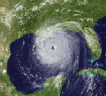
Not everyday you see a MCS with convection this intense in the northern GOM

Storm total verifies well with the 7"-8" I recorded in south Lafayette. The Crowley area was absolutely hammered with over 12" in spots.

Storm total verifies well with the 7"-8" I recorded in south Lafayette. The Crowley area was absolutely hammered with over 12" in spots.
0 likes
-
CYCLONE MIKE
- Category 5
- Posts: 2183
- Joined: Tue Aug 31, 2004 6:04 pm
- Location: Gonzales, LA
Re: SW LA/SE TX Winter 2012-2013
Same here PT. We are at 7 right now and depending on how fast or slow this moves out we could easily get another 2-3. Woke up to my phone going off alerting us for back to back tornado warnings as a squall line moved through. Does seem to be moving to the east a little quicker now will just have to see if it keeps up or slows down this afternoon. Cells seems to be moving ne today instead of due north out the gulf like it did for y'all last night.
0 likes

Re:
BigB0882 wrote:The Baton Rouge area got 7 inches with today's storm or 7 total, including all we got Tuesday? I'm curious how much we had this morning. Still raining but finally slacking off.
Climate log of Baton Rouge says 7.77 inches of rain as of today from Jan 1st so I assume that is total for the entire event. Officially yesterday (Jan 9th) was 2.29 inches
0 likes
The above post and any post by Ntxw is NOT an official forecast and should not be used as such. It is just the opinion of the poster and may or may not be backed by sound meteorological data. It is NOT endorsed by any professional institution including Storm2k. For official information, please refer to NWS products.
Help support Storm2K!
Help support Storm2K!
-
PTrackerLA
- Category 5
- Posts: 5248
- Age: 40
- Joined: Thu Oct 10, 2002 8:40 pm
- Location: Lafayette, LA
Re: SW LA/SE TX Winter 2012-2013
I just crunched the numbers and the "official" total for Lafayette Airport will be 6.36" as the rains have just ended. I am easily over 8.5" at my home in south Lafayette and many areas are in the 10-12" rain. Just at my house I'm over 11" for the month and it's only January 10th! The craziest thing of all is we have high chances of rain Saturday Night - Tuesday and the Vermilion River is now in moderate flood and forecast to stay there for a few days:
117 PM CST THU JAN 10 2013
THE FLOOD WARNING CONTINUES FOR
THE VERMILION RIVER AT LAFAYETTE, SURREY STREET GAGE.
* UNTIL FURTHER NOTICE...OR UNTIL THE WARNING IS CANCELLED.
* AT 12:15 PM THURSDAY THE STAGE WAS 13.9 FEET.
* MINOR FLOODING IS OCCURRING AND MODERATE FLOODING IS FORECAST.
* FLOOD STAGE IS 10.0 FEET.
* FORECAST...THE RIVER WILL CONTINUE RISING TO NEAR 14.5 FEET BY
LATE THIS EVENING AND HOLDING FAIRLY STEADY AS WATER FROM UPSTREAM
BEGINS TO WORK OUT OF THE SYSTEM.
* IMPACT...AT 14.6 FEET...WIDESPREAD MODERATE FLOODING WILL OCCUR.
15.81 ft is the highest level in recent memory (1993) and that level caused quite a few homes to flood here. We will have to watch this situation closely. There were two 16ft + crests in the 1940s and an astonishing 24.87ft from a stalled hurricane in 1940!
0 likes
-
PTrackerLA
- Category 5
- Posts: 5248
- Age: 40
- Joined: Thu Oct 10, 2002 8:40 pm
- Location: Lafayette, LA
Re: SW LA/SE TX Winter 2012-2013
My "official" total at my house using the old analog rain gauge is 8.70". Thankfully I dumped it out after the 3.5" from Tuesday night since it was over the 5" mark this afternoon...had to guestimate the last .2" since it was off the chart  . Time to get a digital/wireless gauge now. We've basically already had 1/6th of the rain we had the entire year of 2012 which was above normal...in just 10 days.
0 likes

Re: SW LA/SE TX Winter 2012-2013
Kennethb, your total is about like mine. From 6 pm Tuesday until the rain ended today, I got a little over 9". I missed measuring the beginning of the rain Tuesday because my gauge hadn't been emptied 
0 likes
Re: SW LA/SE TX Winter 2012-2013
JSDS wrote:Kennethb, your total is about like mine. From 6 pm Tuesday until the rain ended today, I got a little over 9". I missed measuring the beginning of the rain Tuesday because my gauge hadn't been emptied
Yes, my rain gauge only goes to 5 inches and Wednesday morning it was full,
0 likes
-
CajunMama
- Retired Staff

- Posts: 10790
- Joined: Thu Feb 06, 2003 9:57 pm
- Location: 30.22N, 92.05W Lafayette, LA
Re: SW LA/SE TX Winter 2012-2013
PTrackerLA wrote:My "official" total at my house using the old analog rain gauge is 8.70". Thankfully I dumped it out after the 3.5" from Tuesday night since it was over the 5" mark this afternoon...had to guestimate the last .2" since it was off the chart
What area of town are you in? I think you've told me before but I don't remember.
0 likes
Who is online
Users browsing this forum: Google [Bot] and 5 guests